
Steuben County (stu-BEN) is a county located in the U.S. state of New York. As of the 2020 census, the population was 93,584. Its county seat is Bath. Its name is in honor of Baron von Steuben, a Prussian general who fought on the American side in the American Revolutionary War, though it is not pronounced the same.
Tioga County is a county in the Commonwealth of Pennsylvania. As of the 2020 census, the population was 41,045. Its county seat is Wellsboro. The county was created on March 26, 1804, from part of Lycoming County and later organized in 1812. It is named for the Tioga River.

Sullivan County is a county in the Commonwealth of Pennsylvania. It is part of Northeastern Pennsylvania. As of the 2020 census, the population was 5,840, making it the second-least populous county in Pennsylvania. Its county seat is Laporte. The county was created on March 15, 1847, from part of Lycoming County and named for Major General John Sullivan.

Walker County is a county located in the northwestern part of the U.S. state of Georgia. As of the 2020 census, the population was 67,654, down from 68,756 in 2010. The county seat is LaFayette. The county was created on December 18, 1833, from land formerly belonging to the Cherokee Indian Nation.

Rossville is a city in Walker County, Georgia, United States. The population was 3,980 at the 2020 census. It is part of the Chattanooga, TN–GA Metropolitan Statistical Area.

Rossville is a village in Ross Township, Vermilion County, Illinois, United States. As of the 2020 census, the city population was 1,221. It is part of the Danville, Illinois Metropolitan Statistical Area.

Rossville is a city in Shawnee County, Kansas, United States. As of the 2020 census, the population of the city was 1,105.

Rossville is a town in Fayette County, Tennessee, United States. The population was 1,041 at the 2020 census, up from 664 at the 2010 census.

Newburgh is a town in Orange County, New York, United States. It forms part of the Poughkeepsie—Newburgh—Middletown metropolitan area, which is a part of the New York megacity, and is a suburban satellite of the urbanized city of Newburgh. The city of Newburgh was a part of the town prior to 1865. New York Stewart International Airport is partially located within the township, and much of the land into which it could have been expanded has been turned into Stewart State Forest.

Rossville is a neighborhood of Staten Island, New York, on the island's South Shore. It is located to the north of Woodrow, to the west of Arden Heights, and to the south and east of the Arthur Kill. Rossville is located within Staten Island Community Board 3.

Maryland Route 700 is a state highway in the U.S. state of Maryland. Known as Martin Boulevard, the state highway runs 1.97 miles (3.17 km) from MD 150 in Middle River north to U.S. Route 40 in Rossville. MD 700 was constructed as a defense access road in 1941 to improve access to the aircraft manufacturing plant of the Glenn L. Martin Company, one of the predecessor companies of the site's present owner, Lockheed Martin.

New York State Route 427 (NY 427) is an east–west state highway in Chemung County, New York. It extends for 11.5 miles (18.5 km) from its western terminus at an intersection with NY 14 in the town of Southport, south of the city of Elmira, to its eastern terminus at an interchange with I-86/NY 17 in the town of Chemung. Between those two towns, the highway passes through the town of Ashland and serves the village of Wellsburg. Much of NY 427 follows the Chemung River.

Pennsylvania Route 652 is a 10.559-mile-long (16.993 km) east–west state highway located in the northeast Pennsylvania county of Wayne. The western terminus of the route is at U.S. Route 6 in the Texas Township community of Indian Orchard. The highways heads to the northeast, and reaches the eastern terminus at the New York-Pennsylvania border in Damascus Township, where PA 652 crosses the Narrowsburg–Darbytown Bridge over the Delaware River and into New York, continuing as New York State Route 52 and County Route 24 in Sullivan County.

Troups Creek is a tributary of the Cowanesque River in Steuben County, New York and Tioga County, Pennsylvania, in the United States. It is approximately 15.2 miles (24.5 km) long and flows through Troupsburg in Steuben County, New York and Brookfield Township, Deerfield Township, and Knoxville in Tioga County, Pennsylvania. It is possible to canoe on portions of the creek at times.
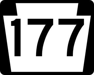
Pennsylvania Route 177 is a 9.6-mile-long (15.4 km) state highway located in York County, Pennsylvania. The southern terminus is an intersection with PA 74 and Township Route 4026 in Rossville. From this intersection, PA 177 bisects the southwestern portion of Pinchot Lake and continues along the northwestern side of Gifford Pinchot State Park. Just south of Lewisberry, PA 177 intersects PA 382 and marks the northern terminus of PA 392 to the north of town. The northern terminus is at PA 262 between Yocumtown and Frogtown, just after an interchange with Interstate 83 (I-83).

Pennsylvania Route 297 (PA 297) is a 6-mile-long (9.7 km) state highway located in York County, Pennsylvania. The southern terminus is at PA 921 in Zions View. The northern terminus is at PA 262 in Cly. PA 297 is a two-lane undivided road in the northern section of York County. The route heads north along Susquehanna Trail a short distance to the west of Interstate 83 (I-83) before reaching an interchange with the highway and heading to the east of it. PA 297 turns northeast in Strinestown and crosses PA 382 before it comes to its northern terminus.

U.S. Route 15 (US 15) is United States Numbered Highway that runs from Walterboro, South Carolina, north to Painted Post, New York. In Pennsylvania, the highway runs for 194.89 miles (313.65 km), from the Maryland state line just south of Gettysburg, north to the New York state line near Lawrenceville.

Pennsylvania Route 287 is a 63.9-mile-long (102.8 km) state highway in the Tioga Valley of Pennsylvania, United States. Route 287 runs from an intersection with U.S. Route 220 in the community of Larrys Creek in Piatt Township, Lycoming County, north to an intersection with PA 49 just south of the New York state line in Lawrenceville, Tioga County. The route follows Larrys Creek through several isolated communities, including Salladasburg and English Center, before working its way towards Hoytville, where it meets PA 414. The route ends up in Wellsboro, where it meets US 6, and reaches Tioga.

Noble is an unincorporated community in Abington Township in Montgomery County, Pennsylvania, United States. Noble is located at the intersection of Pennsylvania Route 611 and Baeder Road, north of Jenkintown. The community is served by the Noble station along SEPTA Regional Rail's West Trenton Line. Noble uses the Jenkintown ZIP code of 19046.
The York Haven Diabase is a rock formation in Pennsylvania, United States. It underlies the Rossville Diabase and is Jurassic in age. The formation is volcanic to subvolcanic, with a mafic composition and is categorized as a basalt. The York Haven Diabase is a member of the larger Gettysburg Basin. It plays an important role in United States history as the diabase outcrops were useful barriers in the union's strategy against the confederates at the Battle of Gettysburg.

