Woodbine, Pennsylvania | |
---|---|
Unincorporated community | |
Coordinates: 39°47′05″N76°24′21″W / 39.78472°N 76.40583°W Coordinates: 39°47′05″N76°24′21″W / 39.78472°N 76.40583°W | |
Country | United States |
State | Pennsylvania |
County | York |
Elevation | 292 ft (89 m) |
Time zone | Eastern (EST) (UTC-5) |
• Summer (DST) | EDT (UTC-4) |
ZIP code | 17302 |
Area code(s) | 717 |
GNIS feature ID | 1204982 [1] |
Woodbine is an unincorporated community in York County, Pennsylvania, United States. Until 1978, this community was served by the Maryland and Pennsylvania Railroad at milepost 50.6.
York County is a county in the U.S. state of Pennsylvania. As of the 2010 census, the population was 434,972. Its county seat is York. The county was created on August 19, 1749, from part of Lancaster County and named either after the Duke of York, an early patron of the Penn family, or for the city and shire of York in England.
Pennsylvania, officially the Commonwealth of Pennsylvania, is a state located in the northeastern and Mid-Atlantic regions of the United States. The Appalachian Mountains run through its middle. The Commonwealth is bordered by Delaware to the southeast, Maryland to the south, West Virginia to the southwest, Ohio to the west, Lake Erie and the Canadian province of Ontario to the northwest, New York to the north, and New Jersey to the east.
The Maryland and Pennsylvania Railroad, familiarly known as the "Ma and Pa", was an American short-line railroad between York and Hanover, Pennsylvania, formerly operating passenger and freight trains on its original line between York and Baltimore, Maryland, from 1901 until the 1950s. The Ma and Pa was popular with railfans in the 1930s and 1940s for its antique equipment and curving, picturesque right-of-way through the hills of rural Maryland and Pennsylvania. Reflecting its origin as the unintended product of the merger of two 19th-century narrow gauge railways, the meandering Ma and Pa line took 77.2 miles (124 km) to connect Baltimore and York, although the two cities are only 45 miles (72 km) apart in a straight line.
Woodbine is located at 39°47′05″N76°24′21″W / 39.78472°N 76.40583°W (39.7848255, -76.4057951).
Highspire is a borough in Dauphin County, Pennsylvania, United States. The population was 2,399 at the 2010 census, down from 2,720 at the 2000 census. It is part of the Harrisburg–Carlisle Metropolitan Statistical Area.
The Wedge is a 1.068-square-mile tract of land along the borders of Delaware, Maryland and Pennsylvania. Ownership of the land was disputed until 1921; it is now recognized as part of Delaware. The tract was created primarily by the shortcomings of contemporary surveying techniques when the boundaries were defined in the 17th century. It is bounded on the north by an eastern extension of the east–west portion of the Mason–Dixon line, on the west by the north–south portion of the Mason–Dixon line, and on the southeast by the Twelve-Mile Circle around New Castle, Delaware. The crossroads community of Mechanicsville, Delaware, lies within the area today.
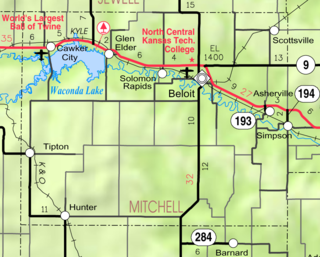
Asherville is an unincorporated, census-designated place rural area in Mitchell County, Kansas, United States.
Valley Forge is a village in the southwest corner of Springettsbury Township, York County, Pennsylvania, United States. The community is located just to the northeast of the city of York near the intersection of US Route 30 and North Sherman Street. Harley-Davidson's York plant is nominally located in Valley Forge.
Foustown is an unincorporated community in West Manchester Township, York County, Pennsylvania, United States.
Brush is a ghost town in Butte County, California, United States. It was located 3.5 miles (5.6 km) north of Berry Creek on the Western Pacific Railroad, at an elevation of 902 feet. It still appeared on maps as of 1948.
Stoverstown is an unincorporated community in York County, Pennsylvania, United States. Stoverstown is located off Pennsylvania Route 616 2 miles outside New Salem.
Brogue is an unincorporated community in Chanceford Township, York County, Pennsylvania, United States. Brogue is located on Pennsylvania Route 74, 7 miles east of Red Lion. Brogue should not be confused with Brogueville, another unincorporated community in Chanceford Township, located about 4 miles southwest.
Tolna is an unincorporated community in York County, Pennsylvania, United States. Tolna is located near Pennsylvania Route 851.
Craley is an unincorporated community in York County, Pennsylvania, United States. Craley is located on Pennsylvania Route 624 2 miles south of East Prospect.
Bryansville is an unincorporated community in York County, Pennsylvania, United States. The village of Bryansville has a large residential area known as Susquehanna Trails almost adjacent to it. Until 1978, this community was served by the Maryland and Pennsylvania Railroad at milepost 45.9.
Creswell is an unincorporated community in Lancaster County, Pennsylvania, United States.
Glenville is an unincorporated community in York County, Pennsylvania, United States.
New Park is an unincorporated community in York County, Pennsylvania, United States.
Admire is an unincorporated community in York County, Pennsylvania, United States.
Big Mountain, often stylized as Big Mount, is an unincorporated community in York County, Pennsylvania, United States.
New Bridgeville is an unincorporated community in York County, Pennsylvania, United States.
Fuhrmans Mill is an unincorporated community in York County, Pennsylvania, United States.
Willoughby Run is a tributary of Marsh Creek in Adams County, Pennsylvania in the United States.
Half Mound is an unincorporated community in Jefferson County, Kansas, in the United States.
This York County, Pennsylvania state location article is a stub. You can help Wikipedia by expanding it. |