Related Research Articles

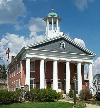
Fulton County is a county in the Commonwealth of Pennsylvania. As of the 2020 census, the population was 14,556, making it the fourth-least populous county in Pennsylvania. Its county seat is McConnellsburg. The county was created on April 19, 1850, from part of Bedford County and named for inventor Robert Fulton.

South Charleston is a village in Clark County, Ohio, United States. The population was 1,693 at the 2010 census. It is part of the Springfield, Ohio Metropolitan Statistical Area.

Jefferson is a borough in York County, Pennsylvania, United States. The population was 655 at the 2020 census. The post office serving Jefferson is called Codorus.

La Feria North is a census-designated place (CDP) in Cameron County, Texas, United States. The population was 212 at the 2010 census. It is part of the Brownsville–Harlingen Metropolitan Statistical Area.

Sideling Hill, also Side Long Hill, is a long, steep, narrow mountain ridge in the Ridge-and-Valley physiographic province of the Appalachian Mountains, located in Washington County in western Maryland and adjacent West Virginia and Pennsylvania, USA. The highest point on the ridge is Fisher Point, at 2,310 feet (700 m) in Fulton County, Pennsylvania.

The Allegheny Mountain Tunnel is a vehicular tunnel carrying the Pennsylvania Turnpike through the Allegheny Mountains. At this point, the Turnpike carries Interstates 70 and 76. When the tunnel was built, it was considered an "engineering marvel."
The Abandoned Pennsylvania Turnpike is the common name of a 13-mile (21 km) stretch of the Pennsylvania Turnpike that was bypassed in 1968 when a modern stretch opened to ease traffic congestion in the tunnels. In this case, the Sideling Hill Tunnel and Rays Hill Tunnel were bypassed, as was one of the Turnpike's travel plazas. The bypass is located just east of the heavily congested Breezewood interchange for Interstate 70 (I-70) eastbound at what is now I-76 exit 161. The section of the turnpike was at one time part of the South Pennsylvania Railroad.
Sideling Hill Creek is a 25.2-mile-long (40.6 km) tributary stream of the Potomac River in the U.S. states of Maryland and Pennsylvania. Sideling Hill Creek flows southward along the western flanks of Sideling Hill, from which the stream takes its name. It forms the boundary between Allegany and Washington counties in Maryland.
Deer Creek is a 52.9-mile-long (85.1 km) river in Maryland and Pennsylvania that flows through the scenic areas of Harford County and empties into the Susquehanna River, roughly halfway between the Interstate 95 bridge and Conowingo Dam. Its watershed area is 171 square miles (440 km2). Its watershed area in MD is 145 square miles (380 km2), with 3% impervious surface in 1994. It serves as a divider between the agricultural and urban/suburban areas of Harford County.
Sideling Hill Creek is a 21.9-mile-long (35.2 km) tributary of Aughwick Creek in Huntingdon County, Pennsylvania in the United States. Via Aughwick Creek and the Juniata River, it is part of the Susquehanna River watershed.
Valley Forge is a village in the southwestern corner of Springettsbury Township, York County, Pennsylvania, United States. The community is located just to the northeast of the city of York near the intersection of U.S. Route 30 and North Sherman Street. Harley-Davidson's York plant is nominally located in Valley Forge.
The Hagerstown–Martinsburg Metropolitan Area, officially designated by the United States Office of Management and Budget (OMB) as Hagerstown–Martinsburg, Maryland–West Virginia Metropolitan Statistical Area (MSA), constitutes the primary cities of Hagerstown, Maryland; Martinsburg, West Virginia; and surrounding areas in three counties: Washington County, Maryland; Berkeley County, West Virginia; and Morgan County, West Virginia. The metro area lies mainly within the rich, fertile Cumberland and Shenandoah valleys, and is approximately a 60–90 minute drive from Washington, D.C.; Baltimore, Maryland; and Harrisburg, Pennsylvania; Hagerstown is approximately 75 miles (121 km) driving distance from all three cities. The population of the metropolitan area as of 2008 is 263,753.
Stoverstown is an unincorporated community in York County, Pennsylvania, United States. Stoverstown is located off Pennsylvania Route 616, two miles outside New Salem.

Brogue is an unincorporated community in Chanceford Township, York County, Pennsylvania, United States. Brogue is located on Pennsylvania Route 74, seven miles (11 km) east-southeast of Red Lion. Brogue should not be confused with Brogueville, another unincorporated community in Chanceford Township, located about four miles (6.4 km) southwest.
Davidsburg is an unincorporated community in York County, Pennsylvania, United States. Davidsburg is located in Dover Township, 3 miles west of Weigelstown.
Bandanna, also known as Pleasant Hill, is an unincorporated area in York County, Pennsylvania, United States. Bandanna is located on Pennsylvania Route 94 about 3 miles south of Hanover.

Yorklyn is a census-designated place (CDP) in York County, Pennsylvania, United States. The population was 1,912 at the 2010 census. The area was delineated as the Springetts Manor-Yorklyn CDP for the 2000 census.

Stonybrook is a census-designated place (CDP) in York County, Pennsylvania, United States. The population was 2,384 at the 2010 census. The area was delineated as the Stonybrook-Wilshire CDP for the 2000 census.

Tyler Run is a census-designated place (CDP) in York County, Pennsylvania, United States. The population was 1,901 at the 2010 census. The area was part of the Tyler Run-Queens Gate CDP at the 2000 census.

Queens Gate is a census-designated place (CDP) in York County, Pennsylvania, United States. The population was 1,464 at the 2010 census. The area was part of the Tyler Run-Queens Gate CDP at the 2000 census.
References
Coordinates: 39°49′31″N76°53′41″W / 39.82528°N 76.89472°W
