Akron is a borough in Lancaster County, Pennsylvania, United States. As of the 2020 census, it had a population of 4,169,

Littlestown is a borough in Adams County, Pennsylvania, United States. The population was 4,782 at the 2020 census.

Clairton is a city in Allegheny County, Pennsylvania, United States. It is located along the Monongahela River and is part of the Pittsburgh Metropolitan Area. The population was 6,181 at the 2020 census. Under Pennsylvania legal classifications for local governments, Clairton is considered a third-class city. It is home to Clairton Works, the largest coke manufacturing facility in the United States.

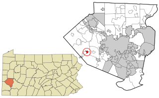
Oakdale is a borough in Allegheny County, Pennsylvania, United States and is a Pittsburgh suburb. The population was 1,475 at the 2020 census. Its zip code is 15071.

Ford City is a borough in Armstrong County, Pennsylvania, United States, 40 miles (64 km) northeast of Pittsburgh along the east bank of the Allegheny River and 4 miles (6 km) south of Kittanning, the county seat. The population was 2,859 at the 2020 census. It is part of the Pittsburgh metropolitan area.

Robesonia is a borough in Berks County, Pennsylvania, United States. The population was 2,061 at the 2010 census. Once famous for its iron furnaces, the town was founded in 1855 by Henry P. Robeson, who had acquired existing iron manufacturing operations and founded the Robesonia Iron Company in 1845. The town is now supported by large industry. Several of the largest employers include C&S Wholesale Grocers, a food distributor, Magnatech International, and Snap-On Tools. The town is also known for its Pennsylvania German-style pottery, also sometimes called redware. The Robesonia area is served by the Conrad Weiser Area School District and Conrad Weiser High School.

Newtown is a borough in Bucks County, Pennsylvania, United States. The population was 2,268 at the 2020 census. It is located just west of the Trenton, New Jersey metropolitan area, and is part of the larger Philadelphia metropolitan area. It is entirely surrounded by Newtown Township, from which it separated in 1838. State Street is the main commercial thoroughfare with wide sidewalks, shops, taverns, and restaurants.

Vintondale is a borough in Cambria County, Pennsylvania, United States. It is part of the Johnstown, Pennsylvania Metropolitan Statistical Area. The population was 414 as of the 2010 census.

New Bethlehem is a borough in Clarion County, Pennsylvania, United States. The population was 979 at the 2020 census. The borough is situated at the southwestern corner of the Pennsylvania Wilds Conservation Landscape. Its main street, PA Route 28-66, is a major thoroughfare between the Pittsburgh metropolitan region and northcentral Pennsylvania.

Ridgway is a borough in and the county seat of Elk County, Pennsylvania. As of the 2020 census it had a population of 4,039

Duryea is a borough in the Greater Pittston area of Luzerne County, Pennsylvania, United States, 9 miles (14 km) south of Scranton. The Susquehanna River marks Duryea's western boundary and the Lackawanna River flows through Duryea. It was incorporated as a borough in 1901, and had a notable switching rail yard, the Duryea yard, connecting the central Wyoming Valley to destinations in lower New York and down-state Pennsylvania. Coal mining and silk manufacturing were the chief industries in Duryea's early years. The population was 5,032 at the 2020 census.

Conshohocken is a borough on the Schuylkill River in Montgomery County, Pennsylvania in suburban Philadelphia. Historically a large mill town and industrial and manufacturing center, after the decline of industry in recent years Conshohocken has developed into a center of riverfront commercial and residential development. In the regional slang, it is sometimes referred to by the colloquial nickname Conshy.

Danville is a borough in and the county seat of Montour County, Pennsylvania, United States, along the North Branch of the Susquehanna River. The population was 4,221 at the 2020 census.

Hellertown is a borough in Northampton County, Pennsylvania. Its population was 6,131 at the 2020 census. Hellertown is part of the Lehigh Valley metropolitan area, which had a population of 861,899 and was the 68th-most populous metropolitan area in the U.S. as of 2020.

Orwigsburg is a borough in Schuylkill County, Pennsylvania. The borough was named for its founder, Peter Orwig, and created from West Brunswick Township in 1823.

Montrose is a borough in Susquehanna County, Pennsylvania, United States, 18.41 miles (29.63 km) south-southeast of Binghamton, New York and 31.39 miles (50.52 km) north by west of Scranton. The land is elevated approximately 1,400 feet (430 m) above sea level. It is the Susquehanna County seat.

Smithton is a borough in Westmoreland County, Pennsylvania, United States. The population was 399 at the 2010 census. As of 2018, the population was listed at 378. Smithton has its own post office, with zip code 15479, and is serviced by Yough School District.

Dillsburg is a borough in York County, Pennsylvania, United States. The population was 2,643 as of the 2020 census.

Glen Rock is a borough in York County, Pennsylvania, United States. The population was 2,120 at the 2020 census.

Shrewsbury is a borough in York County, Pennsylvania, United States. The population was 3,848 at the time of the 2020 census.


