McDonald Lake (Saskatchewan)

Last updated

McDonald Lake
Rafferty Reservoir
ISS-61 McDonald Lake in Saskatchewan, Canada.jpg
McDonald Lake as seen from the ISS
Canada Saskatchewan relief location map.jpg
Red pog.svg
McDonald Lake
Location in Saskatchewan
Canada relief map 2.svg
Red pog.svg
McDonald Lake
McDonald Lake (Canada)
Coordinates 49°11′38″N103°14′17″W / 49.194°N 103.238°W / 49.194; -103.238
Type Reservoir
Primary inflows 
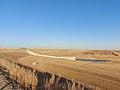
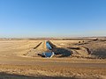
Souris River and a 10-km diversion channel connecting Boundary and Rafferty Reservoirs, which allows water to be diverted from Boundary Reservoir into McDonald Lake.
Primary outflows Souris River
Catchment area 2,448 km2 (945 sq mi)
Managing agency Saskatchewan Water Security Agency
BuiltJuly 1, 1991 (1991-07-01)
Max. length57 km (35 mi)
Max. width1.2 km (0.75 mi)
Surface area4,341.3 ha (10,728 acres) [1]
Max. depth15 m (49 ft)
Water volume439,600 dam3 (356,400 acre⋅ft)
Surface elevation556 m (1,824 ft)
References [2]

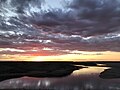
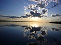
McDonald Lake, also known as Rafferty Reservoir, is a reservoir in the south-eastern part of the Canadian province of Saskatchewan. [3] It was created when the Rafferty Dam was built on the Souris River in 1994. Before the dam was built that flooded the Souris Valley, McDonald Lake was a small lake and marsh on the valley floor adjacent to the Souris River.

Contents

The reservoir provides water to the Shand Power Station and to the city of Estevan. A 10-kilometre long pipeline supplies the power station and a 9.2-kilometre long pipeline, which originates along the Souris River river bed at the bottom of the reservoir, brings water to the Estevan water treatment plant. The water pipeline that brings water to Estevan was completed in 2020 after a three-year project that changed the source of Estevan's drinking water away from Boundary Dam Reservoir. [4]

Rafferty Dam

Rafferty Dam and reservoir Rafferty Dam 02.jpg
Rafferty Dam and reservoir

Rafferty Dam ( 49°09′08″N103°05′22″W / 49.1522°N 103.0894°W / 49.1522; -103.0894 ) is at the south-eastern corner of the lake, about 4.8 kilometres (3.0 mi) upstream from Estevan. It was built in conjunction with the Grant Devine Dam (formally known as Alameda Dam), which was built further downstream on Moose Mountain Creek. Both dams are operated by the Saskatchewan Water Security Agency. The dam and reservoir provide flood control along the Souris River, irrigation, and recreation. [5]

The height of the top of the dam is 555 m (1,821 ft) above sea level. The maximum height available for flood control is 554 m (1,818 ft). The normal full supply level is 550.5 m (1,806 ft) and the normal drawdown level is 549.5 m (1,803 ft). The maximum draw down is 547.5 m (1,796 ft) above sea level. At full supply, the reservoir covers an area of 4,881 ha (12,060 acres). [6] Two additional dams were built to contain the reservoir: The 12.1-metre (40 ft) high Rafferty R3-2 Closure Dam ( 49°20′36″N103°32′06″W / 49.3434°N 103.5351°W / 49.3434; -103.5351 ) and the 10.3-metre (34 ft) high Rafferty R4-1 Closure Dam ( 49°22′18″N103°34′50″W / 49.3717°N 103.5805°W / 49.3717; -103.5805 ). Highway 606 crosses R3-2 and R4-1 is at Mainprize Regional Park.

A 10-kilometre (6.2 mi) long spillway connects the Boundary Dam Reservoir to McDonald Lake, allowing excess water to flow into McDonald Lake. The flow can also be reversed if necessary. [7]

Mainprize Regional Park

Mainprize Regional Park ( 49°22′09″N103°34′56″W / 49.3691°N 103.5821°W / 49.3691; -103.5821 ) is a regional park in the RM of Cymri No. 36 on the eastern shore at the northern end of McDonald Lake. The park includes a golf course, a campground, cabins, Pederson Place (a 5,000 sq ft (460 m2) multi-purpose hall with a 3,000 sq ft (280 m2) deck), a beach area, group camping, a boat launch, hiking trails, and four residential cottage subdivisions. Access to Mainprize is from Highway 606. [8]

In 1961, the regional park was founded in the Souris River Valley about 5 kilometres (3.1 mi) downstream from the park's current location. With the building of the Rafferty Dam and subsequent flooding of the valley, the park was moved to its current location. It was named after Dr. William Graham Mainprize, who served the nearby community of Midale for over 50 years. [9]

The golf course is a par 72, Scottish links-style 18-hole course that was built in 1994. It has grass greens and there are 6,958 total yards. Amenities include a pro shop, rentals, a restaurant, and a licensed lounge. [10] [11]

Fish species

Fish commonly found in McDonald Lake include walleye, northern pike, white sucker, and yellow perch. Between 1992 and 1999, the lake was stocked with over 20 million walleye. [12]

See also

Related Research Articles

<span class="mw-page-title-main">Weyburn</span> City in Saskatchewan, Canada

Weyburn is the tenth-largest city in Saskatchewan, Canada. The city has a population of 11,019. It is on the Souris River 110 kilometres (68 mi) southeast of the provincial capital of Regina and is 70 kilometres (43 mi) north from the North Dakota border in the United States. The name is reputedly a corruption of the Scottish "wee burn," referring to a small creek. The city is surrounded by the Rural Municipality of Weyburn No. 67.

<span class="mw-page-title-main">Souris River</span> River in Canada and the United States

The Souris River or Mouse River is a river in central North America. Approximately 435 miles (700 km) in length, it drains about 23,600 square miles (61,100 km2) in Canada and the United States.

<span class="mw-page-title-main">Grant Devine Dam</span> Dam and reservoir in Saskatchewan, Canada

The Grant Devine Dam, formerly Alameda Dam, is an embankment dam located in the Canadian province near Alameda and Oxbow. It was constructed in 1994 to control flows on Moose Mountain Creek and Souris River. It provides flood protection and irrigation for this area of Saskatchewan, along with protection for Minot, North Dakota. The Grant Devine Reservoir provides opportunities for recreational use such as boating and fishing. At the full supply level of 562 metres (1,844 ft), the reservoir holds 105,000,000 m3 (3.7×10⁹ cu ft) of water. The project is owned and operated by the Saskatchewan Water Security Agency (formerly Saskatchewan Watershed Authority).

<span class="mw-page-title-main">Saskatchewan Highway 35</span> Provincial highway in Saskatchewan, Canada

Highway 35 is a paved, undivided provincial highway in the Canadian province of Saskatchewan. It runs from the U.S. border at the Port of Oungre north to a dead end near the north shore of Tobin Lake. The southern end of Highway 35 is one segment of the CanAm Highway, which is an international highway connecting Canada, the United States, and Mexico. Highway 35 is about 569 kilometres (354 mi) long.

<span class="mw-page-title-main">Saskatchewan Highway 39</span> Provincial highway in Saskatchewan, Canada

Highway 39 is a provincial paved highway in the southern portion of the Canadian province of Saskatchewan connecting North Portal and Moose Jaw in the north. This is a primary Saskatchewan highway maintained by the provincial and federal governments that provides a major trucking and tourism route between the United States at Portal, North Dakota and the Trans-Canada Highway near Moose Jaw.

<span class="mw-page-title-main">Midale</span> Town in Saskatchewan, Canada

Midale is a town in the Rural Municipality of Cymri No. 36, in the Canadian province of Saskatchewan. It is located on Highway 39, midway between the cities of Weyburn and Estevan. It is 160 kilometres (100 mi) south-east of Regina.

Fishing Lake is a closed basin freshwater lake in the Canadian province of Saskatchewan. The lake is 22 kilometres (14 mi) north of the town of Foam Lake, and 24 kilometres (15 mi) east of the town of Wadena and is accessed from Highways 5 and 310. The northern and eastern shore is in the RM of Sasman No. 336 and the southern and western shore is in the RM of Foam Lake No. 276. The north-east portion of the lake–on the east side of McCormick Bay–is designated as Fishing Lake Wildlife Refuge.

<span class="mw-page-title-main">Boundary Dam Reservoir</span> Lake in Saskatchewan, Canada

Boundary Dam Reservoir is a man-made lake in the south-east corner of the Canadian province of Saskatchewan. It is in census division 1, in the RM of Estevan. The closest city is Estevan, which is about 5.5 kilometres (3.4 mi) downstream. There are no towns or villages along the lake's shore but there are two subdivisions and a regional park. The subdivisions, which are in the RM of Estevan, are called Sunset Bay and Lakewood. The primary inflow and outflow for the reservoir is Long Creek. There is a 10-kilometre long diversion channel that goes to McDonald Lake that can take excess water in either direction.

<span class="mw-page-title-main">2011 Souris River flood</span> 2011 flood affecting Canada and USA

The 2011 Souris/Mouse River flood in Canada and the United States occurred in June and was greater than a hundred-year flooding event for the river. The US Army Corps of Engineers estimated the flood to have a recurrence interval of two to five centuries.

Moose Mountain Upland, Moose Mountain Uplands, or commonly Moose Mountain, is a hilly plateau located in the south-east corner of the Canadian province of Saskatchewan, that covers an area of about 13,000 square kilometres (5,000 sq mi). The upland rises about 200 metres (660 ft) above the broad, flat prairie which is about 600 metres (2,000 ft) above sea level. The highest peak is "Moose Mountain" at 830 metres (2,720 ft) above sea level. The upland was named Moose Mountain because of the large number of moose that lived in the area. When it was originally used by fur traders, Métis, and the Indigenous peoples, the plateau was called Montagne a la Bosse, which is French for "The Mountain of the Bump or Knob".

<span class="mw-page-title-main">Moosomin Lake</span> Lake in Saskatchewan, Canada

Moosomin Lake, also known as Moosomin Reservoir, is a man-made lake in south-eastern part of the Canadian province of Saskatchewan. Created by the damming of Pipestone Creek in 1954, Moosomin Lake is located about 10 kilometres (6.2 mi) south of the town of Moosomin and is in the Souris River watershed. The reservoir's uses include irrigation, water supply, and recreation. Moosomin Lake Regional Park is on lake's western shore.

<span class="mw-page-title-main">Long Creek (Saskatchewan)</span> River in central North America

Long Creek is a river in central North America that begins in Saskatchewan, flows south-east into North Dakota, and then flows back north into Saskatchewan. It is a tributary of the Souris River. The Souris River drains into the Assiniboine River, which is part of the Red River drainage basin in a region called the Prairie Pothole Region of North America, which extends throughout three Canadian provinces and five U.S. states. It is also within Palliser's Triangle and the Great Plains ecoregion. In 1957, a dam was built on Long Creek near where it meets the Souris River to create Boundary Dam Reservoir.

<span class="mw-page-title-main">Moose Mountain Creek</span> River in southern Saskatchewan, Canada

Moose Mountain Creek is a river in the Canadian province of Saskatchewan. Its source is the Chapleau Lakes near Montmartre and it is a tributary of the Souris River, which, in turn, is a tributary of the Assiniboine River. The whole system is part of the Red River watershed, which is part of the Hudson Bay drainage basin and in a region called the Prairie Pothole Region of North America, which extends throughout three Canadian provinces and five U.S. states. It is also within Palliser's Triangle and the Great Plains ecoregion.

<span class="mw-page-title-main">Moose Mountain Lake</span> Lake in Saskatchewan, Canada

Moose Mountain Lake is a reservoir in the Canadian province of Saskatchewan. It is located in the RM of Golden West No. 95 in the Prairies Ecozone of Palliser's Triangle at the western edge of Moose Mountain Upland. Moose Mountain Creek is both the primary inflow and outflow of the lake; it enters at the north end and leaves at the dam in the south end. A secondary inflow that comes from Gooseberry Lake enters on the western side near the south end.

<span class="mw-page-title-main">Arm River (Saskatchewan)</span> River in Saskatchewan, Canada

Arm River is a river in the Canadian province of Saskatchewan. It is located in the south central part of the province in a region called the Prairie Pothole Region of North America, which extends throughout three Canadian provinces and five U.S. states. It is also within Palliser's Triangle and the Great Plains ecoregion.

<span class="mw-page-title-main">Moose Jaw River</span> River in Saskatchewan, Canada

Moose Jaw River is a river in the Canadian province of Saskatchewan. It is located in the southern part of the province in a region called the Prairie Pothole Region of North America, which extends throughout three Canadian provinces and five U.S. states. It is also within Palliser's Triangle and the Great Plains ecoregion.

<span class="mw-page-title-main">Avonlea Creek</span> River in Saskatchewan, Canada

Avonlea Creek is a river in the southern part of the Canadian province of Saskatchewan. It is in a region called the Prairie Pothole Region of North America, which extends throughout three Canadian provinces and five U.S. states. It is also within Palliser's Triangle and the Great Plains ecoregion. Avonlea Creek is a main tributary of the Moose Jaw River, which is part of the Upper Qu'Appelle Watershed and the Hudson Bay drainage basin.

Theodore Reservoir is a man-made reservoir along the course of the Whitesand River in the Canadian province of Saskatchewan. The lake was formed with the building of Theodore Dam in 1964. The reservoir and dam were named after the nearby community of Theodore. Whitesand River is the primary inflow and outflow for the reservoir. Lawrie Creek, which begins in the Beaver Hills, flows into the lake on the western side near the dam.

Wood River is a river in the Canadian province of Saskatchewan. It has its source in the Wood Mountain Hills of south-western Saskatchewan and flows in a north-easterly direction to its mouth at Old Wives Lake. Old Wives Lake is a salt water lake with no outflow. As a result, the drainage basin of Wood River is an endorheic one. Along the course of the river, there are several parks, historical sites, and small towns.

<span class="mw-page-title-main">Nickle Lake</span> Lake in Saskatchewan, Canada

Nickle Lake is a man-made reservoir in the Canadian province of Saskatchewan. It was created with the construction of a dam across the Souris River in the 1950s to supply water to the city of Weyburn. In the 1980s, the dam—christened Albert Douglas Dam—was expanded thereby increasing the size of the lake.

References

  1. "McDonald Lake". Angler's Atlas. Retrieved 21 March 2024.
  2. "McDonald Lake". Mapcarta.
  3. "McDonald Lake". Canadian Geographical Names Database. Government of Canada. Retrieved 1 May 2023.
  4. Florizone, Alaura (16 July 2020). "Ceremony for the New Waterline at Rafferty Dam". Discover Estevan. Retrieved 21 March 2024.
  5. "Rafferty-Grant Devine Project". Water Security Agency. 22 February 2021. Retrieved 21 March 2024.
  6. Park, Norm (10 August 2011). "Detailed review of dams and reservoirs coming". Sask Today. Glacier Media Group. The Mercury. Retrieved 21 March 2024.
  7. "Dams and Reservoirs". wsask. Water Security Agency. 27 January 2021. Retrieved 20 March 2024.
  8. "Mainprize Regional Park and Golf Club". Tourism Saskatchewan. Government of Saskatchewan. Retrieved 21 March 2024.
  9. "Mainprize". Regional Parks of Saskatchewan. Saskatchewan Regional Parks. Retrieved 21 March 2024.
  10. "Mainprize Regional Park and Golf Course". Golf Pass. Retrieved 21 March 2024.
  11. "Rafferty Reservoir". Sask Lakes. Retrieved 21 March 2024.
  12. "McDonald Lake". Fishbrain. Retrieved 21 March 2024.