Mildura is a regional city in north-west Victoria, Australia. Located on the Victorian side of the Murray River, Mildura had a population of 34,565 at the 2021 census. When nearby Wentworth, Irymple, Nichols Point, Merbein and Red Cliffs are included, the combined urban area had a population of 58,914 in 2021, having grown marginally at an average annual rate of 1.3% year-on-year over the preceding five years.

Euston is a small town on the banks of the Murray River, in the Murray region of far south-western New South Wales, Australia in Balranald Shire. The twin town of Robinvale is on the other side of the river in the state of Victoria.
Nangiloc is a small rural community in North Western Victoria on the south (left) bank of the Murray River, about 50 km south east of Mildura. Primarily an agricultural settlement, at the 2021 census, Nangiloc and the surrounding area had a population of 153.
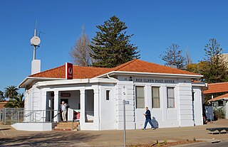
Red Cliffs is a town in Victoria, Australia in the Sunraysia region. It is located on the Calder Highway, 16 km south of Mildura and 544 km north-west of Melbourne.
Boolarra is a small township located in the Latrobe Valley, in central Gippsland, Victoria, Australia. At the 2016 Census, Boolarra had a population of 973 with 48% males and 52% females and an average age of 50. The Boolarra Folk Festival is held in the town every year in March and attracts music lovers from around Australia and the world. The town is also infamous for producing the Boolarra strain of carp which, after their release into the Murray River near Mildura, spread throughout Australia.

Ouyen is a town in Victoria, Australia, located in the Rural City of Mildura at the junction of the Calder Highway and Mallee Highway, 105 kilometres (65 mi) south of Mildura, and 441 km (274 mi) northwest of Melbourne. At the 2016 census, the town had a population of 1,045.

Werrimull is a small town and locality in the Rural City of Mildura, part of the Sunraysia region of Victoria. The place by road, is situated about 10 kilometres west of Karawinna and 10 kilometres east of Bambill. It is 79 kilometres (49 mi) west southwest of Mildura, 13 kilometres south of the Sturt Highway opposite Lake Cullulleraine. At the 2016 census, Werrimull and the surrounding area had a population of 112, declining from 320 in 2011.

Grong Grong is a small town that is located in the Riverina region of New South Wales, Australia. The town is situated on the Newell Highway, 23 kilometres (14 mi) east of Narrandera in the Shire of Narrandera.

Yelta is a locality in Victoria, Australia. It was for a short time in the 1870s and 1880s the Victorian administrative centre of what is now Sunraysia and the Millewa. This role was then taken over by Mildura. At the 2011 census, Yelta and the surrounding area had a population of 281.
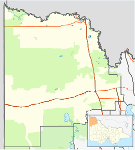
The Millewa is a region of north western Victoria in Australia.
Gol Gol is a small country town in the Wentworth Shire, in the far western region of New South Wales, Australia. It is situated on the banks of the Murray River, within the Sunraysia region. In the fifteen years from 2006 to 2021, the population of Gol Gol increased from 663 to 1,956.
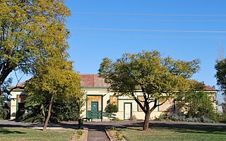
Red Cliffs is a closed railway station in the town of Red Cliffs, on the Mildura line, in Victoria, Australia. It was established as a passenger station in 1920, with a loop siding being provided around this time. In 1922, a railmotor service commenced between Mildura and Red Cliffs, and a railmotor turntable was provided. The service ended in 1928. In April 1924, the Red Cliffs – Werrimull branch line opened, heading west, and was later extended to Meringur and Morkalla.
The Mildura railway line is a heavy rail line in northwestern Victoria, Australia. The line runs from Yelta station to Ballarat station via the settlements of Mildura, Ouyen and Maryborough in an approximate south-southeasterly direction. Initial sections of the line opened from Ballarat in 1874 and the line reached Mildura in 1903.

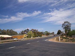
Cardross is a small town approximately 15 km south east of Mildura, in north western Victoria, Australia. At the 2021 census, Cardross and the surrounding area had a population of 847. It was the site of a road fatality in February 2006, in which six teenagers were killed in a hit-run crash.
Bambill is a locality situated on the Redcliffs-Meringur Road in the Sunraysia region. It is about 6 kilometres east from Yarrara and 9 kilometres west from Werrimull. The area was settled in the 1920s, the Post Office opening on 20 April 1926. The railway opened in 1925, and the station was closed in 1977.
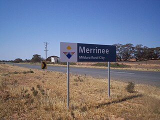
Merrinee is a locality situated in the Sunraysia region. It is situated about 7 kilometres west of Pirlta and 11 kilometres east of Karawinna, on the Red Cliffs-Meringur Road.

Walpeup is a town in the Mallee region of north west Victoria. The town is in the Rural City of Mildura local government area and on the Mallee Highway and Pinnaroo railway line between Ouyen and the South Australian border, 458 kilometres (285 mi) north west of the state capital, Melbourne and 130 kilometres (81 mi) south west of the regional centre of Mildura. At the 2016 census, Walpeup had a population of 158.
Watchupga is a locality in Northern Victoria, Australia. The local government area of Watchupga is the Shire of Buloke. Watchupga has a grain station on the Mildura railway line with a grain silo on the site which is 84 metres tall. However, the station was closed to passenger and parcels traffic on 11 November 1975. Watchupga Post Office opened on 23 July 1900 and was closed on 29 February 1972.
Curyo is a locality in the Mallee Ward of the Shire of Buloke, Victoria, Australia. Curyo has a Grain Depot on the Mildura railway line; however, the station closed to passenger and parcels traffic on 11 November 1975. A CFA fire brigade in the area is located on Pratt Road, adjacent to the grain depot. The post office there opened on 20 January 1900 and was closed on 9 January 1976. Curyo used to have a football club and a golf course.

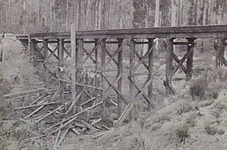
The Morkalla railway line was a railway in the Millewa region of north-western Victoria, Australia. It extended west from Red Cliffs railway station on the Mildura railway line into wheat farming areas established as soldier settlements after World War I.