
Seligman is a census-designated place (CDP) on the northern border of Yavapai County, in northwestern Arizona, United States. The population was 456 at the 2000 census.

Chillicothe is a city on the Illinois River in Peoria County, Illinois, United States. The population was 6,097 at the 2010 census. Chillicothe is just north of the city of Peoria and is part of the Peoria Metropolitan Statistical Area.

Strong City is a city in Chase County, Kansas, United States. Originally known as Cottonwood Station, in 1881 it was renamed Strong City after William Barstow Strong, then vice-president and general manager, and later president of the Atchison, Topeka and Santa Fe Railway. As of the 2020 census, the population of the city was 386. It is located along U.S. Route 50 highway.

Lost Springs is a city in Marion County, Kansas, United States. It was named for the old lost spring near the city. As of the 2020 census, the population of the city was 55. It is located south of Herington, about 0.6 miles west of the intersection of U.S. Route 77 highway and 340th Street next to the Union Pacific Railroad.

BNSF Railway is one of the largest freight railroads in North America. One of seven North American Class I railroads, BNSF has 35,000 employees, 32,500 miles (52,300 km) of track in 28 states, and nearly 8,000 locomotives. It has three transcontinental routes that provide rail connections between the western and eastern United States. BNSF trains traveled over 169 million miles in 2010, more than any other North American railroad.

The EMD FP45 is a cowl unit type of C-C diesel locomotive produced in the United States by General Motors Electro-Motive Division (EMD). It was produced beginning in 1967 at the request of the Atchison, Topeka and Santa Fe Railway, which did not want its prestigious Super Chief/El Capitan and other passenger trains pulled by freight style hood unit locomotives, which have external walkways.

The Atchison, Topeka and Santa Fe Railway, often referred to as the Santa Fe or AT&SF, was one of the larger railroads in the United States. The railroad was chartered in February 1859 to serve the cities of Atchison and Topeka, Kansas, and Santa Fe, New Mexico. The railroad reached the Kansas–Colorado border in 1873 and Pueblo, Colorado, in 1876. To create a demand for its services, the railroad set up real estate offices and sold farmland from the land grants that it was awarded by Congress.

The Santa Fe Trail was a 19th-century route through central North America that connected Franklin, Missouri, with Santa Fe, New Mexico. Pioneered in 1821 by William Becknell, who departed from the Boonslick region along the Missouri River, the trail served as a vital commercial highway until 1880, when the railroad arrived in Santa Fe. Santa Fe was near the end of El Camino Real de Tierra Adentro which carried trade from Mexico City. The trail was later incorporated into parts of the National Old Trails Road and U.S. Route 66.

Dearborn Station was, beginning in the late 1800s, one of six intercity train stations serving downtown Chicago, Illinois. It remained in operation until May 1, 1971. Built in 1883, it is located at Dearborn and Polk Streets, adjacent to Printers Row. The station was owned by the Chicago & Western Indiana Railroad, which itself was owned by the companies operating over its line. The station is now a shopping mall housing office, retail, and entertainment spaces.

The Scout was one of the named passenger trains of the Atchison, Topeka and Santa Fe Railway. It started as train Nos. 1 (westbound) & 10 (eastbound) between Chicago, Illinois and Los Angeles, California. Inaugurated on January 16, 1916, this "budget" heavyweight train had tourist sleeping cars with upper and lower berths, "chair" cars (coaches) and an open-end observation car.

The Scott Special, also known as the Coyote Special, the Death Valley Coyote or the Death Valley Scotty Special, was a one-time, record-breaking passenger train operated by the Atchison, Topeka and Santa Fe Railway from Los Angeles, California, to Chicago, Illinois, at the request of Walter E. Scott, known as "Death Valley Scotty". At the time of its transit in 1905, the Scott Special made the 2,265-mile (3,645 km) trip between the two cities at the fastest speed recorded to date; in doing so, it established the Santa Fe as the leader in high-speed travel between Chicago and the West Coast. The Scott Special made the trip in 44 hours and 54 minutes breaking the previous records, set in 1900 by the Peacock Special, by 13 hours and 2 minutes, and in 1903 by the Lowe Special, by 7 hours and 55 minutes. Santa Fe's regular passenger service from Los Angeles to Chicago at the time was handled on a 2½-day schedule by the California Limited. It was not until the 1936 introduction of the Super Chief that Santa Fe trains would regularly exceed the speeds seen on the Scott Special.

The San Bernardino Santa Fe Depot is a Mission Revival Style passenger rail terminal in San Bernardino, California, United States. It has been the primary station for the city, serving Amtrak today, and the Santa Fe and Union Pacific Railroads in the past. Until the mid-20th century, the Southern Pacific Railroad had a station 3/4 of a mile away. It currently serves one Amtrak and two Metrolink lines. The depot is a historical landmark listed on the National Register of Historic Places as Atchison, Topeka and Santa Fe Railway Passenger and Freight Depot.
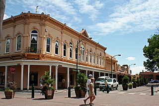
Santa Fe is the capital of the U.S. state of New Mexico. The name "Santa Fe" means 'Holy Faith' in Spanish, and the city's full name as founded remains La Villa Real de la Santa Fe de San Francisco de Asís.
Isaac Hamilton Rapp, was an American architect who has been called the "Creator of the Santa Fe style." He was born in Orange, New Jersey.
Atchison, Topeka and Santa Fe Railway Depot, or variations with Railroad or Station or Passenger and/or Freight may refer to any one of many stations of the Atchison, Topeka and Santa Fe Railway. These include:
Millsdale station was an Atchison, Topeka and Santa Fe Railway station in the ghost town of Millsdale, Illinois. It was located on the east bank of the Des Plaines River, and had two tracks passing through. The station is on the BNSF Chillicothe Subdivision and freight trains still pass by the site of the former depot.

The Fort Worth and Rio Grande Railway, chartered under the laws of Texas on June 1, 1885, was part of a plan conceived by Buckley Burton Paddock and other Fort Worth civic leaders to create a transcontinental route linking New York, Fort Worth, and the Pacific port of Topolobampo, which they believed would stimulate the growth and development of southwest Texas in general, and the economy of Fort Worth in particular.

Galesburg Santa Fe Station was a railway station in the west central Illinois town of Galesburg. The station was along the Atchison, Topeka and Santa Fe Railway's main line and served trains such as the Super Chief and El Captain. After Amtrak took over intercity rail in the United States, it was served by trains such as the Lone Star (1971–1979) and the Southwest Chief (1971–1996).

The Illinois Northern Railroad was an industrial switching railroad serving Chicago's southwest side. From their yard at 26th St. and Western Ave. the line went southwest to the Santa Fe Railway's Corwith Yard, connecting with most major area railroads and serving on-line customers on the way. They also leased and switched track east of their yard. Incorporated in 1901, it was merged into the Santa Fe Railway in 1975.
The Chicago and Illinois Western Railroad was an industrial switching railroad serving the west side of Chicago and southwest Cook County. From a connection with a now defunct north–south railroad line near 31st Blvd. and Western Ave. it went west along 33rd St. to Cicero. Just before Cicero Ave. it turned south and roughly paralleled Cicero Ave. to the Chicago Sanitary and Ship Canal. At the canal it turned west and paralleled the canal and then the Des Plaines River to Hodgkins. Incorporated in 1903, it was merged into the Illinois Central Gulf Railroad in 1984. In 2020 a short segment is used by the Canadian National Railway and the Cicero Central Railroad.

