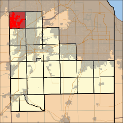
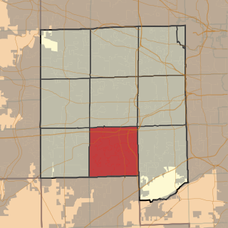
Wheatland Township, Will County, Illinois

Last updated
Wheatland Township
Township
Map highlighting Wheatland Township, Will County, Illinois.svg
Location in Will County
Coordinates: 41°40′45″N88°12′40″W / 41.67917°N 88.21111°W / 41.67917; -88.21111
Country United States
State Illinois
County Will
EstablishedNovember 6, 1849
Area
  Total35.82 sq mi (92.8 km2)
  Land35.49 sq mi (91.9 km2)
  Water0.33 sq mi (0.9 km2)  0.92%
Population
 (2010)
  Estimate 
(2016) [1]
84,602
  Density2,295.9/sq mi (886.5/km2)
Time zone UTC-6 (CST)
  Summer (DST) UTC-5 (CDT)
FIPS code 17-197-81035
Website wheatlandtownship.com

Wheatland Township is located in Will County, Illinois. As of the 2010 census, its population was 81,472 and it contained 25,075 housing units. [2]

Contents

As of 2008, Wheatland Township had over 27,000 parcels located within its boundaries. It ranked third in Will County for land parcels and the highest in EAV (Equalized Assessed Value).

It covers parts of Aurora, Bolingbrook, Plainfield, and Naperville (where the Wheatland Township administrative offices are located).

History

Most of Wheatland Township was still owned by the Potawatomi, a Native American tribe, until 1833. The 1833 Treaty of Chicago obtained this land and officially made it available for settlement. Growth was slow during the 1830s, due to a lack of significant wooded lands. Farmers depended on wood for building and a source of fuel. They also believed if the land could not grow trees then it would not be beneficial for farming.

Wheatland Township was surveyed between 1837-1839 and opened up for sale in 1841. [3] The earliest settlers in this area were predominantly Scottish and English immigrants. Early farming families included: Stewart (1832), Colegrove (1839), Brockway (pre 1842), Boardman (1830–32), Boughton (pre 1842), Foster (1837), Wightman (1838), Mather (Pre 19842), Davis (1843), Findlay (1844) Stewart (1850), McLaren (1848) McMicken (1842), Gilmour (1852), King (1852) Royce (1832), Brown (1862), Kinley (1843), Clow (1844), Catchpole (1844), Cotton (1843), Patterson(1844). [4] Other pre-1850 arrivals include Birkett, Varley, Lantz, Fry, Rathbun, Dundore, Mussey among many others. [3] Many of these families are buried in either the Wheatland Presbyterian Church Cemetery or the Wheatland Township Cemetery where their origin of birth can be seen on the historic tombstones *. Nearby and bordering Townships were populated by German and Swedish families bonded by their respective cultural heritages.

As adjacent townships grew, small settlements developed around rural crossroads, schools, churches and post offices. These centers offered goods and services and were determined by the distance the area farmers could complete a round trip in one-half day's time. Vermont Settlement, in the northwest corner of the township in sections 5–8, was the first settlement; established circa 1843 with the arrival of the Davis, Blanchard and Rice families of Vermont. Later arrivals to the settlement included the Kinley, Leppert, Piedlau and Schoger families. Tamarack crossroads was named in 1852 upon the arrival of Thomas Burnet who brought with him 4 tamarack trees from Detroit Michigan that were planted roughly a quarter-mile apart along 127th Street (originally Chaplins' Road). [5] The crossroads included a post office that was in operation from 1858 to 1902, a general store offering hardware supplies, jewelry and watch repair, operated by Thomas Muir of Glasgow Scotland, a blacksmiths shop run by William Nairn, and a school (Tamarack School District 34) which opened in the fall of 1866 and disbanded during the Wheatland School District consolidations. [6] Later crossroads were created along the Joliet, Elgin and Eastern Railroad. Normantown (1886-1903) and Wolf's Crossing (in Oswego Township, Kendall County 1890–1900) provided markets for farmers to weigh, sell and ship their produce. Other centers included East Wheatland Post Office originally on the Frank Boardman farm, Hoddam Post Office on the William Patterson farm, and the Tokio Post Office on the John Clow farm. [7]

Wheatland Presbyterian Church is a church in the township and known locally as The Scotch Church, in recognition of the numerous Scottish families that had settled the area; it is in section 19. The church was founded in the home of Stephen Findlay on May 20, 1848. Rev. William Oburn was the first Reverend. The first church was built in 1856 and sat in what would currently be the parking lot for the current church constructed in 1906. The original church closed its doors on October 8, 1906, and the current church opened with special services on October 21, 1906. [8]

Across the road on the south side of Ferguson Road, known today as 119th Street, was a one-room schoolhouse called the Wheatland Presbyterian School (District 38). The school house originally served eight grades within a single room in preparation for transfer to high school at either Plainfield, Aurora, or Oswego Illinois. The earliest school records housed at the Little White School Museum in Oswego, Illinois date back to the 1870s. The schoolhouse closed when the Wheatland Township schools consolidated into Wheatland Consolidated School District 40-C in the early 1950s. [6] Other churches in the east Wheatland neighborhood included the Zion Lutheran Church at 103rd Street and Book Road, DuPage Presbyterian Church near Weber Road and Boughton Road.

There were numerous one room schools in Wheatland Township. West Wheatland had Tamarack school, Wheatland Presbyterian School, Lumbard School, Johnson School, and Pilcher School. East Wheatland had White School, Lantz School, Spaulding School, Dannenburg School, and the Red School. [6]

Throughout the early 20th century, the churches created recreational leagues, among themselves, for various competitions including baseball. The most important annual activity within Wheatland Township was the Wheatland Plowing Matches. The plowing competition which began with horses and evolved into tractors measured the quality and accuracy of tilling the soil on various Township farmlands. In later years, the winner of the competition was rewarded with a trip to Scotland, where he could compete with his former countrymen. Farming was the primary industry of the township in the late 19th century and first half of the 20th century. The once magnificently beautiful farmland consisting of thousands of acres within the Township has been reduced to approximately six (6) family-owned farms with over 80 acres (320,000 m2).

Some of the original farmhouses are still in existence today and can be seen throughout the township. For example, the Boughton family farmhouse is located on Plainfield-Naperville Road. The Clow farmhouse and barn have been preserved by the Forest Preserve District of Will County and is located near 111th Street and Book Road.

Wheatland Township has grown from 1,098 population in 1880 to over 81,472 according to the 2010 census.

Geography

According to the 2010 census, the township has a total area of 35.82 square miles (92.8 km2), of which 35.49 square miles (91.9 km2) (or 99.08%) is land and 0.33 square miles (0.85 km2) (or 0.92%) is water. [2]

Cities, Towns, Villages

Unincorporated Towns

Demographics

Historical population
CensusPop.Note
2016 (est.)84,602 [1]
U.S. Decennial Census [9]

Facilities

The Wheatland Athletic Association (WAA) is a non-profit parent volunteer organization which provides Youth Athletic Programs to all residents of the District 204 school community (Naperville/Aurora, Illinois) and surrounding areas. WAA was founded in 1977 to provide T-Ball for 60 children. Today they have over 15,000 participants for children age 2 - 18 as well as adult programs. [10]

Notes

  1. 1 2 "Population and Housing Unit Estimates" . Retrieved June 9, 2017.
  2. 1 2 "Population, Housing Units, Area, and Density: 2010 - County -- County Subdivision and Place -- 2010 Census Summary File 1". United States Census. Archived from the original on 2020-02-12. Retrieved 2013-05-28.
  3. 1 2 Woodruff
  4. Plat
  5. Burnet
  6. 1 2 3 WCRBOE
  7. Keeler
  8. Scots
  9. "Census of Population and Housing". Census.gov. Retrieved June 4, 2016.
  10. "WAA-Wheatland Athletic Association". waasports.org.

Related Research Articles

<span class="mw-page-title-main">Will County, Illinois</span> County in Illinois, United States

Will County is a county in the northeastern part of the state of Illinois. According to the 2020 census, it had a population of 696,355, an increase of 2.8% from 677,560 in 2010, making it Illinois's fourth-most populous county. The county seat is Joliet. Will County is one of the five collar counties of the Chicago-Naperville-Elgin, IL-IN-WI Metropolitan Statistical Area. The portion of Will County around Joliet uses area codes 815 and 779, while 630 and 331 are for far northern Will County and 708 is for central and eastern Will County.

<span class="mw-page-title-main">Kendall County, Illinois</span> County in Illinois, United States

Kendall County is a county in the U.S. state of Illinois, within the Chicago metropolitan area. According to the 2020 census, it has a population of 131,869. Its county seat is Yorkville, and its most populous municipality is Oswego.

<span class="mw-page-title-main">Kane County, Illinois</span> County in Illinois, United States

Kane County is a county in the U.S. state of Illinois. According to the 2020 census, it has a population of 516,522, making it the fifth-most populous county in Illinois. Its county seat is Geneva, and its largest city is Aurora. Kane County is one of the collar counties of the metropolitan statistical area designated "Chicago–Naperville–Elgin, IL–IN–WI" by the US Census.

<span class="mw-page-title-main">DuPage County, Illinois</span> County in Illinois, United States

DuPage County is a county in the U.S. state of Illinois, and one of the collar counties of the Chicago metropolitan area. As of the 2020 census, the population was 932,877, making it Illinois' second-most populous county. Its county seat is Wheaton.

<span class="mw-page-title-main">Somonauk, Illinois</span> Village in Illinois, United States

Somonauk is a village in DeKalb and LaSalle Counties in the U.S. state of Illinois. The population was 1,786 at the 2020 Census, down from 1,893 at the 2010 Census.

<span class="mw-page-title-main">Aurora, Illinois</span> City in Illinois, United States

Aurora is a city in the Chicago metropolitan area. Located primarily in DuPage and Kane Counties, it is the second most populous city in Illinois, after Chicago, and the 144th most populous city in the United States. The population was 197,899 at the 2010 census, and was 180,542 at the 2020 census.

<span class="mw-page-title-main">Bolingbrook, Illinois</span> Village in Illinois, United States

Bolingbrook is a village in Will and DuPage counties in the U.S. state of Illinois. It is a southwest suburb of Chicago on I-55 and Historic Route 66. The village was a new town built on the Gateway Wetlands west of the Des Plaines River in the 1960s. Bolingbrook experienced rapid growth in the 1980s and 1990s, and eventually became the second largest town in the county after Joliet. Per the 2020 census, the population was 73,922. As of 2010, it is the 17th largest incorporated place in Illinois and the state's 2nd largest village.

<span class="mw-page-title-main">Naperville, Illinois</span> City in Illinois, United States

Naperville is a city within the Chicago Metropolitan Area in DuPage and Will counties in the U.S. state of Illinois. It is a western suburb of Chicago located 28 miles (45 km) west of the city.

<span class="mw-page-title-main">Boulder Hill, Illinois</span> Census-Designated Place in Illinois, United States

Boulder Hill is a census-designated place (CDP) in Oswego Township, Kendall County, Illinois, United States. Per the 2020 census, the population was 8,394. It is part of the Chicago metropolitan area on the Fox River, south of Aurora.

<span class="mw-page-title-main">Plainfield, Illinois</span> Village in Illinois, United States

Plainfield is a village in Will and Kendall counties, Illinois, United States. The population was 44,762 at the 2020 census.

Indian Prairie School District 204 serves roughly 27,400 students from the Illinois communities of Aurora, Bolingbrook, Plainfield and Naperville, in DuPage and Will counties. Currently, one preschool, twenty-one elementary schools, seven middle schools, four high schools, and one alternative high school are in the district. There are thirty-one District 204 schools in Naperville and Aurora and one in Bolingbrook.

<span class="mw-page-title-main">Illinois's 11th congressional district</span> U.S. House district for Illinois

The 11th congressional district of Illinois is represented by Democrat Bill Foster.

<span class="mw-page-title-main">Oswego Township, Kendall County, Illinois</span> Township in Illinois, United States

Oswego Township occupies the 6-mile-square-plus additional land to the south of the Fox River in northeast corner of Kendall County, Illinois. As of the 2010 census, its population was 50,870 and it contained 17,914 housing units.

<span class="mw-page-title-main">DuPage Township, Will County, Illinois</span> Township in Illinois, United States

DuPage Township is located in Will County, Illinois. As of the 2010 census, its population was 87,793 and it contained 28,861 housing units making it the most populous township in the county. Like the county of the same name which it borders on the north, this township is named after the DuPage River.

<span class="mw-page-title-main">Lisle Township, DuPage County, Illinois</span> Township in Illinois, United States

Lisle Township is one of nine townships in DuPage County, Illinois, USA. As of the 2020 census, its population was 119,040 and it contained 48,875 housing units.

<span class="mw-page-title-main">Naperville Township, DuPage County, Illinois</span> Township in Illinois, United States

Naperville Township is one of nine townships in DuPage County, Illinois, USA. As of the 2020 census, its population was 104,765 and it contained 41,338 housing units.

<span class="mw-page-title-main">Winfield Township, DuPage County, Illinois</span> Township in Illinois, United States

Winfield Township is one of nine townships in DuPage County, Illinois, USA. As of the 2020 census, its population was 45,836 and it contained 16,445 housing units. It is the least populous of the DuPage County Townships.

<span class="mw-page-title-main">95th Street (Chicago)</span>

95th Street is a major east–west highway on Chicago's South Side and in the southwest suburbs, designated as 9500 South in Chicago's address system. 95th Street is 11 miles (18 km) south of Madison Street.

<span class="mw-page-title-main">Edward Hospital</span> Hospital in Illinois, United States

Edward Hospital & Health Services is a healthcare provider located in southwest suburban Naperville, DuPage County, Illinois. The current President & Chief Executive Officer is Bill Kottmann, active since January 2017 replacing long-time President & CEO Pamela Meyer Davis who began her position in 1988.

Mary "Meg" Loughran Cappel is a Democratic member of the Illinois Senate from the 49th district since December 10, 2020. The 49th district, located in the Chicago area, includes all or parts of Aurora, Bolingbrook, Boulder Hill, Channahon, Crest Hill, Crystal Lawns, Joliet, Montgomery, Naperville, Oswego, Plainfield, Romeoville, and Shorewood.

References