Lemont, Illinois

Last updated

Lemont, Illinois
Hypnosis-lemont-illinois.jpg
Budnik Plaza clock and Stephen Street facades in historic downtown Lemont
Lemont Logo.png
Etymology: From French for "The Mount"
Motto(s): 
Village of Faith, Enjoy Our Scene!
DuPage County Illinois Incorporated and Unincorporated areas Lemont Highlighted.svg
Location of Lemont in DuPage County, Illinois.
Location map United States Chicago.png
Red pog.svg
Lemont
USA Illinois relief location map.svg
Red pog.svg
Lemont
Usa edcp relief location map.png
Red pog.svg
Lemont
Coordinates: 41°40′30″N87°59′51″W / 41.67500°N 87.99750°W / 41.67500; -87.99750
CountryUnited States
StateIllinois
County Cook, Will, and DuPage
Township Lemont, Downers Grove, DuPage, Homer
Settled1836
IncorporatedJune 9, 1873
Government
  Mayor John Egofske
Area
[1]
  Total8.74 sq mi (22.64 km2)
  Land8.37 sq mi (21.67 km2)
  Water0.38 sq mi (0.97 km2)
Population
 (2020)
  Total17,629
  Density2,107.47/sq mi (813.70/km2)
Time zone UTC-6 (CST)
  Summer (DST) UTC-5 (CDT)
ZIP Code(s)
60439, 60490
Area codes 630/331
FIPS code 17-42795
Wikimedia CommonsLemont, Illinois
Website lemont.il.us

Lemont is a village located in Cook, DuPage, and Will counties in the U.S. state of Illinois, and is a south-west suburb of Chicago. The population was 17,629 as of the 2020 census. [2] The village is situated on a hillside along the south banks of the Des Plaines River. It overlooks Waterfall Glen's Midwestern Bluff Savanna on the opposite side. Lemont is home to Argonne National Laboratory and other heavy industrial sites, and has a substantial European immigrant population.

Contents

History

Before European settlers arrived in Lemont, Native Americans traveled the Des Plaines River in birch bark canoes on trading trips between the Mississippi River and Lake Michigan. The native Potawatomi lived off the land in this area, directly using natural resources for food, shelter, clothing and medicine. In the 18th century, French voyageurs traveled down the Des Plaines River, trading Native Americans metal, beads and cloth for animal furs.

Lemont was originally known as Keepataw (after a Potawatomi chief) and a post office was established in 1840 as Keepatau. After that, it was named Athens and then Palmyra. The name Lemont (literally, 'the mountain' in French) was chosen in 1850 at the suggestion of Lemuel Brown, the postmaster and justice of the peace, or perhaps by his brother Nathaniel Brown. [3]

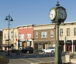
Established in 1836, the village of Lemont stands as one of the oldest American communities in northeastern Illinois. It is historically significant for its role in transforming the northern region of the state from a sparsely settled frontier to a commercial, agricultural, and industrial region that supplied Chicago and areas beyond with commodities. Lemont is also unique in boasting an authentic historic district that remains intact and has been continually used since the 19th century. In 2016, the Lemont Downtown Historic District was listed on the National Register of Historic Places. [4]

Both Lemont's history and architectural uniqueness connect to the Illinois and Michigan Canal (I&M Canal). Construction of the I&M Canal began in 1837 and stands as one of the last major canal undertakings in the United States (the Hennepin Canal opened in 1907). When it was completed in 1848, it provided a continuous waterway stretching from New York (through the Erie Canal, Lake Erie, Lake Huron and Lake Michigan to Chicago, then through the I&M Canal for 97 miles (156 km) entering the Illinois River at LaSalle, Illinois, to the Mississippi River, to New Orleans) to the Gulf of Mexico.

Immigrant workers, mostly Irish, settled in Lemont to work on the canal and later moved along the corridor of the canal, improving farms within the many communities that sprang up along it.

In digging, workers discovered Lemont yellow dolomite, a harder and finer grained version of limestone. This delayed digging of the canal, but was the start of the area's second industry, quarrying. By the mid-19th century, limestone quarrying took over as the main economic factor in Lemont and sustained its growth. The town's important major buildings were faced with the Lemont limestone, abundant in local quarries. Today, 38 of those buildings remain as the Lemont downtown district. Lemont limestone was used to build the Chicago Water Tower, a building that "gained special significance as one of the few buildings to survive the destructive path of the Great Chicago Fire of 1871". [5] In the early years, this stone was known as "Athens Marble" as a nod to its place of origin. [6] An 1859 item in the Chicago Daily Tribune had this to say: “The Athens and DesPlaines quarries, situated on the Illinois and Michigan canal, embrace 335 acres of the finest stone in the West, known as “Athens Marble”. This stone has a high reputation for color, durability and beauty, which renders it quite an article of commerce”. [7]

Cargo and passengers were transported on the I&M until the early 20th century, when the wider, deeper Chicago Sanitary and Ship Canal was built parallel to it. The Sanitary Canal is still used today as part of the Illinois Waterway system.

Lemont's motto is "Village of Faith", and its church spires reflect the many ethnic groups who came here to quarry stone, dig the Sanitary and Ship Canal and work in other industries.

Lemont is credited with being the largest recruiting station for the Union Army during the American Civil War, and the Old Stone Church, built in 1861 of limestone, was used as a recruiting depot. It served as the Lemont Methodist Episcopal Church for 100 years, from 1861 until 1970, when it became home to the Lemont Area Historical Society. The oldest building in Lemont, it now serves as a museum and is listed on the National Register of Historic Places.

During the Civil War, Lemont was required to sign up 33 soldiers, the village recruited 293 soldiers; only 63 returned. The Lemont Civil War Memorial Committee was formed to build a memorial to honor Lemont's Civil War veterans. The monument was dedicated in 2008 in Legion Park at the east end of Main Street, opposite the Metra Station. Of the 293 soldiers sent to fight in the war, only 243 names of the enlisted soldiers are known. Among them is Cpl. John Warden, the only Lemont resident ever awarded the Medal of Honor. [8]

By 1854, railroads transported goods faster than water, and the I&M became obsolete as Lemont evolved into a railroad community; the village was incorporated on June 9, 1873. [9]

Increasingly, the canal was used to carry wastes away from Chicago. In 1900, the larger Sanitary and Ship Canal went into operation, carrying both wastes and larger, more modern barges. All use of the I&M Canal ended in 1933, with the opening of the canal's modern successor - the Illinois Waterway.

By about 1920, the quarries declined as styles changed and builders began to use Bedford limestone from Indiana and less expensive materials like concrete.

During World War II, the Metallurgical Laboratory of the University of Chicago moved into the nearby Argonne Forest preserves to carry out Enrico Fermi's work on nuclear reactors for the Manhattan Project. After the war, Argonne National Laboratory was designated as the first national laboratory in the United States on July 1, 1946. [10]

In 1984, President Ronald Reagan signed legislation establishing the Illinois & Michigan Canal National Heritage Corridor as the nation's first National Heritage Corridor. The status recognizes the historic importance of this region and the waterway that connected Lake Michigan and the Illinois River. Today, it is a 100-mile-long (160 km) cultural park between Chicago and LaSalle/Peru, representing an ongoing partnership between the public and private sectors created to achieve a successful mixture of preservation, public use and industrial activity.

Sacred architecture is a strong suit of Lemont, whose skyline is dominated by two landmark religious edifices: the Hindu Temple of Greater Chicago and SS. Cyril and Methodius church in the Polish Cathedral style. Both are situated on the sides of hills, giving an even more dramatic backdrop to their monumental architecture.[ citation needed ]

Tornadoes

On June 13, 1976, at 5:18 PM, a killer tornado struck Lemont and took three lives. 23 were injured, 87 homes were destroyed and 82 more were damaged. Damage to the high school alone was estimated at $500,000 (equivalent to $2,680,000in 2023 [11] ). Many people reported watching neighbors' homes explode, implode, shattering before their eyes. Cited as an unusual tornado, it backed up on its path before heading North, somewhat parallel to its path of origin. [12] [13] [14] See Tornadoes of 1976 for more information on the outbreak.

On March 27, 1991, Lemont was again hit by a tornado. [15] See Tornadoes of 1991 for more information on the outbreak.

Geography

According to the 2021 census gazetteer files, Lemont has a total area of 8.74 square miles (22.64 km2), of which 8.37 square miles (21.68 km2) (or 95.71%) is land and 0.38 square miles (0.98 km2) (or 4.29%) is water. [16]

The village has 10 exclaves[ why? ].

Demographics

Historical population
CensusPop.Note
1880 2,108
1900 2,449
1910 2,284−6.7%
1920 2,3221.7%
1930 2,58211.2%
1940 2,557−1.0%
1950 2,7577.8%
1960 3,39723.2%
1970 5,08049.5%
1980 5,64011.0%
1990 7,34830.3%
2000 13,09878.3%
2010 16,00022.2%
2020 17,62910.2%
U.S. Decennial Census [17]
2010 [18] 2020 [19]

As of the 2020 census [20] there were 17,629 people, 5,911 households, and 4,606 families residing in the village. The population density was 2,017.05 inhabitants per square mile (778.79/km2). There were 6,773 housing units at an average density of 774.94 per square mile (299.21/km2). The racial makeup of the village was 89.29% White, 0.91% African American, 0.11% Native American, 2.45% Asian, 0.03% Pacific Islander, 1.38% from other races, and 5.83% from two or more races. Hispanic or Latino of any race were 7.12% of the population.

There were 5,911 households, out of which 38.9% had children under the age of 18 living with them, 67.64% were married couples living together, 7.58% had a female householder with no husband present, and 22.08% were non-families. 18.74% of all households were made up of individuals, and 11.06% had someone living alone who was 65 years of age or older. The average household size was 3.27 and the average family size was 2.85.

The village's age distribution consisted of 25.1% under the age of 18, 6.5% from 18 to 24, 20.5% from 25 to 44, 29.6% from 45 to 64, and 18.3% who were 65 years of age or older. The median age was 43.5 years. For every 100 females, there were 100.8 males. For every 100 females age 18 and over, there were 94.7 males.

The median income for a household in the village was $114,509, and the median income for a family was $133,456. Males had a median income of $75,542 versus $43,283 for females. The per capita income for the village was $45,675. About 4.4% of families and 5.1% of the population were below the poverty line, including 5.9% of those under age 18 and 5.3% of those age 65 or over.

Lemont village, Illinois – Demographic Profile
(NH = Non-Hispanic) [lower-alpha 1]
Race / EthnicityPop 2010 [18] Pop 2020 [19] % 2010% 2020
White alone (NH)14,71915,37091.99%87.19%
Black or African American alone (NH)581470.36%0.83%
Native American or Alaska Native alone (NH)920.06%0.01%
Asian alone (NH)2584221.61%2.39%
Pacific Islander alone (NH)260.01%0.03%
Some Other Race alone (NH)4230.03%0.13%
Mixed Race/Multi-Racial (NH)1284040.80%2.29%
Hispanic or Latino (any race)8221,2555.14%7.12%
Total16,00017,629100.00%100.00%

Sports

In 2006, the Lemont Little League All-Star team traveled to the 60th Little League World Series in South Williamsport, Pennsylvania. The team, which represented the Great Lakes region, received 4th place after losing to the Beaverton, Oregon, team and was the only team to beat the champions from Georgia. Upon returning home, the Lemont team received a parade down State Street in honor of their achievements.

The BMW Championship (PGA Tour), and the prior Western Open, were held in unincorporated Lemont township between 1991 and 2007, and 2009 to 2011. Cog Hill Golf & Country Club has subsequently rejected incorporation into Lemont and has agreed to incorporate into Palos Park. The tournament was played at Cog Hill Golf & Country Club, which was founded in 1927. The Ruffled Feathers Golf Club is located in Lemont.

In 2008, the girls 11-year-old Lemont Little League All-Star team traveled to Beardstown, Illinois, for the state tournament and won the state title.

In 2009, a new group of 11-year-old All-Stars from Lemont won the State Championship for a second consecutive year.

The Lemont High School varsity cheerleading team placed first at the IHSA State Championships in the years 2009, 2010, 2011, 2014, and 2017.

In 2020, the Lemont High School wrestling program won the 2020 IHSA Class 2A Dual Team State Championship and set a school record for wins. [21]

Education

Three National Blue Ribbon Schools are located in Lemont, recognized by the US Department of Education for excellence in student achievement. Lemont High School received the Blue Ribbon award in 2017. [22] Saints Cyril and Methodius School received the Blue Ribbon award in 2019. [23]

Public schools in Lemont include: [24]

Private/Parochial Schools

Media

Productions filmed in Lemont include:

Infrastructure

Transportation

Lemont has a station on Metra's Heritage Corridor, which provides weekday rail service between Joliet and Chicago Union Station.

In 2007, the Interstate 355 tollway extension opened, providing Lemont with more direct access to the Chicago expressway system. An interchange is located on 127th Street.

Notable people

Notes

  1. The US Census treats Hispanic/Latino as an ethnic category. This table excludes Latinos from the racial categories and assigns them to a separate category. Hispanics/Latinos can be of any race.

Related Research Articles

<span class="mw-page-title-main">Illinois and Michigan Canal</span> Canal system in Illinois (1848–1933)

The Illinois and Michigan Canal connected the Great Lakes to the Mississippi River and the Gulf of Mexico. In Illinois, it ran 96 miles (154 km) from the Chicago River in Bridgeport, Chicago to the Illinois River at LaSalle-Peru. The canal crossed the Chicago Portage, and helped establish Chicago as the transportation hub of the United States, before the railroad era. It was opened in 1848. Its function was partially replaced by the wider and deeper Chicago Sanitary and Ship Canal in 1900, and it ceased transportation operations with the completion of the Illinois Waterway in 1933.

<span class="mw-page-title-main">Cook County, Illinois</span> County in Illinois, United States

Cook County is the most populous county in the U.S. state of Illinois and the second-most-populous county in the United States, after Los Angeles County, California. More than 40 percent of all residents of Illinois live within Cook County. As of 2020, the population was 5,275,541. The county seat is Chicago, the most populous city in Illinois and the third most populous city in the United States. The county is at the center of the Chicago metropolitan area.

<span class="mw-page-title-main">Hillside, Illinois</span> Village in Illinois, United States

Hillside is a village in Cook County, Illinois, United States. As of the 2020 census it had a population of 8,320.

<span class="mw-page-title-main">Lyons, Illinois</span> Village in Illinois, United States

Lyons is a village in Cook County, Illinois, United States. Per the 2020 census, the population was 10,817. The Chicago Portage National Historic Site is located in Lyons.

<span class="mw-page-title-main">Summit, Illinois</span> Village in Illinois, United States

Summit is a village in Cook County, Illinois, United States. The population was 11,161 at the 2020 census. The name Summit, in use since 1836, refers to the highest point on the Chicago Portage between the northeast-flowing Chicago River and the southwest-flowing Des Plaines River located just north of the village.

<span class="mw-page-title-main">Willow Springs, Illinois</span> Village in Illinois, United States

Willow Springs is a village in Cook County, Illinois, with a small portion in DuPage County. The village was founded in 1892, and was named for the springs along the Des Plaines River. In 2020, the population was 5,857.

<span class="mw-page-title-main">Woodridge, Illinois</span> Village in Illinois, United States

Woodridge is a village in DuPage County, Illinois, with small portions in Will and Cook counties, and a southwestern suburb of Chicago. Per the 2020 census, the population was 34,158.

<span class="mw-page-title-main">Darien, Illinois</span> City in Illinois, United States

Darien is a city in DuPage County, Illinois, United States. Per the 2020 census, the population was 22,011. A southwestern suburb of Chicago, Darien was named after the town of Darien, Connecticut. Darien is just north of I-55 and Historic U.S. Route 66. The entire south edge of the town borders Waterfall Glen.

<span class="mw-page-title-main">Seneca, Illinois</span> Village in Illinois, United States

Seneca is a village in LaSalle and Grundy counties in the U.S. state of Illinois. The population was 2,353 at the 2020 census, down from 2,371 at the 2010 census.

<span class="mw-page-title-main">Joliet, Illinois</span> City in Illinois, United States

Joliet is a city in Will and Kendall counties in the U.S. state of Illinois, 35 miles (56 km) southwest of Chicago. It is the county seat of Will County. It had a population of 150,362 at the 2020 census, making it the third-most populous city in Illinois.

<span class="mw-page-title-main">Peru, Illinois</span> City in Illinois, United States

Peru is a city in LaSalle and Bureau counties, Illinois, United States. The population was 9,896 at the 2020 census, down from 10,295 at the 2010 census. It is part of the Ottawa, IL Micropolitan Statistical Area. Peru and its twin city, LaSalle, make up the core of Illinois Valley.

<span class="mw-page-title-main">Lockport, Illinois</span> City in Illinois, United States

Lockport is a city in Will County, Illinois, United States, located 30 miles southwest of Chicago. Per the 2020 census, the population was 26,094. The city was incorporated in 1853. It is situated along the Illinois and Michigan (I&M) Canal, and was the headquarters of the canal when the canal was operating. A section of the canal runs through Lockport, including the remains of the canal's Lock No. 1 from which the town received its name. The canal right-of-way is now the Illinois and Michigan National Heritage Corridor.

<span class="mw-page-title-main">Plainfield, Illinois</span> Village in Illinois, United States

Plainfield is a village in Will and Kendall counties, Illinois, United States. The population was 44,762 at the 2020 census.

<span class="mw-page-title-main">Romeoville, Illinois</span> Village in Illinois, United States

Romeoville is a village in Will County, Illinois, United States. The village is located 26 mi (42 km) southwest of Chicago on the Gateway Wetlands, directly west of the Des Plaines River. Per the 2020 census, the population was 39,863. It is located in the southwest suburban area of Chicago near Interstate 55 and Interstate 355.

<span class="mw-page-title-main">Chicago Sanitary and Ship Canal</span> Canal system connecting the Chicago and Des Plaines rivers in Illinois

The Chicago Sanitary and Ship Canal, historically known as the Chicago Drainage Canal, is a 28-mile-long (45 km) canal system that connects the Chicago River to the Des Plaines River. It reverses the direction of the Main Stem and the South Branch of the Chicago River, which now flows out of Lake Michigan rather than into it. The related Calumet-Saganashkee Channel does the same for the Calumet River a short distance to the south, joining the Chicago canal about halfway along its route to the Des Plaines. The two provide the only navigation for ships between the Great Lakes Waterway and the Mississippi River system.

<span class="mw-page-title-main">Palos Township, Cook County, Illinois</span> Township in Illinois, United States

Palos Township is one of 29 townships in Cook County, Illinois. As of the 2020 census, its population was 56,836, with its most populous municipality being Palos Hills. The vast majority of the township's population resides in its eastern half; the half west of La Grange Road consists of the Palos Forest Preserves, a section of the Cook County Forest Preserves. In 1850 the small town of Trenton, Illinois changed its name to Palos; this recommendation was made by M.S. Powell, the local postmaster, whose ancestor supposedly sailed with Christopher Columbus from Palos de la Frontera. When it incorporated as a village in 1914, Palos officially became Palos Park. Nearby communities incorporated later: Hickory Hills, in 1951, and Palos Hills, in 1958. All three municipalities lie completely or substantially within Palos Township. Palos Heights, partially in Worth Township, incorporated in 1959.

<span class="mw-page-title-main">St. James Catholic Church and Cemetery (Lemont, Illinois)</span> Historic site in Cook County, Illinois, US

St. James Catholic Church and Cemetery, also known as St. James at Sag Bridge Church is a historic church and cemetery in the Sag Bridge area of the village of Lemont, Illinois. It is situated on a high bluff at the western tip of the glacier-carved Mount Forest Island, overlooking the Calumet Sag Channel and the community of Sag Bridge.

<span class="mw-page-title-main">Sag Bridge, Illinois</span> Unincorporated community in Illinois, United States

Sag Bridge, Illinois is an Unincorporated community in Lemont Township in southwestern Cook County, Illinois, United States. Sag Bridge is an important waterway junction between the Calumet Sag Channel and the Chicago Sanitary and Ship Canal. It is also the junction of IL 83 and IL 171 which meet at Sag Bridge to cross the Calumet Sag Channel together on the eponymous bridge. The community was named for a predecessor of the present bridge. It is within the village limits and postal delivery zone of Lemont, Illinois.

<span class="mw-page-title-main">Lemont Central Grade School</span> United States historic place

The Lemont Central Grade School is a former school building at 410 McCarthy Road in Lemont, Illinois. The school was built in 1869 to replace Lemont's first school, which opened in 1836 when the area was still largely rural. Locally quarried limestone was used to construct the school; at the time, limestone production was one of the city's main industries. Architect John Barnes of Joliet designed the Victorian building. As the city's population grew considerably during the construction of the Chicago Sanitary and Ship Canal in the 1890s, an annex was placed on the school in 1896 to accommodate additional students. The school operated until building safety issues forced its closure in 1974; at the time, it was the oldest continuously operating school in the state. The building has since been converted to condominiums.

<span class="mw-page-title-main">Lemont Downtown Historic District</span> Historic district in Illinois, United States

The Lemont Downtown Historic District is a commercial historic district encompassing 14 city blocks in downtown Lemont, Illinois. The district has served as the village's downtown since the 1850s, when the newly opened Illinois & Michigan Canal and subsequent limestone quarrying in the area sparked a local economic boom. It expanded through the late nineteenth and early twentieth centuries as new railroads and the Chicago Sanitary and Ship Canal brought residents and business opportunities to the village. The commercial buildings in the district exhibit a variety of common building types seen between 1850 and 1950; one-part, two-part, gable-front, and false-front buildings are all present, and their designs feature Italianate, Commercial, and revival style architecture. The district also includes several of Lemont's government buildings, including its village hall and post office.

References

  1. "2020 U.S. Gazetteer Files". United States Census Bureau. Retrieved March 15, 2022.
  2. "Lemont village, Illinois". United States Census Bureau . Retrieved April 15, 2022.
  3. Callary, Edward. 2009. Place Names of Illinois. Champaign: University of Illinois Press, p. 197.
  4. "Lemont Downtown Historic District". www.nps.gov. Retrieved March 9, 2020.
  5. "City Gallery in the Historic Water Tower". City of Chicago - Department of Cultural Affairs and Special Events. Retrieved October 13, 2013.
  6. Schapper, Ferdinand (1917). Southern Cook County and History of Blue Island before the Civil War. Manuscript. p. 103.
  7. "Stock Quote". The Chicago Daily Tribune: 3. January 1, 1859.
  8. Sauder, Erin. "5 Things to Know: Civil War Memorial". www.mysuburbanlife.com. Retrieved March 12, 2020.
  9. Illinois Regional Archives Depository System. "Name Index to Illinois Local Governments". Illinois State Archives. Illinois Secretary of State . Retrieved September 11, 2013.
  10. Holl, Hewlett, and Harris, page xx (Introduction).
  11. 1634–1699: McCusker, J. J. (1997). How Much Is That in Real Money? A Historical Price Index for Use as a Deflator of Money Values in the Economy of the United States: Addenda et Corrigenda (PDF). American Antiquarian Society. 1700–1799: McCusker, J. J. (1992). How Much Is That in Real Money? A Historical Price Index for Use as a Deflator of Money Values in the Economy of the United States (PDF). American Antiquarian Society. 1800–present: Federal Reserve Bank of Minneapolis. "Consumer Price Index (estimate) 1800–" . Retrieved February 29, 2024.
  12. "1976 Tornado". lemonthistorical.org. Archived from the original on September 24, 2019. Retrieved June 8, 2016.
  13. "June 13, 1976 Tornadoes". Tornado History Projects. Storm Prediction Center. Retrieved July 16, 2020.
  14. June 13, 1976 Lemont Tornado, NWS Chicago, retrieved February 20, 2023
  15. "1991 Tornado". lemonthistorical.org. Archived from the original on September 30, 2018. Retrieved June 8, 2016.
  16. "Gazetteer Files". Census.gov. Retrieved June 29, 2022.
  17. "Decennial Census of Population and Housing by Decades". US Census Bureau.
  18. 1 2 "P2 HISPANIC OR LATINO, AND NOT HISPANIC OR LATINO BY RACE – 2010: DEC Redistricting Data (PL 94-171) – Lemont village, Illinois". United States Census Bureau .
  19. 1 2 "P2 HISPANIC OR LATINO, AND NOT HISPANIC OR LATINO BY RACE – 2020: DEC Redistricting Data (PL 94-171) – Lemont village, Illinois". United States Census Bureau .
  20. "Explore Census Data". data.census.gov. Retrieved June 28, 2022.
  21. "Lemont Wrestling Team Wins 2020 IHSA Class 2A State Championship". Lemont, IL Patch. March 3, 2020. Retrieved March 9, 2020.
  22. "NBRS Lemont High School of Lemont, IL". National Blue Ribbon Schools Program. Retrieved March 9, 2020.
  23. "NBRS Saints Cyril and Methodius School of Lemont, IL". National Blue Ribbon Schools Program. Retrieved March 9, 2020.
  24. "Welcome to Lemont-Bromberek Combined School District 113A in Lemont, IL". www.sd113a.org.
  25. "St. Alphonsus Saint Patrick School - Home". www.stals-stpats.org.
  26. "SS. Cyril & Methodius Parish".
  27. "Everest Academy". Everest Academy.
  28. "Montessori of Lemont | for all the little reasons..."
  29. Schaults, Janine (December 9, 2007). "From Lemont to Hollywood, with a pole dance in between". Chicago Tribune . Retrieved February 11, 2015.
  30. Virtel, Louis (July 8, 2013). "TheBacklot Interview: "All-American Boy" Steve Grand". TheBacklot.com. Archived from the original on July 12, 2013. Retrieved July 18, 2013.
  31. Luevano, Amanda (August 3, 2012). "ABC Meteorologist Jerry Taft Talks Weather, Military Service with Lemont Rotary Club". Patch. Retrieved July 23, 2020.