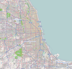
Forest View, Illinois

Last updated

Forest View, Illinois
Chicago Portage National Historic Site.jpg
Forestview Logo.png
Cook County Illinois Incorporated and Unincorporated areas Forest View Highlighted.svg
Location of Forest View in Cook County, Illinois.
Location map United States Chicago.png
Red pog.svg
Forest View
USA Illinois relief location map.svg
Red pog.svg
Forest View
Usa edcp relief location map.png
Red pog.svg
Forest View
Coordinates: 41°48′27″N87°47′10″W / 41.80750°N 87.78611°W / 41.80750; -87.78611
CountryFlag of the United States (23px).png  United States
StateIllinois
County Cook
Township Stickney
Incorporated 1924
Government
  Type Trustee-village
   President Nancy L. Miller
Area
[1]
  Total1.29 sq mi (3.36 km2)
  Land1.17 sq mi (3.03 km2)
  Water0.13 sq mi (0.33 km2)  10.83%
Population
 (2020)
  Total792
  Density678.08/sq mi (261.73/km2)
 Down 10.28% from 2000
Standard of living (2007-11)
   Per capita income $26,547
   Median home value $234,900
ZIP code(s)
60402
Area code(s) 708
Geocode 26987
FIPS code 17-26987
Website http://villageofforestview.com/

Forest View is a village in Cook County, Illinois, United States. Per the 2020 census, the population was 792. [2] It is primarily an industrial corridor adjacent to the Chicago neighborhood of Garfield Ridge, which is on the village's southern border.

Contents

Geography

Forest View is located at 41°48′27″N87°47′10″W / 41.80750°N 87.78611°W / 41.80750; -87.78611 (41.807379, -87.786065). [3]

According to the 2021 census gazetteer files, Forest View has a total area of 1.30 square miles (3.37 km2), of which 1.17 square miles (3.03 km2) (or 90.19%) is land and 0.13 square miles (0.34 km2) (or 9.81%) is water. [4]

Demographics

Historical population
CensusPop.Note
1930 125
1940 20866.4%
1950 29139.9%
1960 1,042258.1%
1970 927−11.0%
1980 764−17.6%
1990 743−2.7%
2000 7784.7%
2010 698−10.3%
2020 79213.5%
U.S. Decennial Census [5]
2010 [6] 2020 [7]

As of the 2020 census [8] there were 792 people, 361 households, and 301 families residing in the village. The population density was 611.58 inhabitants per square mile (236.13/km2). There were 288 housing units at an average density of 222.39 per square mile (85.87/km2). The racial makeup of the village was 54.17% White, 2.02% African American, 4.42% Native American, 1.52% Asian, 0.00% Pacific Islander, 20.33% from other races, and 17.55% from two or more races. Hispanic or Latino of any race were 48.86% of the population.

There were 361 households, out of which 33.1% had children under the age of 18 living with them, 66.20% were married couples living together, 9.42% had a female householder with no husband present, and 16.62% were non-families. 14.40% of all households were made up of individuals, and 6.65% had someone living alone who was 65 years of age or older. The average household size was 4.07 and the average family size was 3.63.

The village's age distribution consisted of 31.8% under the age of 18, 4.7% from 18 to 24, 23.8% from 25 to 44, 24.7% from 45 to 64, and 15.0% who were 65 years of age or older. The median age was 37.1 years. For every 100 females, there were 105.3 males. For every 100 females age 18 and over, there were 96.7 males.

The median income for a household in the village was $97,321, and the median income for a family was $110,347. Males had a median income of $50,379 versus $46,000 for females. The per capita income for the village was $33,010. About 1.3% of families and 1.8% of the population were below the poverty line, including 0.0% of those under age 18 and 1.5% of those age 65 or over.

Forest View village, Illinois – Racial and ethnic composition
Note: the US Census treats Hispanic/Latino as an ethnic category. This table excludes Latinos from the racial categories and assigns them to a separate category. Hispanics/Latinos may be of any race.
Race / Ethnicity (NH = Non-Hispanic)Pop 2000 [9] Pop 2010 [6] Pop 2020 [7] % 2000% 2010% 2020
White alone (NH)68546735988.05%66.91%45.33%
Black or African American alone (NH)35160.39%0.72%2.02%
Native American or Alaska Native alone (NH)0000.00%0.00%0.00%
Asian alone (NH)013120.00%1.86%1.52%
Pacific Islander alone (NH)0200.00%0.29%0.00%
Other race alone (NH)0500.00%0.72%0.00%
Mixed race or Multiracial (NH)93181.16%0.43%2.27%
Hispanic or Latino (any race)8120338710.41%29.08%48.86%
Total778698792100.00%100.00%100.00%

Government

Forest View is in Illinois' 3rd congressional district.

Education

Forest View is served by Lyons School District 103. Grade school students attend Home Elementary School in neighboring Stickney, and George Washington Middle School in Lyons.

It is served by J. Sterling Morton High School District 201's Morton West located in Berwyn as its residential areas are west of Ridgeland Avenue. [10] [11]

Transportation

Pace provides bus service on routes 307 and 311 connecting Forest View to destinations across the region. [12]

Related Research Articles

<span class="mw-page-title-main">Bedford Park, Illinois</span> Village in Illinois, United States

Bedford Park is a village in Cook County, Illinois, United States, and is an industrial suburb of Chicago. The population was 602 at the 2020 census. Bedford Park consists of a small residential area and vast amounts of heavy industry sprawling to the east and a small amount to the west.

<span class="mw-page-title-main">Broadview, Illinois</span> Village in Illinois, United States

Broadview is a village in Cook County, Illinois, 12 miles (19 km) west of downtown Chicago. As of the 2020 census it had a population of 7,998.

<span class="mw-page-title-main">Burbank, Illinois</span> City in Illinois, United States

Burbank is a city in Cook County, Illinois, United States. The population was 29,439 at the 2020 census. It borders the southwest edge of the city of Chicago; the Chicago city limit – specifically that of the Ashburn neighborhood – is in common with Burbank's eastern city limit. Burbank shares a boundary with Oak Lawn to its south, Bridgeview to its west, and Bedford Park to its north; the city of Hometown is also adjacent to Burbank's southeast corner. Burbank is less than two miles south of Chicago Midway International Airport.

<span class="mw-page-title-main">Burnham, Illinois</span> Village in Illinois, United States

Burnham is a village in Cook County, Illinois, United States. The population was 4,046 at the 2020 census. The ZIP code is 60633.

<span class="mw-page-title-main">Deer Park, Illinois</span> Village in Illinois, United States

Deer Park is a village in Lake and Cook Counties, Illinois. Per the 2020 census, the population was 3,681. The village is one of the few left in the Chicago area that enjoy a green belt which is bordered by two large natural areas providing outdoor recreation and open space. The village is home to popular shopping and dining destinations: Deer Park Town Center and the Town Center Promenade. The town is also home to the Vehe Farm, an Illinois Centennial Farm.

<span class="mw-page-title-main">Glenwood, Illinois</span> Village in Illinois, United States

Glenwood is a village in Cook County, Illinois, United States. The population was 8,662 at the 2020 census.

<span class="mw-page-title-main">Indian Head Park, Illinois</span> Village in Illinois, United States

Indian Head Park is a village in Cook County, Illinois, United States, slightly north of the intersection of Interstate 294 and Interstate 55. The village is south of Western Springs, west of Countryside, north and east of Burr Ridge. Per the 2020 census, the population was 4,065. The village's ZIP code is 60525.

<span class="mw-page-title-main">Lynwood, Illinois</span> Village in Illinois, United States

Lynwood is a village in Cook County, Illinois, United States and a suburb of Chicago. The population was 9,116 at the 2020 census.

<span class="mw-page-title-main">Lyons, Illinois</span> Village in Illinois, United States

Lyons is a village in Cook County, Illinois, United States. Per the 2020 census, the population was 10,817. The Chicago Portage National Historic Site is located in Lyons.

<span class="mw-page-title-main">McCook, Illinois</span> Village in Illinois, United States

McCook is a village in Cook County, Illinois, United States, and is an industrial suburb of Chicago. As of the 2020 census, the village population was 249, which is the lowest population of all municipalities in the county.

<span class="mw-page-title-main">Merrionette Park, Illinois</span> Village in Illinois, United States

Merrionette Park is a village in Cook County, Illinois, United States. The population was 1,969 as of the 2020 census.

<span class="mw-page-title-main">Richton Park, Illinois</span> Village in Illinois, United States

Richton Park is a village and a south suburb of Chicago in Cook County, Illinois, United States. The population was 12,775 at the 2020 census.

<span class="mw-page-title-main">South Barrington, Illinois</span> Village in Illinois, United States

South Barrington is a residential suburb in Cook County, Illinois, United States, south of Barrington. Per the 2020 census, the population was 5,077. South Barrington is a wealthy suburb of Chicago. It is the location of the famous megachurch Willow Creek Community Church, Goebbert's Pumpkin Patch and Farm, and a lifestyle center named The Arboretum of South Barrington.

<span class="mw-page-title-main">South Chicago Heights, Illinois</span> Village in Illinois, United States

South Chicago Heights is a village and a south suburb in Cook County, Illinois, United States. The population was 4,026 at the 2020 census.

<span class="mw-page-title-main">Stickney, Illinois</span> Village in Illinois, United States

Stickney is a village in Cook County, Illinois, United States. The village is named for Alpheus Beede Stickney, a railroad executive who played a central role in establishing the Clearing Industrial District. Per the 2020 census, the population was 7,110. It was well known in the 1920s and early 1930s as the home for several bordellos linked to mobster Al Capone's empire.

<span class="mw-page-title-main">Thornton, Illinois</span> Village in Illinois, United States

Thornton is a village in Cook County, Illinois, United States and a south suburb of Chicago. The population was 2,386 at the 2020 census. Thornton is home to the Thornton Quarry, one of the largest quarries in the world.

<span class="mw-page-title-main">University Park, Illinois</span> Village in Illinois, United States

University Park is a village in Will County with a small portion in Cook County in the U.S. state of Illinois. It is a south suburb of Chicago. The village is one of the region's few planned communities; it was developed in the 1960s as Wood Hill, then Park Forest South, and finally University Park. Governors State University was established in the village in 1969. The village population was 7,145 at the 2020 census.

<span class="mw-page-title-main">Green Oaks, Illinois</span> Village in Illinois, United States

Green Oaks is a village in Libertyville Township, Lake County, Illinois, United States. Per the 2020 census, the population was 4,128.

<span class="mw-page-title-main">Bull Valley, Illinois</span> Village in Illinois, United States

Bull Valley is a village in McHenry County, Illinois, United States. The population was 1,128 at the 2020 census. Surrounded by larger, exurb towns of Crystal Lake, Woodstock, and McHenry, the village prides itself in its rural, low-density character. The village is in the outer most ring of the Chicago suburbs.

<span class="mw-page-title-main">Stickney Township, Illinois</span> Township in Illinois, United States

Stickney Township is one of 29 townships in Cook County, Illinois. As of the 2020 census, its population was 41,514, with approximately 71% of that total living in the city of Burbank.

References

  1. "2020 U.S. Gazetteer Files". United States Census Bureau. Retrieved March 15, 2022.
  2. "Forest View village, Illinois". United States Census Bureau . Retrieved April 15, 2022.
  3. "US Gazetteer files: 2010, 2000, and 1990". United States Census Bureau. February 12, 2011. Retrieved April 23, 2011.
  4. Bureau, US Census. "Gazetteer Files". Census.gov. Retrieved June 29, 2022.{{cite web}}: |last= has generic name (help)
  5. "Decennial Census of Population and Housing by Decades". US Census Bureau.
  6. 1 2 "P2 : Hispanic or Latino, and Not Hispanic or Latino by Race – 2010: DEC Redistricting Data (PL 94-171) – Forest View village, Illinois". United States Census Bureau .
  7. 1 2 "P2 : Hispanic or Latino, and Not Hispanic or Latino by Race – 2020: DEC Redistricting Data (PL 94-171) – Forest View village, Illinois". United States Census Bureau .
  8. "Explore Census Data". data.census.gov. Retrieved June 28, 2022.
  9. "P004: Hispanic or Latino, and Not Hispanic or Latino by Race – 2000: DEC Summary File 1 – Forest View village, Illinois". United States Census Bureau .
  10. "1950s." J. Sterling Morton High School East. Retrieved on December 20, 2016.
  11. "SCHOOL DISTRICT REFERENCE MAP (2010 CENSUS): Cook County, IL Page 4." U.S. Census Bureau. Retrieved on December 20, 2016.
  12. "RTA System Map" (PDF). Retrieved January 31, 2024.