Lansing, Illinois | |
---|---|
Motto(s): "A community of pride, progress, and possibilities" | |
Coordinates: 41°33′57″N87°32′45″W / 41.56583°N 87.54583°W | |
Country | United States |
State | Illinois |
County | Cook |
Townships | Thornton, Bloom |
Incorporated | 1893 |
Government | |
• Type | Mayor-Trustee |
• Body | Board of Trustees |
• Mayor | Patty Eidam |
• Trustees | Saad Abbasy, Maureen Grady-Perovich, Brian Hardy, Micaela Smith, Leo Valencia, Jerry Zeldenrust |
Area | |
• Total | 7.52 sq mi (19.48 km2) |
• Land | 7.46 sq mi (19.33 km2) |
• Water | 0.06 sq mi (0.15 km2) 0.88% |
Population (2020) | |
• Total | 29,076 |
• Density | 3,896.54/sq mi (1,504.42/km2) |
Standard of living (2009-11) | |
• Per capita income | $24,329 |
• Median home value | $148,500 |
ZIP code(s) | 60438 |
Area code(s) | 708 |
Geocode | 42028 |
FIPS code | 17-42028 |
Website | villageoflansing |
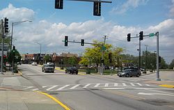
Lansing is a village in Cook County, Illinois, United States. Lansing is a south suburb of Chicago. The population was 29,076 at the 2020 census. [2]
The first family to settle in Lansing was that of August Hildebrandt in 1843. Henry, George, and John Lansing settled the area in 1846, which was incorporated in 1893. Early settlement in the village was primarily by Dutch and German immigrants. Industrial development of the surrounding Calumet region attracted immigrants from Ireland and Eastern Europe to the village in the 20th century. These settlement patterns are reflected in Lansing's current demographics; according to the census [3] the top five ancestries that were in Lansing in 2000 were German (17%), Polish (13%), Irish (13%), Dutch (11%), and Italian (7%). However, according to City-data.com 2016 estimates, these ancestries began to change in the mid-90s and early 2000s, when most residents were of African American ancestry (8,871), followed by Latinos (4,183), and Asian (Southeast Asian) (255). [4]
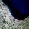
Lansing is 6.9 miles (11.1 km) south of the Chicago city limits at 138th Street, and 25.6 miles (41.2 km) from the Chicago Loop.
According to the 2021 census gazetteer files, Lansing has a total area of 7.52 square miles (19.48 km2), of which 7.46 square miles (19.32 km2) (or 99.24%) is land and 0.06 square miles (0.16 km2) (or 0.76%) is water. [5] Lansing sits on the Calumet Shoreline, an ancient shoreline of Lake Michigan.
Lansing is bordered by South Holland to the northwest, Calumet City to the north, Hammond to the northeast, Munster to the east and southeast, Lynwood to the south, Glenwood to the southwest, and Thornton to the west.
Census | Pop. | Note | %± |
---|---|---|---|
1900 | 830 | — | |
1910 | 1,060 | 27.7% | |
1920 | 1,409 | 32.9% | |
1930 | 3,378 | 139.7% | |
1940 | 4,462 | 32.1% | |
1950 | 8,682 | 94.6% | |
1960 | 17,475 | 101.3% | |
1970 | 22,916 | 31.1% | |
1980 | 28,958 | 26.4% | |
1990 | 28,131 | −2.9% | |
2000 | 28,332 | 0.7% | |
2010 | 28,331 | 0.0% | |
2020 | 29,076 | 2.6% | |
U.S. Decennial Census [6] 2010 [7] 2020 [8] |
Race / Ethnicity (NH = Non-Hispanic) | Pop 2000 [9] | Pop 2010 [7] | Pop 2020 [8] | % 2000 | % 2010 | % 2020 |
---|---|---|---|---|---|---|
White alone (NH) | 23,238 | 14,681 | 8,462 | 82.02% | 51.82% | 29.10% |
Black or African American alone (NH) | 2,983 | 8,847 | 13,421 | 10.53% | 31.23% | 46.16% |
Native American or Alaska Native alone (NH) | 22 | 38 | 26 | 0.08% | 0.13% | 0.09% |
Asian alone (NH) | 201 | 255 | 264 | 0.71% | 0.90% | 0.91% |
Pacific Islander alone (NH) | 12 | 5 | 3 | 0.04% | 0.02% | 0.01% |
Other race alone (NH) | 21 | 39 | 172 | 0.07% | 0.14% | 0.59% |
Mixed race or Multiracial (NH) | 231 | 363 | 734 | 0.82% | 1.28% | 2.52% |
Hispanic or Latino (any race) | 1,624 | 4,103 | 5,993 | 5.73% | 14.48% | 20.61% |
Total | 28,332 | 28,331 | 29,076 | 100.00% | 100.00% | 100.00% |
As of the 2020 census [10] there were 29,076 people, 10,741 households, and 6,818 families residing in the village. The population density was 3,867.00 inhabitants per square mile (1,493.06/km2). There were 12,053 housing units at an average density of 1,603.01 per square mile (618.93/km2). The racial makeup of the village was 46.62% African American, 32.17% White, 0.72% Native American, 0.93% Asian, 0.02% Pacific Islander, 10.67% from other races, and 8.88% from two or more races. Hispanic or Latino of any race were 20.61% of the population.
There were 10,741 households, out of which 31.7% had children under the age of 18 living with them, 35.18% were married couples living together, 22.04% had a female householder with no husband present, and 36.52% were non-families. 31.80% of all households were made up of individuals, and 10.87% had someone living alone who was 65 years of age or older. The average household size was 3.23 and the average family size was 2.56.
The village's age distribution consisted of 24.2% under the age of 18, 7.2% from 18 to 24, 24.8% from 25 to 44, 26.6% from 45 to 64, and 17.2% who were 65 years of age or older. The median age was 40.2 years. For every 100 females, there were 77.7 males. For every 100 females age 18 and over, there were 73.6 males.
The median income for a household in the village was $57,659, and the median income for a family was $70,775. Males had a median income of $47,236 versus $31,684 for females. The per capita income for the village was $28,708. About 12.4% of families and 16.7% of the population were below the poverty line, including 27.8% of those under age 18 and 5.3% of those age 65 or over.
The current mayor of Lansing is Patty Eidam, while the board of trustees is composed of Saad Abbasy, Maureen Grady-Perovich, Brian Hardy, Micaela Smith, Leo Valencia, and Jerry Zeldenrust. Vivian Payne is the Village Clerk. [11]
Lansing is represented in the United States Congress by Representative Robin Kelly, of Illinois's 2nd congressional district, as well as Senators Dick Durbin and Tammy Duckworth in the United States Senate.
Pace provides bus service connecting Lansing to destinations across the Southland. [14] Lansing is also served by the Grand Trunk Western Main Line between Chicago and Port Huron.
Bellwood is a village in Proviso Township, Cook County, Illinois, United States. Located 13 miles (21 km) west of Chicago's downtown Loop, the Village of Bellwood is bounded by the Eisenhower Expressway (south), the Proviso yards of the former Chicago & Northwestern, now Union Pacific Railroad (north), and the suburbs of Maywood (east) and Hillside and Berkeley (west). The population was 18,789 at the 2020 census.
Bridgeview is a village in Cook County, Illinois, United States. It is located approximately 15 miles (24 km) southwest of the Chicago Loop. As of the 2020 census, the village population was 17,027.
Burnham is a village in Cook County, Illinois, United States. The population was 4,046 at the 2020 census. Burnham has a Chicago ZIP code (60633) and was named for Telford Burnham, who drew its plat.
Calumet City is a city in Cook County, Illinois, United States. The population was 36,033 at the 2020 census. It is part of the Chicago metropolitan area.
Calumet Park is a village in Cook County, Illinois, United States. The population was 7,025 at the 2020 census. It is a suburb of Chicago.
Crestwood is a village about 24 miles (39 km) southwest of Chicago in Cook County, Illinois, United States. Per the 2020 census, the population was 10,826.
Deer Park is a village in Lake and Cook Counties, Illinois. Per the 2020 census, the population was 3,681. The village is one of the few left in the Chicago area that enjoy a green belt which is bordered by two large natural areas providing outdoor recreation and open space. The village is home to popular shopping and dining destinations: Deer Park Town Center and the Town Center Promenade. The town is also home to the Vehe Farm, an Illinois Centennial Farm.
East Hazel Crest is a village in Cook County, Illinois, United States. It is a south suburb of Chicago. As of the 2020 census, the village population was 1,297.
Glenwood is a village in Cook County, Illinois, United States. The population was 8,662 at the 2020 census.
Lynwood is a village in Cook County, Illinois, United States, and a suburb of Chicago. The population was 9,116 at the 2020 census.
Matteson is a village in Cook County, Illinois, United States. The population was 19,073 at the 2020 census. It is a suburb of Chicago.
Palos Park is a village in southwestern Cook County, Illinois, United States. Per the 2020 census, the population was 4,899.
South Barrington is a residential suburb in Cook County, Illinois, United States, south of Barrington. Per the 2020 census, the population was 5,077. It is the location of the famous megachurch Willow Creek Community Church, Goebbert's Pumpkin Patch and Farm, and a lifestyle center named The Arboretum of South Barrington.
South Holland is a village and south suburb of Chicago in Cook County, Illinois, United States, within Thornton Township. The population was 21,465 at the 2020 census. It is named after the Dutch province of South Holland.
Thornton is a village in Cook County, Illinois, United States, and a south suburb of Chicago. The population was 2,386 at the 2020 census. Thornton is home to the Thornton Quarry, one of the largest quarries in the world.
University Park is a village in Will County with a small portion in Cook County in the U.S. state of Illinois. It is a south suburb of Chicago. The village is one of the region's few planned communities; it was developed in the 1960s as Wood Hill, then Park Forest South, and finally University Park. Governors State University was established in the village in 1969. The village population was 7,145 at the 2020 census.
Wood Dale is a city in Addison Township, DuPage County, Illinois, United States. Per the 2020 census, the population was 14,012.
Hampshire is a village in Kane and McHenry counties, Illinois, United States. As of the 2020 census it had a population of 7,667.
Munster is a suburban town in North Township, Lake County, Indiana, United States. It is in the Chicago metropolitan area, approximately 30 miles (48 km) southeast of the Chicago Loop, and shares municipal boundaries with Hammond to the north, Highland to the east, Dyer and Schererville to the south, and Lansing and Lynwood directly west over the Illinois border. Its population was 23,894 at the 2020 US Census.
Thornton Township is one of 29 townships in Cook County, Illinois. As of the 2020 census, its population was 157,865.