Berkeley, Illinois

Last updated

Berkeley, Illinois
Village
Village of Berkeley, Illinois
Flag of Berkeley, Illinois.png
Berkeley Illinois Seal.png
Cook County Illinois Incorporated and Unincorporated areas Berkeley Highlighted.svg
Location of Berkeley in Cook County, Illinois.
Illinois in United States (US48).svg
Location of Illinois in the United States
Coordinates: 41°53′12″N87°54′38″W / 41.88667°N 87.91056°W / 41.88667; -87.91056
CountryFlag of the United States (23px).png  United States
StateIllinois
County Cook
Township Proviso
Incorporated 1924
Government
  TypePresident-Trustee
   President Robert E. Lee, Jr.
Area
[1]
  Total1.40 sq mi (3.63 km2)
  Land1.40 sq mi (3.63 km2)
  Water0.00 sq mi (0.00 km2)  0%
Population
 (2020)
  Total5,338
  Density3,807.42/sq mi (1,470.57/km2)
Standard of living (2007-11)
   Per capita income $25,952
   Median home value $202,200
ZIP code(s)
60163
Area code(s) 708/464
Geocode 17-05404
FIPS code 17-05404
Website www.berkeley.il.us

Berkeley (pronounced BURK-lee) is a village located in Cook County, Illinois, United States. Incorporated in 1924, the population at the 2020 census was 5,338. [2]

Contents

The town has a commuter railroad station on Metra's Union Pacific West Line with service to downtown Chicago.

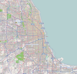
Berkeley is situated fourteen miles west of the Chicago Loop in Cook County. Berkeley is on the western edge of Cook County. Berkeley has instant access to the metropolitan area, with Interstates 290 and 294 comprising its western and part of its southern boundaries, and the Union Pacific Railroad (originally the Chicago & North Western) and the large Proviso classification yard to the north. However, the transit arteries that link Berkeley to separate locations also function to isolate the village from its close neighbors, providing it a small-town atmosphere.

Geography

Berkeley is located at 41°53′12″N87°54′38″W / 41.88667°N 87.91056°W / 41.88667; -87.91056 (41.886794, -87.910528). [3]

According to the 2021 census gazetteer files, Berkeley has a total area of 1.40 square miles (3.63 km2), all land. [4]

History

Farmers, mostly of German and Dutch heritage, began to settle in the region that would become Berkeley around 1835. The Dutch sought to be truck farmers, dwelling on farms spanning from 40 to 160 acres, whereas the Germans conducted general farming. In 1848, a small group of farm families founded Sunnyside, a one-room school. Sunnyside Elementary School is still in operation today, however it is now located in a bigger and newer structure. Farmland was provided for what is now known as Old Settler's Cemetery a short distance west on St. Charles Road (which was finished in 1836).

The Chicago, Aurora & Elgin Railroad (interurban) opened in 1902, providing the area with its first passenger rail service at Berkeley. Subdivisions were made in 1908 and again in 1914-1915 introduced new residential building and new inhabitants to the region, who were mostly English. Berkeley became a village in 1924, thanks to the efforts of these people.

The early 1900s population surge paled in comparison to the post-World War II population explosion in Berkeley, which saw the village population triple from 1,882 in 1950 to 5,792 in 1960. Berkeley also lost a number of homes when the Interstate 290 expansion was built in the late 1950s, cutting a north–south swath across the village's western part. The Chicago, Aurora & Elgin Railway ceased passenger service in 1957 when traffic was transferred to the new expressway system, but its path is still preserved through the community by the Prairie Path for bicyclists.

Berkeley bought property from the railroad in the 1960s to stretch its northern borders, enabling for the development of a small industrial park. Electrical contractors, printing firms, warehouses, wholesalers, and the World Dryer Corporation, one of the world's largest hand dryer manufacturers, were among the facility's 12 light industries in 2000. Berkeley, on the other hand, has remained mostly a residential neighborhood. Many of the residents who bought houses in the village in the 1950s stayed into the 1990s. The village anticipated large residential turnover when these long-term homeowners sold their homes at the turn of the twenty-first century.

Demographics

Historical population
CensusPop.Note
1930 779
1940 724−7.1%
1950 1,882159.9%
1960 5,792207.8%
1970 6,1526.2%
1980 5,467−11.1%
1990 5,137−6.0%
2000 5,2452.1%
2010 5,209−0.7%
2020 5,3382.5%
U.S. Decennial Census [5] 2010-2020 [6]

As of the 2020 census [7] there were 5,338 people, 1,793 households, and 1,339 families residing in the village. The population density was 3,807.42 inhabitants per square mile (1,470.05/km2). There were 1,933 housing units at an average density of 1,378.74 per square mile (532.33/km2). The racial makeup of the village was 32.60% African American, 27.58% White, 4.23% Asian, 1.85% Native American, 0.06% Pacific Islander, 22.26% from other races, and 11.43% from two or more races. Hispanic or Latino of any race were 37.62% of the population.

There were 1,793 households, out of which 32.3% had children under the age of 18 living with them, 54.60% were married couples living together, 13.72% had a female householder with no husband present, and 25.32% were non-families. 22.09% of all households were made up of individuals, and 11.38% had someone living alone who was 65 years of age or older. The average household size was 3.30 and the average family size was 2.82.

The village's age distribution consisted of 19.9% under the age of 18, 9.5% from 18 to 24, 25.7% from 25 to 44, 28.6% from 45 to 64, and 16.4% who were 65 years of age or older. The median age was 42.3 years. For every 100 females, there were 114.8 males. For every 100 females age 18 and over, there were 96.9 males.

The median income for a household in the village was $71,025, and the median income for a family was $72,051. Males had a median income of $48,333 versus $30,346 for females. The per capita income for the village was $29,940. About 0.5% of families and 3.1% of the population were below the poverty line, including 0.0% of those under age 18 and 9.7% of those age 65 or over.

Berkeley village, Illinois – Racial and Ethnic Composition
(NH = Non-Hispanic)
Note: the US Census treats Hispanic/Latino as an ethnic category. This table excludes Latinos from the racial categories and assigns them to a separate category. Hispanics/Latinos may be of any race.
Race / EthnicityPop 2010 [8] Pop 2020 [6] % 2010% 2020
White alone (NH)1,6841,24232.33%23.27%
Black or African American alone (NH)1,6101,71830.91%32.18%
Native American or Alaska Native alone (NH)17130.33%0.24%
Asian alone (NH)1992193.82%4.10%
Pacific Islander alone (NH)130.02%0.06%
Some Other Race alone (NH)4130.08%0.24%
Mixed Race/Multi-Racial (NH)961221.84%2.29%
Hispanic or Latino (any race)1,5982,00830.68%37.62%
Total5,2095,338100.00%100.00%

Education

Most children in Berkeley attend schools in Berkeley School District 87 which are Sunnyside Elementary School and MacArthur Middle School. Others attend Hillside School in Hillside School District 93. [9]

Proviso Township High Schools District 209 operates public high schools. The community is served by Proviso West High School in Hillside. [10] Berkeley residents may apply to Proviso Math & Science Academy in Forest Park.

Private school education is available in the Berkeley area with Immanuel Lutheran grade schools in Hillside, Immaculate Conception, Visitation, and Immanuel Lutheran grade schools in neighboring Elmhurst. High school age students have several schools to choose from in the Berkeley area including Immaculate Conception High School in Elmhurst and Nazareth Academy in LaGrange Park. Timothy Christian school in Elmhurst is also an option and has students from K through 12. Lastly, an option that has been growing in popularity is Walther Christian Academy in Melrose Park.

Transportation

The Berkeley station provides Metra commuter rail service along the Union Pacific West Line to the community. Trains travel east to Ogilvie Transportation Center in Chicago and west to Elburn station. Pace provides bus service on routes 301 and 313 connecting Berkeley to destinations across the region. [11]

Companies based in Berkeley

Sister city

The village has a sister city in England, Berkeley, Gloucestershire.

Related Research Articles

<span class="mw-page-title-main">Bellwood, Illinois</span> Village in Illinois, United States

Bellwood is a village in Proviso Township, Cook County, Illinois, United States. Located 13 miles (21 km) west of Chicago's downtown Loop, the Village of Bellwood is bounded by the Eisenhower Expressway (south), the Proviso yards of the former Chicago & Northwestern, now Union Pacific Railroad (north), and the suburbs of Maywood (east) and Hillside and Berkeley (west). The population was 18,789 at the 2020 census.

<span class="mw-page-title-main">Broadview, Illinois</span> Village in Illinois, United States

Broadview is a village in Cook County, Illinois, 12 miles (19 km) west of downtown Chicago. As of the 2020 census it had a population of 7,998.

<span class="mw-page-title-main">East Hazel Crest, Illinois</span> Village in Illinois, United States

East Hazel Crest is a village in Cook County, Illinois, in the United States. It is a south suburb of Chicago. As of the 2020 census, the village population was 1,297.

<span class="mw-page-title-main">Elmhurst, Illinois</span> City in Illinois, United States

Elmhurst is a city mostly in DuPage County and overlapping into Cook County in the U.S. state of Illinois, and a western suburb of Chicago.

<span class="mw-page-title-main">Forest View, Illinois</span> Village in Illinois, United States

Forest View is a village in Cook County, Illinois, United States. Per the 2020 census, the population was 792. It is primarily an industrial corridor adjacent to the Chicago neighborhood of Garfield Ridge, which is on the village's southern border.

<span class="mw-page-title-main">Glenwood, Illinois</span> Village in Illinois, United States

Glenwood is a village in Cook County, Illinois, United States. The population was 8,662 at the 2020 census.

<span class="mw-page-title-main">Hillside, Illinois</span> Village in Illinois, United States

Hillside is a village in Cook County, Illinois, United States. As of the 2020 census it had a population of 8,320.

<span class="mw-page-title-main">Indian Head Park, Illinois</span> Village in Illinois, United States

Indian Head Park is a village in Cook County, Illinois, United States, slightly north of the intersection of Interstate 294 and Interstate 55. The village is south of Western Springs, west of Countryside, north and east of Burr Ridge. Per the 2020 census, the population was 4,065. The village's ZIP code is 60525.

<span class="mw-page-title-main">La Grange Park, Illinois</span> Village in Illinois, United States

La Grange Park is a village in Cook County, Illinois, United States. According to the 2020 census, the population was 13,475.

<span class="mw-page-title-main">Maywood, Illinois</span> Village in Illinois, United States

Maywood is a village in Cook County, Illinois, United States, in the Chicago metropolitan area. It was founded on April 6, 1869, and organized October 22, 1881. The population was 23,512 at the 2020 census.

<span class="mw-page-title-main">McCook, Illinois</span> Village in Illinois, United States

McCook is a village in Cook County, Illinois, United States, and is an industrial suburb of Chicago. As of the 2020 census, the village population was 249, which is the lowest population of all municipalities in the county.

<span class="mw-page-title-main">Northlake, Illinois</span> City in Illinois, United States

Northlake is a city in Cook County, Illinois, United States. The population was 12,840 at the 2020 census. The city's moniker is "The City of Friendly People". The name "Northlake" comes from two streets, North Avenue and Lake Street, which intersect on the city's West border.

<span class="mw-page-title-main">Richton Park, Illinois</span> Village in Illinois, United States

Richton Park is a village and a southern suburb of Chicago in Cook County, Illinois, United States. The population was 12,775 at the 2020 census. The community was named after a Richton in Vermont, the native home of a first settler.

<span class="mw-page-title-main">Stickney, Illinois</span> Village in Illinois, United States

Stickney is a village in Cook County, Illinois, United States. The village is named for Alpheus Beede Stickney, a railroad executive who played a central role in establishing the Clearing Industrial District. Per the 2020 census, the population was 7,110. It was well known in the 1920s and early 1930s as the home for several bordellos linked to mobster Al Capone's empire.

<span class="mw-page-title-main">Stone Park, Illinois</span> Village in Illinois, United States

Stone Park is a village in Cook County, Illinois, United States. The population was 4,576 at the 2020 census. Incorporated in 1939, the town was named for insurance magnate Clement Stone, who bought most of the land when it was still corn fields.

<span class="mw-page-title-main">Westchester, Illinois</span> Village in Illinois, United States

Westchester is a village in Cook County, Illinois, United States. It is a western suburb of Chicago. The population was 16,892 at the 2020 census.

<span class="mw-page-title-main">Old Mill Creek, Illinois</span> Village in Illinois, United States

Old Mill Creek is a village in Lake County, Illinois, United States. Per the 2020 census, the population was 162.

<span class="mw-page-title-main">Hamlin, Texas</span> City in Texas, United States

Hamlin is a city in Jones and Fisher Counties in the U.S. state of Texas. The population was 2,124 at the 2010 census, and in 2018, the estimated population was 1,997. The Jones County portion of Hamlin is part of the Abilene, Texas metropolitan area.

<span class="mw-page-title-main">Addison Township, DuPage County, Illinois</span> Township in Illinois, United States

Addison Township is one of nine townships in DuPage County, Illinois, USA. As of the 2020 census, its population was 88,351 and it contained 32,306 housing units.

<span class="mw-page-title-main">Proviso Township, Cook County, Illinois</span> Township in Illinois, United States

Proviso Township is one of 29 townships in Cook County, Illinois, United States. As of the 2020 census, its population was 151,209. It was organized in 1850 and originally named "Taylor", but shortly afterward its name was changed to make reference to the Wilmot Proviso, a contemporary piece of legislation intended to stop the spread of slavery.

References

  1. "2020 U.S. Gazetteer Files". United States Census Bureau. Retrieved March 15, 2022.
  2. "Berkeley village, Illinois". United States Census Bureau . Retrieved January 30, 2022.
  3. "US Gazetteer files: 2010, 2000, and 1990". United States Census Bureau. February 12, 2011. Retrieved April 23, 2011.
  4. Bureau, US Census. "Gazetteer Files". Census.gov. Retrieved June 29, 2022.
  5. "Decennial Census of Population and Housing by Decades". US Census Bureau.
  6. 1 2 "P2 HISPANIC OR LATINO, AND NOT HISPANIC OR LATINO BY RACE - 2020: DEC Redistricting Data (PL 94-171) - Berkeley village, Illinois". United States Census Bureau .
  7. "Explore Census Data". data.census.gov. Retrieved June 28, 2022.
  8. "P2 HISPANIC OR LATINO, AND NOT HISPANIC OR LATINO BY RACE - 2010: DEC Redistricting Data (PL 94-171) - Berkeley village, Illinois". United States Census Bureau .
  9. "Education." Village of Berkeley. Retrieved on March 18, 2017.
  10. "About Proviso Township High Schools District 209 Archived 2017-04-12 at the Wayback Machine ." Proviso Township High Schools District 209. Retrieved on February 23, 2014.
  11. "RTA System Map" (PDF). Retrieved January 30, 2024.