Calumet Park, Illinois DeYoung, Illinois | |
---|---|
Village | |
Motto: "The Place to be" | |
Coordinates: 41°39′56″N87°39′29″W / 41.66556°N 87.65806°W | |
Country | United States |
State | Illinois |
County | Cook |
Township | Calumet |
Incorporated | 1912 |
Government | |
• Type | Council–manager |
• Mayor [1] | Ronald Denson |
Area | |
• Total | 1.15 sq mi (2.99 km2) |
• Land | 1.12 sq mi (2.89 km2) |
• Water | 0.04 sq mi (0.09 km2) 3.48% |
Population (2020) | |
• Total | 7,025 |
• Density | 6,289.17/sq mi (2,427.87/km2) |
Standard of living (2007-11) | |
• Per capita income | $24,204 |
• Median home value | $141,900 |
ZIP code(s) | 60643, 60827 |
Area code(s) | 708 |
Geocode | 17-10513 |
FIPS code | 17-10513 |
Website | calumetparkvillage |
Calumet Park (formerly DeYoung) is a village in Cook County, Illinois. The population was 7,025 at the 2020 census. [3]
On May 13, 2010, Mayor Joseph DuPar and the Village Board approved renaming 127th Street as Obama Drive, in honor of the 44th President of the United States. On August 21, 2010, State Senator Emil Jones III read a proclamation of the Illinois Senate in honor of the dedication on the same date. This road became the first Obama Drive in the country and the first road named after President Barack Obama in his home state of Illinois.
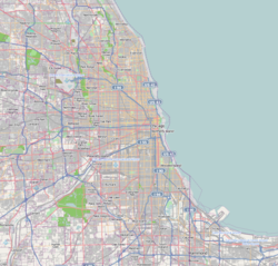
Calumet Park is located at 41°39′56″N87°39′29″W / 41.66556°N 87.65806°W (41.665602, -87.658139). [4]
According to the 2021 census gazetteer files, Calumet Park has a total area of 1.15 square miles (2.98 km2), of which 1.12 square miles (2.90 km2) (or 96.88%) is land and 0.04 square miles (0.10 km2) (or 3.12%) is water. [5]
Census | Pop. | Note | %± |
---|---|---|---|
1920 | 1,237 | — | |
1930 | 1,429 | 15.5% | |
1940 | 1,593 | 11.5% | |
1950 | 2,500 | 56.9% | |
1960 | 8,448 | 237.9% | |
1970 | 10,069 | 19.2% | |
1980 | 8,788 | −12.7% | |
1990 | 8,418 | −4.2% | |
2000 | 8,516 | 1.2% | |
2010 | 7,835 | −8.0% | |
2020 | 7,025 | −10.3% | |
U.S. Decennial Census [6] 2010 [7] 2020 [8] |
As of the 2020 census [9] there were 7,025 people, 3,256 households, and 1,973 families residing in the village. The population density was 6,092.80 inhabitants per square mile (2,352.44/km2). There were 3,074 housing units at an average density of 2,666.09 per square mile (1,029.38/km2). The racial makeup of the village (including Hispanics in the racial categories) was 3.36% White, 89.27% African American, 0.30% Native American, 0.09% Asian, 0.03% Pacific Islander, 3.77% from other races, and 3.19% from two or more races. Hispanic or Latino of any race were 6.45% of the population.
There were 3,256 households, out of which 30.6% had children under the age of 18 living with them, 23.68% were married couples living together, 30.41% had a female householder with no husband present, and 39.40% were non-families. 37.04% of all households were made up of individuals, and 10.23% had someone living alone who was 65 years of age or older. The average household size was 3.48 and the average family size was 2.57.
The village's age distribution consisted of 23.9% under the age of 18, 8.0% from 18 to 24, 23.5% from 25 to 44, 27.5% from 45 to 64, and 17.1% who were 65 years of age or older. The median age was 40.9 years. For every 100 females, there were 84.0 males. For every 100 females age 18 and over, there were 80.4 males.
The median income for a household in the village was $50,049, and the median income for a family was $60,689. Males had a median income of $41,402 versus $32,665 for females. The per capita income for the village was $25,250. About 15.5% of families and 19.4% of the population were below the poverty line, including 24.5% of those under age 18 and 17.7% of those age 65 or over.
Race / Ethnicity (NH = Non-Hispanic) | Pop 2000 [10] | Pop 2010 [7] | Pop 2020 [8] | % 2000 | % 2010 | % 2020 |
---|---|---|---|---|---|---|
White alone (NH) | 720 | 322 | 186 | 8.45% | 4.11% | 2.65% |
Black or African American alone (NH) | 7,036 | 6,893 | 6,230 | 82.62% | 87.98% | 88.68% |
Native American or Alaska Native alone (NH) | 13 | 6 | 9 | 0.15% | 0.08% | 0.13% |
Asian alone (NH) | 6 | 24 | 5 | 0.07% | 0.31% | 0.07% |
Pacific Islander alone (NH) | 1 | 2 | 0 | 0.01% | 0.03% | 0.00% |
Other race alone (NH) | 9 | 6 | 37 | 0.11% | 0.08% | 0.53% |
Mixed race or Multiracial (NH) | 72 | 46 | 105 | 0.85% | 0.59% | 1.49% |
Hispanic or Latino (any race) | 659 | 536 | 453 | 7.74% | 6.84% | 6.45% |
Total | 8,516 | 7,835 | 7,025 | 100.00% | 100.00% | 100.00% |
Calumet Park is located in Elementary School District #132, High School District #218, and Moraine Valley Community College District #524. [11]
Calumet Park is divided between two congressional districts. The area east of Interstate 57 and south of 123rd Street is in Illinois' 2nd Congressional District; the rest of the village is part of the 1st Congressional District.
The Ashland/Calumet Park station provides Metra commuter rail service along the Blue Island branch of the Metra Electric District line. Trains travel north to Millennium station in Chicago and south to Blue Island.
Pace and CTA provide bus service connecting Calumet Park to destinations across the Southland. [12]
Bedford Park is a village in Cook County, Illinois, United States, and is an industrial suburb of Chicago. The population was 602 at the 2020 census. Bedford Park consists of a small residential area and vast amounts of heavy industry sprawling to the east and a small amount to the west.
Broadview is a village in Cook County, Illinois, 12 miles (19 km) west of downtown Chicago. As of the 2020 census it had a population of 7,998.
Burnham is a village in Cook County, Illinois, United States. The population was 4,046 at the 2020 census. The ZIP code is 60633.
Deer Park is a village in Lake and Cook Counties, Illinois. Per the 2020 census, the population was 3,681. The village is one of the few left in the Chicago area that enjoy a green belt which is bordered by two large natural areas providing outdoor recreation and open space. The village is home to popular shopping and dining destinations: Deer Park Town Center and the Town Center Promenade. The town is also home to the Vehe Farm, an Illinois Centennial Farm.
East Dundee is a village in Kane County with a small section in Cook County. The population was 3,152 at the 2020 census.
East Hazel Crest is a village in Cook County, Illinois, in the United States. It is a south suburb of Chicago. As of the 2020 census, the village population was 1,297.
Forest View is a village in Cook County, Illinois, United States. Per the 2020 census, the population was 792. It is primarily an industrial corridor adjacent to the Chicago neighborhood of Garfield Ridge, which is on the village's southern border.
Hanover Park is a village in Cook and DuPage counties in the U.S. state of Illinois, a suburb of Chicago. The population was 37,470 at the 2020 census. Ontarioville is a neighborhood within the village.
Hometown is a city in Cook County, Illinois, United States. The population was 4,343 at the 2020 census.
Lansing is a village in Cook County, Illinois, United States. Lansing is a south suburb of Chicago. The population was 29,076 at the 2020 census.
Lynwood is a village in Cook County, Illinois, United States and a suburb of Chicago. The population was 9,116 at the 2020 census.
Merrionette Park is a village in Cook County, Illinois, United States. The population was 1,969 as of the 2020 census.
Palos Park is a village in southwestern Cook County, Illinois, United States. Per the 2020 census, the population was 4,899.
Richton Park is a village and a south suburb of Chicago in Cook County, Illinois, United States. The population was 12,775 at the 2020 census.
Riverdale is a village in Cook County, Illinois, United States. The population was 10,663 at the 2020 census. The village shares its name with the bordering Riverdale neighborhood in Chicago.
South Holland is a village and south suburb of Chicago in Cook County, Illinois, United States, within Thornton Township. The population was 21,465 at the 2020 census.
Stickney is a village in Cook County, Illinois, United States. The village is named for Alpheus Beede Stickney, a railroad executive who played a central role in establishing the Clearing Industrial District. Per the 2020 census, the population was 7,110. It was well known in the 1920s and early 1930s as the home for several bordellos linked to mobster Al Capone's empire.
Thornton is a village in Cook County, Illinois, United States and a south suburb of Chicago. The population was 2,386 at the 2020 census. Thornton is home to the Thornton Quarry, one of the largest quarries in the world.
Green Oaks is a village in Libertyville Township, Lake County, Illinois, United States. Per the 2020 census, the population was 4,128.
Frankfort Township is one of twelve townships in Franklin County, Illinois, USA. As of the 2020 census, its population was 6,443 and it contained 3,256 housing units.
{{cite web}}
: |last=
has generic name (help)