Countryside, Illinois

Last updated

Countryside, Illinois
City
Countryside Illinois Logo.png
Cook County Illinois Incorporated and Unincorporated areas Countryside Highlighted.svg
Location of Countryside in Cook County, Illinois.
Illinois in United States (US48).svg
Location of Illinois in the United States
Coordinates: 41°46′44″N87°52′26″W / 41.77889°N 87.87389°W / 41.77889; -87.87389
CountryUnited States
StateIllinois
County Cook
Township Lyons
Incorporated 1960
Government
  Type Council–manager
   Mayor Sean McDermott
Area
[1]
  Total2.88 sq mi (7.45 km2)
  Land2.88 sq mi (7.45 km2)
  Water0.00 sq mi (0.00 km2)  0%
Population
 (2020)
  Total6,420
  Density2,230.72/sq mi (861.32/km2)
 Down 1.6% from 2000
Standard of living (2007-11)
   Per capita income $28,124
   Median home value $226,700
ZIP code(s)
60525
Area code(s) 708
Geocode 17-16873
FIPS code 17-16873
Website www.countryside-il.org

Countryside is a city in Cook County, Illinois, United States. Per the 2020 census, the population was 6,420. [2]

Contents

History

The land where Countryside sits was originally inhabited by the Potawatomi Indians and later by early American pioneers in the beginning of the 19th century. Settler Joseph Vial and his family were among the first non-native people to settle in the Countryside area in 1833.

The area remained large expanses of rural farmland until the Great Chicago Fire of 1871, when the fire sent thousands of city dwellers into what is now west suburban Chicago. Land sold for only $2 an acre, which made areas such as Countryside a welcome respite from the congestion and industry in Chicago.

Despite the settlement of these early Countryside inhabitants, the area largely remained a quiet farming community until the post-World War II era when suburban areas such as Countryside began to experience explosive growth. The area's first residential subdivision was LaGrange Terrace, built in 1947; it was later followed by the Don L. Dise and Edgewood Park subdivisions in the 1950s.

The City of Countryside was officially incorporated in 1960.

Around 1917, the Marx Brothers family (later a famous comedy team) bought a chicken farm near Joliet Road (Route 66) and La Grange Road. Groucho Marx later claimed that the brothers spent too much time at Wrigley Field watching the Chicago Cubs to make the farm economically viable.

Geography

According to the 2021 census gazetteer files, Countryside has a total area of 2.88 square miles (7.46 km2), all land. [3]

Neighboring communities are Hodgkins, McCook, and La Grange.

Demographics

Historical population
CensusPop.Note
1970 2,864
1980 6,242117.9%
1990 5,716−8.4%
2000 5,9914.8%
2010 5,895−1.6%
2020 6,4208.9%
U.S. Decennial Census [4]
2010 [5] 2020 [6]

As of the 2020 census [7] there were 6,420 people, 2,543 households, and 1,531 families residing in the city. The population density was 2,230.72 inhabitants per square mile (861.29/km2). There were 2,812 housing units at an average density of 977.07 per square mile (377.25/km2). The racial makeup of the city was 72.94% White, 2.83% African American, 2.27% Asian, 0.53% Native American, 0.05% Pacific Islander, 9.45% from other races, and 11.92% from two or more races. Hispanic or Latino of any race were 24.00% of the population.

There were 2,543 households, out of which 26.7% had children under the age of 18 living with them, 40.11% were married couples living together, 10.58% had a female householder with no husband present, and 39.80% were non-families. 36.02% of all households were made up of individuals, and 10.70% had someone living alone who was 65 years of age or older. The average household size was 3.09 and the average family size was 2.32.

The city's age distribution consisted of 21.0% under the age of 18, 9.3% from 18 to 24, 19.2% from 25 to 44, 34.2% from 45 to 64, and 16.1% who were 65 years of age or older. The median age was 45.2 years. For every 100 females, there were 108.7 males. For every 100 females age 18 and over, there were 106.6 males.

The median income for a household in the city was $67,201, and the median income for a family was $90,804. Males had a median income of $52,837 versus $38,649 for females. The per capita income for the city was $44,265. About 5.7% of families and 6.8% of the population were below the poverty line, including 13.2% of those under age 18 and 4.3% of those age 65 or over.

Countryside city, Illinois – Demographic Profile
(NH = Non-Hispanic)
Race / EthnicityPop 2010 [5] Pop 2020 [6] % 2010% 2020
White alone (NH)4,6084,41078.17%68.69%
Black or African American alone (NH)1791663.04%2.59%
Native American or Alaska Native alone (NH)340.05%0.06%
Asian alone (NH)861451.46%2.26%
Pacific Islander alone (NH)110.02%0.02%
Some Other Race alone (NH)7200.12%0.31%
Mixed Race/Multi-Racial (NH)451330.76%2.07%
Hispanic or Latino (any race)9661,54116.39%24.00%
Total5,8956,420100.00%100.00%

Note: the US Census treats Hispanic/Latino as an ethnic category. This table excludes Latinos from the racial categories and assigns them to a separate category. Hispanics/Latinos can be of any race.

Economy

The International Union of Operating Engineers (IUOE) Local 150 is based in Countryside at 6200 Joliet Road.

Countryside Plaza is a large draw for regional shopping. [8]

Government

Countryside is in Illinois's 6th congressional district.

Education

Countryside is served by La Grange School District 105 and Pleasantdale School District 107. Elementary students attend Ideal Elementary School in Countryside or Pleasantdale Elementary School in Willow Springs. Middle school students attend William F.Gurrie Middle School in La Grange or Pleasantdale Middle School in Burr Ridge IL. High school students move onto Lyons Township High School District 204 which has campuses in La Grange, and Western Springs.

Infrastructure

Fire department

Countryside is served by the Pleasantview Fire Protection District, founded in 1946. It is directed by a board of trustees which is elected by the areas which make up the district. The fire district currently maintains three stations in its coverage area.

Transportation

Pace provides bus service on routes 330 and 392 connecting Countryside to Summit, O'Hare International Airport and other destinations. [9]

Related Research Articles

<span class="mw-page-title-main">Will County, Illinois</span> County in Illinois, United States

Will County is a county in the northeastern part of the state of Illinois. According to the 2020 census, it had a population of 696,355, an increase of 2.8% from 677,560 in 2010, making it Illinois's fourth-most populous county. The county seat is Joliet. Will County is one of the five collar counties of the Chicago–Naperville–Elgin, IL–IN–WI Metropolitan Statistical Area. The portion of Will County around Joliet uses area codes 815 and 779, while 630 and 331 are for far northern Will County and 708 is for central and eastern Will County.

<span class="mw-page-title-main">Brookfield, Illinois</span> Village in Illinois, United States

Brookfield is a village in Cook County, Illinois, United States, located 13 miles (21 km) west of downtown Chicago. Per the 2020 census, the population was 19,476. The city is home to the Brookfield Zoo.

<span class="mw-page-title-main">Burr Ridge, Illinois</span> Village in Illinois, United States

Burr Ridge is a village in Cook and DuPage counties in the U.S. state of Illinois. Per the 2020 census, the population was 11,192.
<span class="mw-page-title-main">Frankfort, Illinois</span> Village in Illinois, United States

Frankfort is a village in Will County and Cook County in the U.S. state of Illinois. It is a southern suburb of Chicago, and is approximately 28 miles south of the city. As of the 2020 census, the population was 20,296.

<span class="mw-page-title-main">Hanover Park, Illinois</span> Village in Illinois, United States

Hanover Park is a village in Cook and DuPage counties in the U.S. state of Illinois, a suburb of Chicago. The population was 37,470 at the 2020 census. Ontarioville is a neighborhood within the village.

<span class="mw-page-title-main">Hodgkins, Illinois</span> Village in Illinois, United States

Hodgkins is a village in Cook County, Illinois, United States, and is an industrial suburb of Chicago. The population was 1,500 at the 2020 census, down from 1,897 at the 2010 census.

<span class="mw-page-title-main">Indian Head Park, Illinois</span> Village in Illinois, United States

Indian Head Park is a village in Cook County, Illinois, United States, slightly north of the intersection of Interstate 294 and Interstate 55. The village is south of Western Springs, west of Countryside, north and east of Burr Ridge. Per the 2020 census, the population was 4,065. The village's ZIP code is 60525.

<span class="mw-page-title-main">La Grange Park, Illinois</span> Village in Illinois, United States

La Grange Park is a village in Cook County, Illinois, United States, about 13 miles (21 km) west-southwest of Chicago. According to the 2020 census, the population was 13,475.

<span class="mw-page-title-main">Lyons, Illinois</span> Village in Illinois, United States

Lyons is a village in Cook County, Illinois, United States. Per the 2020 census, the population was 10,817. The Chicago Portage National Historic Site is located in Lyons.

<span class="mw-page-title-main">McCook, Illinois</span> Village in Illinois, United States

McCook is a village in Cook County, Illinois, United States, and is an industrial suburb of Chicago. As of the 2020 census, the village population was 249, which is the lowest population of all municipalities in the county.

<span class="mw-page-title-main">Richton Park, Illinois</span> Village in Illinois, United States

Richton Park is a village and a south suburb of Chicago in Cook County, Illinois, United States. The population was 12,775 at the 2020 census.
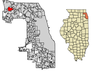
<span class="mw-page-title-main">South Barrington, Illinois</span> Village in Illinois, United States

South Barrington is a residential suburb in Cook County, Illinois, United States, south of Barrington. Per the 2020 census, the population was 5,077. South Barrington is a wealthy suburb of Chicago. It is the location of the famous megachurch Willow Creek Community Church, Goebbert's Pumpkin Patch and Farm, and a lifestyle center named The Arboretum of South Barrington.

<span class="mw-page-title-main">South Holland, Illinois</span> Village in Illinois, United States

South Holland is a village and south suburb of Chicago in Cook County, Illinois, United States, within Thornton Township. The population was 21,465 at the 2020 census.

<span class="mw-page-title-main">Summit, Illinois</span> City in Illinois, United States

Summit is a city in Cook County, Illinois, United States. The population was 11,161 at the 2020 census. The name Summit, in use since 1836, refers to the highest point on the Chicago Portage between the northeast-flowing Chicago River and the southwest-flowing Des Plaines River located just north of the city.

<span class="mw-page-title-main">Willow Springs, Illinois</span> Village in Illinois, United States

Willow Springs is a village in Cook County, Illinois, United States, with a small portion extending into DuPage County. The village was founded in 1892 and was named for the springs along the Des Plaines River. In 2020, the population was 5,857.

<span class="mw-page-title-main">Glendale Heights, Illinois</span> Village in Illinois, United States

Glendale Heights is a village in DuPage County, Illinois, United States. Per the 2020 census, the population was 33,176. The village is almost entirely residential, and is a far west suburb of Chicago.

<span class="mw-page-title-main">North Aurora, Illinois</span> Village in Illinois, United States

North Aurora is a village in Kane County, Illinois, United States, and a suburb of Aurora. Per the 2020 census, the population was 18,261. North Aurora maintains its own public library district, fire district, and police department, but public spaces and parks are managed by the neighboring Fox Valley Park District.

<span class="mw-page-title-main">Joliet, Illinois</span> City in Illinois, United States

Joliet is a city in Will and Kendall counties in the U.S. state of Illinois, 35 miles (56 km) southwest of Chicago. It is the county seat of Will County. It had a population of 150,362 at the 2020 census, making it the third-most populous city in Illinois.
<span class="mw-page-title-main">Long Grove, Illinois</span> Village in Lake County, Illinois, United States

Long Grove is a village in Lake County, Illinois, United States, approximately 35 miles (56 km) away from and a northwest suburb of Chicago. Per the 2020 census, the population was 8,366. The village has strict building ordinances to preserve its "country atmosphere".

<span class="mw-page-title-main">Lyons Township, Illinois</span> Township in Illinois, United States

Lyons Township is one of 29 townships in Cook County, Illinois. As of the 2020 census, its population was 115,105, with its most populous municipalities including La Grange, Justice and Summit. Lyons Township was established in 1850. The village of Lyons, almost all of which lies within the township, is often confused with it.
References

  1. "2020 U.S. Gazetteer Files". United States Census Bureau. Retrieved March 15, 2022.
  2. "Countryside city, Illinois". United States Census Bureau . Retrieved April 15, 2022.
  3. US Census Bureau. "Gazetteer Files". Census.gov. Retrieved June 29, 2022.
  4. "Decennial Census of Population and Housing by Decades". US Census Bureau.
  5. 1 2 "P2 HISPANIC OR LATINO, AND NOT HISPANIC OR LATINO BY RACE – 2010: DEC Redistricting Data (PL 94-171) – Countryside city, Illinois". United States Census Bureau .
  6. 1 2 "P2 HISPANIC OR LATINO, AND NOT HISPANIC OR LATINO BY RACE – 2020: DEC Redistricting Data (PL 94-171) – Countryside city, Illinois". United States Census Bureau .
  7. "Explore Census Data". data.census.gov. Retrieved June 28, 2022.
  8. "Countryside Plaza". Washington Prime Group. Retrieved July 14, 2019.
  9. "RTA System Map" (PDF). Retrieved January 30, 2024.