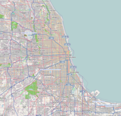
Palos Heights, Illinois | |
---|---|
Coordinates: 41°39′55″N87°47′50″W / 41.66528°N 87.79722°W | |
Country | United States |
State | Illinois |
County | Cook |
Township | Palos, Worth |
Incorporated | 1959 |
Government | |
• Type | Mayor–council |
• Mayor | Robert Straz |
Area | |
• Total | 3.87 sq mi (10.03 km2) |
• Land | 3.77 sq mi (9.77 km2) |
• Water | 0.10 sq mi (0.25 km2) 2.58% |
Population (2020) | |
• Total | 12,068 |
• Density | 3,197.67/sq mi (1,234.77/km2) |
Standard of living (2007-11) | |
• Per capita income | $39,954 |
• Median home value | $301,300 |
ZIP code(s) | 60463 |
Area code(s) | 708 |
Geocode | 57381 |
FIPS code | 17-57381 |
Website | www |
Palos Heights is a city in Cook County, Illinois, United States. It is a southwest suburb of Chicago. Per the 2020 census, the population was 12,068. [2]
According to the 2021 census gazetteer files, Palos Heights has a total area of 3.87 square miles (10.02 km2), of which 3.77 square miles (9.76 km2) (or 97.47%) is land and 0.10 square miles (0.26 km2) (or 2.53%) is water. [3]
Census | Pop. | Note | %± |
---|---|---|---|
1960 | 3,775 | — | |
1970 | 8,544 | 126.3% | |
1980 | 11,096 | 29.9% | |
1990 | 11,478 | 3.4% | |
2000 | 11,260 | −1.9% | |
2010 | 12,515 | 11.1% | |
2020 | 12,068 | −3.6% | |
U.S. Decennial Census [4] 2010 [5] 2020 [6] |
As of the 2020 census [7] there were 12,068 people, 4,625 households, and 3,407 families residing in the city. The population density was 3,116.74 inhabitants per square mile (1,203.38/km2). There were 5,114 housing units at an average density of 1,320.76 per square mile (509.95/km2). The racial makeup of the city was 90.25% White, 1.91% Asian, 1.67% African American, 0.07% Native American, 1.32% from other races, and 4.78% from two or more races. Hispanic or Latino of any race were 5.35% of the population.
There were 4,625 households, out of which 21.1% had children under the age of 18 living with them, 62.46% were married couples living together, 9.04% had a female householder with no husband present, and 26.34% were non-families. 21.75% of all households were made up of individuals, and 15.16% had someone living alone who was 65 years of age or older. The average household size was 2.98 and the average family size was 2.55.
The city's age distribution consisted of 17.3% under the age of 18, 7.3% from 18 to 24, 19.2% from 25 to 44, 25.7% from 45 to 64, and 30.4% who were 65 years of age or older. The median age was 51.7 years. For every 100 females, there were 99.0 males. For every 100 females age 18 and over, there were 96.8 males.
The median income for a household in the city was $90,995, and the median income for a family was $105,134. Males had a median income of $64,583 versus $44,342 for females. The per capita income for the city was $44,721. About 3.8% of families and 5.7% of the population were below the poverty line, including 8.9% of those under age 18 and 5.3% of those age 65 or over.
Race / Ethnicity (NH = Non-Hispanic) | Pop 2000 [8] | Pop 2010 [5] | Pop 2020 [6] | % 2000 | % 2010 | % 2020 |
---|---|---|---|---|---|---|
White alone (NH) | 10,727 | 11,456 | 10,734 | 95.27% | 91.54% | 88.95% |
Black or African American alone (NH) | 47 | 208 | 196 | 0.42% | 1.66% | 1.62% |
Native American or Alaska Native alone (NH) | 9 | 6 | 4 | 0.08% | 0.05% | 0.03% |
Asian alone (NH) | 232 | 249 | 224 | 2.06% | 1.99% | 1.86% |
Pacific Islander alone (NH) | 0 | 1 | 0 | 0.00% | 0.01% | 0.00% |
Other race alone (NH) | 6 | 13 | 29 | 0.05% | 0.10% | 0.24% |
Mixed race or Multiracial (NH) | 78 | 108 | 235 | 0.69% | 0.86% | 1.95% |
Hispanic or Latino (any race) | 161 | 474 | 646 | 1.43% | 3.79% | 5.35% |
Total | 11,260 | 12,515 | 12,068 | 100.00% | 100.00% | 100.00% |
As of the 2000 census, [9] there were 11,561 people, 4,123 households, and 3,133 families residing in the city. The population density was 2,978.6 people per square mile (1,150.0 people/km2). There were 4,268 housing units at an average density of 1,129.0 per square mile (435.9/km2). The racial makeup of the city was 96.39% White, 0.44% African American, 0.09% Native American, 2.06% Asian, 0.25% from other races, and 0.78% from two or more races. Hispanic or Latino of any race were 1.43% of the population.
The top five ancestries reported in Palos as of the 2000 census were Irish (27.2%), German (20.5%), Polish (14.1%), Italian (10.5%) and Dutch (9.1%). [10]
There were 4,123 households, out of which 25.0% had children under the age of 18 living with them, 67.0% were married couples living together, 6.6% had a female householder with no husband present, and 24.0% were non-families. 22.2% of all households were made up of individuals, and 14.2% had someone living alone who was 65 years of age or older. The average household size was 2.54 and the average family size was 2.98.
In the city, the population was spread out, with 20.2% under the age of 18, 8.2% from 18 to 24, 18.6% from 25 to 44, 27.5% from 45 to 64, and 25.5% who were 65 years of age or older. The median age was 47 years. For every 100 females, there were 86.2 males. For every 100 females age 18 and over, there were 81.8 males.
The median income for a household in the city was $69,907, and the median income for a family was $81,100. Males had a median income of $61,786 versus $37,188 for females. The per capita income for the city was $32,895. About 2.6% of families and 3.2% of the population were below the poverty line, including 4.0% of those under age 18 and 4.1% of those age 65 or over.
Palos Heights has the following neighborhoods, each with distinct characteristics:
Palos Heights is divided between three congressional districts. Most of the city, including all the area in Worth Township, is in Illinois's 1st congressional district; most of the area in Palos Township, excepting some of the southern portions (generally south of 131st Street) are in the 3rd district; an area under 0.05 square miles (100,000 m2) northeast of 131st Street and 80th Avenue, along with a small area around Palos Community Hospital, is in the 13th district. The City Council is made up of a mayor, city clerk, city treasurer and eight aldermen from wards:
The City Administrator is Dan Nisavic.
This section needs additional citations for verification .(January 2017) |
Palos Heights is served by four school districts. The four districts are: Palos Heights School District 128, Palos Community Consolidated School District 118, Community High School District 218, and Consolidated High School District 230. [11]
District 128 operates one pre-school (Indian Hill), two elementary schools (Chippewa and Navajo Heights), and a junior high school (Independence). District 118 also operates two elementary schools (Palos East and Palos West) and a middle school (Palos South). The district's Palos East elementary is situated within the city's boundaries. [12]
Community High School District 218's Alan B. Shepard High School serves Palos Heights and several neighboring communities. Students can choose from more than 200 different courses, including advanced placement courses, foreign language, computer programming, computer-aided design, robotics, graphic design, and desktop publishing. In addition, students can participate in a full roster of sports.
Consolidated High School District 230's Amos Alonzo Stagg High School, located in Palos Hills, serves Palos Heights students living west of Harlem Avenue (Illinois Route 43). [13] It also offers more than 200 courses designed to meet the academic needs of college-bound students and the training needs of career-oriented students.
Several private and parochial schools in Palos Heights offer alternatives to public school education. Among the schools are St. Alexander Catholic School, Palos Evangelical Lutheran Elementary School, Elim Christian School, Chicago Christian High School, and Stone Church Christian Academy. [11] The latter offers the full range of college preparatory, business, and technology courses.[ citation needed ] Kennedy School is in nearby Palos Hills. [11] The Roman Catholic Archdiocese of Chicago operates the Catholic schools. Incarnation Catholic School closed in 2018. [14]
Palos Heights students can readily commute to Moraine Valley Community College in nearby Palos Hills. Moraine Valley serves the local residents through classes, seminars, lectures, concerts, plays, and other activities. Trinity Christian College is also located in Palos Heights.
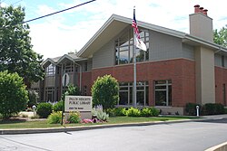
Palos Heights Public Library serves the community. [15]
Palos Heights was incorporated on April 11, 1959, on its fourth attempt at the ballot with the results 850 to 684. It officially became a city on April 16, 1959. Shortly thereafter, Z. Erol Smith was elected its first mayor and was re-elected three times, serving until 1973. [16]
In 1965, a group of scholars met in Palos Heights to discuss the need for a contemporary translation of the Bible. The necessity of the project was agreed upon, and shortly thereafter, the New International Version (NIV) was initiated in Palos Heights.
Palos Heights has a station on Metra's SouthWest Service, which provides daily rail service between the village of Manhattan and Chicago Union Station. Palos Heights is served by three Pace bus routes. [21]
Alsip is a village in Cook County, Illinois, United States. The population was 19,063 at the 2020 census. It is part of the Chicago metropolitan area.
Chicago Heights is a city in Cook County, Illinois, United States. The population was 27,480 at the 2020 census. It is part of the Chicago metropolitan area. Its nicknames include "The Crossroads of the Nation" and "The Heights”.
Glenwood is a village in Cook County, Illinois, United States. The population was 8,662 at the 2020 census.
Harwood Heights is a village in Cook County, Illinois, United States. The population was 9,065 at the 2020 census. Harwood Heights and its neighbor Norridge form an enclave surrounded by the city of Chicago.
Hickory Hills is a city in Cook County, Illinois, United States. Located principally in Palos Township, it is a suburb of Chicago. The population in 2020 was 14,505.
Lynwood is a village in Cook County, Illinois, United States and a suburb of Chicago. The population was 9,116 at the 2020 census.
Palos Hills is a city in Cook County, Illinois, United States. It is a southwest suburb of Chicago. The city was established in 1958 and had reached a population of 18,530 in the 2020 census. It is named after Palos de la Frontera, Spain, from which Christopher Columbus set sail to North America. Moraine Valley Community College as and Amos Alonzo Stagg High School are its main schools.
Palos Park is a village in southwestern Cook County, Illinois, United States. Per the 2020 census, the population was 4,899.
Prospect Heights is a city in Cook County, Illinois, United States, and is a suburb of Chicago. Per the 2020 census, the population was 16,058.
South Chicago Heights is a village and a south suburb in Cook County, Illinois, United States. The population was 4,026 at the 2020 census.
Steger is a village in Cook County and Will County, Illinois, United States. It is 35 miles (56 km) south of Chicago and had a population of 9,584 at the 2020 census.
Willow Springs is a village in Cook County, Illinois, United States, with a small portion extending into DuPage County. The village was founded in 1892 and was named for the springs along the Des Plaines River. In 2020, the population was 5,857.
Worth is a village in Cook County, Illinois, United States, a suburb of Chicago. Per the 2020 census, the population was 10,970.
Glendale Heights is a village in DuPage County, Illinois, United States. Per the 2020 census, the population was 33,176. The village is almost entirely residential, and is a far west suburb of Chicago.
South Elgin is a village in Kane County, Illinois, United States. Per the 2020 census, the population was 23,865. In 2007, Money magazine named South Elgin as 82nd of 100 entries in its "America's Best Places to Live" edition and again in 2011 as 98th of 100 entries.
Long Lake is an unincorporated community and census-designated place (CDP) in Lake County, Illinois, United States. Per the 2020 census, the population was 3,663.
Centreville was a city in St. Clair County, Illinois, United States. The population was 5,309 in 2010, down from 5,951 at the 2000 census. On May 6, 2021, the city ceased to exist, being incorporated along with Alorton and Cahokia into the new city of Cahokia Heights.
Fairview Heights is a city in St. Clair County, Illinois, United States within Greater St. Louis. It is an eastern suburb of St. Louis. The population was 17,078 at the 2010 census. Fairview Heights is a dominant shopping center for Greater St. Louis and Southern Illinois and includes numerous shopping plazas and St. Clair Square mall.
Vinita Park is a city in St. Louis County, Missouri, United States, located just east of I-170 and south of St. Charles Rock Road. The population was 1,970 at the 2020 census.
Worth Township is one of 29 townships in Cook County, Illinois. As of the 2020 census, its population was 152,934, with its most populous municipalities including Oak Lawn, Evergreen Park (19,943), Alsip, and Chicago Ridge. It was founded in 1849, when the county voted to subdivide itself into townships.