Hillside, Illinois

Last updated

Hillside, Illinois
Village of Hillside
DiGangi-QueenofHeaven.jpg
Queen of Heaven Mausoleum at corners of Wolf and Roosevelt roads
Hillside Seal.jpg
Cook County Illinois Incorporated and Unincorporated areas Hillside Highlighted.svg
Location of Hillside in Cook County, Illinois.
Illinois in United States (US48).svg
Location of Illinois in the United States
Coordinates: 41°52′29″N87°54′1″W / 41.87472°N 87.90028°W / 41.87472; -87.90028
CountryUnited States
StateIllinois
County Cook
Area
[1]
  Total3.17 sq mi (8.20 km2)
  Land3.17 sq mi (8.20 km2)
  Water0.00 sq mi (0.00 km2)
Population
 (2020)
  Total8,320
  Density2,626.26/sq mi (1,014.11/km2)
Time zone UTC-6 (CST)
  Summer (DST) UTC-5 (CDT)
ZIP Code(s)
60162
Area code(s) 708/464
FIPS code 17-35086
Wikimedia CommonsHillside, Illinois
Website www.hillside-il.org

Hillside is a village in Cook County, Illinois, United States. As of the 2020 census it had a population of 8,320. [2]

Contents

Geography

Hillside is located at 41°52′29″N87°54′1″W / 41.87472°N 87.90028°W / 41.87472; -87.90028 (41.874797, −87.900372). [3]

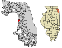
According to the 2021 census gazetteer files, Hillside has a total area of 3.17 square miles (8.21 km2), all land. [4]

History

German Lutheran immigrants planted farms and constructed Hillside's first school and church (Immanuel) near the intersection of Wolf and 22nd Street in the 1840s, which marked the start of the community's formal settlement. Although the majority of Hillside's later construction was located north of 12th Street, Immanuel Lutheran Church and School were incorporated inside village boundaries, giving Hillside its characteristic form.

However, Marion Covell found a significant limestone deposit just a few feet below the surface of his property during the 1850s, despite the fact that farming was the main industry at the time. The quarry he started in 1854 was still in operation until the middle of the 1970s, providing crushed stone for the construction of roads across the Chicago metropolitan area. The John Sexton Company purchased the quarry in 1979 and operated it as a sanitary landfill.

Cemeteries also took the place of active farming immediately beyond Hillside on its western and southern borders, first with Mt. Carmel in 1894, then Oak Ridge, Glen Oak, and ultimately Queen of Heaven in 1947. The Illinois Central Railroad station and the Chicago, Aurora & Elgin Railroad interurban's 12th Street spur made the cemetery easily accessible, which led to the development of taverns, restaurants, monument businesses, greenhouses, and flower stores. The Illinois Central Railroad station, known as Hillside because westbound trains had to ascend a slope at this location, served as the inspiration for the village's name when it was founded in 1905.

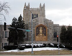
The community had its first significant residential growth during the 1920s when additional farmland was split up and sold. In the 1920s, there were substantial holdings obtained by St. Domitilla Roman Catholic Church and Mater Dolorosa Seminary. These institutions were formerly surrounded by open space, but following World War II, when Hillside's population quadrupled (from 1,080 to 2,131) between 1940 and 1950, then surged to 7,794 in 1960, it was submerged in a wave of residential building. Hillside Retail Mall, a pioneering regional shopping area, was next to the just finished Congress Expressway in 1956. Soon after, a Holiday Inn, Hillside Theaters, the High Point Tower office structure, and the industrial park on Fencl Lane surrounding the center.

Hillside Retail Center's heyday was brief due to the construction of newer, bigger malls and shopping complexes in the 1960s. The mall's deterioration was unaffected by changes to the exterior look of the building, its tenants, or its ownership. The majority of the mall was razed in 1997 to make room for a large auto dealership.

According to the 2010 census, Hillside has a total area of 3.18 square miles (8.24 km2), all land. [5]

Demographics

Historical population
CensusPop.Note
1910 328
1920 55569.2%
1930 1,00480.9%
1940 1,0807.6%
1950 2,13197.3%
1960 7,794265.7%
1970 8,88814.0%
1980 8,279−6.9%
1990 7,672−7.3%
2000 8,1556.3%
2010 8,1570.0%
2020 8,3202.0%
U.S. Decennial Census [6]
2010-2020 [7]

As of the 2020 census [8] there were 8,320 people, 2,744 households, and 1,660 families residing in the village. The population density was 2,626.26 inhabitants per square mile (1,014.00/km2). There were 3,151 housing units at an average density of 994.63 per square mile (384.03/km2). The racial makeup of the village was 42.92% African American, 21.19% White, 1.42% Native American, 3.06% Asian, 0.02% Pacific Islander, 19.09% from other races, and 12.30% from two or more races. Hispanic or Latino of any race were 35.55% of the population.

There were 2,744 households, out of which 23.8% had children under the age of 18 living with them, 39.69% were married couples living together, 14.47% had a female householder with no husband present, and 39.50% were non-families. 34.73% of all households were made up of individuals, and 16.84% had someone living alone who was 65 years of age or older. The average household size was 3.79 and the average family size was 2.80.

The village's age distribution consisted of 19.3% under the age of 18, 10.1% from 18 to 24, 25.6% from 25 to 44, 30.5% from 45 to 64, and 14.6% who were 65 years of age or older. The median age was 40.2 years. For every 100 females, there were 98.0 males. For every 100 females age 18 and over, there were 97.8 males.

The median income for a household in the village was $56,019, and the median income for a family was $76,548. Males had a median income of $45,093 versus $29,670 for females. The per capita income for the village was $25,953. About 4.0% of families and 5.5% of the population were below the poverty line, including 1.3% of those under age 18 and 6.4% of those age 65 or over.

Hillside village, Illinois - Demographic Profile
(NH = Non-Hispanic)
Race / EthnicityPop 2010 [9] Pop 2020 [7] % 2010% 2020
White alone (NH)2,0221,41424.79%17.00%
Black or African American alone (NH)3,4853,51942.72%42.30%
Native American or Alaska Native alone (NH)6100.07%0.12%
Asian alone (NH)2692533.30%3.04%
Pacific Islander alone (NH)320.04%0.02%
Some Other Race alone (NH)12350.15%0.42%
Mixed Race/Multi-Racial (NH)1081291.32%1.55%
Hispanic or Latino (any race)2,2522,95827.61%35.55%
Total8,1578,320100.00%100.00%

Note: the US Census treats Hispanic/Latino as an ethnic category. This table excludes Latinos from the racial categories and assigns them to a separate category. Hispanics/Latinos can be of any race.

Government

Hillside is divided into three congressional districts. The area north of Harrison Street, and most of the area northeast of Roosevelt Road and Haase Avenue, is in Illinois's 7th congressional district; the southern arm of the city, south of Roosevelt Road along Wolf Road, is in the 3rd district; the area in between (primarily Mount Carmel Cemetery) is in the 4th district.

Education

Primary and secondary schools

Public schools

Hillside residents are served by various school districts for elementary and middle school .

Hillside School District 93 :

Berkeley School District 87 :

Bellwood School District 88 :

All residents are served by Proviso Township High Schools District 209's Proviso West High School in Hillside, though qualified students may also attend the Proviso Mathematics and Science Academy in nearby Forest Park. [10]

Hillside is also the home and birthplace of the famous rap group Do or Die.

Colleges and universities

Nearby colleges and universities include:

Transportation

Pace provides bus service on multiple routes connecting Hillside to destinations across the region. [11]

Business

Commercial Light Company, located at 245 Fencl Lane, is one of the village's largest employers. [12]

Notable Cemeteries

Two notable cemeteries in Hillside. One is the Mount Carmel Cemetery. On the grounds of the cemetery are the graves of a number of organized crime figures, such as Al Capone and Dion O'Bannion. A number of Bishops and Archbishops of the Archdiocese of Chicago are buried in the Bishop's Mausoleum at Mount Carmel Cemetery. The other Catholic cemetery, Queen of Heaven Cemetery, is located immediately south of Mount Carmel, across Roosevelt Road.

Notable people

Related Research Articles

<span class="mw-page-title-main">Alsip, Illinois</span> Village in Illinois, United States

Alsip is a village in Cook County, Illinois, United States. The population was 19,063 at the 2020 census. It is part of the Chicago metropolitan area.

<span class="mw-page-title-main">Bellwood, Illinois</span> Village in Illinois, United States

Bellwood is a village in Proviso Township, Cook County, Illinois, United States. Located 13 miles (21 km) west of Chicago's downtown Loop, the Village of Bellwood is bounded by the Eisenhower Expressway (south), the Proviso yards of the former Chicago & Northwestern, now Union Pacific Railroad (north), and the suburbs of Maywood (east) and Hillside and Berkeley (west). The population was 18,789 at the 2020 census.

<span class="mw-page-title-main">Berkeley, Illinois</span> Village in Illinois, United States

Berkeley is a village located in Cook County, Illinois, United States. Incorporated in 1924, the population at the 2020 census was 5,338.

<span class="mw-page-title-main">Broadview, Illinois</span> Village in Illinois, United States

Broadview is a village in Cook County, Illinois, 12 miles (19 km) west of downtown Chicago. As of the 2020 census it had a population of 7,998.

<span class="mw-page-title-main">Evergreen Park, Illinois</span> Village in Illinois, United States

Evergreen Park is a village in Cook County, Illinois, United States. In 2020, the population was 19,943.

<span class="mw-page-title-main">Forest Park, Illinois</span> Village in Illinois, United States

Forest Park is a village in Cook County, Illinois, a suburb of Chicago, United States. The population was 14,339 at the 2020 census. The Forest Park terminal on the CTA Blue Line is the line's western terminus, located on the Eisenhower Expressway at Des Plaines Avenue. This makes it one of just two municipalities served by the Chicago "L" train network that does not directly border Chicago.

<span class="mw-page-title-main">Glenwood, Illinois</span> Village in Illinois, United States

Glenwood is a village in Cook County, Illinois, United States. The population was 8,662 at the 2020 census.

<span class="mw-page-title-main">La Grange Park, Illinois</span> Village in Illinois, United States

La Grange Park is a village in Cook County, Illinois, United States. According to the 2020 census, the population was 13,475.

<span class="mw-page-title-main">Maywood, Illinois</span> Village in Illinois, United States

Maywood is a village in Proviso Township, Cook County, Illinois, United States in the Chicago metropolitan area. It was founded on April 6, 1869, and organized October 22, 1881. The population was 23,512 at the 2020 United States Census.

<span class="mw-page-title-main">Melrose Park, Illinois</span> Village in Illinois, United States

Melrose Park is a village in Cook County, Illinois, United States. It is a suburb of Chicago. As of the 2020 census it had a population of 24,796.

<span class="mw-page-title-main">Mount Prospect, Illinois</span> Village in Illinois, United States

Mount Prospect is a village in Elk Grove Village and Wheeling Townships in Cook County, Illinois, about 20 miles (32 km) northwest of downtown Chicago, and approximately 4 miles north of O'Hare International Airport. As of the 2020 census, the village had a total population of 56,852.

<span class="mw-page-title-main">Northfield, Illinois</span> Village in Illinois, United States

Northfield is a village in Cook County, Illinois, United States, located approximately 19 miles (31 km) north of downtown Chicago. As of the 2020 census, the village's population was 5,751. It is part of a collection of upscale residential communities north of Chicago that belong to New Trier and Northfield Townships and the greater North Shore.

<span class="mw-page-title-main">Posen, Illinois</span> Village in Illinois, United States

Posen is a village in Cook County, Illinois, United States. Posen is the German-language name for the western Polish city of Poznań. The population of the village was 5,632 at the 2020 census.

<span class="mw-page-title-main">South Barrington, Illinois</span> Village in Illinois, United States

South Barrington is a residential suburb in Cook County, Illinois, United States, south of Barrington. Per the 2020 census, the population was 5,077. South Barrington is a wealthy suburb of Chicago. It is the location of the famous megachurch Willow Creek Community Church, Goebbert's Pumpkin Patch and Farm, and a lifestyle center named The Arboretum of South Barrington.

<span class="mw-page-title-main">Stickney, Illinois</span> Village in Illinois, United States

Stickney is a village in Cook County, Illinois, United States. The village is named for Alpheus Beede Stickney, a railroad executive who played a central role in establishing the Clearing Industrial District. Per the 2020 census, the population was 7,110. It was well known in the 1920s and early 1930s as the home for several bordellos linked to mobster Al Capone's empire.

<span class="mw-page-title-main">Stone Park, Illinois</span> Village in Illinois, United States

Stone Park is a village in Cook County, Illinois, United States. The population was 4,576 at the 2020 census. Incorporated in 1939, the town was named for insurance magnate Clement Stone, who bought most of the land when it was still corn fields.

<span class="mw-page-title-main">Thornton, Illinois</span> Village in Illinois, United States

Thornton is a village in Cook County, Illinois, United States and a south suburb of Chicago. The population was 2,386 at the 2020 census. Thornton is home to the Thornton Quarry, one of the largest quarries in the world.

<span class="mw-page-title-main">Westchester, Illinois</span> Village in Illinois, United States

Westchester is a village in Cook County, Illinois, United States. It is a western suburb of Chicago. The population was 16,892 at the 2020 census.

<span class="mw-page-title-main">Proviso Township, Cook County, Illinois</span> Township in Illinois, United States

Proviso Township is one of 29 townships in Cook County, Illinois, United States. As of the 2020 census, its population was 151,209. It was organized in 1850 and originally named "Taylor", but shortly afterward its name was changed to make reference to the Wilmot Proviso, a contemporary piece of legislation intended to stop the spread of slavery.

<span class="mw-page-title-main">Downers Grove Township, DuPage County, Illinois</span> Township in Illinois, United States

Downers Grove Township is one of nine townships in DuPage County, Illinois, USA. As of the 2020 census, its population was 149,921 and it contained 61,933 housing units. It is the largest township in the county, both in terms of area and population.

References

  1. "2020 U.S. Gazetteer Files". United States Census Bureau. Retrieved March 15, 2022.
  2. "Hillside village, Illinois". United States Census Bureau . Retrieved January 30, 2022.
  3. "US Gazetteer files: 2010, 2000, and 1990". United States Census Bureau. February 12, 2011. Retrieved April 23, 2011.
  4. Bureau, US Census. "Gazetteer Files". Census.gov. Retrieved June 29, 2022.
  5. "G001 - Geographic Identifiers - 2010 Census Summary File 1". United States Census Bureau. Archived from the original on February 13, 2020. Retrieved August 3, 2015.
  6. "Census of Population and Housing from 1790". US Census Bureau . Retrieved January 24, 2022.
  7. 1 2 "P2 HISPANIC OR LATINO, AND NOT HISPANIC OR LATINO BY RACE - 2020: DEC Redistricting Data (PL 94-171) - Hillside village, Illinois". United States Census Bureau .
  8. "Explore Census Data". data.census.gov. Retrieved June 28, 2022.
  9. "P2 HISPANIC OR LATINO, AND NOT HISPANIC OR LATINO BY RACE - 2010: DEC Redistricting Data (PL 94-171) - Hillside village, Illinois". United States Census Bureau .
  10. "About Proviso Township High Schools District 209 Archived 2017-04-12 at the Wayback Machine ." Proviso Township High Schools District 209. Retrieved on February 23, 2014.
  11. "RTA System Map" (PDF). Retrieved January 31, 2024.
  12. "Village of Hillside; Largest Employers". Hillside, IL. Archived from the original on July 26, 2011. Retrieved July 13, 2011.