Burr Ridge, Illinois

Last updated

Burr Ridge, Illinois
Village
Village of Burr Ridge
Flag of Burr Ridge, Illinois.svg
Burr Ridge Logo.png
Motto: 
"A Very Special Place"
DuPage County Illinois Incorporated and Unincorporated areas Burr Ridge Highlighted.svg
Location of Burr Ridge in DuPage County, Illinois.
Coordinates("): 41°45′11″N87°55′12″W / 41.75306°N 87.92000°W / 41.75306; -87.92000
CountryFlag of the United States (23px).png  United States
StateIllinois
Counties DuPage, Cook
Townships Downers Grove, Lyons
Incorporated 1956
Government
  Type Council–manager
   Mayor Gary Grasso (R) [1]
Area
[2]
  Total7.33 sq mi (18.99 km2)
  Land7.20 sq mi (18.64 km2)
  Water0.14 sq mi (0.35 km2)  1.96%
Elevation
702 ft (214 m)
Population
 (2020)
  Total11,192
  Density1,554.88/sq mi (600.32/km2)
Standard of living (2007-11)
   Per capita income $81,192
   Home value $679,400
ZIP code(s)
60527
Area code(s) 630 and 331
Geocode 17-09980
FIPS code 17-09980
Website www.burr-ridge.gov OOjs UI icon edit-ltr-progressive.svg

Burr Ridge (formerly Harvester) is a village in Cook and DuPage counties in the U.S. state of Illinois. Per the 2020 census, the population was 11,192. [3]

Contents

Geography

Burr Ridge is located at 41°45′11″N87°55′12″W / 41.75306°N 87.92000°W / 41.75306; -87.92000 (41.753030, -87.919998). [4]

According to the 2021 census gazetteer files, Burr Ridge has a total area of 7.29 square miles (18.88 km2), of which 7.16 square miles (18.54 km2) (or 98.15%) is land and 0.14 square miles (0.36 km2) (or 1.85%) is water. [5]

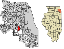
Burr Ridge lies in both Du Page and Cook counties. The village is bordered by Hinsdale to the north, Western Springs to the northeast, Indian Head Park to the east, Willow Springs to the south and southeast, and Willowbrook to the west, along with several unincorporated areas.

History

Burr Ridge's gently rolling hills were carved by glaciers at the end of the last ice age, and most of the village lies on the Valparaiso Moraine. Flagg Creek, a tributary of the Des Plaines River, runs through town.

Joseph Vial erected a log cabin near Wolf and Plainfield roads in 1834. Vial also ran a hotel on the stagecoach line, and the Vial family was actively involved in Lyons Township politics and the creation of the Lyonsville congregational church. The first Democratic convention in Cook County was held in Burr Ridge in 1835. After 1848, farmers shipped their goods to Chicago along the Illinois and Michigan Canal. A small settlement of German farmers also inhabited Flagg Creek by the 1880s.

In 1917, the International Harvester Company purchased 414 acres (1.7 km2) for an experimental farm, where it tested the world's first all-purpose tractor, the Farmall. Also in 1917, the Cook County Prison Farm (also known as the Bridewell Farm) began operation in what is now Burr Ridge.

In 1947, developer Robert Bartlett, whose company also developed Beverly Shores and Countryside, established the Hinsdale Countryside Estates out of a former pig farm. In 1956 these residents decided to incorporate as the village of Harvester, in honor of International Harvester.

In the 1940s, Denver Busby bought 190 acres (0.8 km2) that became known as the Burr Ridge dairy farm. He later launched the Burr Ridge Estates, with 5-acre (20,000 m2) home sites. In 1961, International Harvester and the Burr Ridges Estates merged with Harvester, changing the community's name to Burr Ridge. The town name is derived from a group of bur oak. By 1963, the population had more than doubled, to 790, and by 1975 it had soared to over 2,200.

In 1969, Chicago mayor Richard J. Daley suggested a proposal to build low-income subsidized housing on the prison farm property, but Republican-dominated DuPage County quashed the idea. The prison farm site became the Ambriance subdivision, a gated community of multimillion-dollar homes. The Four Pines Farm gave way to the Carriage Way subdivision, at whose entrance the original farmhouse still stands, and in 1971 additional farmland became the Braemoor neighborhood. An area known as Valley View, once owned by a Chicago industrialist and later by the Chicago chapter of the Boy Scouts of America, was developed in the early 1970s as the Burr Ridge Club. The village also has five corporate parks. As with other towns in the industrial corridor southwest of Chicago, close proximity to Interstates 294 and 55 spurred development in Burr Ridge.

Demographics

Historical population
CensusPop.Note
1960 299
1970 1,637447.5%
1980 3,838134.5%
1990 7,66999.8%
2000 10,40835.7%
2010 10,5591.5%
2020 11,1926.0%
U.S. Decennial Census [6]
2010 [7] 2020 [8]

As of the 2020 census [9] there were 11,192 people, 4,278 households, and 3,194 families residing in the village. The population density was 1,534.83 inhabitants per square mile (592.60/km2). There were 4,562 housing units at an average density of 625.62 per square mile (241.55/km2). The racial makeup of the village was 74.42% White, 16.46% Asian, 1.96% African American, 0.16% Native American, 0.03% Pacific Islander, 1.22% from other races, and 5.76% from two or more races. Hispanic or Latino of any race were 5.44% of the population.

There were 4,278 households, out of which 26.0% had children under the age of 18 living with them, 66.29% were married couples living together, 6.76% had a female householder with no husband present, and 25.34% were non-families. 23.26% of all households were made up of individuals, and 13.58% had someone living alone who was 65 years of age or older. The average household size was 2.97 and the average family size was 2.50.

The village's age distribution consisted of 20.3% under the age of 18, 4.4% from 18 to 24, 13.7% from 25 to 44, 32.2% from 45 to 64, and 29.5% who were 65 years of age or older. The median age was 54.5 years. For every 100 females, there were 99.4 males. For every 100 females age 18 and over, there were 87.7 males.

The median income for a household in the village was $151,900, and the median income for a family was $204,167. Males had a median income of $115,272 versus $63,266 for females. The per capita income for the village was $97,295. About 1.1% of families and 3.3% of the population were below the poverty line, including 1.6% of those under age 18 and 2.8% of those age 65 or over.

Burr Ridge village, Illinois – Racial and Ethnic Composition
(NH = Non-Hispanic)
Note: the US Census treats Hispanic/Latino as an ethnic category. This table excludes Latinos from the racial categories and assigns them to a separate category. Hispanics/Latinos may be of any race.
Race / EthnicityPop 2010 [7] Pop 2020 [8] % 2010% 2020
White alone (NH)8,1678,21277.35%73.37%
Black or African American alone (NH)2072081.96%1.86%
Native American or Alaska Native alone (NH)450.04%0.04%
Asian alone (NH)1,5631,83414.80%16.39%
Pacific Islander alone (NH)000.00%0.00%
Some Other Race alone (NH)21270.20%0.24%
Mixed Race/Multi-Racial (NH)1672971.58%2.65%
Hispanic or Latino (any race)4306094.07%5.44%
Total10,55911,192100.00%100.00%

Notable people

Government and infrastructure

Burr Ridge is located in Illinois's 3rd congressional district, which has been represented by Democrat Marie Newman [10]

Burr Ridge is served by Pleasantview Fire Protection District (headquartered in LaGrange Highlands) [11] and Tri-State Fire Protection District (headquartered in Darien). [12] Tri-State Fire Protection District Station 3 is located on Madison Street in southern Burr Ridge.

Transportation

Pace provides bus service from the Burr Ridge Park-n-Ride via Routes 850 and 855 which travel on I-55 from Plainfield to Chicago. [13]

Education

Primary schools

High schools

Community colleges

Parks

Burr Ridge includes 12 major parks. One of the largest parks, and home of the Burr Ridge Park District, is Harvester Park. Other larger parks include "Pleasantdale Park District" with adjacent Walker Park at 7425 S. Wolf Road in the Cook County portion of the Village. In DuPage County are Citizens Park, Kraml Park, Palisades Park, Stevens Park, and Whittaker Park in the south, Garywood Park and McCullough Park on Plainfield Road, and Oak Grove Park and Woods Pool Park in the north. [14]

Religious institutions

Related Research Articles

<span class="mw-page-title-main">Alsip, Illinois</span> Village in Illinois, United States

Alsip is a village in Cook County, Illinois, United States. The population was 19,063 at the 2020 census. It is part of the Chicago metropolitan area.

<span class="mw-page-title-main">Berkeley, Illinois</span> Village in Illinois, United States

Berkeley is a village located in Cook County, Illinois, United States. Incorporated in 1924, the population at the 2020 census was 5,338.

<span class="mw-page-title-main">Bridgeview, Illinois</span> Village in Illinois, United States

Bridgeview is a village in Cook County, Illinois, United States. It is located approximately 15 miles (24 km) southwest of the Chicago Loop. As of the 2020 census, the village population was 17,027.

<span class="mw-page-title-main">Countryside, Illinois</span> City in Illinois, United States

Countryside is a city in Cook County, Illinois, United States. Per the 2020 census, the population was 6,420.

<span class="mw-page-title-main">Elk Grove Village, Illinois</span> Village in Illinois, United States

Elk Grove Village is a village in Cook and DuPage counties in the U.S. state of Illinois. Per the 2020 census, the population was 32,812. Located 20 miles (32 km) northwest of Chicago along the Golden Corridor, the Village of Elk Grove Village was incorporated on July 17, 1956. It is directly adjacent to O'Hare International Airport and is economically important to the Chicago metropolitan area due to its large industrial park, located on the eastern border of the village. The community is served by several Interstate highways including I-90, I-290/I-355/Route 53, and IL-390. Elk Grove is also expected to be served by the I-490 Western O'Hare Bypass upon completion of the project.

<span class="mw-page-title-main">Ford Heights, Illinois</span> Village in Illinois, United States

Ford Heights is a village and a suburb of Chicago in Cook County, Illinois, United States. The population was 1,813 at the 2020 census. Many of the area’s first settlers were African American and since its incorporation in 1949 the village has remained predominantly Black. Due to the lack of commercial activity and financial stability, the village has declined over the years. Urban renewal efforts were attempted in the 1960s, although the village has continued to decline.

<span class="mw-page-title-main">Glenview, Illinois</span> Village in Illinois, United States

Glenview is an incorporated village located in Cook County, Illinois, United States, approximately 15 miles northwest of the Chicago Loop. Per the 2020 census, the population was 48,705. The current Village President is Michael Jenny.

<span class="mw-page-title-main">Hanover Park, Illinois</span> Village in Illinois, United States

Hanover Park is a village in Cook and DuPage counties in the U.S. state of Illinois, a suburb of Chicago. The population was 37,470 at the 2020 census. Ontarioville is a neighborhood within the village.

<span class="mw-page-title-main">Hillside, Illinois</span> Village in Illinois, United States

Hillside is a village in Cook County, Illinois, United States. As of the 2020 census it had a population of 8,320.

<span class="mw-page-title-main">Hinsdale, Illinois</span> Village in the US State of Illinois

Hinsdale is a village in Cook and DuPage counties in the U.S. state of Illinois. Hinsdale is a western suburb of Chicago. The population was 17,395 at the 2020 census, most of whom lived in DuPage County.

<span class="mw-page-title-main">Hodgkins, Illinois</span> Village in Illinois, United States

Hodgkins is a village in Cook County, Illinois, United States, and is an industrial suburb of Chicago. The population was 1,500 at the 2020 census, down from 1,897 at the 2010 census.

<span class="mw-page-title-main">Indian Head Park, Illinois</span> Village in Illinois, United States

Indian Head Park is a village in Cook County, Illinois, United States, slightly north of the intersection of Interstate 294 and Interstate 55. The village is south of Western Springs, west of Countryside, north and east of Burr Ridge. Per the 2020 census, the population was 4,065. The village's ZIP code is 60525.

<span class="mw-page-title-main">Norridge, Illinois</span> Village in Illinois, United States

Norridge is a village in Cook County, Illinois, United States. The population was 15,251 at the 2020 census. The village and its neighbor to the east, Harwood Heights, together form an enclave within the city of Chicago. Norridge is sometimes referred to as the "Island Within a City". The current President of Norridge is Daniel Tannhauser.

<span class="mw-page-title-main">River Forest, Illinois</span> Village in Illinois, United States

River Forest is a suburban village adjacent to Chicago in Cook County, Illinois, United States. Per the 2020 census, the population was 11,717. Two universities make their home in River Forest, Dominican University and Concordia University Chicago. The village is closely tied to the larger neighboring community of Oak Park. There are significant architectural designs located in River Forest such as the Winslow House by Frank Lloyd Wright. River Forest has a railroad station with service to Chicago on Metra's Union Pacific West Line.

<span class="mw-page-title-main">Streamwood, Illinois</span> Village in Illinois, United States

Streamwood is a village in Cook County, Illinois, United States. Per the 2020 census, the population was 39,577. It is a northwest suburb of Chicago, and is a part of the Chicago metropolitan area.

<span class="mw-page-title-main">Westchester, Illinois</span> Village in Illinois, United States

Westchester is a village in Cook County, Illinois, United States. It is a western suburb of Chicago. The population was 16,892 at the 2020 census.

<span class="mw-page-title-main">Willow Springs, Illinois</span> Village in Illinois, United States

Willow Springs is a village in Cook County, Illinois, with a small portion in DuPage County. The village was founded in 1892, and was named for the springs along the Des Plaines River. In 2020, the population was 5,857.

<span class="mw-page-title-main">Darien, Illinois</span> City in Illinois, United States

Darien is a city in DuPage County, Illinois, United States. Per the 2020 census, the population was 22,011. A southwestern suburb of Chicago, Darien was named after the town of Darien, Connecticut. Darien is just north of I-55 and Historic U.S. Route 66. The entire south edge of the town borders Waterfall Glen.

<span class="mw-page-title-main">Lyons Township, Cook County, Illinois</span> Township in Illinois, United States

Lyons Township is one of 29 townships in Cook County, Illinois. As of the 2020 census, its population was 115,105, with its most populous municipalities including La Grange, Justice and Summit. Lyons Township was established in 1850. The village of Lyons, almost all of which lies within the township, is often confused with it.

<span class="mw-page-title-main">Downers Grove Township, DuPage County, Illinois</span> Township in Illinois, United States

Downers Grove Township is one of nine townships in DuPage County, Illinois, USA. As of the 2020 census, its population was 149,921 and it contained 61,933 housing units. It is the largest township in the county, both in terms of area and population.

References

  1. https://ballotpedia.org/Gary_Grasso
  2. "2020 U.S. Gazetteer Files". United States Census Bureau. Retrieved March 15, 2022.
  3. "Burr Ridge village, Illinois". United States Census Bureau . Retrieved April 15, 2022.
  4. "US Gazetteer files: 2010, 2000, and 1990". United States Census Bureau. February 12, 2011. Retrieved April 23, 2011.
  5. "Gazetteer Files". Census.gov. Retrieved June 29, 2022.
  6. "Decennial Census of Population and Housing by Decades". US Census Bureau.
  7. 1 2 "P2 HISPANIC OR LATINO, AND NOT HISPANIC OR LATINO BY RACE – 2010: DEC Redistricting Data (PL 94-171) – Burr Ridge village, Illinois". United States Census Bureau .
  8. 1 2 "P2 HISPANIC OR LATINO, AND NOT HISPANIC OR LATINO BY RACE – 2020: DEC Redistricting Data (PL 94-171) – Burr Ridge village, Illinois". United States Census Bureau .
  9. "Explore Census Data". data.census.gov. Retrieved June 28, 2022.
  10. "Illinois 3rd Congressional District" Retrieved October 31, 2016
  11. "Pleasantview FPD". Archived from the original on September 27, 2013. Retrieved September 22, 2013.
  12. "Tri-State Fire Protection District" . Retrieved September 22, 2013.
  13. "RTA System Map" (PDF). Retrieved January 30, 2024.
  14. "Burr Ridge Park District" Accessed October 30, 2016
  15. "History of The Zoroastrian Association of Metropolitan Chicago" Archived 2017-01-28 at the Wayback Machine Retrieved October 30, 2016