Bedford Park, Illinois

Last updated

Bedford Park, Illinois
Village
Flag of Bedford Park, Illinois.png
Bedford Park Illinois Logo.jpg
Cook County Illinois Incorporated and Unincorporated areas Bedford Park Highlighted.svg
Location of Bedford Park in Cook County, Illinois.
Illinois in United States (US48).svg
Location of Illinois in the United States
USA Illinois location map.svg
Red pog.svg
Bedford Park
Location in Illinois
Usa edcp location map.svg
Red pog.svg
Bedford Park
Bedford Park (the United States)
North America laea location map.svg
Red pog.svg
Bedford Park
Bedford Park (North America)
Coordinates: 41°45′9″N87°47′9″W / 41.75250°N 87.78583°W / 41.75250; -87.78583
CountryFlag of the United States.svg  United States
StateIllinois
County Cook
Township Lyons, Stickney
Incorporated 1940
Government
  Type Council–manager
   President David R. Brady
Area
[1]
  Total6.04 sq mi (15.64 km2)
  Land5.93 sq mi (15.37 km2)
  Water0.11 sq mi (0.27 km2)  1.82%
Population
 (2020)
  Total602
  Density101.45/sq mi (39.17/km2)
 Up 1.04% from 2000
Standard of living (2007-11)
   Per capita income $23,925
   Median home value $218,900
ZIP code(s)
60455, 60458, 60459, 60499, 60501, 60638
Area code(s) 708, 773
Geocode 04572
FIPS code 17-04572
Website www.villageofbedfordpark.com
Demographics (2010) [2]
DemographicProportion
White 83.8%
Black 0.7%
Asian 0.0%
Islander 0.0%
Native 0.3%
Other15.1%
Hispanic
(any race)
24.3%

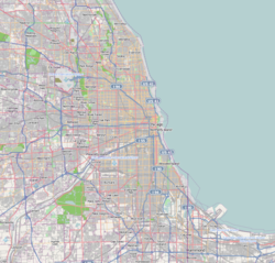
Bedford Park is a village in Cook County, Illinois, United States, and is an industrial suburb of Chicago. The population was 602 at the 2020 census. Bedford Park consists of a small residential area and vast amounts of heavy industry sprawling to the east and a small amount to the west.

Contents

Geography

Bedford Park is located at 41°45′9″N87°47′9″W / 41.75250°N 87.78583°W / 41.75250; -87.78583 (41.768508, -87.785803). [3]

According to the 2021 census gazetteer files, Bedford Park has a total area of 6.04 square miles (15.64 km2), of which 5.93 square miles (15.36 km2) (or 98.25%) is land and 0.11 square miles (0.28 km2) (or 1.75%) is water. [4]

Demographics

Historical population
CensusPop.Note
1950 651
1960 73713.2%
1970 583−20.9%
1980 98869.5%
1990 566−42.7%
2000 5741.4%
2010 5801.0%
2020 6023.8%
U.S. Decennial Census [5]

As of the 2020 census [6] there were 602 people, 211 households, and 166 families residing in the village. The population density was 99.67 inhabitants per square mile (38.48/km2). There were 213 housing units at an average density of 35.26 per square mile (13.61/km2). The racial makeup of the village was 61.30% White, 2.82% African American, 0.33% Native American, 1.66% Asian, 0.17% Pacific Islander, 13.62% from other races, and 20.10% from two or more races. Hispanic or Latino of any race were 36.88% of the population.

The top ancestries reported were Polish (16.1%), Irish (12.4%), German (9.7%), and Italian (6.7%).

There were 211 households, out of which 36.5% had children under the age of 18 living with them, 60.66% were married couples living together, 15.64% had a female householder with no husband present, and 21.33% were non-families. 17.06% of all households were made up of individuals, and 6.64% had someone living alone who was 65 years of age or older. The average household size was 3.63 and the average family size was 3.17.

The village's age distribution consisted of 26.5% under the age of 18, 7.8% from 18 to 24, 23.9% from 25 to 44, 27.5% from 45 to 64, and 14.3% who were 65 years of age or older. The median age was 37.4 years. For every 100 females, there were 136.4 males. For every 100 females age 18 and over, there were 113.9 males.

The median income for a household in the village was $99,375, and the median income for a family was $99,500. Males had a median income of $47,083 versus $47,700 for females. The per capita income for the village was $37,871. About 4.2% of families and 3.7% of the population were below the poverty line, including 5.1% of those under age 18 and 0.0% of those age 65 or over.

Government

Bedford Park is in Illinois's 3rd congressional district.

Education

Elementary and middle school students attend school in Cook County School District 104, which operates Walker Elementary School in Bedford Park. [7] High school students move on to Argo Community High School District 217 in Summit.

The Bedford Park Public Library is in the community. [8]

Parks and recreation

The Bedford Park District operates public parks in Bedford Park and Bridgeview Gardens. [9]

Business

The Institute for Food Safety and Health is located in Bedford Park, adjacent to the Ingredion plant. It is affiliated with the Illinois Institute of Technology and the Food and Drug Administration's Center for Food Safety and Applied Nutrition. [10]

Transportation

Both Pace and CTA provide bus service in the village. [11]

Related Research Articles

<span class="mw-page-title-main">Broadview, Illinois</span> Village in Illinois, United States

Broadview is a village in Cook County, Illinois, 12 miles (19 km) west of downtown Chicago. As of the 2020 census it had a population of 7,998.

<span class="mw-page-title-main">Burr Ridge, Illinois</span> Village in Illinois, United States

Burr Ridge is a village in Cook and DuPage counties in the U.S. state of Illinois. Per the 2020 census, the population was 11,192.

<span class="mw-page-title-main">Calumet Park, Illinois</span> Village in Illinois, United States

Calumet Park is a village in Cook County, Illinois. The population was 7,025 at the 2020 census.

<span class="mw-page-title-main">Deer Park, Illinois</span> Village in Illinois, United States

Deer Park is a village in Lake and Cook Counties, Illinois. Per the 2020 census, the population was 3,681. The village is one of the few left in the Chicago area that enjoy a green belt which is bordered by two large natural areas providing outdoor recreation and open space. The village is home to popular shopping and dining destinations: Deer Park Town Center and the Town Center Promenade. The town is also home to the Vehe Farm, an Illinois Centennial Farm.

<span class="mw-page-title-main">East Hazel Crest, Illinois</span> Village in Illinois, United States

East Hazel Crest is a village in Cook County, Illinois, in the United States. It is a south suburb of Chicago. As of the 2020 census, the village population was 1,297.

<span class="mw-page-title-main">Forest View, Illinois</span> Village in Illinois, United States

Forest View is a village in Cook County, Illinois, United States. Per the 2020 census, the population was 792. It is primarily an industrial corridor adjacent to the Chicago neighborhood of Garfield Ridge, which is on the village's southern border.

<span class="mw-page-title-main">Glenwood, Illinois</span> Village in Illinois, United States

Glenwood is a village in Cook County, Illinois, United States. The population was 8,662 at the 2020 census.

<span class="mw-page-title-main">Hanover Park, Illinois</span> Village in Illinois, United States

Hanover Park is a village in Cook and DuPage counties in the U.S. state of Illinois, a suburb of Chicago. The population was 37,470 at the 2020 census. Ontarioville is a neighborhood within the village.

<span class="mw-page-title-main">Indian Head Park, Illinois</span> Village in Illinois, United States

Indian Head Park is a village in Cook County, Illinois, United States, slightly north of the intersection of Interstate 294 and Interstate 55. The village is south of Western Springs, west of Countryside, north and east of Burr Ridge. Per the 2020 census, the population was 4,065. The village's ZIP code is 60525.

<span class="mw-page-title-main">Lansing, Illinois</span> Village in Illinois, United States

Lansing is a village in Cook County, Illinois, United States. Lansing is a south suburb of Chicago. The population was 29,076 at the 2020 census.

<span class="mw-page-title-main">Lynwood, Illinois</span> Village in Illinois, United States

Lynwood is a village in Cook County, Illinois, United States and a suburb of Chicago. The population was 9,116 at the 2020 census.

<span class="mw-page-title-main">McCook, Illinois</span> Village in Illinois, United States

McCook is a village in Cook County, Illinois, United States, and is an industrial suburb of Chicago. As of the 2020 census, the village population was 249, which is the lowest population of all municipalities in the county.

<span class="mw-page-title-main">Palos Park, Illinois</span> Village in Illinois, United States

Palos Park is a village in southwestern Cook County, Illinois, United States. Per the 2020 census, the population was 4,899.

<span class="mw-page-title-main">Richton Park, Illinois</span> Village in Illinois, United States

Richton Park is a village and a southern suburb of Chicago in Cook County, Illinois, United States. The population was 12,775 at the 2020 census. The community was named after a Richton in Vermont, the native home of a first settler.

<span class="mw-page-title-main">Stickney, Illinois</span> Village in Illinois, United States

Stickney is a village in Cook County, Illinois, United States. The village is named for Alpheus Beede Stickney, a railroad executive who played a central role in establishing the Clearing Industrial District. Per the 2020 census, the population was 7,110. It was well known in the 1920s and early 1930s as the home for several bordellos linked to mobster Al Capone's empire.

<span class="mw-page-title-main">Stone Park, Illinois</span> Village in Illinois, United States

Stone Park is a village in Cook County, Illinois, United States. The population was 4,576 at the 2020 census. Incorporated in 1939, the town was named for insurance magnate Clement Stone, who bought most of the land when it was still corn fields.

<span class="mw-page-title-main">Bloomingdale, Illinois</span> Village in Illinois, United States

Bloomingdale is a village in DuPage County, Illinois, United States, settled in 1833, and 25 miles northwest of downtown Chicago. The population was 22,382 at the 2020 census.

<span class="mw-page-title-main">Glendale Heights, Illinois</span> Village in Illinois, United States

Glendale Heights is a village in DuPage County, Illinois, United States. Per the 2020 census, the population was 33,176. The village is almost entirely residential, and is a far west suburb of Chicago.

<span class="mw-page-title-main">Lostant, Illinois</span> Village in Illinois, United States

Lostant is a village in LaSalle County, Illinois, United States. The population was 423 at the 2020 census, down from 498 at the 2010 census. It is part of the Ottawa Micropolitan Statistical Area.

<span class="mw-page-title-main">Crete, Illinois</span> Village in Illinois, United States

Crete is a village in Will County, Illinois, United States. It is a far south suburb of Chicago, 30 miles from the Loop and only 6 miles from the Indiana border. The population was 8,465 at the 2020 census. Originally named Wood's Corner, it was founded in 1836 by Vermonters Dyantha and Willard Wood.

References

  1. "2020 U.S. Gazetteer Files". United States Census Bureau. Retrieved March 15, 2022.
  2. "Profile of General Population and Housing Characteristics: 2010 Demographic Profile Data (DP-1): Bedford Park village, Illinois". U.S. Census Bureau, American Factfinder. Archived from the original on February 12, 2020. Retrieved February 15, 2013.
  3. "US Gazetteer files: 2010, 2000, and 1990". United States Census Bureau. February 12, 2011. Retrieved April 23, 2011.
  4. Bureau, US Census. "Gazetteer Files". Census.gov. Retrieved June 29, 2022.
  5. "Census of Population and Housing". Census.gov. Retrieved June 4, 2015.
  6. "Explore Census Data". data.census.gov. Retrieved June 28, 2022.
  7. Home. Walker Elementary School. Retrieved on January 19, 2017.
  8. Home. Bedford Park Public Library. Retrieved on January 19, 2017.
  9. Home. Bedford Park District. Retrieved on January 19, 2017.
  10. "About". IIT IFSH. Illinois Institute of Technology. Archived from the original on June 28, 2013. Retrieved March 21, 2014.
  11. "RTA System Map" (PDF). Retrieved January 30, 2024.