Sussex is a census-designated place (CDP) in and the county seat of Sussex County, Virginia, United States. The population as of the 2020 Census was 181.
Bovina is a census-designated place and unincorporated community located about 7 miles (11 km) east of Vicksburg in Warren County, Mississippi, on Interstate 20. It is part of the Vicksburg Micropolitan Statistical Area.

Valley Park is a census-designated place and unincorporated community in Issaquena County, Mississippi, United States. Its elevation is 95 feet. Although unincorporated, it has a post office, with the ZIP code of 39177.
Agricola is a census-designated place and unincorporated community in George County, Mississippi. Per the 2020 Census, the population was 346.
Glen Allan is a census-designated place and unincorporated community located in far southern Washington County, Mississippi. It is situated immediately east of Lake Washington's southern shore.

Winterville is a census-designated place and unincorporated community located in Washington County, Mississippi, near Mississippi Highway 1. Winterville is approximately 3 miles (4.8 km) north of Greenville, the county seat, and approximately 4 miles (6.4 km) south of Lamont.
Benndale is a census-designated place and unincorporated community in George County, Mississippi. It is located near the intersection of State Highways 26 and 57. The community is part of the Pascagoula Metropolitan Statistical Area. Prior to the creation of George County, Benndale was located in Jackson County. It was first named as a CDP prior in the 2020 Census which listed a population of 65.
Delta City is a census-designated place and unincorporated community located on Mississippi Highway 434 in Sharkey County, Mississippi. Delta City is approximately 6 miles (9.7 km) east of Panther Burn and approximately 5 miles (8.0 km) north of Nitta Yuma. Although an unincorporated community, Delta City has a zip code of 39061.

Moselle is a census-designated place and unincorporated community in southern Jones County, Mississippi. The community is part of the Laurel micropolitan area.
Eastabuchie is a census-designated place and unincorporated community in southwestern Jones County, Mississippi. It is located along U.S. Route 11, just north of the Forrest County line. the community has a post office with the ZIP code 39436. Eastabuchie is part of the Laurel Micropolitan Statistical Area.
Grace is a census-designated place and unincorporated community in Issaquena County, Mississippi, United States. It is located several miles northeast of Mayersville.

Nitta Yuma is a census-designated place and unincorporated community located in Sharkey County, Mississippi, United States. Nitta Yuma is located along U.S. Route 61, approximately four miles north of Anguilla.

Scott is a census-designated place and unincorporated community located in Bolivar County, Mississippi, United States on Mississippi Highway 1. Scott is approximately 5 miles (8.0 km) north of Lamont and approximately 7 miles (11 km) south of Benoit.
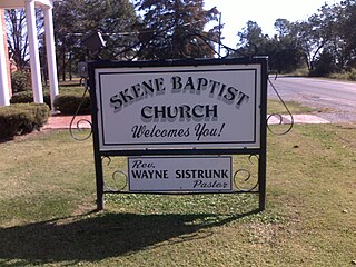
Skene is a census-designated place and unincorporated community located in Bolivar County, Mississippi, United States on Mississippi Highway 446. Skene is approximately 3 miles (4.8 km) west of Boyle and approximately 7 miles (11 km) north of Shaw. Skene was a station on the Boyle and Sunflower branch of the former Yazoo and Mississippi Valley Railroad.
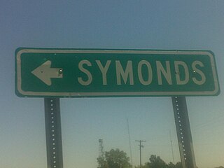
Symonds is a census-designated place and unincorporated community located in Bolivar County, Mississippi, United States. Symonds is approximately 3 miles (4.8 km) southeast of Malvina and approximately 4 miles (6.4 km) northwest of Pace. Symonds is located on the former Yazoo and Mississippi Valley Railroad.
Longview is a census-designated place and unincorporated community located in Oktibbeha County, Mississippi. Longview is approximately 7 miles (11 km) southwest of Starkville and approximately 8 miles (13 km) northeast of Sturgis.
Mount Pleasant is a census-designated place and unincorporated community in northeastern Marshall County, Mississippi, located along U.S. Route 72 at State Route 311. Although unincorporated, it has a post office serving the nearby city of Holly Springs. The zip code is 38649. The community also has a volunteer fire department located on Boswell road, and a K-12 school located off of US Highway 72. Mount Pleasant is bordered by Cayce and Taska to the west, Holly Springs to the south, Slayden to the east, and Collierville, Tennessee to the north.
Paris is a census-designated place and unincorporated community in Lafayette County, Mississippi, United States. Paris is located at the junction of Mississippi Highway 9W and Mississippi Highway 315 10 miles (16 km) east of Water Valley.

Biggersville is a census-designated place and unincorporated community in Alcorn County, Mississippi, United States. It lies along U.S. Route 45 six miles south of Corinth in the northeastern part of the state. Biggersville is home to Biggersville High School and several small businesses. It was first named as a CDP in the 2020 Census which listed a population of 205.
Alcorn State University is a census-designated place (CDP) and the official name for an area covering the Alcorn State University campus, in Jefferson County, Mississippi, United States.


