
The Mohave Trail was a Native American trade route between Mohave Indian villages on the Colorado River and settlements in coastal Southern California.
The Mohave Trail was a Native American trade route between Mohave Indian villages on the Colorado River and settlements in coastal Southern California.
Starting from Mohave villages along the Colorado River in the upper Mohave Valley, the Mohave Trail ran westward between springs across the Mojave Desert, from Piute Spring to Indian Well, to Rock Springs, then to Marl Spring and Soda Spring on the west side of Soda Lake. From there the trail led to the mouth of the Mojave River southwest of Soda Lake. It then followed the river up stream, finding oases of water and vegetation where the river came to the surface at various places along its course.
At what is now Summit Valley, the trail turned upward into and over the San Bernardino Mountains at Monument Peak, then descended into the San Bernardino Valley at the mouth of Cajon Canyon.
The Franciscan missionary Francisco Garcés was the first European to travel and report on the route in 1776. The Mohave Trail later became the route of raiders, preying on the herds of the California missions and ranchos. Spanish (and later, Mexican) soldiers pursued the raiders along the route. [1]
The Mohave Trail was later used by the first Americans to reach Alta California by land, the expedition of fur trappers led by Jedediah Smith in November, 1826. [2] Subsequently, from 1829 to 1848, New Mexican and American merchants used much of the length of the trail westward from Piute Spring as part of the main route of the Old Spanish Trail trade routes.
In 1847 - 1848, Mormons from Salt Lake City and from Los Angeles opened up a wagon road route between the Mormon settlements near Salt Lake City, Utah and Los Angeles in Southern California, This route intercepted and then followed the Old Spanish Trail from Utah. It met the old Mojave Trail where the Mormon Road joined it at Fork of the Road on the Mojave River and followed the trail along the river upstream until its Last Crossing before leaving the old trail and crossing 17 miles of desert to Cajon Pass. From 1849, the Mormon Road became heavily traveled winter road to California by Forty-niners seeking to avoid the fate of the Donner Party, and subsequent travelers, post riders and commercial wagon freighters. [3]
In 1857, the route of the old trail was part of the route that linked Beale's Wagon Road route, across the Mojave Desert from Fort Tejon, to where they met at Beale's Crossing on the Colorado River. This ran from the Colorado crossing to where it left the Mojave River, west of the vicinity of modern Barstow. In 1858, during the Mohave War the old native footpath and pack trail between Fork of the Road and the Colorado River was converted into the Mojave Road, a wagon road to supply the newly established Fort Mohave from Los Angeles. During the Colorado River Gold Rush from 1862 it became one of the major roads to the gold and silver mining regions on the upper river and linked by the Hardyville - Prescott Road in 1864 to the mining regions in northern and central Arizona.
The eastern Mojave Desert route of the Mohave Trail, from Manix Wash east to the Colorado River is now closely followed by a jeep trail called the Mojave Road.

The Mojave River is an intermittent river in the eastern San Bernardino Mountains and the Mojave Desert in San Bernardino County, California, United States. Most of its flow is underground, while its surface channels remain dry most of the time, with the exception of the headwaters and several bedrock gorges in the lower reaches.

The California Trail was an emigrant trail of about 3,000 mi (4,800 km) across the western half of the North American continent from Missouri River towns to what is now the state of California. After it was established, the first half of the California Trail followed the same corridor of networked river valley trails as the Oregon Trail and the Mormon Trail, namely the valleys of the Platte, North Platte, and Sweetwater rivers to Wyoming. In the present states of Wyoming, Idaho, and Utah, the California and Oregon trails split into several different trails or cutoffs.

The Muddy River, formerly known as the Moapa River, is a short river located in Clark County, in southern Nevada, United States. It is in the Mojave Desert, approximately 60 miles (97 km) north of Las Vegas.

The Old Spanish Trail is a historical trade route that connected the northern New Mexico settlements of Santa Fe, New Mexico with those of Los Angeles, California and southern California. Approximately 700 mi (1,100 km) long, the trail ran through areas of high mountains, arid deserts, and deep canyons. It is considered one of the most arduous of all trade routes ever established in the United States. Explored, in part, by Spanish explorers as early as the late 16th century, the trail saw extensive use by pack trains from about 1830 until the mid-1850s.

Oro Grande is an unincorporated community in the Mojave Desert of San Bernardino County, California, United States. It lies on the city boundary of Victorville and Adelanto. It is at 3,000 feet (910 m) elevation in Victor Valley north of the San Bernardino mountain range. It is located on old Route 66 near Interstate 15 between Victorville and Barstow. The ZIP code is 92368 and the community is inside area codes 442 and 760. Less than 1,000 residents live in the unincorporated area.

The Mojave Road, also known as Old Government Road, is a historic route and present day dirt road across what is now the Mojave National Preserve in the Mojave Desert in the United States. This rough road stretched 147 miles (237 km) from Beale's Crossing, to Fork of the Road location along the north bank of the Mojave River where the old Mojave Road split off from the route of the Old Spanish Trail/Mormon Road.

The Salt Spring Hills are a low mountain range in the Mojave Desert, in northern San Bernardino County, California. They are just outside the southeastern corner of Death Valley National Park, southeast of the Saddle Peak Hills. The road south from Shoshone to Baker passes through the hills.
In the American Old West, overland trails were built by pioneers and immigrants throughout the 19th century and especially between 1829 and 1870 as an alternative to sea and railroad transport. These immigrants began to help colonize much of North America west of the Great Plains as part of the mass overland migrations of the mid-19th century. Settlers emigrating from the eastern United States were spurred by various motives, among them religious persecution and economic incentives, to move to destinations in the far west via routes including the Oregon Trail, California Trail, and Mormon Trail. After the end of the Mexican–American War in 1849, vast new American conquests again enticed mass immigration. Legislation like the Donation Land Claim Act and significant events like the California Gold Rush further lured people to travel overland to the west.

The Mohave War was an armed conflict between the Mohave people against the United States from 1858 to 1859. With the California Gold Rush of 1849, thousands of American settlers headed west through Mohave country and into California. The influx of migrants passing through, combined with simple misunderstandings, led to conflict. Fort Mohave on the Arizona side of the Colorado River was built for operations against the hostile natives and was the second American military post established on the river after Fort Yuma. Eventually advanced weaponry and tactics forced the Mohave and their allies to surrender. After the signing of a peace treaty in 1859, the Mohave never again opposed the United States through warfare. The peace also ended a long guerrilla war between the Mohave and the Maricopa of south central Arizona.

Southern Emigrant Trail, also known as the Gila Trail, the Kearny Trail, Southern Trail and the Butterfield Stage Trail, was a major land route for immigration into California from the eastern United States that followed the Santa Fe Trail to New Mexico during the California Gold Rush. Unlike the more northern routes, pioneer wagons could travel year round, mountain passes not being blocked by snows, however it had the disadvantage of summer heat and lack of water in the desert regions through which it passed in New Mexico Territory and the Colorado Desert of California. Subsequently, it was a route of travel and commerce between the eastern United States and California. Many herds of cattle and sheep were driven along this route and it was followed by the San Antonio-San Diego Mail Line in 1857-1858 and then the Butterfield Overland Mail from 1858 - 1861.
Glen Helen Regional Park is a county park located in San Bernardino, California, United States adjacent to the Cajon Pass. It was the site of both US Festivals of the early 1980s. It is also home to the Glen Helen Amphitheater, the largest outdoor amphitheater in the United States. The park also hosts several off-road races since 1985.

In October 1857, an expedition led by Edward Fitzgerald Beale was tasked with establishing a trade route along the 35th parallel from Fort Smith, Arkansas to Los Angeles, California.
Bitter Spring is a spring within the Fort Irwin National Training Center in San Bernardino County, California. It lies at an elevation of 1355 feet and is located in a valley between the Soda Mountains to the east, the Tiefort Mountains to the northwest, Alvord Mountain to the southwest and Cronese Mountains to the south and southeast.

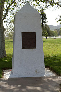
Monument Peak is a summit in the San Bernardino Mountains, of San Bernardino County, California. It lies at an elevation of 5272 feet.
Crowder Canyon, originally Coyote Canyon, is a valley in San Bernardino County, California. Its mouth was at an elevation of 2,999 feet / 914 meters at its confluence with Cajon Canyon. Its source was at an elevation of 4200 feet at 34°21′02″N117°26′04″W near Cajon Summit. The canyon runs southward just west of the top of Cajon Pass then turns southwestward to meet Cajon Canyon.
Fork of the Road was the locale along the Mojave River where the junction of the Mojave Trail / Mojave Road and the Old Spanish Trail / Mormon Road was located in San Bernardino County, California. The location of Fork of the Road was on the north side of the Mojave River, 18.75 miles southwest of Bitter Spring, about 14.5 miles east of Grapevine, and 10.9 miles west of Camp Cady. The location was an oasis where the Mojave River came to the surface. There travelers could get water, camp, rest and graze their animals before or after crossing the desert.
Lane's Crossing was a ford below the Lower Narrows of the Mojave River in San Bernardino County, California. "Lane's" a ranch and store for travelers at this crossing on the Mormon Road was established by "Captain" Aaron G. Lane the first pioneer settler on the Mojave River.
Mormon Road, also known to the 49ers as the Southern Route, of the California Trail, was a seasonal wagon road first pioneered by a Mormon party from Salt Lake City, Utah led by Jefferson Hunt, that followed the route of Spanish explorers and the Old Spanish Trail across southwestern Utah, northwestern Arizona, southern Nevada and the Mojave Desert of California to Los Angeles in 1847. From 1855, it became a military and commercial wagon route between California and Utah, called the Los Angeles - Salt Lake Road. In later decades this route was variously called the "Old Mormon Road", the "Old Southern Road", or the "Immigrant Road" in California. In Utah, Arizona and Nevada it was known as the "California Road".
Beale's Crossing, was a river crossing of the Colorado River, near the head of the Mohave Valley, between New Mexico Territory and California along the along the 35th Parallel route of Beale's Wagon Road. The crossing was located at what became the site of Fort Mohave in what is now Fort Mohave, Arizona and west of Beaver Lake, Nevada. The crossing was named for Edward Fitzgerald Beale who lead the expedition that built what came to be called Beale's Wagon Road from Albuquerque, New Mexico to Beale's Crossing in California, then by way of the Mohave Trail/Old Spanish Trail, and another old route west from the Mojave River to Fort Tejon, California.

The Mojave Road Los Angeles was designated a California Historic Landmark on March 19, 1985. It runs from Drum Barracks in Los Angeles County to the Colorado River in San Bernardino County, California