Bailey's Crossroads is a census-designated place (CDP) in Fairfax County, Virginia, United States. The population was 23,643 at the 2010 census. Bailey's Crossroads lies at the "crossroads" of State Route 7 and State Route 244.

The A24 is a major road in England that runs for 53.2 miles (85.6 km) from Clapham in south-west London to Worthing on the English Channel in West Sussex via the suburbs of south-west London, as well as through the counties of Surrey and West Sussex.

Junction is an unincorporated community in Hampshire County in the U.S. state of West Virginia. Historically referred to as Moorefield Junction, Junction received its name because of its location at the crossroads of U.S. Route 220/West Virginia Route 28 and the Northwestern Turnpike. The community is located along Mill Creek.

Lehew is an unincorporated community in Hampshire County, West Virginia on the Virginia line. Lehew is located on Timber Ridge along West Virginia Route 259 at its crossroads with H.G. Brill Road and White Pine Ridge Road.

Sleepy Creek is a 44.0-mile-long (70.8 km) tributary of the Potomac River in the United States, belonging to the Chesapeake Bay's watershed. The stream rises in Frederick County, Virginia, and flows through Morgan County, West Virginia before joining the Potomac near the community of Sleepy Creek.

Stotlers Crossroads is a small unincorporated community hamlet in southeastern Morgan County, West Virginia. It is situated along Winchester Grade Road between the South and Middle Forks of Sleepy Creek on the eastern flanks of Highland Ridge.

Spohrs Crossroads is an unincorporated community along Martinsburg Road to the west of Sleepy Creek in Morgan County in the U.S. state of West Virginia. The community was originally named Spohrs Cross Roads for the local Spohr family. It sometimes erroneously known as Stohrs Cross Roads or Stohrs Crossroads.

Smith Crossroads is an unincorporated community in Morgan County in the U.S. state of West Virginia's Eastern Panhandle. The hamlet lies at the crossroads of the Winchester Grade Road with County Routes 26 and 13/1. According to the Geographic Names Information System, Smith Crossroads has also been referred to as Smiths Corners, Smiths Cross Roads, and Smiths Forks.
Crossroads, crossroad, cross road or similar may refer to:
Timber Ridge is a mountain ridge of the Ridge-and-valley Appalachians straddling the U.S. states of Virginia and West Virginia. Timber Ridge extends from the forks of Sleepy Creek at Stotlers Crossroads in Morgan County, West Virginia, to Lehew in Hampshire County, West Virginia. The ridge is predominantly forested, as its name suggests, with the exception of a number of orchards and open fields. From WV 127/VA 127 at Good to Lehew, Timber Ridge serves as the boundary line between Hampshire County, West Virginia, and Frederick County, Virginia.

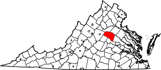
Zion Crossroads is an unincorporated community in Louisa and Fluvanna counties, Virginia, at the intersections of James Madison Highway and Three Notch Road and Interstate 64 in Virginia.

Daybrook is an unincorporated community in Monongalia County, West Virginia, United States. It is situated at a crossroads of West Virginia Route 218 at an altitude of 1,007 feet (307 m).
Crossroads, West Virginia may refer to:

Yards is an unincorporated community straddling the border between Tazewell County, Virginia and Mercer County, West Virginia, United States. Yards is located on the Bluestone River, 4 miles (6.4 km) northwest of Bluefield, Virginia. Yards had a post office on the Virginia side of the border from 1888 until May 28, 1994. The community was named for its railroad yards.

Schneider Crossroads is an unincorporated community in Fairfax County, in the U.S. state of Virginia. State Route 620 and State Route 609 cross here and it is located 5.3 miles northwest by road from Centreville. It contains little more than a florists' and a site called Cox Farms. Pleasant Valley Golf Club lies to the northeast, with the two other quadrants also incorporated into yet undeveloped Fairfax County Park Authority parks. As the crossroads is a major traffic bottleneck, with traffic flow formally managed by 4-way stop signs, Loudoun County, just west of the crossroads, offered over a million of the county's funds in 2012 to pay for the intersection upgrade as their residents were inconvenienced the most by the traffic problem, although the intersection is completely in Fairfax County. The Virginia Department of Transportation determined that the optimal solution was a roundabout which was built from 2015 to 2016. Although traffic is much improved, the poor nature of the two-lane Braddock Road to the east of the traffic circle is now the main impediment of east-bound morning traffic.

Mountain is an unincorporated community in Ritchie County, West Virginia, United States. Mountain is located in extreme northeastern Ritchie County along West Virginia Route 74 and the Hughes River, 6.2 miles (10.0 km) north-northeast of Pennsboro. The community was known as Mole Hill prior to 1949, when residents requested that the name be changed to Mountain. The post office ultimately closed on November 9, 2002.

Peapatch is an unincorporated community in Buchanan County, Virginia and McDowell County, West Virginia.

Crossroads is an unincorporated community in Monongalia County, West Virginia.

Crossroads is an unincorporated community in Summers County, West Virginia, United States, located northeast of Hinton.


