
Collier County is a county in the U.S. state of Florida. As of the 2020 census, its population was 375,752; an increase of 16.9% since the 2010 United States Census. Its county seat is East Naples, where the county offices were moved from Everglades City in 1962.

Monroe County is the southernmost county of the state of Florida. As of the 2020 census, the population was 82,874. Its county seat is Key West. Monroe County includes the islands of the Florida Keys and comprises the Key West-Key Largo Micropolitan Statistical Area. Over 99.9% of the county's population lives on the Florida Keys. The mainland, which is part of the Everglades, comprises 87% of the county's land area and is virtually uninhabited with only 17 people recorded in the 2020 census.

Flamingo is the southernmost headquarters of Everglades National Park, in Monroe County, Florida, United States. Flamingo is one of the two end points of the 99-mile (159-km) Wilderness Waterway, and the southern end of the only road through the park from Florida City. It began as a small coastal settlement on the eastern end of Cape Sable on the southern tip of the Florida peninsula, facing Florida Bay. The actual town of Flamingo was located approximately 4+1⁄2 miles west of the current Flamingo campground area. All that remains of the former town are a few remnants of building foundations, and it is considered a ghost town.
The Tamiami Trail is the southernmost 284 miles (457 km) of U.S. Highway 41 (US 41) from State Road 60 (SR 60) in Tampa to US 1 in Miami. A portion of the road also has the hidden designation of State Road 90 (SR 90).

Collier–Seminole State Park is a Florida State Park located on US 41, 17 miles (27 km) south of Naples, Florida. The park is the home of a National Historic Mechanical Engineering Landmark, the Bay City Walking Dredge used to build the Tamiami Trail through the Everglades. The park includes of 6,430 acres (26 km2) of mangrove swamp, cypress swamps, salt marshes, mangrove river estuaries, and pine flatwoods. Among the wildlife of the park are American alligators, raccoons, ospreys, and American white ibis. brown pelicans, wood storks, bald eagles, red-cockaded woodpeckers, American crocodiles, Florida black bears and Big Cypress fox squirrels also inhabit the park.

The Caples'–Ringlings' Estates Historic District comprises the John Ringling Estate, the Edith and Charles Ringling and Hester Ringling Lancaster Sanford Estates, and the Ellen and Ralph Caples Estate as a U.S. historic district located in Sarasota, Florida. The historic designation was given on December 15, 1982. The district is bounded by Sarasota Bay, Tamiami Trail, Parkview Avenue, and North Shore Drive. The district contains 18 historic buildings and 5 structures as well as contributing factors. Architecture, landscape architecture, art, sculpture, as well as social and humanitarian factors are cited on the 1980 nomination form as the significant qualification factors for listing the district. The district was the first National Register of Historic Places nomination for a site in the city of Sarasota. The estates associated with three of the homes are the part of the New College of Florida campus that is west of Bay Shore Road, all except that of John Ringling.

The Central–Cocoanut Historic District is a U.S. historic district located in Sarasota, Florida. The district is along Cocoanut Avenue, between 11th and 22nd Streets to the south and north, and between Tamiami Trail and the railroad tracks to the west and east.
The Burns Lake Site is a historic site in Ochopee, Florida. It is located three miles west of Ochopee on U.S. 41. On May 27, 1986, it was added to the U.S. National Register of Historic Places.
The Plaza Site is an archaeological site near Ochopee, Florida. It is located in the Big Cypress National Preserve. On May 28, 1986, it was added to the U.S. National Register of Historic Places.
The Sugar Pot Site is an archaeological site near Ochopee, Florida. It is located in the Big Cypress National Preserve. On December 15, 1978, it was added to the U.S. National Register of Historic Places.
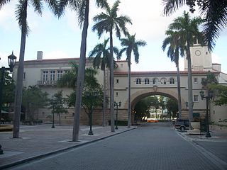
The Douglas Entrance is a historic site in Coral Gables, Florida. It is located at the junction of Douglas Road and Tamiami Trail. The architect was Phineas Paist and it was completed in 1924. On September 22, 1972, it is listed on the U.S. National Register of Historic Places.

The Punta Gorda Ice Plant is a historic ice plant in Punta Gorda, Florida, United States. It is located at 408 Tamiami Trail. Currently, it houses a pub and pizzeria. It was added to the National Register of Historic Places in 1990.

The Bay Haven School is a historic school in Sarasota, Florida, United States. It is located at 2901 West Tamiami Circle.

The El Vernona Hotel–John Ringling Hotel was a famous hotel located at 111 North Tamiami Trail in Sarasota, Florida, United States.

Shark Valley is a geological depression at the head of the Shark River Slough in far western Miami-Dade County, Florida, United States. It is currently part of Everglades National Park. Shark Valley empties into Shark River in the Ten Thousand Islands of Monroe County. Shark Valley characteristically includes sawgrass prairie that floods during the rainy season, hence the name "river of grass"—Pa-Hay-Okee, from the Mikasuki language—for such marshes in the Everglades. Shark Valley features a Visitor Center with educational displays, a park video, an underwater camera and informational brochures. The entrance to Shark Valley is located along Tamiami Trail near the Miami-Dade–Collier County line.
Dwight James Baum was an American architect most active in New York and in Sarasota, Florida. His work includes Cà d'Zan, the Sarasota Times Building (1925), Sarasota County Courthouse (1926), early residences in Temple Terrace, Florida, Sarasota County Courthouse (1927), Pinecroft, West Side YMCA on 63rd Street between Central Park and Columbus Avenue, Columbus Circle (1934) and Hendricks Memorial Chapel.

The Tamiami Formation is a Late Miocene to Pliocene geologic formation in the southwest Florida peninsula.

The Bay City Walking Dredge is a historic structure in Collier County, Florida. It was built in 1924 and declared a National Historic Mechanical Engineering Landmark in 1994. It was added to the National Register of Historic Places on May 29, 2013. It is located at 20200 E. Tamiami Trail in the vicinity of Naples, Florida at Collier-Seminole State Park. The dredge was built by Bay City Dredge Works of Bay City, Michigan and was used to construct part of the Tamiami Trail.

Poinciana was a planned community that was to be located along the Lostmans River in Monroe County, Florida. Poinciana has been described as the Everglades's "most spectacular commercial enterprise" and "the prototype of all Florida scams".


