Moose Mountain Lake

Last updated

Moose Mountain Lake
Moose Mountain Lake 01.jpg
Moose Mountain Lake
Canada Saskatchewan relief location map.jpg
Red pog.svg
Moose Mountain Lake
Location in Saskatchewan
Canada relief map 2.svg
Red pog.svg
Moose Mountain Lake
Moose Mountain Lake (Canada)
Location Saskatchewan
Coordinates 49°53′51″N103°02′24″W / 49.8975°N 103.0400°W / 49.8975; -103.0400
Type Reservoir
Primary inflows Moose Mountain Creek
Primary outflows Moose Mountain Creek
Catchment area Souris River
Basin  countries Canada
Max. length11.2 km (7.0 mi)
Max. width1.5 km (0.93 mi)
Surface area395.2 ha (977 acres)
Max. depth14.3 m (47 ft)
Water volume11,535 dam3 (9,352 acre⋅ft)
Shore length128 km (17 mi)
Surface elevation629 m (2,064 ft)
1 Shore length is not a well-defined measure.

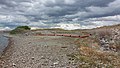
Moose Mountain Lake [1] is a reservoir in the Canadian province of Saskatchewan. It is located in the RM of Golden West No. 95 in the Prairies Ecozone [2] of Palliser's Triangle at the western edge of Moose Mountain Upland. Moose Mountain Creek is both the primary inflow and outflow of the lake; it enters at the north end and leaves at the dam [3] in the south end. A secondary inflow that comes from Gooseberry Lake enters on the western side near the south end.

Contents

The lake runs at a diagonal in a north to east direction and is about seven miles long while less than a mile wide. The total surface area is 395 hectares (980 acres) and the shoreline measures 28 kilometres (17 mi). It was created in 1937 with the damming of Moose Mountain Creek and is situated in the Moose Mountain Creek valley, which was formed during the last ice age. [4]

Parks and recreation

Near the dam, along the lake, there is a small park with a picnic area and boat launch called Lost Horse Hills Heritage Park. It is named after the nearby Lost Horse Hills. Fishing in the lake is popular and northern pike are a common fish species found in the lake. [5] [6]

At the northern end, where Moose Mountain Creek flows into the lake, is Saint Clair National Wildlife Area, which is one of 28 Prairie National Wildlife Areas in Saskatchewan. [7]

Moose Mountain Dam

Moose Mountain Dam Moose Mountain Dam 02.jpg
Moose Mountain Dam

Moose Mountain Dam ( 49°53′28″N103°01′55″W / 49.8911°N 103.0319°W / 49.8911; -103.0319 ) is an earthen dam built in 1937. It is owned and operated by the Saskatchewan Water Security Agency (WSA). [8] The building of the dam created the reservoir called Moose Mountain Lake that holds 11,535 cubic decametres (9,352 acre⋅ft) of water. The reservoir is used for irrigation, flood control, recreation, and as a wildlife and fish habitat. In 2012, the WSA spent more than $1.7 million in upgrades to the dam. Part of the upgrade was to build a fish passageway to allow migrating fish access to the reservoir. On 26 September 2012, the minister responsible for the Saskatchewan Watershed Authority, Ken Cheveldayoff said,

"Maintaining our water infrastructure is key to our government's vision for resource management in Saskatchewan. This investment will help safeguard the health, safety, and reliability of this watershed now and years to come." [9]

See also

Related Research Articles

<span class="mw-page-title-main">South Saskatchewan River</span> River in Western Canada

The South Saskatchewan River is a major river in the Canadian provinces of Alberta and Saskatchewan. The river begins at the confluence of the Bow and Oldman Rivers in southern Alberta and ends at the Saskatchewan River Forks in central Saskatchewan. The Saskatchewan River Forks is the confluence of the South and North Saskatchewan Rivers and is the beginning of the Saskatchewan River.

<span class="mw-page-title-main">Qu'Appelle River</span> River in Western Canada

The Qu'Appelle River is a river in the Canadian provinces of Saskatchewan and Manitoba that flows 430 kilometres (270 mi) east from Lake Diefenbaker in south-western Saskatchewan to join the Assiniboine River in Manitoba, just south of Lake of the Prairies, near the village of St. Lazare. It is in a region called the Prairie Pothole Region of North America, which extends throughout three Canadian provinces and five U.S. states. It is also within Palliser's Triangle and the Great Plains ecoregion.

<span class="mw-page-title-main">Grant Devine Dam</span> Dam and reservoir in Saskatchewan, Canada

The Grant Devine Dam, formerly Alameda Dam, is an embankment dam located in the Canadian province near Alameda and Oxbow. It was constructed in 1994 to control flows on Moose Mountain Creek and Souris River. It provides flood protection and irrigation for this area of Saskatchewan, along with protection for Minot, North Dakota. The Grant Devine Reservoir provides opportunities for recreational use such as boating and fishing. At the full supply level of 562 metres (1,844 ft), the reservoir holds 105,000,000 m3 (3.7×10⁹ cu ft) of water. The project is owned and operated by the Saskatchewan Water Security Agency (formerly Saskatchewan Watershed Authority).

<span class="mw-page-title-main">Last Mountain Lake</span> Lake in Saskatchewan, Canada

Last Mountain Lake, also known as Long Lake, is a prairie lake formed from glaciation 11,000 years ago. It is located in south central Saskatchewan, Canada, about 40 kilometres (25 mi) north-west of the city of Regina. It flows into the Qu'Appelle River via Last Mountain Creek, which flows past Craven. It is approximately 93 km (58 mi) long, and 3 km (1.9 mi) wide at its widest point. It is the largest naturally occurring body of water in southern Saskatchewan. Only Lake Diefenbaker, which is man-made, is larger. The lake is a popular resort area for residents of south-eastern Saskatchewan.

Gooseberry Lake is a lake in the Canadian province of Saskatchewan. It is a shallow, natural lake located north-west of Moose Mountain Lake in the Moose Mountain Creek watershed. The lake has a large catchment area and flows into Moose Mountain Lake via the east flowing Gooseberry Creek. It is in the Prairies Ecozone of Palliser's Triangle and the area around the lake has a knob and kettle landscape with poor drainage that, during years with heavy spring run-off or rains, is known to flood.

<span class="mw-page-title-main">Buffalo Pound Lake</span> Lake in Sasketchewan, Canada

Buffalo Pound Lake is a eutrophic prairie lake in Saskatchewan, Canada, formed from glaciation about 10,000 years ago, on the Qu'Appelle River approximately 28 kilometres (17 mi) north of Moose Jaw and 11 kilometres (6.8 mi) north-east of Tuxford. The lake gets its name from the method used by First Nations people to capture the bison using the natural topography as corrals or buffalo pounds. Bison, once numbering more than 60 million on the prairies but almost extinct by 1900, were reintroduced into the area in 1972.

The Saskatchewan Water Security Agency is an arm's length organization responsible for the management of water resources to ensure safe drinking water sources and reliable water supplies for economic, environmental, and social benefits in Saskatchewan, Canada. The Agency is a Treasury Board Crown Corporation administered by a board of directors appointed by the provincial government. Water Security Agency is located in Moose Jaw, SK, Canada and is part of the Water, Sewage and Other Systems Industry. Water Security Agency has 320.5 full time equivalent employees across all of its locations.

<span class="mw-page-title-main">McDonald Lake (Saskatchewan)</span> Lake in Saskatchewan, Canada

McDonald Lake, also known as Rafferty Reservoir, is a reservoir in south-east part of the Canadian province of Saskatchewan. It was created when the Rafferty Dam was built on the Souris River in 1994. Before the dam was built that flooded the Souris Valley, McDonald Lake was a small lake and marsh on the valley floor adjacent to the Souris River.

Moose Mountain Upland, Moose Mountain Uplands, or commonly Moose Mountain, is a hilly plateau located in the south-east corner of the Canadian province of Saskatchewan, that covers an area of about 13,000 km2 (5,000 sq mi). The upland rises about 200 m (660 ft) above the broad, flat prairie which is about 600 m (2,000 ft) above sea level. The highest peak is "Moose Mountain" at 830 m (2,720 ft) above sea level. The area was named Moose Mountain because of the large number of moose that lived in the area. When it was originally used by fur traders, Métis, and the Indigenous peoples, the plateau was called Montagne a la Bosse, which is French for "The Mountain of The Bump or Knob."

<span class="mw-page-title-main">Pipestone Creek (Saskatchewan)</span> River in central North America

Pipestone Creek is a river in the Souris River watershed. Its flow begins in southeastern Saskatchewan, just south of the town of Grenfell and travels in a southeastern direction into Manitoba in the Westman Region where it empties into Oak Lake through the Oak Lake Marsh.

<span class="mw-page-title-main">Moose Mountain Creek</span> River in southern Saskatchewan, Canada

Moose Mountain Creek is a river in the Canadian province of Saskatchewan. Its source is the Chapleau Lakes near Montmartre and it is a tributary of the Souris River, which, in turn, is a tributary of the Assiniboine River. The whole system is part of the Red River watershed, which is part of the Hudson Bay drainage basin and in a region called the Prairie Pothole Region of North America, which extends throughout three Canadian provinces and five U.S. states. It is also within Palliser's Triangle and the Great Plains ecoregion.

<span class="mw-page-title-main">Lanigan Creek</span> River in Saskatchewan, Canada

Lanigan Creek is a river in the Canadian province of Saskatchewan. It is located in the south central part of the province in a region called the Prairie Pothole Region of North America, which extends throughout three Canadian provinces and five U.S. states. It is also within Palliser's Triangle and the Great Plains ecoregion.

<span class="mw-page-title-main">Brightwater Creek</span> River in Saskatchewan, Canada

Brightwater Creek is a river in south central part of the Canadian province of Saskatchewan. It is a tributary of the South Saskatchewan River in a region called the Prairie Pothole Region of North America, which extends throughout three Canadian provinces and five U.S. states. It is also within Palliser's Triangle and the Great Plains ecoregion. Along the river's course there is a dam and reservoir and a regional park. There are no communities along its course.

<span class="mw-page-title-main">Moose Jaw River</span> River in Saskatchewan, Canada

Moose Jaw River is a river in the Canadian province of Saskatchewan. It is located in the southern part of the province in a region called the Prairie Pothole Region of North America, which extends throughout three Canadian provinces and five U.S. states. It is also within Palliser's Triangle and the Great Plains ecoregion.

<span class="mw-page-title-main">Avonlea Creek</span> River in Saskatchewan, Canada

Avonlea Creek is a river in the southern part of the Canadian province of Saskatchewan. It is in a region called the Prairie Pothole Region of North America, which extends throughout three Canadian provinces and five U.S. states. It is also within Palliser's Triangle and the Great Plains ecoregion. Avonlea Creek is a main tributary of the Moose Jaw River, which is part of the Upper Qu'Appelle Watershed and the Hudson Bay drainage basin.

Craven Dam is at the confluence of the Qu'Appelle River and Last Mountain Creek and immediately east of the village of Craven on the Qu'Appelle River at LSD SW 24-20-21 W2. It is in the Canadian province of Saskatchewan in the RM of Longlaketon No. 219. The dam does not create a reservoir as its purpose is to regulate water flow along the Qu'Appelle River. The dam is operated by the Saskatchewan Water Security Agency and can be accessed on the north side by Highway 99.

<span class="mw-page-title-main">Cowan River</span> River in Saskatchewan, Canada

Cowan River is a river in the west-central part of the Canadian province of Saskatchewan in the boreal forest ecozone of Canada. The river begins at Cowan Lake Dam near the northern end of Cowan Lake and flows north-west through muskeg and forest to meet Beaver River. Beaver River then flows into Lac Île-à-la-Crosse and the Churchill River. The entirety of Cowen River is within the Northern Saskatchewan Administration District and while there are no communities along its course, the towns of Big River and Spiritwood are in its watershed.

<span class="mw-page-title-main">Christopher Lake (Saskatchewan)</span> Lake in Saskatchewan, Canada

Christopher Lake is a recreational lake in the boreal forest ecozone in the Canadian province of Saskatchewan. It is located south-east of Emma Lake and Great Blue Heron Provincial Park in the central part of the province in the District of Lakeland No. 521. Access to Christopher Lake is from Highways 953 and 263 and it is about 42 km (26 mi) north of the city of Prince Albert.

Cypress Lake is an interbasin transfer reservoir in the Canadian province of Saskatchewan on the southern slopes of the Cypress Hills in the Rural Municipality of Reno No. 51. The reservoir was created by the damming of the east and west sides of a much smaller Cypress Lake in the late 1930s. There is a provincial recreation site on the southern shore and a wildlife refuge on Heglund Island in the lake. Access to the lake is from Township Road 60 off of Highway 21.

Fife Lake is a fresh water prairie lake in the Canadian province of Saskatchewan. It is in the south-central part of the province at the eastern end of the Wood Mountain Hills. The entire lake and its shoreline is designated an Important Bird Area (IBA) of Canada to protect the nationally endangered piping plover. While there are no communities along the lake's shore, there is a park and campground at the southern end. Nearby communities include Fife Lake, Rockglen, and Lisieux. Access is from Highway 18.

References

  1. Government of Canada, Natural Resources Canada. "Place names - Moose Mountain Lake". www4.rncan.gc.ca.
  2. "Prairies Ecozone". Ecozones.
  3. "Dams and Reservoirs". Water Security Agency. Water Security Agency. Retrieved 17 March 2024.
  4. "Moose Mountain Lake Fishing Map". Gps Nautical Charts. Bist LLC. Retrieved 12 January 2022.
  5. "Moose Mountain Lake". Fish brain. Retrieved 12 January 2022.
  6. "Moose Mountain Lake". Anglers Atlas. Angler's Atlas. Retrieved 12 January 2022.
  7. "St. Clair National Wildlife Area, Corning SK".
  8. "WSA Owned Dams".
  9. "MOOSE MOUNTAIN DAM RECEIVES $1.7 MILLION REHABILITATION | News and Media".

Commons-logo.svg Media related to Moose Mountain Lake at Wikimedia Commons