Moran Township, Michigan

Last updated

Moran Township, Michigan
Moran Township, MI office.jpg
Moran Township Office
Moran Township (Mackinac), MI location2.png
Location within Mackinac County
USA Michigan location map.svg
Red pog.svg
Moran Township
Usa edcp location map.svg
Red pog.svg
Moran Township
Coordinates: 45°58′41″N84°55′33″W / 45.97806°N 84.92583°W / 45.97806; -84.92583
CountryUnited States
State Michigan
County Mackinac
Established1844
Government
  SupervisorSusan Dionne
   Clerk Kristine Vallier
Area
[1]
  Total134.42 sq mi (348.1 km2)
  Land127.57 sq mi (330.4 km2)
  Water6.85 sq mi (17.7 km2)
Elevation
646 ft (197 m)
Population
 (2020) [2]
  Total1,029
  Density8.07/sq mi (3.12/km2)
Time zone UTC-5 (Eastern (EST))
  Summer (DST) UTC-4 (EDT)
ZIP Codes
49760 (Moran)
49762 (Naubinway)
49781 (St. Ignace)
Area code 906
FIPS code 26-55480 [1]
GNIS feature ID1626766 [3]
Website www.morantownship.com

Moran Township is a civil township of Mackinac County in the U.S. state of Michigan. The population was 1,029 at the 2020 census. [4]

Contents

Geography

The township is in central Mackinac County, along the northeast shore of Lake Michigan. The southeastern end of the township touches the Straits of Mackinac at the northeast end of the lake. The city of St. Ignace borders the township to the southeast.

According to the United States Census Bureau, the township has a total area of 134.42 square miles (348.15 km2), of which 127.57 square miles (330.40 km2) are land and 6.85 square miles (17.74 km2), or 5.10%, are water. [1]

Communities

Attractions

Demographics

In 2020, the township population was 1,029. [4]

Related Research Articles

<span class="mw-page-title-main">Mackinac County, Michigan</span> County in Michigan, United States

Mackinac County is a county in the Upper Peninsula of the U.S. state of Michigan. As of the 2020 census, the population was 10,834. The county seat is St. Ignace. Formerly known as Michilimackinac County, in 1818 it was one of the first counties of the Michigan Territory, as it had long been a center of French and British colonial fur trading, a Catholic church and Protestant mission, and associated settlement.

<span class="mw-page-title-main">Kinderhook Township, Michigan</span> Civil township in Michigan, United States

Kinderhook Township is a civil township of Branch County in the U.S. state of Michigan. As of the 2010 census, the township population was 1,497.

<span class="mw-page-title-main">Peaine Township, Michigan</span> Civil township in Michigan, United States

Peaine Township is a civil township of Charlevoix County in the U.S. state of Michigan. The population was 292 at the 2010 census.

<span class="mw-page-title-main">Mackinaw Township, Michigan</span> Civil township in Michigan, United States

Mackinaw Township is a civil township of Cheboygan County in the U.S. state of Michigan. The population was 539 at the 2010 census.

<span class="mw-page-title-main">Chippewa Township, Chippewa County, Michigan</span> Civil township in Michigan, United States

Chippewa Township is a civil township of Chippewa County in the U.S. state of Michigan. As of the 2010 census, the township population was 213.

<span class="mw-page-title-main">Pickford Township, Michigan</span> Civil township in Michigan, United States

Pickford Township is a civil township of Chippewa County in the U.S. state of Michigan. As of the 2010 census, the township population was 1,595.

<span class="mw-page-title-main">Raber Township, Michigan</span> Civil township in Michigan, United States

Raber Township is a civil township of Chippewa County in the U.S. state of Michigan. The population was 647 at the 2010 census.

<span class="mw-page-title-main">Sugar Island Township, Michigan</span> Civil township in Michigan, United States

Sugar Island Township is a civil township of Chippewa County in the U.S. state of Michigan. The population was 652 at the 2010 census. The township consists entirely of Sugar Island in the St. Marys River, and the waters directly around the island.

<span class="mw-page-title-main">Brevort Township, Michigan</span> Civil township in Michigan, United States

Brevort Township is a civil township of Mackinac County in the U.S. state of Michigan. As of the 2020 census, the population was 502, down from 594 in 2010.

<span class="mw-page-title-main">Clark Township, Michigan</span> Civil township in Michigan, United States

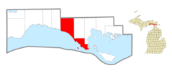
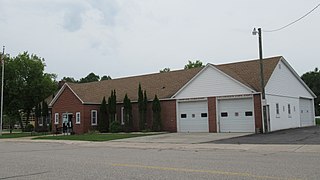
Clark Township is a civil township of Mackinac County in the U.S. state of Michigan. As of the 2020 census, the population was 1,917, down from 2,256 in 2010.

<span class="mw-page-title-main">Garfield Township, Mackinac County, Michigan</span> Civil township in Michigan, United States

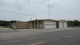
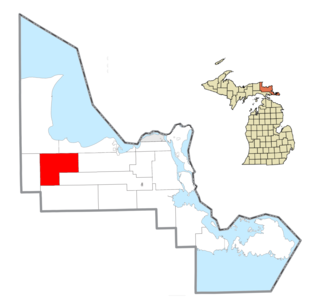
Garfield Township is a civil township of Mackinac County in the U.S. state of Michigan. The population was 1,146 at the 2010 census, and 1,166 in 2020.

<span class="mw-page-title-main">Hendricks Township, Michigan</span> Civil township in Michigan, United States

Hendricks Township is a civil township of Mackinac County in the U.S. state of Michigan. The population was 117 at the 2020 census, down from 153 in 2010.

<span class="mw-page-title-main">Hudson Township, Mackinac County, Michigan</span> Civil township in Michigan, United States

Hudson Township is a civil township of Mackinac County in the U.S. state of Michigan. As of the 2020 census, its population was 193.

<span class="mw-page-title-main">Newton Township, Mackinac County, Michigan</span> Civil township in Michigan, United States

Newton Township is a civil township of Mackinac County in the U.S. state of Michigan. As of 2020, its population was 430.

<span class="mw-page-title-main">St. Ignace Township, Michigan</span> Civil township in Michigan, United States

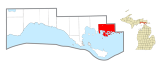
St. Ignace Township is a civil township of Mackinac County in the U.S. state of Michigan. As of the 2010 census, the township population was 939. In 2020, its population grew to 973.

<span class="mw-page-title-main">Brevort, Michigan</span> Unincorporated community in Michigan, United States

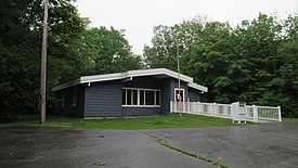
Brevort is an unincorporated community in Mackinac County in the U.S. state of Michigan. The community is located along the northern shores of Lake Michigan along U.S. Route 2 within Moran Township. As an unincorporated community, Brevort has no legally defined boundaries or population statistics of its own.

<span class="mw-page-title-main">Pine River (Michigan)</span> Index of articles associated with the same name

Pine River may refer to any of the following rivers in the U.S. state of Michigan:

<span class="mw-page-title-main">M-123 (Michigan highway)</span> State highway in Michigan, United States

M-123 is a state trunkline highway in the eastern Upper Peninsula of the US state of Michigan. It is one of only a few highways in Michigan that curve around and form a U-shape. In fact, M-123 has three intersections with only two state trunklines; it meets M-28 twice as a result of its U-shaped routing. M-123 also has a rare signed concurrency with a County-Designated Highway in Michigan; in Trout Lake, there is a concurrency with H-40. All of M-123 north of M-28 is a Scenic Heritage Route within the Michigan Heritage Route system.

Carp River is a 40.2-mile-long (64.7 km) river in Chippewa and Mackinac counties in the U.S. state of Michigan. 21.7 miles (34.9 km) of the river were added to the National Wild and Scenic Rivers System in 1992.

<span class="mw-page-title-main">Portage Township, Mackinac County, Michigan</span> Civil township in Michigan, United States

Portage Township is a civil township of Mackinac County in the U.S. state of Michigan. In 2020, its population was 907.

References

  1. 1 2 3 "2022 U.S. Gazetteer Files: Michigan". United States Census Bureau. Retrieved August 14, 2023.
  2. "P1. Race – Moran township, Michigan: 2020 DEC Redistricting Data (PL 94-171)". U.S. Census Bureau. Retrieved August 14, 2023.
  3. U.S. Geological Survey Geographic Names Information System: Moran Township, Michigan
  4. 1 2 "Explore Census Data". data.census.gov. Retrieved August 4, 2023.
  5. U.S. Geological Survey Geographic Names Information System: Brevort, Michigan
  6. U.S. Geological Survey Geographic Names Information System: Gros Cap, Michigan
  7. U.S. Geological Survey Geographic Names Information System: Ozark, Michigan
  8. Romig, Walter (1986) [1973]. Michigan Place Names. Detroit, Michigan: Wayne State University Press. ISBN   0-8143-1838-X.