The township was named after Henry Brevort (or Brevoort), a surveyor assigned to subdivide the area in 1845.[6] Most of the township land is within the eastern portion of the Hiawatha National Forest. The township includes part of the Mackinac Wilderness.
Geography
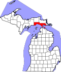
The township is in central Mackinac County, bordered to the west and south by Moran Township and to the east by St. Ignace Township. It is bordered to the north by Trout Lake Township in Chippewa County. According to the U.S. Census Bureau, Brevort Township has a total area of 98.84 square miles (255.99km2), of which 92.48 square miles (239.52km2) are land and 6.36 square miles (16.47km2) (6.43%) are water.[1]
Highway M-123 passes diagonally southeast–northwest through the township, and U.S. Route 2 and Interstate 75 are just outside of the township boundaries to the south and east.
Moran is an unincorporated community on M-123 at 45°59′39″N84°49′51″W / 45.99417°N 84.83083°W / 45.99417; -84.83083[8] approximately 13 miles (21km) northwest of St. Ignace. Confusingly, the community is not a part of Moran Township, which is adjacent to Brevort Township on the south and west. It was initially called "Jacob City", after the president of the German Land Company of Detroit, which sold land to members in 1881–83. In 1883, Jacob was accused of fraud and ousted from the organization. Another member of the group, William B. Moran, loaned the group funds to buy additional land, and the settlement was renamed after him in 1883. A post office named "Jacob City" was established in February 1882 and renamed "Moran" in January 1883. The office was transferred to and renamed "Allenville" in April 1898, but a Moran post office was re-established in May 1910. The name of Moran Township and other nearby places named Moran such as East Moran Bay in St. Ignace, West Moran Bay on Lake Michigan, and the Moran River all have a different origin, and instead derive from the FrenchMorin.[6]
This page is based on this Wikipedia article Text is available under the CC BY-SA 4.0 license; additional terms may apply. Images, videos and audio are available under their respective licenses.