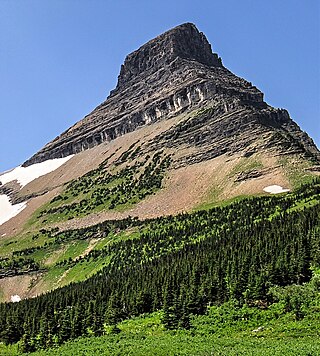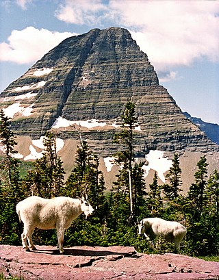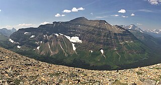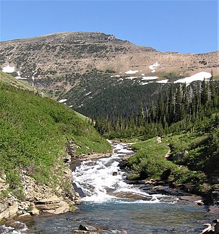
Mount Jackson is located in the Lewis Range, Glacier National Park in the U.S. state of Montana. Mount Jackson is the fourth tallest mountain in Glacier National Park and it is situated on the Continental Divide. Both the mountain and its namesake Jackson Glacier are easily seen from the Going-to-the-Sun Road. Harrison Glacier, the park's largest remaining glacier, is located on the mountain's southern flank. Based on the Köppen climate classification, Mount Jackson has an alpine climate characterized by long, usually very cold winters, and short, cool to mild summers. Temperatures can drop below −10 °F with wind chill factors below −30 °F.

Ipasha Peak is located in the Lewis Range, Glacier National Park in the U.S. state of Montana. Ipasha Peak is 1.29 miles (2.08 km) south of Mount Merritt and is in the northeastern section of Glacier National Park. Ahern Glacier is located on the southeastern slopes of the mountain while the Ipasha Glacier is to the southwest of the peak. Helen Lake lies almost 4,500 feet (1,400 m) below the summit of Ipasha Peak to the southeast.

Kaina Mountain is located in the Lewis Range, Glacier National Park in the U.S. state of Montana. Kaina Mountain is in the northeastern section of Glacier National Park and north of Kaina Lake.

Lone Walker Mountain is located in the Lewis Range, Glacier National Park in the U.S. state of Montana. Lone Walker Mountain is situated immediately southwest of Upper Two Medicine Lake along the Continental Divide.

Mount Helen is located in the Lewis Range, Glacier National Park in the U.S. state of Montana. Mount Helen rises immediately to the northwest roughly 3,100 feet (940 m) above Upper Two Medicine Lake in the southeastern part of Glacier National Park. The Continental Divide of the Americas passes over the summit of Mount Helen.

Mount Henkel is located in the Lewis Range, Glacier National Park in the U.S. state of Montana. Kennedy Lake is just to the north of the mountain.
Mount James is located in the Lewis Range, Glacier National Park in the U.S. state of Montana. Mount James is 1.35 miles (2.17 km) northeast of Triple Divide Peak. The Blackfeet name for the mountain is Ah'-kow-to-mak-an.

Mount Kipp is located in the Lewis Range, Glacier National Park in the U.S. state of Montana. Immediately east of the summit lies the retreating Chaney Glacier. Mount Kipp is situated along the Continental Divide. The mountain is presumed to have been named for Joe Kipp, a half-breed Indian trapper and scout who tried to prevent the Marias Massacre.

Norris Mountain is located in the Lewis Range, Glacier National Park in the U.S. state of Montana. Norris Mountain is situated along the Continental Divide; it is the parent of Triple Divide Peak—the point at which North America's Arctic, Atlantic, and Pacific drainage basins converge—located 0.8 miles (1.3 km) east-southeast.

Wahcheechee Mountain is located in the Lewis Range, Glacier National Park in the U.S. state of Montana. Stoney Indian Lake is just northeast of the peak.

Wynn Mountain is located in the Lewis Range of Glacier National Park, in the U.S. state of Montana. Wynn Mountain rises above the south shores of Lake Sherburne. The mountain is named for Frank B. Wynn, physician and scientist who was killed while attempting to climb nearby Mount Siyeh on July 27, 1927.

Battlement Mountain is located in the Lewis Range, Glacier National Park in the U.S. state of Montana. Lake Isabel is northeast of the peak.

Bearhat Mountain is located in the Lewis Range, Glacier National Park in the U.S. state of Montana. Bearhat Mountain is immediately west of Hidden Lake. The mountain was named after a Kootenai Native American, and was officially adopted by the U.S. Board on Geographic Names in 1932.

Boulder Peak is located in the Livingston Range, Glacier National Park in the U.S. state of Montana. The remnant Boulder Glacier is situated on the northern slopes of the mountain.

Chapman Peak is located in the Livingston Range, Glacier National Park in the U.S. state of Montana. Chapman Peak is situated along the Continental Divide. The mountain is named for Robert H. Chapman, one of the US Geological Survey topographers who worked on mapping Glacier Park between 1900 and 1904.

Mount Cannon is located in the Lewis Range, Glacier National Park in the U.S. state of Montana. Formerly called Goat Mountain it was renamed for the leading physiologist Dr. Walter Bradford Cannon and his wife Cornelia, who made the first recorded ascent of the mountain in 1901.

Mount Doody is located in the Lewis Range, Glacier National Park in the U.S. state of Montana. Mount Doody is astride the same ridgeline as the Cloudcroft Peaks which are to the immediate northeast. Dan Doody was one of the first six rangers at Glacier National Park. Doody patrolled the Middle Fork drainages, using his own homestead as a headquarters. Later, because of his recognized hunting abilities, Doody became a park hunter skilled at removing "undesirable" wildlife from the area.

Mount Phillips is located in the Lewis Range, Glacier National Park in the U.S. state of Montana. Lupfer Glacier is located on the east slope of Mount Phillips.

Cataract Mountain is located in the Lewis Range, Glacier National Park in the U.S. state of Montana. Cataract Mountain is .70 miles (1.13 km) NNE of Piegan Mountain and more than a mile west of Mount Siyeh.

Gardner Point is a 7,405-foot-elevation (2,257-meter) mountain summit in Flathead County, Montana.


