Muara Enim Regency

Last updated
Muara Enim Regency
(Kabupaten Muara Enim)
Lambang Kabupaten Muara Enim.gif
Lokasi Sumatra Selatan Kabupaten Muara Enim.svg
Location of Muara Enim Regency (in red) in South Sumatra, following the separation off of Penukal Abab Lematang Ilir Regency in 2012; this old map is before the late 2022 adjustments.
Country Indonesia
Province South Sumatra
Regency seat Muara Enim
Area
  Total5,178.3 km2 (1,999.4 sq mi)
Population
 (mid 2022 estimate) [1]
  Total424,019
  Density82/km2 (210/sq mi)
Time zone UTC+7 (WIB)

Muara Enim Regency is a regency of South Sumatra Province, Indonesia. The regency seat is the town of Muara Enim. The city of Prabumulih is an administrative body separating the main part of Muara Enim to the south of the city from a smaller part to its north. The regency until late 2012 covered an area of 8,587.94 km² and had a population of 717,717 at the 2010 Census; [2] however, on 14 December 2012 five districts from the Muara Enim Regency were split off to form the new Penukal Abab Lematang Ilir Regency.

Contents

The residual regency thus covered 7,486.21 km2 and within its reduced area had a population of 551,202 at the 2010 Census [2] and 612,900 at the 2020 Census, the latter comprising 312,953 males and 299,947 females; [3] the official estimate as at mid 2022 was 624,019 [1] prior to the further separation in late 2022 of another six districts to form the new Rambang Lubai Lematang Regency, [4] which comprised 70 villages (desa) with an area of 2,311.27 km2 and 167,610 people as at mid 2022.

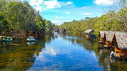
Mining and agricultural activities are abundant in the regency and it is also a producer of oil. [5] [6] Notable crops include rice and coconuts.

Location

Bumi Serasan Sekundang is located in the heart of South Sumatra Province. The boundaries are:

North Penukal Abab Lematang Ilir Regency, Banyuasin Regency, Palembang City
South South Ogan Komering Ulu Regency, Kaur Regency (Bengkulu Province)
West Musi Rawas Regency, Lahat Regency, Pagar Alam City
East Ogan Komering Ulu Regency, Rambang Lubai Lematang Regency, Prabumulih City

Administrative Districts

Muara Enim Regency was divided as at 2000 into twenty-eight districts (kecamatan); however, six of these districts - Rambang Kapak Tengah (Central Rambang Kapak), Prabumulih Timur (East Prabumulih), Prabumulih Selatan (South Prabumulih), Prabumulih Barat (West Prabumulih), Prabumulih Utara (North Prabumulih) qnd Cambai - were separated from the regency on 21 June 2001 to create the independent city (kota) of Prabumulih, and another five of these districts - Talang Ubi, Penukal, Tanah Abang, Penukal Utara and Abab - were separated out from the regency on 14 December 2012 to form the new Penukal Abab Lematang Ilir Regency. Subsequently, four additional districts (Panang Enim, Lubai Ulu, Belimbing and Belida Darat) were created by the division of existing districts, while the former Rambang Dangku was split into two new districts (Rambang Nuru and Empat Petulai Dangku). Finally in 2022 another new regency - Rambang Lubai Lematang Regency - was created to consist of the six districts of Rambang, Lubai, Lubai Ulu, Belimbing, Rambang Niru and Empat Petulai Dangku.

The resulting twenty-two districts (including the six now in the new Rambang Lubai Lematang Regency) are listed below with their areas and their populations at the 2010 Census [2] and the 2020 Census, [3] together with the official estimates as at mid 2022. [1] The table also includes the locations of the district administrative centres, together with the number of villages in each district (comprising 245 rural desa and 10 urban kelurahan), and their post code(s). The topography of the regency comprised a southern group of five districts with an altitude of over 100 metres above sea level in the Bukit Barisan mountain chain, a west-central group of five districts, an east-central group of six districts (those split off in late 2022), and a northern group of six districts of mainly swamp area facing directly with the Musi River basin, which (since the creation of the Penukal Abab Lematang Ilir Regency in 2013) are physically separated from the rest of the Muara Enim Regency by the city of Prabumulih.

Kode
Wilayah
Name of
District
(kecamatan)
Area
in
km2
Pop'n
Census
2010
Pop'n
Census
2020
Pop'n
Estimate
mid 2022
Admin
centre
No.
of
villages
Post
code
16.03.08Semende Darat Laut269.1412,89514,74015,080Pulau Panggung1031358
16.03.10Semende Darat Ulu426.6415,80516,80016,950Aremantai1031355
16.03.09Semende Darat Tengah302.249,63510,97011,200Seri Tanjung1231359
16.03.01Tanjung Agung517.1037,51629,02029,860Tanjung Agung1431354
16.03.27Panang Enim192.92(a)13,37013,450Lebak Budi1231354
Southern group1,708.0475,85184,90086,54058
16.03.15Rambang378.0727,47928,05028,080Sugih Waras1331175
16.03.14Lubai529.3252,77325,81026,100Beringin1031173
16.03.25Lubai Ulu478.49(b)32,80033,550Karang Agung1131174
16.03.23Belimbing148.69(e)25,55025,870Cinta Kasih1031352
16.03.03Rambang Niru638.35(f)33,56033,840Tebat Agung1631172
16.03.26Empat Petulai Dangku138.35(f)19,98020,170Dangku1031172
East-Central group2,311.27n/a165,750167,61070
16.03.07Lawang Kidul287.2662,88772,12073,850Keban Agung731711
-31713
16.03.02Muara Enim187.0861,58573,55075,900Muara Enim16 (c)31311
-31315
16.03.11Ujan Mas311.3323,21426,75027,420Ujan Mas Baru9 (d)31351
16.03.04Gunung Megang471.3656,40535,31035,720Gunung Megang Dalam1331353
16.03.19Benakat451.968,7649,6409,790Padang Bindu631626
West-Central group1,708.99n/a217,370222,68051
16.03.06Gelumbang705.5753,82961,32062,710Gelumbang23 (g)31170
16.03.17Lembak101.4430,94019,70019,860Lembak1031177
16.03.16Sungai Rotan344.1429,99531,93032,220Sukarami1931357
16.03.22Muara Belida204.677,5947,9407,980Patra Tani831178
16.03.21Kelekar138.039,38111,02011,330Menanti731176
16.03.24Belida Darat264.26(h)12,99013,090Tanjung Bunut1031171
Northern group1,758.11131,739144,900147,19077
Totals7,486.21551,202612,900624,019Muara Enim255

Notes:
(a) the 2010 population of the new Panang Enim District was included in the 2010 total for Tanjung Agung District, from which it was cut out.
(b) the 2010 population of the new Lubai Ulu District was included in the 2010 total for Lubai District, from which it was cut out.
(c) including 3 kelurahan. (d) including 6 kelurahan. (e) the 2010 population of the new Belimbing District was included in the 2010 total for Gunung Megang District, from which it was cut out.
(f) the 2010 populations of the new Rambang Niru and Empat Petulai Dangku Districts are included in the figure of 50,455 which was the total of the former Rambang Dangku District, which was divided to form the new districts.
(g) including 1 kelurahan (Gelumbang). (h) the 2010 population of the new Belide Darat District was included in the 2010 total for Lembak District, from which it was cut out.

Notable people

Related Research Articles

<span class="mw-page-title-main">Prabumulih</span> City in South Sumatra, Indonesia

Prabumulih is a city in South Sumatra, Indonesia. It was originally part of Muara Enim Regency, from which it was separated to become an independent city on 21 June 2001. It has an area of 477.10 km² and had a population of 161,814 at the 2010 Census and 193,196 at the 2020 Census; the official estimate as at mid 2022 was 199,047. Geographically, this city is located at 3°25′58″S 104°14′8″E in the heart of the province, and it is surrounded on all sides by Muara Enim Regency, apart from a short stretch bordering Penukal Abab Lematang Ilir Regency.

<span class="mw-page-title-main">Lahat Regency</span> Regency in South Sumatra, Indonesia

Lahat Regency is a regency of South Sumatra province, Indonesia. It originally included much of the southwestern part of the province, but on 21 June 2001 the town of Pagar Alam was removed from the regency to become an independent city, and on 2 January 2007 the western districts were split off to form the new Empat Lawang Regency. The reduced regency now covers a total area of 4,361.83 km2 and had a population of 369,974 at the 2010 Census and 430,071 at the 2020 Census; the official estimate as at mid 2022 was 441,174. The city of Pagar Alam remains an enclave within the regency, but is administratively separate.

<span class="mw-page-title-main">Batanghari Regency</span> Regency in Jambi, Indonesia

Batanghari is a regency of Jambi Province in Sumatra, Indonesia. It originally covered a wider area, but on 4 October 1999 this was split between a new Muaro Jambi Regency in the east and a reduced Batang Hari Regency in the west, which now covers an area of 5,804.83 km2. It had a population of 241,334 at the 2010 census and 301,700 at the 2020 census; the official estimate as at mid 2022 was 313,209. The administrative capital is the town of Muara Bulian.

<span class="mw-page-title-main">West Kutai Regency</span> Regency in Kalimantan, Indonesia

West Kutai Regency is a regency (kabupaten) in the Indonesian province of East Kalimantan. It previously covered a much greater area, with a population of 165,091 at the 2010 Census, but in December 2012 the five northernmost districts were split off to form a new Mahakam Ulu Regency; the residual area of 20,384.6 km2 had a population of 140,097 at the 2010 Census, and 165,938 at the 2020 Census; the official estimate as at mid 2022 was 172,288. The town of Sendawar is the administrative capital.

<span class="mw-page-title-main">Mandailing Natal Regency</span> Regency in North Sumatra, Indonesia

Mandailing Natal, abbreviated as Madina, is a regency in North Sumatra Province of Indonesia. It covers an area of 6,620.70 square kilometres and it had a population of 403,894 people at the 2010 census and 472,886 at the 2020 Census; the official estimate as at mid 2022 was 484,874. The capital lies at Panyabungan. The Regency was formerly a part of South Tapanuli Regency until it was created as a separate regency on 23 November 1998. It is the southernmost regency in North Sumatra, and the largest regency by land area in the province, with Langkat Regency second to it.

<span class="mw-page-title-main">Musi Banyuasin Regency</span> Regency in South Sumatra, Indonesia

Musi Banyuasin Regency is a regency of South Sumatra province, in Indonesia. Originally much larger, it was reduced by about 45% of its former area on 10 April 2002 by the splitting off of most of its eastern and northeastern districts to form the new Banyuasin Regency. It now has a total area of 14,265.96 km2 (5,508 sq mi) and a population of 561,458 at the 2010 Census and 622,206 at the 2020 Census; the official estimate as at mid 2022 was 633,124.

<span class="mw-page-title-main">Bungo Regency</span> Regency in Indonesia

Bungo Regency is a regency (kabupaten) of Jambi Province in Sumatra, Indonesia. It was created on 4 October 1999 by the division of the former Bungo Tebo Regency into a new Tebo Regency and this Bungo Regency. The regency covers an area of 4,659 km2. As at the 2010 census, the regency had a population of 303,135 and 362,363 at the 2020 census; the official estimate as at mid 2022 was 373,344. The administrative capital is the town of Muara Bungo.

<span class="mw-page-title-main">Seluma Regency</span> Regency in Bengkulu, Indonesia

Seluma Regency is a regency of Bengkulu Province, Indonesia, on the west coast of the island of Sumatra. It was created on 25 February 2003 from what were formerly the northwestern districts of the South Bengkulu Regency. The regency seat is at the town of Pasar Tais. It covers an area of 2,479.36 km2, and had a population of 173,507 at the 2010 Census and 207,877 at the 2020 Census; the official estimate as at mid 2022 was 213,755.

<span class="mw-page-title-main">Banyuasin Regency</span> Regency of South Sumatra in South Sumatra

Banyuasin is a regency of South Sumatra Province in Indonesia. The Regency was formed on 10 April 2002 from the coastal and eastern areas formerly part of the Musi Banyuasin Regency. It takes its name from the main river which drains that area, the Banyuasin River. Pangkalan Balai is the regency seat. The regency borders Musi Banyuasin Regency, Jambi province and Bangka Strait to the north, Bangka Strait to the east, Ogan Komering Ilir Regency, Muara Enim Regency, and the city of Palembang to the south, and Musi Banyuasin Regency to the west. It has an area of 11,832.99 km2 and had a population of 749,107 at the 2010 census and 836,914 at the 2020 census; the official estimate as at mid 2022 was 839,401. Much of the regency is coastal lowland.

<span class="mw-page-title-main">Empat Lawang Regency</span> Regency in South Sumatra, Indonesia

Empat Lawang Regency is a regency of South Sumatra Province, Indonesia. It was created on 2 January 2007 from what had been formerly the western districts of Lahat Regency. It covers an area of 2,256.44 km² and had a population of 221,176 at the 2010 Census and 333,622 at the 2020 Census; the official estimate as at mid 2022 was 357,673. The regency seat is at the town of Tebing Tinggi.

<span class="mw-page-title-main">Musi Rawas Regency</span> Regency in South Sumatra, Indonesia

Musi Rawas Regency is a regency of South Sumatra Province, Indonesia. Prior to 2013, it covered an area of 12,134.57 km2 and had a population of 524,919 at the 2010 Census; however on 10 June 2013 the northern half of the regency was split off to form a separate North Musi Rawas Regency. Previous to 2001, the Regency had also included the city of Lubuklinggau, which was split off to form an independent city outside the regency.

<span class="mw-page-title-main">Ogan Komering Ilir Regency</span> Regency in South Sumatra

Ogan Komering Ilir Regency is a regency of South Sumatra Province, Indonesia. It takes its name from the Ogan River and the Komering River, which are the two main rivers that drain the area. The name Ilir means downstream. The administrative centre is the town of Kayu Agung. The regency borders Banyuasin Regency to the northwest, Bangka Strait, and the Java Sea to the east, Lampung Province to the south, and Palembang city, Ogan Ilir Regency, and East Ogan Komering Ulu Regency to the west.

<span class="mw-page-title-main">Ogan Ilir Regency</span> Regency in South Sumatra

Ogan Ilir Regency is a regency of South Sumatra Province, Indonesia. It takes its name from the main river which stream that area, Ogan River. And the name Ilir means downstream. Indralaya is the regency seat. The regency borders Palembang City and Muara Enim Regency to the north, Ogan Komering Ilir Regency to the east, Ogan Komering Ilir Regency, and East Ogan Komering Ulu Regency to the south, and Muara Enim Regency to the west.

<span class="mw-page-title-main">East Ogan Komering Ulu Regency</span> Regency in South Sumatra, Indonesia

East Ogan Komering Ulu Regency is a regency of South Sumatra Province, Indonesia. It was created on 18 December 2003 from what had formerly been the eastern districts of Ogan Komering Ulu Regency. It covers an area of 3,370 km2 and had a population of 609,982 at the 2010 Census and 649,853 at the 2020 Census; the official estimate as at mid 2022 was 673,966. The regency seat is the town of Martapura. It borders Ogan Ilir Regency to the north, Ogan Komering Ulu Regency to the west, Ogan Komering Ilir Regency in the east and Lampung Province and South Ogan Komering Ulu Regency in the south.

<span class="mw-page-title-main">South Ogan Komering Ulu Regency</span> Regency in South Sumatra, Indonesia

South Ogan Komering Ulu Regency is an inland regency in the far south of South Sumatra Province, Indonesia. It was created on 18 December 2003 from what had previously been the southernmost districts of Ogan Komering Ulu Regency. It covers an area of 5,493.94 km2, and had a population of 318,428 at the 2010 Census and 408,981 at the 2020 Census; the official estimate as at mid 2022 was 426,687. The administrative centre is the town of Muaradua. It borders Ogan Komering Ulu Regency, East Ogan Komering Ulu Regency and Muara Enim Regency to the north. It also borders Lampung Province to the south and east and Bengkulu Province to the west.

<span class="mw-page-title-main">South Sorong Regency</span> Regency in Southwest Papua, Indonesia

South Sorong Regency is a regency of Southwest Papua province of Indonesia. It has an area of 6,594.31 km2, and had a population of 37,900 at the 2010 Census and 52,469 at the 2020 Census; the official estimate as at mid 2022 was 53,884. The administrative centre is the town of Teminabuan.

<span class="mw-page-title-main">Penukal Abab Lematang Ilir Regency</span> Regency in South Sumatra, Indonesia

Penukal Abab Lematang Ilir Regency is a regency of South Sumatra Province, Indonesia. It takes its name from the three main rivers which flow through that area - the Penukal River, Abab River and Lematang River - while the name Ilir means "downstream". The town of Talang Ubi is the administrative centre of this regency. The regency borders Musi Banyuasin Regency to the north, Banyuasin Regency, and Muara Enim Regency to the east and the south, and by Musi Rawas Regency, and Muara Enim Regency to the west.

References

  1. 1 2 3 Badan Pusat Statistik, Jakarta, 2023, Kabupaten Muara Enim Dalam Angka 2023 (Katalog-BPS 1102001.1603)
  2. 1 2 3 Biro Pusat Statistik, Jakarta, 2011.
  3. 1 2 Badan Pusat Statistik, Jakarta, 2021.
  4. split off
  5. Indonesia agriculture: investment opportunities in agribusiness. Feraco in cooperated with Center for Permit and Investment Services, Ministry of Agriculture, Republic of Indonesia. 2007. ISBN   978-979-3824-16-1 . Retrieved 19 February 2011.
  6. THE ENCYCLOPAEDIA BRITANNICA. 1930. p. 115. Retrieved 19 February 2011.

4°13′58″S103°36′51″E / 4.2327°S 103.6141°E / -4.2327; 103.6141