North Musi Rawas Regency Kabupaten Musi Rawas Utara Muratara | |
|---|---|
 Coat of arms | |
| Nickname: Muratara | |
| Motto: Malay: Berselang Serundingan Indonesian: Kebersamaan Kesepakatan English: Togetherness in the one Consensus | |
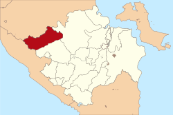 Location of North Musi Rawas Regency in red | |
| Coordinates: 2°29′07″S103°17′37″E / 2.4853°S 103.2935°E | |
| Country | Indonesia |
| Province | South Sumatra |
| Established | 2013 |
| Founded by | Government of Indonesia |
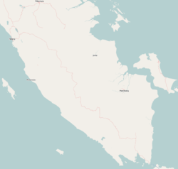
| Regency seat | Rupit |
| Government | |
| • Type | Regency Government |
| • Regent | Devi Suhartoni |
| • Vice Regent | Junius Wahyudi |
| Area | |
• Total | 6,008.66 km2 (2,319.96 sq mi) |
| Population (mid 2024 estimate) [1] | |
• Total | 203,688 |
| • Density | 33.8991/km2 (87.7982/sq mi) |
| • Ethnicity | Malay and Others |
| Time zone | UTC+7 (Indonesia Western Standard Time) |
| Postcode | 316xx |
| Area code | (+62) 733 |
| Website | muratarakab.go.id/ |


North Musi Rawas Regency (Indonesian : Kabupaten Musi Rawas Utara, abbreviation Muratara) is a regency of South Sumatra Province, Indonesia. It takes its name from the two main rivers which drain that area, Musi River and Rawas River. This regency was created on 10 June 2013 by splitting off the seven northernmost districts of Musi Rawas Regency.
Contents
The new regency borders Jambi province to the north, Musi Banyuasin Regency to the east, Musi Rawas Regency to the south, and Bengkulu province to the west. [2] It covers an area of 6,008.66 km2 and had a population of 169,432 at the 2010 Census [3] and 188,861 at the 2020 Census; [4] the official estimate as at mid 2024 was 203,688 (comprising 103,582 males and 100,106 females). [1] The administrative centre is the town of Rupit.