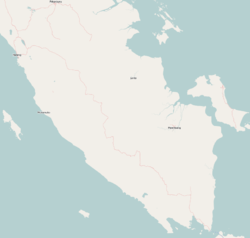
Prabumulih is a city in South Sumatra, Indonesia. It was originally part of Muara Enim Regency, from which it was separated to become an independent city on 21 June 2001. It has an area of 447.31 km² and had a population of 161,814 at the 2010 Census and 193,196 at the 2020 Census; the official estimate as at mid 2023 was 200,673. Geographically, this city is located at 3°25′58″S 104°14′8″E in the heart of the province, and it is surrounded on all sides by Muara Enim Regency, apart from a short stretch bordering Penukal Abab Lematang Ilir Regency.
Central Hulu Sungai Regency is one of the regencies in the Indonesian province of South Kalimantan. The area is 1,770.77 km2 and the population was 243,460 at the 2010 Census and 258,721 at the 2020 Census; the official estimate as at mid 2023 was 268,360. The administrative centre is the town of Barabai.

Kutai Kartanegara Regency is a regency of East Kalimantan Province, Indonesia. It has a land area of 27,263.10 km2 and a water area of 4,097 km2, geographically located between 1°18′40″S and 116°31′36″E. The population of the regency was 626,286 at the 2010 Census and 729,382 at the 2020 Census; the official estimate as of mid-2023 was 788,113. The town of Tenggarong is the capital of the regency.

Batanghari is a regency of Jambi Province in Sumatra, Indonesia. It originally covered a wider area, but on 4 October 1999 this was split between a new Muaro Jambi Regency in the east and a reduced Batang Hari Regency in the west, which now covers an area of 5,804.83 km2. It had a population of 241,334 at the 2010 census and 301,700 at the 2020 census; the official estimate as at mid 2023 was 312,279. The administrative capital is the town of Muara Bulian.

West Kutai Regency is a regency (kabupaten) in the Indonesian province of East Kalimantan. It previously covered a much greater area, with a population of 165,091 at the 2010 Census, but on 11 January 2013 the five northernmost districts were split off to form a new Mahakam Ulu Regency; the residual area of West Kutai Regency is 20,384.6 km2, and it had a population of 140,097 at the 2010 Census, and 165,938 at the 2020 Census; the official estimate as at mid 2023 was 177,007. The town of Sendawar is the administrative capital.

Nias Selatan Regency is a regency in North Sumatra province, Indonesia, created on 25 February 2003 by the division of the existing Nias Regency. The regency covers a land area of 2,487.99 square kilometres and according to the 2010 census had a population of 289,708; the 2020 Census showed a population of 360,531, while the official estimate for mid 2023 was 382,539. Its administrative centre is the port of Teluk Dalam. Apart from the southern portion of Nias Island, the regency also includes the smaller Batu Islands to the south, lying between Nias and Siberut; these islands occupy nearly half of the land area of the Regency, but have just 9% of its population.

North Tapanuli Regency is a landlocked regency in North Sumatra province, Sumatra, Indonesia. Its capital is Tarutung. The regency covers an area of 3,793.71 square kilometres and it had a population of 278,897 at the 2010 Census and 312,758 at the 2020 Census; the official estimate as of mid-2023 was 323,102.

Musi Banyuasin Regency is a regency of South Sumatra province, in Indonesia. Originally much larger, it was reduced by about 45% of its former area on 10 April 2002 by the splitting off of most of its eastern and northeastern districts to form the new Banyuasin Regency. It now has a total area of 14,265.96 km2 (5,508 sq mi) and a population of 561,458 at the 2010 Census and 622,206 at the 2020 Census; the official estimate as at mid 2023 was 707,290.

Manggarai Regency is a regency in East Nusa Tenggara province of Indonesia, situated on the island of Flores. Established in 1958 the regency was reduced in size and population by the separation of the more western districts to form West Manggarai Regency in 2003 and of the more eastern districts to form East Manggarai Regency in 2007. The area of the residual Manggarai Regency is 1,343.83 km2 and its population was 292,037 at the 2010 census and 312,855 at the 2020 census; the official estimate as at mid 2023 was 328,758. The capital of the regency is the town of Ruteng.

East Tanjung Jabung Regency is a regency of Jambi Province, Indonesia. It is located on the island of Sumatra. The regency was created on 4 October 1999 by the division of the then Tanjung Jabung Regency into eastern and western halves. It now has an area of 5,087.07 km2 and had a population of 205,272 at the 2010 census and 229,813 at the 2020 census; the official estimate as at mid 2023 was 236,727. The regency's administrative capital lies at the town of Muara Sabak, a riverine port near the mouth of the Berbak River.

Banyuasin is a regency of South Sumatra Province in Indonesia. The Regency was formed on 10 April 2002 from the coastal and eastern areas formerly part of the Musi Banyuasin Regency. It takes its name from the main river which drains that area, the Banyuasin River. Pangkalan Balai is the regency seat. The regency borders Musi Banyuasin Regency, Jambi province and Bangka Strait to the north, Bangka Strait to the east, Ogan Komering Ilir Regency, Muara Enim Regency, and the city of Palembang to the south, and Musi Banyuasin Regency to the west. It has an area of 12,551.15 km2 and had a population of 749,107 at the 2010 census and 836,914 at the 2020 census; the official estimate as at mid 2023 was 850,022. Much of the regency is coastal lowland.

Muara Enim Regency is a regency of South Sumatra Province, Indonesia. The regency seat is the town of Muara Enim. The city of Prabumulih is an administrative body separating the main part of Muara Enim to the south of the city from a smaller part to its north. The regency until late 2012 covered an area of 8,587.94 km² and had a population of 717,717 at the 2010 Census; however, on 14 December 2012 five districts from the Muara Enim Regency were split off to form the new Penukal Abab Lematang Ilir Regency.

Musi Rawas Regency is a regency of South Sumatra Province, Indonesia. Prior to 2013, it covered an area of 12,134.57 km2 and had a population of 524,919 at the 2010 Census; however on 10 June 2013 the northern half of the regency was split off to form a separate North Musi Rawas Regency. Previous to 2001, the Regency had also included the city of Lubuklinggau, which was split off to form an independent city outside the regency.
Ogan Komering Ilir Regency is a regency of South Sumatra Province, Indonesia. It takes its name from the Ogan River and the Komering River, which are the two main rivers that drain the area. The name Ilir means downstream. The administrative centre is the town of Kayu Agung. The regency borders Banyuasin Regency to the northwest, Bangka Strait, and the Java Sea to the east, Lampung Province to the south, and Palembang city, Ogan Ilir Regency, and East Ogan Komering Ulu Regency to the west.

Ogan Ilir Regency is a regency of South Sumatra Province, Indonesia. It takes its name from the main river which stream that area, Ogan River. And the name Ilir means downstream. Indralaya is the regency seat. The regency borders Palembang City and Muara Enim Regency to the north, Ogan Komering Ilir Regency to the east, Ogan Komering Ilir Regency, and East Ogan Komering Ulu Regency to the south, and Muara Enim Regency to the west.

North Barito Regency is one of the thirteen regencies which divide the Central Kalimantan Province on the island of Kalimantan, Indonesia. It originally included much more of the northern part of the province, but on 10 April 2002 the larger northwestern part of the regency was split off to create a new Murung Raya Regency. Muara Teweh is the capital of North Barito Regency, which covers an area of 10,152.25 km2. The population of North Barito Regency was 121,573 at the 2010 Census and 154,812 at the 2020 Census; the official estimate as at mid 2023 was 160,605.

Pesisir Barat Regency is a regency in Lampung Province of Indonesia. It was created on 25 October 2012 from the eight western districts of West Lampung Regency. It covers an area of 2,907.23 km2, and had a population of 141,741 at the 2010 Census and 162,697 at the 2020 Census; the official estimate as of mid-2023 was 174,695. The administrative center is the town of Krui. The majority group in the Pesisir Barat Regency is the Lampung people, while the Bengkulu language is also spoken in some districts.

North Musi Rawas Regency is a regency of South Sumatra Province, Indonesia. It takes its name from the two main river which drain that area, Musi River and Rawas River. This regency was created on 10 June 2013 by splitting off the seven northernmost districts of Musi Rawas Regency.
Talang Ubi is a town and administrative district (kecamatan) in Penukal Abab Lematang Ilir Regency, of South Sumatra province of Indonesia and it is the seat (capital) of Penukal Abab Lematang Ilir Regency. The district covers an area of 648.40 km2, and had a population of 91,700 according to the official estimates as at mid 2023, of which the four kelurahan forming Talang Ubi town together cover 128.36 km2 with a population of 34,330 at the 2020 Census.