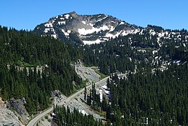
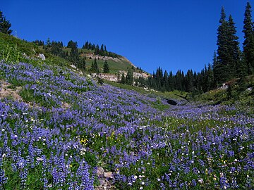
Chinook Pass is a pass through the Cascade Range in the state of Washington.

The Naches River is a tributary of the Yakima River in central Washington in the United States. Beginning as the Little Naches River, it is about 75 miles (121 km) long. After the confluence of the Little Naches and Bumping River the name becomes simply the Naches River. The Naches and its tributaries drain a portion of the eastern side of the Cascade Range, east of Mount Rainier and northeast of Mount Adams. In terms of discharge, the Naches River is the largest tributary of the Yakima River.

Chikamin Peak is a 6,994-foot (2,132-metre) mountain summit located in the Cascade Range, in Kittitas County of Washington state. It is situated within the Alpine Lakes Wilderness on land managed by the Okanogan–Wenatchee National Forest. The mountain's name "Chikamin" derives from Chinook Jargon meaning "money" or "metal", and was submitted by Edmond S. Meany, president of The Mountaineers. This name was officially adopted in 1916 by the U.S. Board on Geographic Names. Chikamin Peak is the highest point of Chikamin Ridge, six miles (9.7 km) northeast of Snoqualmie Pass. Other notable peaks on Chikamin Ridge include Four Brothers and Three Queens. Precipitation runoff from this mountain drains into tributaries of the Yakima River. The Pacific Crest Trail traverses the southwest slope of Chikamin Ridge, and from the trail a scramble up a gully leads to the summit and several alpine lakes including Chikamin Lake and Spectacle Lake.

Lane Peak is a 6,012-foot (1,832-metre) mountain summit in Lewis County of Washington state. It is situated on the crest of the Tatoosh Range which is a sub-range of the Cascade Range. It is located south of Mount Rainier within Mount Rainier National Park.

Huckleberry Mountain is a 6,320+ ft summit located on the shared border of King County and Kittitas County in Washington state.
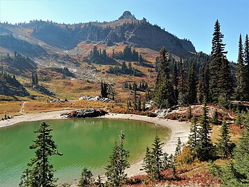
Dewey Peak is a 6,710-foot (2,045 m) summit located on the shared border of Mount Rainier National Park and William O. Douglas Wilderness. It is also on the shared border of Pierce County and Yakima County in Washington state. Dewey Peak is situated on the crest of the Cascade Range southeast of Chinook Pass, east of Seymour Peak, and northeast of Shriner Peak. The nearest higher peak is Chinook Peak, 3.97 mi (6.39 km) to the north. Dewey Peak is named in association with Dewey Lake which is set below its north aspect. Precipitation runoff from Dewey Peak drains into tributaries of the Cowlitz River and Yakima River.

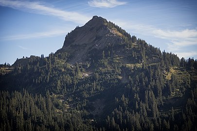
Chinook Peak is a 6,904-foot (2,104 m) summit located on the eastern border of Mount Rainier National Park. It is also on the shared border of Pierce County and Yakima County in Washington state. Chinook Peak is situated north of Chinook Pass on the crest of the Cascade Range. Its nearest higher peak is Crystal Mountain, 1.31 miles (2.11 km) to the north. Crystal Peak lies 0.75 miles (1.21 km) to the northwest, and Cupalo Rock is 1.0 mile (1.6 km) to the east-northeast. Precipitation runoff from Chinook Peak drains into tributaries of the White River and Yakima River.

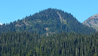
Tahtlum Peak is a 6,567-foot-elevation mountain summit in Yakima County of Washington state.

Yakima Peak is a 6,226-ft summit located on the eastern border of Mount Rainier National Park. It is also on the shared border of Pierce County and Yakima County in Washington state. Yakima Peak is situated northwest of Tipsoo Lake and west of Chinook Pass on the crest of the Cascade Range. Yakima Peak is a major triple divide point with precipitation runoff draining into tributaries of the White River, Cowlitz River, and Yakima River. Its nearest higher neighbor is Deadwood Peak, 0.59 mi (0.95 km) to the north. The name Yakima Peak honors the Yakima Tribe of eastern Washington state. From Chinook Pass, a short scramble up a gully on the north side leads to a flat summit with unobstructed views of Mount Rainier and Naches Peak.

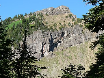
Deadwood Peak is a 6,280-foot-elevation mountain summit located on the eastern border of Mount Rainier National Park. It is also situated on the shared border of Pierce County and Yakima County in Washington state. Deadwood Peak is set on the crest of the Cascade Range, immediately north of Yakima Peak and Chinook Pass, with the Pacific Crest Trail traversing its east slope. Its nearest higher peak is Naches Peak, 0.59 mi (0.95 km) to the southeast. Deadwood Peak takes its name from Deadwood Lakes and Deadwood Creek to its northwest, and their names came from the large number of downed trees in the area. From Chinook Pass, a short scramble up the south side leads to the summit with unobstructed views of Mount Rainier.

Cupalo Rock is a 6,593-foot summit located in Yakima County in Washington state. Cupalo Rock is situated two miles north-northeast of Chinook Pass, one mile east-northeast of Chinook Peak, and barely east of the crest of the Cascade Range. The nearest higher peak is Three Way Peak, 0.42 mi (0.68 km) to the west-northwest. Access for climbing Cupalo Rock is normally from the Pacific Crest Trail at Sourdough Gap. Precipitation runoff from Cupalo Rock drains into tributaries of the American River.

Fifes Peaks is a compact group of summits and spires from an eroded volcanic cone located in Yakima County in Washington state. Fifes Peaks is situated in the Cascade Range on the east side of the crest, within the Norse Peak Wilderness. The Fifes Peaks are remnants of a now extinct caldera which exploded 25 million years ago with volcanic activity extending from 20 to 30 million years ago.
Three Way Peak is a 6,796 feet (2,071 m) summit located on the eastern border of Mount Rainier National Park. It is also on the shared border of Pierce County and Yakima County in Washington state. Three Way Peak is situated 0.42 mi (0.68 km) north of Cupalo Rock on the crest of the Cascade Range. Its nearest higher peak is Crystal Mountain, 0.56 mi (0.90 km) to the northwest. Chinook Peak is 0.8 mile to the southwest. Precipitation runoff from Three Way Peak drains into tributaries of the White River and Naches River.
Silver Peak is a prominent 5,609 ft (1,710 m) mountain located on the shared border between King County and Kittitas County of Washington state. It is set on the crest of the Cascade Range, on land managed by Mount Baker-Snoqualmie National Forest. Silver Peak is situated 4.5 miles southwest of Snoqualmie Pass, and three miles west of Keechelus Lake. The Pacific Crest Trail traverses its east flank and provides easiest access. The nearest higher neighbor is Granite Mountain, 3.98 miles (6.41 km) to the north-northwest. Precipitation runoff from the east side of the mountain drains into Cold Creek, a tributary of the Yakima River, whereas the west side of the mountain drains into the South Fork Snoqualmie River via Humpback Creek.
Buell Peak is a small 5,756 ft summit located in Mount Rainier National Park in Pierce County of Washington state. It is part of the Cascade Range and is situated 1.5 miles southwest of Cayuse Pass and 0.53 mile east-southeast of Barrier Peak, which is the nearest higher peak. Precipitation runoff from Buell Peak drains into tributaries of the Cowlitz River. The normal climbing access is from the Owyhigh Lakes Trail. The peak's toponym honors John Latimore Buell who arrived in Orting, Washington, in 1890 and went into the hardware business.
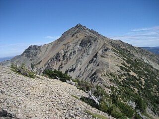
Mount Aix is a 7,766-foot (2,367 m) mountain summit in Yakima County of Washington state.
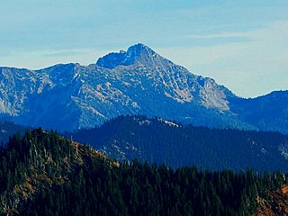
Bismarck Peak is a 7,585-foot-elevation mountain summit in Yakima County of Washington state. It is also 24 miles east-southeast of Mount Rainier and centrally located in the William O. Douglas Wilderness, on land administered by the Wenatchee National Forest. Bismarck Peak is situated east of the crest of the Cascade Range, southeast of Bumping Lake, south of Mount Aix, and northwest of Rimrock Lake. Its nearest higher peak is Mount Aix, 2.2 mi (3.5 km) to the north-northeast. Aix and Bismarck are the two highest peaks midway between Mount Rainier National Park and Yakima, Washington so they are quite prominent. Precipitation runoff from Bismarck Peak drains into tributaries of the Yakima River, thence to the Columbia River.

Crystal Peak is a 6,595-foot summit located in eastern Mount Rainier National Park, in Pierce County of Washington state. Crystal Peak is situated 0.75 mi (1.21 km) northwest of Chinook Peak, and nearly on the crest of the Cascade Range. Crystal Mountain and Crystal Lakes lie immediately to the northeast, and Three Way Peak is 1.09 mi (1.75 km) to the east. Access to the summit is via a hiking trail which branches off from the Crystal Lakes Trail. That trailhead starts along Highway 410, which traverses the western base of the mountain. Precipitation runoff from Crystal Peak drains into tributaries of the White River.
Mother Mountain is a 6,480+ ft multi-summit, 3-mile long ridge-like mountain located in Mount Rainier National Park, in Pierce County of Washington state. It is part of the Cascade Range, and lies 7 mi (11 km) northwest of the summit of Mount Rainier. The Wonderland Trail provides one approach option to this mountain, and the summit offers views of Mount Rainier. East Fay Peak is its nearest higher neighbor, 0.42 mi (0.68 km) to the south. Precipitation runoff from Mother Mountain is drained by Cataract Creek on the south side of the mountain, and Ipsut Creek drains the north side of it, and both are tributaries of the Carbon River. The west side drains into Mowich Lake, and thence Mowich River.

Tumtum Peak is a 4,678-foot-elevation (1,426-meter) mountain summit located in the southwest corner of Mount Rainier National Park, in Pierce County of Washington state. This top-to-bottom forested peak is part of the Cascade Range and lies 8.7 mi (14.0 km) southwest of the summit of Mount Rainier. The nearest higher neighbor is Mount Wow, 2.2 mi (3.5 km) to the northwest, and Iron Mountain rises 3.56 mi (5.73 km) to the northeast. Precipitation runoff from Tumtum Peak is drained by Tahoma Creek on the west side of the mountain, whereas Kautz Creek drains the east side, and both are tributaries of the Nisqually River. The Road to Paradise traverses the southern base of the peak shortly after visitors to the park enter via the Nisqually Entrance. Topographic relief is significant as the southwest aspect rises nearly 2,500 feet above the road in one mile.