Nadowli District | |
|---|---|
Former District | |
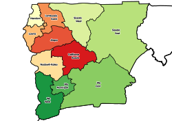
 Districts of Upper West Region | |
 Nadowli District Location of Nadowli District within Upper West | |
| Coordinates: 10°22′26″N2°40′26″W / 10.37389°N 2.67389°W | |
| Country | |
| Region | Upper West |
| Capital | Nadowli |
| Government | |
| • District Executive | Eric Dakura |
| Area | |
• Total | 2,594 km2 (1,002 sq mi) |
| Population (2013) | |
• Total | — |
| Time zone | UTC+0 (GMT) |
| ISO 3166 code | GH-UW-ND |
Nadowli District is a former district that was located in Upper West Region, Ghana. Originally created as an ordinary district assembly in 1988. However, on 28 June 2012, it was split off into two new districts: Nadowli-Kaleo District (capital: Nadowli) and Daffiama-Bussie-Issa District (capital: Issa). The district assembly was located in the western part of Upper West Region and had Nadowli as its capital town.