
The Coast Mountains are a major mountain range in the Pacific Coast Ranges of western North America, extending from southwestern Yukon through the Alaska Panhandle and virtually all of the Coast of British Columbia south to the Fraser River. The mountain range's name derives from its proximity to the sea coast, and it is often referred to as the Coast Range. The range includes volcanic and non-volcanic mountains and the extensive ice fields of the Pacific and Boundary Ranges, and the northern end of the volcanic system known as the Cascade Volcanoes. The Coast Mountains are part of a larger mountain system called the Pacific Coast Ranges or the Pacific Mountain System, which includes the Cascade Range, the Insular Mountains, the Olympic Mountains, the Oregon Coast Range, the California Coast Ranges, the Saint Elias Mountains and the Chugach Mountains. The Coast Mountains are also part of the American Cordillera—a Spanish term for an extensive chain of mountain ranges—that consists of an almost continuous sequence of mountain ranges that form the western backbone of North America, Central America, South America and Antarctica.

The Stikine River is a major river in northern British Columbia (BC), Canada and southeastern Alaska in the United States. It drains a large, remote upland area known as the Stikine Country east of the Coast Mountains. Flowing west and south for 610 kilometres (379 mi), it empties into various straits of the Inside Passage near Wrangell, Alaska. About 90 percent of the river's length and 95 percent of its drainage basin are in Canada. Considered one of the last truly wild large rivers in BC, the Stikine flows through a variety of landscapes including boreal forest, steep canyons and wide glacial valleys.

The Boundary Ranges, also known in the singular and as the Alaska Boundary Range, are the largest and most northerly subrange of the Coast Mountains. They begin at the Nass River, near the southern end of the Alaska Panhandle in the Canadian province of British Columbia and run to the Kelsall River, near the Chilkoot Pass, beyond which are the Alsek Ranges of the Saint Elias Mountains, and northwards into the Yukon Territory flanking the west side of the Yukon River drainage as far as Champagne Pass, north of which being the Yukon Ranges. To their east are the Skeena Mountains and Stikine Plateau of the Interior Mountains complex that lies northwest of the Interior Plateau; the immediately adjoining subregion of the Stikine Plateau is the Tahltan Highland. To their northeast is the Tagish Highland, which is a subregion of the Yukon Plateau. Both highlands are considered in some descriptions as included in the Coast Mountains. The Alexander Archipelago lies offshore and is entirely within Alaska.
Spatsizi Plateau Wilderness Provincial Park is located in the northern portion of British Columbia, Canada, approximately 698, 659 hectares and encompasses the Spatsizi River and Gladys Lake Ecological Reserve. The park is a designated protected area that is intended for the conservation and research on caribou, grizzly bears, fish, and other wildlife species populations. Before the provincial park's establishment in 1975, the area was a historical hunting ground for local Indigenous communities like the Tahltan First Nations. It is the second largest provincial park in British Columbia.
The Skeena Mountains, also known as the Skeenas, are a subrange of the Interior Mountains of northern British Columbia, Canada, essentially flanking the upper basin of the Skeena River. They lie just inland from the southern end of the Boundary Ranges of the Coast Mountains, and also of the northern end of the Kitimat Ranges. Their southern limit is described by the Bulkley River and the upper northwestern reaches of Babine and Takla Lakes, and on their northeast by the upper reaches of the Omineca River.
The Stikine Ranges are a group of mountain ranges and mountainous plateaus in northwestern British Columbia, Canada. They are the northernmost subdivision of the Cassiar Mountains and among the least explored and most undeveloped parts of the province.

The Interior Mountains or Northern Interior Mountains are the semi-official names for an expansive collection of mountain ranges that comprises much of the northern half of the Canadian province of British Columbia and a large area of southern Yukon.

The British Columbia Interior, popularly referred to as the BC Interior or simply the Interior, is a geographic region of the Canadian province of British Columbia. While the exact boundaries are variously defined, the British Columbia Interior is generally defined to include the 14 regional districts that do not have coastline along the Pacific Ocean or Salish Sea, and are not part of the Lower Mainland. Other boundaries may exclude parts of or even entire regional districts, or expand the definition to include the regional districts of Fraser Valley, Squamish–Lillooet, and Kitimat–Stikine.

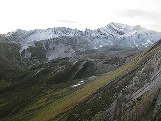
Level Mountain is a large volcanic complex in the Northern Interior of British Columbia, Canada. It is located 50 kilometres north-northwest of Telegraph Creek and 60 kilometres west of Dease Lake on the Nahlin Plateau. With a maximum elevation of 2,164 metres, it is the second-highest of four large complexes in an extensive north–south trending volcanic region. Much of the mountain is gently-sloping; when measured from its base, Level Mountain is about 1,100 metres tall, slightly taller than its neighbour to the northwest, Heart Peaks. The lower, broader half of Level Mountain consists of a shield-like structure while its upper half has a more steep, jagged profile. Its broad summit is dominated by the Level Mountain Range, a small mountain range with prominent peaks cut by deep valleys. These valleys serve as a radial drainage for several small streams that flow from the mountain. Meszah Peak is the only named peak in the Level Mountain Range.
The Sheslay River is a tributary of the Inklin River in northwest part of the province of British Columbia, Canada. It joins the Nahlin River to form the Inklin River, one of the main tributaries of the Taku River. The lower Sheslay River marks the boundary between the Taku Plateau and the Nahlin Plateau. Its mouth at the Nahlin River marks the junction of the Taku, Nahlin, and Kawdy Plateaus. All three of these are part of the larger Stikine Plateau region.
The Inklin River is a tributary of the Taku River in the northwest part of the province of British Columbia, Canada. It originates at the confluence of its two main tributaries, the Nahlin River and the Sheslay River and flows generally west and northwest about 83 km (52 mi) to join the Nakina River. The confluence of the Inklin and Nakina Rivers, at the uninhabited locality of Inklin, marks the beginning of the Taku River. The mouth of the Inklin River is located about 100 km (62 mi) northeast of Juneau, Alaska and about 160 km (99 mi) northwest of Telegraph Creek, British Columbia.

The Tahltan River is a tributary of the Stikine River in northwest part of the province of British Columbia, Canada. It flows generally east and southeast about 95 km (59 mi) to join the Stikine River at Tahltan, British Columbia. The lower Tahltan River marks the boundary between the Tahltan Highland and the Nahlin Plateau, both of which are part of the larger Stikine Plateau region.

The Stikine Plateau is a plateau in northern British Columbia, Canada. It lies between the Boundary Ranges of the Coast Mountains on the west and southwest and the Cassiar Mountains along its northeast, and between the Skeena Mountains on its south and southeast and the Jennings and Nakina Rivers on the north.
The Spatsizi Plateau is a plateau in the upper basin of the Stikine River in north-central British Columbia, Canada. Most of the plateau, which is a sub-plateau of the Stikine Plateau, is enshrined in either Spatsizi Plateau Wilderness Provincial Park or Spatsizi Headwaters Provincial Park. It is flanked on the south and southwest by the Skeena Mountains, on the southeast by the Omineca Mountains, on the northeast by the Stikine Ranges of the Cassiar Mountains, and on the west by the Klastline Plateau.
The Tanzilla Plateau is a plateau in the Stikine Country of the Northern Interior of British Columbia, Canada. It is a sub-plateau of the Stikine Plateau and is located east of the Tuya River, north of the Stikine River and surrounding Dease Lake; its eastern extremity verges on the Stikine Ranges of the Cassiar Mountains at Dark Mountain and Pyramid Mountain. The Spatsizi Plateau is to the southeast, the Klastline Plateau to the south, the Tahltan Highland to the west and southwest, and the Kawdy Plateau to the west and northwest. All are also sub-plateaus of the Stikine Plateau.
The Taku Plateau is a sub-plateau of the Stikine Plateau in the far northwestern Interior of British Columbia, Canada. It lies to the south of the Teslin Plateau, part of the Yukon Plateau and to the southeast of the Yukon Plateau's other major sub-area within British Columbia, the Tagish Highland. Immediately northeast is the Kawdy Plateau and to the northwest of the Nahlin Plateau. The Inklin River forms the plateau's southwestern boundary with the northwestern extremities of the Tahltan Highland, beyond which are the Boundary Ranges. Very mountainous, its highest summit is Nahlin Mountain.
The Tuya River is a major tributary of the Stikine River in northwest part of the province of British Columbia, Canada. From its source at High Tuya Lake in Tuya Mountains Provincial Park just south of Ash Mountain, the highest peak of the Tuya Range, the Tuya River flows south about 200 km (120 mi) to meet the Stikine River in the Grand Canyon of the Stikine. The Tuya River's main tributary is the Little Tuya River. The Tuya River divides the Tanzilla Plateau on the east from the Kawdy Plateau, to the northwest, and the Nahlin Plateau, to the southwest. All three are considered sub-plateaus of the Stikine Plateau. The Tuya River's watershed covers 3,575 km2 (1,380 sq mi), and its mean annual discharge is estimated at 36.9 m3/s (1,300 cu ft/s). The mouth of the Tuya River is located about 24 km (15 mi) northeast of Telegraph Creek, British Columbia, about 67 km (42 mi) southwest of Dease Lake, British Columbia, and about 210 km (130 mi) east of Juneau, Alaska. The Tuya River's watershed's land cover is classified as 35.7% shrubland, 31.4% conifer forest, 14.0% mixed forest, 7.2% herbaceous, and small amounts of other cover.
The Koshin River is a tributary of the Nahlin River in northwest part of the province of British Columbia, Canada. It flows generally north about 58 km (36 mi) to join the Nahlin River, which forms the Inklin River, one of the main tributaries of the Taku River. The Koshin River flows through the Nahlin Plateau. It joins the Nahlin River at the boundary between the Nahlin and Kawdy plateaus. Both plateaus are part of the larger Stikine Plateau region.
Beatty Creek is a tributary of the Tahltan River in northwest part of the province of British Columbia, Canada. It flows generally south about 62 km (39 mi) to join the Tahltan River a few kilometres downstream from the Little Tahltan River confluence. The Tahltan River is one of the main tributaries of the Stikine River.

