This article needs to be updated.(June 2019) |
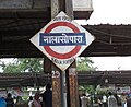
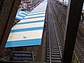
Nalla Sopara | |||||||||||
|---|---|---|---|---|---|---|---|---|---|---|---|
| Mumbai Suburban Railway station | |||||||||||
 | |||||||||||
| General information | |||||||||||
| Location | Nala Sopara | ||||||||||
| Coordinates | 19°24′55″N72°51′41″E / 19.4154°N 72.8613°E | ||||||||||
| Owned by | Ministry of Railways, Indian Railways | ||||||||||
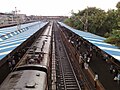
| Line(s) | Western Line | ||||||||||
| Platforms | 4 | ||||||||||
| Tracks | 4 | ||||||||||
| Construction | |||||||||||
| Structure type | Standard on-ground station | ||||||||||
| Other information | |||||||||||
| Status | Active | ||||||||||
| Station code | NSP | ||||||||||
| Fare zone | Western Railways | ||||||||||
| History | |||||||||||
| Opened | 1865 [1] | ||||||||||
| Electrified | Yes | ||||||||||
| Passengers | |||||||||||
| 69 eut | |||||||||||
| Services | |||||||||||
| |||||||||||
| |||||||||||

Nalla Sopara (station code NSP) is a railway station on the Western line of the Mumbai Suburban Railway network, serving the town of Nala Sopara, within the Mumbai Metropolitan Region. [2]