Gujrat is the thirteenth largest city in the Pakistani province of Punjab. Located on the western bank of the Chenab River in northern Punjab's Chaj Do'āb, it serves as the headquarters of the eponymous district and disvision; and is the 20th most populous in Pakistan, with a population of 390,533 in 2017. Along with Sialkot and Gujranwala, Gujrat forms part of the "Golden Triangle of Punjab", as these industrial cities have export-oriented economies.

Gujranwala is a city and capital of Gujranwala Division located in Pakistan. It is also known as "City of Wrestlers" and is quite famous for its food. It is the 5th most populous city proper after Karachi, Lahore, Faisalabad and Rawalpindi respectively. Founded in the 18th century, Gujranwala is a relatively modern town compared to the many nearby millennia-old cities of northern Punjab. The city served as the capital of the Sukerchakia Misl state between 1763 and 1799, and is the birthplace of the founder of the Sikh Empire, Maharaja Ranjit Singh.

Wazirabad is a city in Punjab, Pakistan. It is the administrative capital of Wazirabad District.
Sargodha is a city and capital of Sargodha Division, located in Punjab province, Pakistan. It is Pakistan's 12th largest city by population and one of the fastest-growing cities of the country. Sargodha is also known as the City of Eagles on account of hosting the headquarters of the Pakistan Air Force.

Sheikhupura also known as Qila Sheikhupura, is a city and district in the Pakistani province of Punjab. Founded by the Mughal Emperor Jahangir in 1607, Sheikhupura is the 16th largest city of Pakistan by population and is the headquarters of Sheikhupura District. The city is an industrial centre and satellite town, and is located about 38 km northwest of Lahore. It also borders Sialkot, Gujranwala, Nankana Sahib and Kasur districts of Punjab, Pakistan.

Batala is the eighth largest city in the state of Punjab, India in terms of population after Ludhiana, Amritsar, Jalandhar, Patiala, Bathinda, Mohali and Hoshiarpur. Batala ranks as the second-oldest city after Bathinda. It is a municipal corporation in Gurdaspur district in the Majha region of the state of Punjab. It is located about 32 km from Gurdaspur, the headquarters of the district. It is also a Police district. Batala holds the status of the most populated town of the district with 31% of the district's total population. It is the biggest industrial town in the district.
Pasrur, is a historical city of Sialkot District in the Punjab province of Pakistan. The city is the capital of Pasrur Tehsil and is administratively subdivided into 26 wards of the municipal committee Pasrur. The inportant point of tehsil pasrur are Badyana, Chawinda, chobara, kingra, sabz peer, chichharwali and Dhodha. Pasrur is the central city linked Narowal, Sialkot, Daska and Gujranwala. A railway track also passing through this city which connect sialkot to lahore via narowal junction.

Sialkot District, is one of the districts of the Punjab province of Pakistan. It is located in the Majha region of Punjab, otherwise the northeast of the province. The city of Sialkot is the capital of the district. The Sialkot Cantonment was established in 1852.

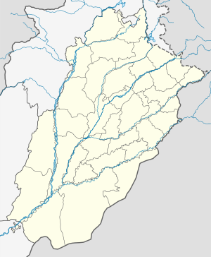
Majha is a region located in the central parts of the historical Punjab region, currently split between the republics of India and Pakistan. It extends north from the right banks of the river Beas, and reaches as far north as the river Jhelum. People of the Majha region are given the demonym "Mājhī" or "Majhail". Most inhabitants of the region speak the Majhi dialect, which is the basis of the standard register of the Punjabi language. The most populous city in the area is Lahore on the Pakistani side, and Amritsar on the Indian side of the border.

Gujranwala District, is a district that is a part of the Majha region in Punjab, Pakistan. Gujranwala District is bordered by the districts of Wazirabad, Sialkot, Hafizabad and Sheikhupura. Gujranwala district has 5 National Assembly and 12 Punjab Assembly constituencies. Gujranwala is known as the city of wrestlers and famous for its food.

Kartarpur is a town located, just 102 km from Lahore city in the Shakargarh Tehsil, Narowal District in Punjab, Pakistan. Located on the right bank of the Ravi River, it is said to have been founded by the first guru of Sikhism, Guru Nanak, where he established the first Sikh commune.

The Punjab Colleges is a group of colleges active in Punjab, Pakistan.
Qila Sobha Singh is a town in Narowal District of Punjab province of Pakistan. Before 1 July 1991 it was part of Sialkot District but after 1 July 1991 it was made part of Narowal District. It is part of Narowal District and is located at 32°14′0″N74°46′0″E and has an altitude of 240 metres (790 ft).
Baddomalhi is a town located 35 miles northeast of Lahore, Pakistan in Narowal District. It is located at 31°58'60 North 74°40'0 East with an altitude of 217 metres (715 feet). The boundary of Baddomalhi post office is extended to cheenay kay dograa village and this is the last village of District Narowal and village is small but violent areas.
Zafarwal, Urdu: ظفروال, is a quaint town in the Narowal District of Punjab, Pakistan. Serving as the administrative hub of Zafarwal Tehsil, this settlement boasts rich historical significance.

The Board of Intermediate and Secondary Education, Gujranwala is an examination board for secondary and intermediate education in Gujranwala Division.
Chowk Azam is a city in the Layyah District of Punjab, Pakistan. It is located 25 kilometres (16 mi) from Layyah, the headquarters of the Layyah District, on the Mianwali and Multan road. Chowk Azam has an estimated population of more than 150,000 people. The city has many educational and vocational institutions, including the Government Muslim High School, Divisional Public School, Government College for Boys and Government College for Girls. The campus of the Government College University Faisalabad and Bahauddin Zakariya University in Layyah provides point services for the commuting of Chowk Azam students and others who live in the vicinity. YouTube channels, Haseeb Electronics. and Haseeb Electronics Urdu. are from this city. Friends Public School, Garrison Public School, Millat Public School are well known private schools

Jainism in Pakistan has an extensive heritage and history, with several ancient Jain shrines scattered across the country. Baba Dharam Dass was a holy man whose tomb is located near the bank of a creek called near Chawinda Phatic, behind the agricultural main office in Pasrur, near the city of Sialkot in Punjab, Pakistan. Another prominent Jain monk of the region was Vijayanandsuri of Gujranwala, whose samadhi still stands in the city.
Nurkot is a town located on the Right (western) bank of the Nullah Baein torrent, 20 km by road northeast of Shakargarh city, in Shakargarh Tehsil of Narowal District of the Punjab province of Pakistan, at an elevation of 258 meters. Nurkot and the adjoining town of Maingri have grown into each other and are often referred to collectively. Together, they form the largest and the most important town of the Constituency PP-48 of Punjab Assembly. It is the economic, educational, social and transport hub for the surrounding small towns and villages in the region. Because of its proximity to the Indian border and permanent presence of military forces in the cantonment area, Nurkot is a strategically important town.
Pasrur Railway Station is located in Pasrur city, Sialkot district of Punjab province, Pakistan. There are two functional and three nonfuntional railway tracks at this railway station.