National road 94 (Poland)

Last updated
DK94-PL.svg
National Road 94
Droga krajowa nr 94
Mapa DK94.png
Route information
Maintained by GDDKiA
Length675 km (419 mi)
Major junctions
West end A4-PL.svg A4, Zgorzelec
51°10′21″N15°01′49″E / 51.1724°N 15.0303°E / 51.1724; 15.0303
East end A4-PL.svg A4, Korczowa
49°57′40″N23°05′37″E / 49.96113°N 23.09350°E / 49.96113; 23.09350
Location
Country Poland
Major cities Bolesławiec, Legnica, Środa Śląska, Wrocław, Oława, Brzeg, Opole, Strzelce Opolskie, Zabrze, Bytom, Piekary Śląskie, Siemianowice Śląskie, Czeladź, Będzin, Sosnowiec, Dąbrowa Górnicza, Sławków, Olkusz, Kraków, Wieliczka, Bochnia, Brzesko, Tarnów, Dębica, Rzeszów, Łańcut, Przeworsk, Korczowa
Highway system
National roads of Poland
DK93-PL.svg DK 93 DK95-PL.svg DK 95
National Road 94 in Wielka Wies, Lesser Poland Voivodeship DK 94 Wielka Wies.jpg
National Road 94 in Wielka Wieś, Lesser Poland Voivodeship
National Road 94 in Modlniczka, Lesser Poland Voivodeship DK 94 Modlniczka.jpg
National Road 94 in Modlniczka, Lesser Poland Voivodeship
National Road 94 in Olkusz 94 Olkusz.jpg
National Road 94 in Olkusz
Roundabout in Debica (DK94) Rondo w Debicy (DK94).jpg
Roundabout in Dębica (DK94)
Junction (Wielicka Street) of National Road 94 with A4 in Krakow IC Krakow Wielicka scheme.svg
Junction (Wielicka Street) of National Road 94 with A4 in Kraków

National Road 94 (Polish : Droga krajowa nr 94) is a road in Poland. It runs through 5 voivodeships: Lower Silesian Voivodeship, Opole Voivodeship, Silesian Voivodeship, Lesser Poland Voivodeship and Subcarpathian Voivodeship. It is a road of GP class and partially G class. [1] The road runs as a free alternative route for A4 motorway. National road 94 in large part runs along the old route of national road no. 4 and because of that it is colloquially called the old four by drivers. After the completion of the A4 motorway the formerly parallel-running national road no. 4 has become of secondary importance and serves as a backup route; it can be useful in case of a traffic collision or other source disrupting traffic on the A4.

Contents

History

From 1996 [2] to 2001, [3] there were plans to build expressway S94 on route Bielsko-BiałaŻywiecZwardoń. In 2000 [4] the national road network was reformed and this section got number 69, which was later built as S69. In 2016 the route was incorporated into S1.

Sections

National road 94, compared to most Polish national roads, has unusual mileage numbers – it's being counted from kilometre zero multiple times, despite the completion of A4 motorway in 2016.

Mileage numbers of national road no. 94
SectionStart kmEnd kmNotes
Interchange Zgorzelec (A4) – BolesławiecKrzywa interchange (A4)0≈57,3former course of national road no. 4
Krzywa interchange (A4) – Legnica, Dziennikarska street0≈27,5Oldest section of the road (got its number in 2000)
Legnica, Dziennikarska street – Leszczyńska street (DW333)0≈0,9Local numbering
Legnica, Leszczyńska street – Wrocław, Milenijna street (DK5)27,592,8 
Wrocław, Powstańców Śląskich street (DK5) – Oława – Karczów (DK46)97173 
Karczów (DK46) – Opole-Kolonia Gosławicka (DK46) – Opole-Grudzice018,8Local numbering on the northern Opole bypass; between Karczów and the DK46/DK94 crossing in Kolonia Gosławicka should be counted within road with the lower number
Opole-Grudzice – Strzelce Opolskie – Pyskowice – Bytom-Karb (DK88)189,6263 
Bytom-Karb (DK88) – Piekary Śląskie – Będzin (DK86)0≈18,3 
Sosnowiec-Pogoń (DK86) – Dąbrowa Górnicza – border between Silesian and Lesser Poland voivodeships1940,8 
Border between Silesian and Lesser Poland voivodeships – Olkusz – Modlnica285,5327,9 
Modlnica – Modlniczka interchange (S52, DK7)02,4Local numbering
Kraków Wieliczka interchange (A4) – Tarnów (DK73) – border between Lesser Poland and Subcarpathian voivodeships088,4Mileages on the segment shared with DK73 should be numbered within road with the lower number
Border between Lesser Poland and Subcarpathian voivodeships – Pilzno bypass527,5534,9Mileages on the segment shared with DK73 should be numbered within road with the lower number
Pilzno bypass02,5Local numbering; 1,9 km long segment shared with national road no. 73
Pilzno bypass – Dębica – Ropczyce bypass538,3561,3Renewal of numbering on the terminal point of Pilzno bypass
Ropczyce bypass – Witkowice Górne0≈4,5Local numbering
Witkowice Górne – Sędziszów Małopolski – Świlcza (S19) – Rzeszów (DK97) – Łańcut – Przeworsk – Jarosław bypass565,4645The Rzeszów (DK97) – Łańcut – Przeworsk – Jarosław Zachód interchange (A4) segment is the newest one (got its number in 2016)
Jarosław bypass011,3Local numbering; 3–11,3 km long segment shared with national road no. 77 should be numbered within road with the lower number
Jarosław bypass – Radymno (DK77) – Korczowa interchange (A4) – road 1698R655,5≈686Section shared with DK77 numbering between 655,5 and 664 km

Road class

The road is a class GP for almost all of its length – with the exception of section from Krzywa interchange to Prochowice, which is of G class. [1]

Weight limit

Since March 13, 2021 the road allows vehicles with weight up to 11,5 tons per single axle. [5]

Towns and cities along the road

Jędrzychowice, Bolesławiec, Krzywa, Chojnów, Legnica, Prochowice, Środa Śląska, Wrocław, Siechnice, Oława, Brzeg, Skorogoszcz, Opole, Walidrogi, Nakło, Izbicko, Strzelce Opolskie, Toszek, Pyskowice, Wieszowa, Zabrze, Bytom, Piekary Śląskie, Siemianowice Śląskie, Czeladź, Będzin, Sosnowiec, Dąbrowa Górnicza, Sławków, Olkusz, Modlniczka, Kraków, Wieliczka, Bochnia, Brzesko, Wojnicz, Tarnów, Pilzno, Dębica, Ropczyce, Sędziszów Małopolski, Świlcza, Rzeszów, Łańcut, Przeworsk, Mirocin, Jarosław, Radymno, Skołoszów, Korczowa

Related Research Articles

<span class="mw-page-title-main">National roads in Poland</span> Category of public roads in Poland

According to classes and categories of public roads in Poland, a national road is a public trunk road controlled by the Polish central government authority, the General Directorship of National Roads and Motorways. All motorways and expressways in Poland are classified as part of the national roads network.

<span class="mw-page-title-main">Voivodeship road</span> Road type in Poland

According to classes and categories of public roads in Poland, a voivodeship road is a category of roads one step below national roads in importance. The roads are numbered from 100 to 993. Total length of voivodeship roads in Poland is 28,536 km (17,730 mi) of which 61.4 km (38 mi) are unpaved (2008).

<span class="mw-page-title-main">Recław</span> Village in West Pomeranian Voivodeship, Poland

Recław is a village in the West Pomeranian Voivodeship, Poland, located within Gmina Wolin, Kamień County.

<span class="mw-page-title-main">Expressway S3 (Poland)</span> Expressway in Poland connecting Baltic Sea with Czech Republic

Expressway S3 or express road S3 is a Polish highway, which is planned to run from Świnoujście on the Baltic Sea through Szczecin, Gorzów Wielkopolski, Zielona Góra and Legnica, to the border with the Czech Republic, where it will connect to the planned D11 motorway. The total intended length is 470.6 km (292.4 mi), of which 436.0 km (270.9 mi) is open to traffic and 33.0 km (20.5 mi) is under construction as of January 2025.

<span class="mw-page-title-main">National road 2 (Poland)</span> National road in Poland

National road 2 is an A-class, S-class and GP-class Polish national road, being part of the European route E30 from Cork (Ireland) to Omsk (Russia). The highway traverses through the Lubusz, Greater Poland, Łódź. Masovian and Lublin voivodeships. It runs latitudinally.

<span class="mw-page-title-main">National road 98 (Poland)</span> Former road designation in Poland

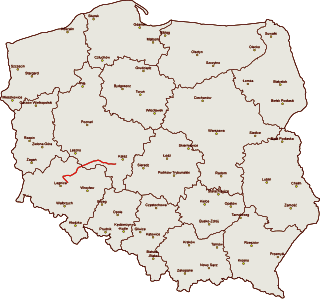
Droga krajowa nr 98 was a route belonging to Polish national roads network.

<span class="mw-page-title-main">Expressway S52 (Poland)</span> Polish highway under construction

Expressway S52 is a Polish highway under construction with a planned length of 116 km (72 mi), located in the Silesian and Lesser Poland voivodeships. Upon completion it will connect the border of the Czech Republic in Cieszyn with Kraków.

<span class="mw-page-title-main">National road 41 (Poland)</span> Road in Poland

National Road 41 is a route belonging to the Polish national roads network. The route runs from Nysa to Prudnik, in the Opole Voivodeship, then on to the border with the Czech Republic.

<span class="mw-page-title-main">National road 92 (Poland)</span> National road in Poland

National road 92 is a route belonging to Polish national roads network, which serves as an alternative route parallel to motorway A2. The road has one lane per direction on the majority of its length. Before the A2 motorway was constructed, it had served as the main connection between Warsaw, Poznań and the Polish-German border as DK 2; because of this, the route is sometimes referred to as "starą dwójką".

<span class="mw-page-title-main">A50 autostrada (Poland)</span> Planned motorway in Poland

The autostrada A50 is a planned motorway in Poland, in Masovian Voivodeship. It will run as a circular road south of the Warsaw metropolitan area to take over the transit traffic from the existing expressway ring around the city, mainly from the S2 expressway. Once built, the motorway bypass will also be one of the road connectors to the planned Solidarity Transport Hub. It was added to the motorway and expressway index by Polish government on 24 September 2019.

<span class="mw-page-title-main">Expressway S50 (Poland)</span> Planned motorway in Poland

The S50 expressway is a planned expressway in Poland, in Masovian Voivodeship. It will run as a circle road north to the Warsaw metropolitan area to take over the transit traffic from the existing expressway ring around the city, mainly from the S8 and S17 expressways, as well as will be one of the road connectors to the planned Solidarity Transport Hub. It was added to the motorway and expressway index by Polish government on 24 September 2019.

<span class="mw-page-title-main">National road 36 (Poland)</span> National road in Poland

National road 36 is an about 150 km long G class and GP class national road connecting Prochowice in Lower Silesian Voivodeship with Ostrów Wielkopolski in Greater Poland Voivodeship.

<span class="mw-page-title-main">National road 54 (Poland)</span> National road in Poland

National road 54 is a route belonging to the Polish national road network. The highway is a GP-class road, 18 km (11 mi) long, located in the Warmian-Masurian Voivodeship. This route connects the Expressway S22 at the Braniewo-Południe junction near Chruściel with the Gronowo-Mamonovo border crossing near Russia.

<span class="mw-page-title-main">National road 53 (Poland)</span> Road in Poland

National road 53 is a route belonging to the Polish national road network. The highway is a GP-class and G-class road, 123 km (76 mi) long and is located in the Masovian and Warmian-Masurian Voivodeship. This route connects Olsztyn with Ostrołęka. The winding section between Olsztyn and Szczytno is the most difficult for drivers.

<span class="mw-page-title-main">National road 52 (Poland)</span> Road in Poland

National road 52 is a route belonging to the Polish national road network. The highway is a GP-class and S-class road, 72 km (45 mi) long and is located in the Lesser Poland and Silesian Voivodeship. This route consists of two fragments that are not connected with each other. The first one connects Cieszyn through Bielsko-Biała with Głogoczów. The second is the north-west bypass of Kraków.

<span class="mw-page-title-main">National road 69 (Poland)</span> Former national road in Poland connecting Bielsko-Biała to Poland–Slovakia border in Zwardoń

National road 69 was a route belonging to the Polish national road network. The highway connected Bielsko-Biała with Poland–Slovakia border in Zwardoń.

<span class="mw-page-title-main">National road 68 (Poland)</span> National road in Poland

National road 68 is a main road of accelerated traffic belonging to the Polish national road network. The length of the route is 11.4 kilometres (7.1 mi), of which 5.197 kilometres (3.229 mi) is maintained by General Directorate for National Roads and Highways. The highway connects the Kukuryki border crossing on Belarus–Poland border with national road 2 in Wólka Dobryńska. It runs entirely in Lublin Voivodeship, in Biała County. According to signage, national road 68 is a component of European highway E30.

<span class="mw-page-title-main">National road 37 (Poland)</span> National road in Poland

National road 37 is a main road (Polish: droga główna, droga klasy G) route belonging to Polish national roads network, located in West Pomeranian Voivodeship. With its length of 14.6 kilometres (9.1 mi), the route connects the town of Darłowo with national road 6 near Karwice. In the future a new junction will be constructed, linking road 37 with expressway S6.

<span class="mw-page-title-main">Expressway S47 (Poland)</span> Unbuilt expressway in Poland

Expressway S47 – former planned expressway in Poland on the stretch of national road 47 between Rabka-Zdrój and Zakopane.

<span class="mw-page-title-main">National road 96 (Poland)</span> National road in Poland

National road 96 is a main road of accelerated traffic, belonging to Polish national roads network, with length of 1.5 kilometres (0.93 mi) and located in Toruń County. It connects motorway A1 with national road 15. With its length, the route is the shortest one of all national roads in Poland.A

References

  1. 1 2 Generalna Dyrekcja Dróg Krajowych i Autostrad. "Zarządzenie nr 34 Generalnego Dyrektora Dróg Krajowych i Autostrad z dnia 3 października 2017 r. w sprawie klas istniejących dróg krajowych" (PDF) (in Polish). gddkia.gov.pl . Retrieved 2017-10-22.
  2. "Rozporządzenie Rady Ministrów z dnia 23 stycznia 1996 r. w sprawie ustalenia sieci autostrad i dróg ekspresowych". Dziennik Ustaw (in Polish) (12): 63. 1996.
  3. "Rozporządzenie Rady Ministrów z dnia 29 września 2001 r. w sprawie ustalenia sieci autostrad, dróg ekspresowych oraz dróg o znaczeniu obronnym". Dziennik Ustaw (in Polish) (120): 1283. 2001.
  4. "Zarządzenie nr 6 Generalnego Dyrektora Dróg Publicznych z dnia 9 maja 2000 r. w sprawie nowych numerów dróg krajowych" (in Polish). Rzeczpospolita. 2000-07-04.
  5. "Ustawa z dnia 18 grudnia 2020 r. o zmianie ustawy o drogach publicznych oraz niektórych innych ustaw". Dziennik Ustaw (in Polish) (54). 2021.