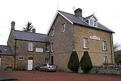
The Campaign for Real Ale (CAMRA) is an independent voluntary consumer organisation headquartered in St Albans, England, which promotes what they designate as "real" ale, "real" cider, "real" perry and traditional British pubs and clubs. With just under 160,000 members, it is the largest single-issue consumer group in the UK, and is a founding member of the European Beer Consumers Union (EBCU).

Lakenheath is a village and civil parish in the West Suffolk district of Suffolk in eastern England. It has a population of 4,691 according to the 2011 Census, and is situated in the Forest Heath district of Suffolk, close to the county boundaries of both Norfolk and Cambridgeshire, and at the meeting point of The Fens and the Breckland natural environments.

Pamphill is a village in south-east Dorset, England, just outside Wimborne Minster, four miles north of Poole. The village has a population of 704 (2001).

Chaddleworth is a village and civil parish in the English county of Berkshire.

Wymeswold is a village and civil parish in the Charnwood district of Leicestershire, England. It is in the north of Leicestershire, and north-east of Loughborough. The village has a population of about 1,000, measured at 1,296 in the 2011 census. It is close to Prestwold and Burton on the Wolds in Leicestershire, and the Nottinghamshire villages of Rempstone and Willoughby on the Wolds.

Rangeworthy is a semi-rural farming village in South Gloucestershire, England, nearby communities include Falfield and Charfield. The village population taken at the 2011 census was 675.

Alpraham is a village and civil parish in Cheshire, England, on the A51 road between Nantwich and Chester, seven miles north-west of Nantwich. The population is around 400.

Barthomley is a village and ancient parish, and is now a civil parish in the unitary authority of Cheshire East and the ceremonial county of Cheshire, England. According to the 2001 and the 2011 census' the parish had a population of 202. The village is situated near junction 16 of the M6 motorway and by the border with Staffordshire. It is about three miles south-west of Alsager.

Netherton is an area of the Metropolitan Borough of Dudley, 1.5 miles (2 km) south of Dudley town centre in the West Midlands of England, but historically in Worcestershire. Part of the Black Country, Netherton is bounded by nature reserves to the east and west, and an industrial area and the Dudley Southern By-Pass to the north.

Iken is a small village and civil parish in the sandlands of the English county of Suffolk, an area formerly of heathland and sheep pasture. It is near the estuary of the River Alde on the North Sea coast and is located south east of Snape and due north of Orford. To its west is Tunstall Forest, created since the 1920s by the Forestry Commission and now part of the Sandlings Forest.

Hudswell is a village and civil parish on the border of the Yorkshire Dales, in the Richmondshire district of North Yorkshire, England. The population at the ONS Census 2011 was 353.

Itteringham is a village and civil parish in the English county of Norfolk, some 4+1⁄2 miles (7.2 km) northwest of the market town of Aylsham. It covers an area of 8.20 km2 (3.17 sq mi) and had a population of 136 in 60 households at the 2001 census, the population reducing to 125 at the 2011 Census. For the purposes of local government, it falls within the district of North Norfolk.
The National Pub of the Year is an annual competition held by CAMRA, the winner of which is announced in the February of the year following that in which the competition is run, that finds the best pub in the UK. Established in 1988, the competition helps to highlight quality pubs around the UK that are worth seeking out and visiting. Each year, each local CAMRA branch nominates one pub in their area to be entered. These 200 pubs then go through to the regional competition, which then whittles down to 4 pubs to go to the national final.
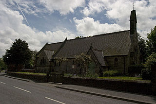
Horsley Woodhouse is a village and civil parish in the Amber Valley district of Derbyshire, in the East Midlands of England. The population of the civil parish taken at the 2011 Census was 1,219. It is situated on the A609 road between the neighbouring villages of Kilburn and Smalley. The nearest towns are Heanor, situated 2.6 miles (4.2 km) northeast, and Belper, 3.2 miles (5.1 km) northwest, while the city of Derby is located about 6 miles (9.6 km) south-southwest.
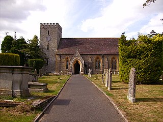
Titley is a village and civil parish in Herefordshire, England. It lies on the B4355 between Kington and Presteigne.
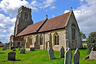
Hawkedon is a village and civil parish in the West Suffolk district of Suffolk in eastern England. Located around 7 miles (11 km) south-south-west of Bury St Edmunds, the parish also contains the hamlet of Thurston End, and in 2005 had a population of 120. The majority of the village is classed as a conservation area.

Leavening is a village and civil parish in the Ryedale district of North Yorkshire, England. The village is situated approximately 13 miles (20 km) north-east from the centre of the city of York. It was historically part of the East Riding of Yorkshire until 1974.

Faccombe is a village and civil parish in Hampshire, England. The village lies on the Hampshire-Berkshire border and is situated on the North Downs. Its nearest Hampshire town is Andover, approximately 8 miles (13 km) away although Newbury in Berkshire is 2 miles (3.2 km) closer.
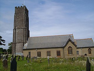
Stoke Fleming is a village and civil parish in the South Hams district of Devon, England. It lies on the A379 road about one and a half miles south of the town of Dartmouth, at the north end of Start Bay and within the South Devon Area of Outstanding Natural Beauty. In 2001 the parish had a population of 1,012, compared to 708 in 1901, reducing again to 803 at the 2011 census The parish is a major part of the Skerries electoral ward. The ward's total population at the same census was 1,927. Stoke Fleming has a pub called The Green Dragon, a primary school, library and a football club.
The Railway is a Grade II listed public house at 153 Manchester Road, Broadheath, Altrincham, Greater Manchester WA14 5NT.
