Neuenstein | |
---|---|
Location of Neuenstein within Hersfeld-Rotenburg district | |
Coordinates: 50°56′N09°33′E / 50.933°N 9.550°E | |
Country | Germany |
State | Hesse |
Admin. region | Kassel |
District | Hersfeld-Rotenburg |
Subdivisions | 8 districts |
Government | |
• Mayor (2021–27) | Roland Urstadt [1] (CDU) |
Area | |
• Total | 64.84 km2 (25.03 sq mi) |
Elevation | 307 m (1,007 ft) |
Population (2022-12-31) [2] | |
• Total | 3,170 |
• Density | 49/km2 (130/sq mi) |
Time zone | UTC+01:00 (CET) |
• Summer (DST) | UTC+02:00 (CEST) |
Postal codes | 36286 |
Dialling codes | 06677 06621 (Untergeis/Gittersdorf) |
Vehicle registration | HEF |
Website | www.neuenstein.net |
Neuenstein is a municipality in the Hersfeld-Rotenburg district of northeastern Hesse, Germany.
The community lies in the Knüllgebirge (range) in the drainage basin of the Geisbach, which rises here and only 10 km from here, in Bad Hersfeld, empties into the Fulda.
Neuenstein borders in the north on the community of Knüllwald (in the Schwalm-Eder-Kreis), in the east on the community of Ludwigsau, in the south on the towns of Bad Hersfeld and Kirchheim (all in Hersfeld-Rotenburg), in the southwest on the community of Oberaula, and in the west on the town of Schwarzenborn (both in the Schwalm-Eder-Kreis).
Neuenstein's Ortsteile are Aua, Gittersdorf, Mühlbach, Obergeis, Raboldshausen, Saasen, Salzberg and Untergeis.
The first documentary mention of any of the constituent communities came in 852 when Aua (Owe) was named in one of the Hersfeld Abbey’s donation documents. The abbot at Hersfeld founded a monastery here in 1190, although this moved to Blankenheim, now an outlying centre of Bebra, in 1229.
The community of Salzesberg had its first documentary mention in 1190. There is however a document from 782 about this place, but its authenticity is in dispute. All other places had their first documentary mentions in the 12th and 13th centuries. Most constituent communities were long under the Hersfeld Abbey’s or were fiefs of the Lords of Wallenstein. Albert I of Wallenstein built a castle above Saasen that had its first documentary mention in 1267 as Neuwallenstein (the family’s ancestral seat was Wallenstein Castle – now a ruin – in Knüllwald-Wallenstein). On 24 July 1318, the castle, which had since become a den for robber barons, was destroyed by Hessian Landgrave Otto’s troops as well as the Hersfeld Abbot Simon I of Buchenau’s and Count Johann I of Ziegenhain’s men, and also Eberhard von Breuberg’s, who was the state justice of the peace and Imperial state Vogt. Only in 1357 was the castle restored by Simon von Wallenstein. [3]
Neuenstein Castle is nowadays used as a conference and event centre.
The above-named constituent communities merged into the new greater community of Neuenstein with effect from 1 January 1972, with the exception of Obergeis, which was only merged, forcibly, in the course of municipal reform on 1 August 1972.
The new community’s namesake was the castle, whose mediaeval name was Neuwallenstein Castle (it is now called Neuenstein Castle, or Burg Neuenstein in German).
This section needs to be updated.(July 2021) |
The municipal election held on 26 March 2006 yielded the following results:
Parties and voter communities | % 2006 | Seats 2006 | % 2001 | Seats 2001 | |
CDU | Christian Democratic Union of Germany | 53.6 | 12 | 59.6 | 14 |
SPD | Social Democratic Party of Germany | 28.8 | 7 | 40.4 | 9 |
FWN | Freie Wähler Neuenstein | 17.6 | 4 | – | – |
Total | 100.0 | 23 | 100.0 | 23 | |
Voter turnout in % | 66.8 | 72.6 |
After the greater community's formation, Konrad Käberich took charge of the mayor's job from December 1972 to August 1973. The first elected mayor was Georg Ries from January 1974 to January 1980. After him came Walter Schmidt, replaced by Walter Glänzer (CDU) in 2003. The current mayor, Roland Urstadt, was elected on 26 September 2021 with 63% of the vote.
The community's arms might be described thus: Gules a mount of three vert upon which barrulets argent and issuant from which a tower of the last.
The tower belongs to Neuenstein Castle, and is the community's landmark.
The community lies right at interchange 85, Bad Hersfeld-West on Autobahn A 7 (Flensburg–Füssen). Furthermore, Bundesstraße 324 runs through the municipal area.
Hersfeld-Rotenburg is a Kreis (district) in the east of Hesse, Germany. Neighboring districts are Werra-Meißner, Wartburgkreis, Fulda, Vogelsbergkreis, Schwalm-Eder.
Schwalm-Eder-Kreis is a Kreis (district) in the north of Hesse, Germany. Neighbouring districts are Kassel, Werra-Meißner, Hersfeld-Rotenburg, Vogelsberg, Marburg-Biedenkopf, and Waldeck-Frankenberg.
Werra-Meißner is a Kreis (district) in the north of Hesse, Germany. Neighboring districts are Göttingen, Eichsfeld, Unstrut-Hainich-Kreis, Wartburgkreis, district-free Eisenach, Hersfeld-Rotenburg, Schwalm-Eder-Kreis, Kassel.
Rauschenberg is a town in the north of Marburg-Biedenkopf district in Hesse, Germany.
Felsberg is a town in the Schwalm-Eder district about 25 kilometres south of Kassel.
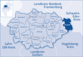
Neustadt is a town in the Marburg-Biedenkopf district in Hesse, Germany.
Oberaula is a municipality in the Schwalm-Eder district in Hesse, Germany.
Ottrau is a municipality in the Schwalm-Eder-Kreis in Hesse, Germany.
Schwarzenborn is the smallest town in Hesse, Germany. It lies in the Schwalm-Eder district some 13.5 km from Homberg in the Knüll. Through the constituent community of Grebenhagen flows the river Efze. The town consists of the two centres of Grebenhagen and Schwarzenborn.
Antrifttal is a municipality in the Vogelsbergkreis in Hesse, Germany.
Alheim is a municipality in Hersfeld-Rotenburg district in northeastern Hesse, Germany. It is named after nearby Alheimer Mountain. Alheim consist of 10 former souverain villages situated on both banks of the river Fulda.
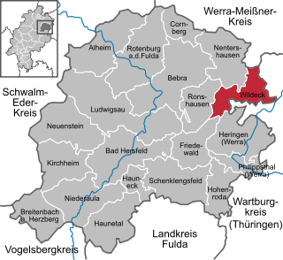
Wildeck is a municipality in Hersfeld-Rotenburg district in northeastern Hesse, Germany lying right at the boundary with Thuringia, 54 km southeast of Kassel.
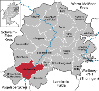
Niederaula is a market community in Hersfeld-Rotenburg district in northeastern Hesse, Germany, 59 km south of Kassel.
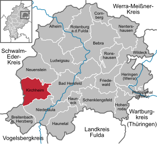
Kirchheim is a municipality in Hersfeld-Rotenburg district in northeastern Hesse, Germany.
Breitenbach am Herzberg is a municipality in southwesternmost Hersfeld-Rotenburg district in eastern Hesse, Germany.
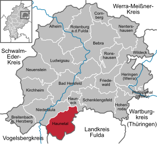
Haunetal is a municipality in Hersfeld-Rotenburg district in eastern Hesse, Germany. Haunetal is the district's southernmost municipality.
Hauneck is a municipality in Hersfeld-Rotenburg district in eastern Hesse, Germany.
Ludwigsau is a municipality in Hersfeld-Rotenburg district in northeastern Hesse, Germany. With an area of 112 km² it is Hesse's biggest community by land area.
Nentershausen is a municipality in Hersfeld-Rotenburg district in northeastern Hesse, Germany.
The County of Nidda (German: Grafschaft Nidda was a small county of the Holy Roman Empire centred on the city of Nidda in modern Wetteraukreis, Hesse. It was located on the northern edge of the Wetterau river valley and consisted of a relatively cohesive block of land held in fief from the Abbey of Fulda.