Related Research Articles

Soil erosion is the denudation or wearing away of the upper layer of soil. It is a form of soil degradation. This natural process is caused by the dynamic activity of erosive agents, that is, water, ice (glaciers), snow, air (wind), plants, and animals. In accordance with these agents, erosion is sometimes divided into water erosion, glacial erosion, snow erosion, wind (aeolian) erosion, zoogenic erosion and anthropogenic erosion such as tillage erosion. Soil erosion may be a slow process that continues relatively unnoticed, or it may occur at an alarming rate causing a serious loss of topsoil. The loss of soil from farmland may be reflected in reduced crop production potential, lower surface water quality and damaged drainage networks. Soil erosion could also cause sinkholes.

Stormwater, also written storm water, is water that originates from precipitation (storm), including heavy rain and meltwater from hail and snow. Stormwater can soak into the soil (infiltrate) and become groundwater, be stored on depressed land surface in ponds and puddles, evaporate back into the atmosphere, or contribute to surface runoff. Most runoff is conveyed directly as surface water to nearby streams, rivers or other large water bodies without treatment.
The Global Environment Facility (GEF) is a multilateral environmental fund that provides grants and blended finance for projects related to biodiversity, climate change, international waters, land degradation, persistent organic pollutants (POPs), mercury, sustainable forest management, food security, and sustainable cities in developing countries and countries with economies in transition. It is the largest source of multilateral funding for biodiversity globally and distributes more than $1 billion a year on average to address inter-related environmental challenges.

A gully is a landform created by running water, mass movement, or commonly a combination of both eroding sharply into soil or other relatively erodible material, typically on a hillside or in river floodplains or terraces.
Environmental issues in Pakistan include air pollution, water pollution, noise pollution, climate change, pesticide misuse, soil erosion, natural disasters, desertification and flooding. According to the 2020 edition of the environmental performance index (EPI) ranking released by Yale Center for Environmental Law & Policy, Pakistan ranks 142 with an EPI score of 33.1, an increase of 6.1 over a 10-year period. It ranked 180 in terms of air quality. The climatic changes and global warming are the most alarming issues risking millions of lives across the country. The major reasons of these environmental issues are carbon emissions, population explosion, and deforestation.

Surface runoff is the unconfined flow of water over the ground surface, in contrast to channel runoff. It occurs when excess rainwater, stormwater, meltwater, or other sources, can no longer sufficiently rapidly infiltrate in the soil. This can occur when the soil is saturated by water to its full capacity, and the rain arrives more quickly than the soil can absorb it. Surface runoff often occurs because impervious areas do not allow water to soak into the ground. Furthermore, runoff can occur either through natural or human-made processes.
Environmental issues in the Niger Delta are caused by its petroleum industry. The delta covers 20,000 km2 (7,700 sq mi) within wetlands of 70,000 km2 (27,000 sq mi) formed primarily by sediment deposition. Home to 20 million people and 40 different ethnic groups, this floodplain makes up 7.5% of Nigeria's total land mass. It is the largest wetland and maintains the third-largest drainage basin in Africa. The Delta's environment can be broken down into four ecological zones: coastal barrier islands, mangrove swamp forests, freshwater swamps, and lowland rainforests. Fishing and farming are the main sources of livelihoods for majority of her residents.

African environmental problems are problems caused by the direct and indirect human impacts on the natural environment and affect humans and nearly all forms of life in Africa. Issues include deforestation, soil degradation, air pollution, water pollution, coastal erosion, garbage pollution, climate change, Oil spills, Biodiversity loss, and water scarcity. These issues result in environmental conflict and are connected to broader social struggles for democracy and sovereignty. The scarcity of climate adaptation techniques in Africa makes it the least resilient continent to climate change.
Imo State is a state in the South-East geopolitical zone of Nigeria, bordered to the north by Anambra State, Rivers State to the west and south, and Abia State to the east. It takes its name from the Imo River which flows along the state's eastern border. The state capital is Owerri and the State's slogan is the "Eastern Heartland."
The extensive and rapid clearing of forests (deforestation) within the borders of Nigeria has significant impacts on both local and global scales.
There is a long and established framework for water resources management in Colombia. The Environment Ministry and up to 33 Regional Authorities, are in charge of water resources management and policies at the national and regional and watershed level, respectively. Other sectoral ministries are in charge of water demand for energy, water supply and sanitation and water for irrigation.

Ideato South is a Local Government Area in Imo State, South-eastern Nigeria. Ideato South, with a total of 23 autonomous communities has its headquarters in the town of Dikenafai, the source of Orashi River. Ideato South has an area of 88 km² and a population of 159,879 at the 2006 census. The postal code of the area is 475.

Auchi is a city in Edo State, Nigeria.
Umueshi is a community in Ideato South Local Government Area in Imo State, Nigeria. The community comprises 15 villages, including: Okorobi, Umuezeanuwai, Umunwangwu, Umuanajughi, Ukabi, Umuokwara, Umudieshi, Okoroikpa, Umuduruaku, Umudire, and Obinugwu.
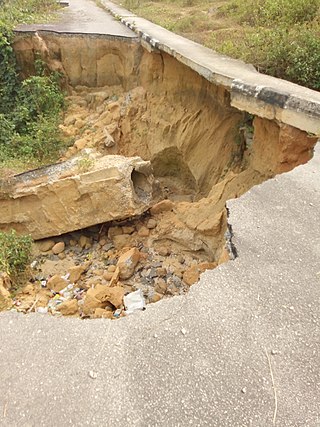
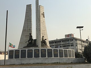
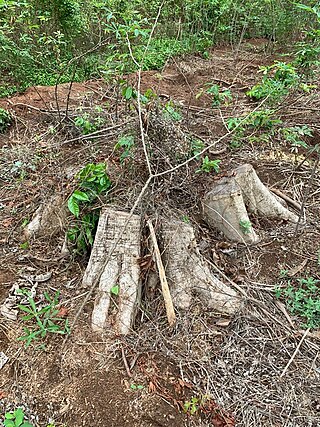
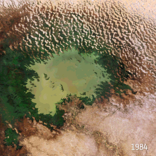
The Nigerian gully erosion crisis has been underway since before 1980. It is an ecological, environmental, economic, and humanitarian disaster resulting in land degradation, as well as the loss of lives and properties worth millions of dollars. The estimated number of gullies in the country is at 3,000.
Environmental issues in Sri Lanka include large-scale logging of forests and degradation of mangroves, coral reefs and soil. Air pollution and water pollution are challenges for Sri Lanka since both cause negative health impacts. Overfishing and insufficient waste management, especially in rural areas, leads to environmental pollution. Sri Lanka is also vulnerable to climate change impacts such as extreme weather events and sea level rise.
Climate Change in Nigeria is evident from temperature increase, rainfall variability. It is also reflected in drought, desertification, rising sea levels, erosion, floods, thunderstorms, bush fires, landslides, land degradation, more frequent, extreme weather conditions and loss of biodiversity. All of which continues to negatively affect human and animal life and also the ecosystems in Nigeria. Although, depending on the location, regions experience climate change with significant higher temperatures during the dry seasons while rainfalls during rainy seasons help keep the temperature at milder levels. The Effects of Climate Change prompted the World Meteorological Organization, in its 40th Executive Council 1988, to establish a new international scientific assessment panel to be called the International Panel on Climate Change (IPCC). The 2007 IPCC's fourth and final Assessment Report (AR4) revealed that there is a considerable threat of Climate Change that requires urgent global attention. The report further attributed the present global warming to largely anthropogenic practices. The Earth is almost at a point of no return as it faces environmental threats which include atmospheric and marine pollution, global warming, ozone depletion, the dangers of pollution by nuclear and other hazardous substances, and the extinction of various wildlife species.

The Chinese Loess Plateau, or simply the Loess Plateau, is a plateau in north-central China formed of loess, a clastic silt-like sediment formed by the accumulation of wind-blown dust. It is located southeast of the Gobi Desert and is surrounded by the Yellow River. It includes parts of the Chinese provinces of Qinghai, Gansu, Shaanxi and Shanxi. The depositional setting of the Chinese Loess Plateau was shaped by the tectonic movement in the Neogene period, after which strong southeast winds caused by the East Asian Monsoon transported sediment to the plateau during the Quaternary period. The three main morphological types in the Loess Plateau are loess platforms, ridges and hills, formed by the deposition and erosion of loess. Most of the loess comes from the Gobi Desert and other nearby deserts. The sediments were transported to the Loess Plateau during interglacial periods by southeasterly prevailing winds and winter monsoon winds. After the deposition of sediments on the plateau, they were gradually compacted to form loess under the arid climate.

Natural disasters in Nigeria are mainly related to the climate of Nigeria, which has been reported to cause loss of lives and properties. A natural disaster might be caused by flooding, landslides, and insect infestation, among others. To be classified as a disaster, there is needs to be a profound environmental effect or human loss which must lead to financial loss. This occurrence has become an issue of concern, threatening large populations living in diverse environments in recent years.
The Federal Ministry of Environment is a ministry of the Federal Government of Nigeria created in 1999 with a mandate to address environmental issues and to ensure the effective coordination of all environmental matters in the country. The ministry works to ensure the control of environmental issues and the protection and conservation of natural resources. It also formulates policies and supervises activities for curbing desertification and deforestation;the management of flood, erosion and pollution, as well as climate change and clean energy.
References
- ↑ "Nigeria Erosion and Watershed Management Project | eConservation". econservation.jrc.ec.europa.eu. Retrieved 2022-09-02.
- 1 2 "About Us – NEWMAP". newmap.gov.ng. Archived from the original on 2020-04-08. Retrieved 2018-03-08.
- ↑ "Federal Ministry of Environment - NEWMAP". environment.gov.ng. Retrieved 2018-03-08.
- ↑ "Plateau NEWMAP | Nigeria Erosion and Watershed Management Project". newmapplateau.org. Archived from the original on 2022-09-02. Retrieved 2022-09-02.
- ↑ "Projects : Nigeria Erosion and Watershed Management Project | The World Bank". projects.worldbank.org. Retrieved 2018-03-08.
- ↑ "Home". Delta State Nigeria Erosion and Watershed Management Project. Retrieved 2024-08-09.
- ↑ "NEWMAP – Channels Television" . Retrieved 2022-09-02.
- ↑ "Nigeria - Erosion and Watershed Management Project : resettlement plan (Vol. 8) : Resettlement action plan for Eziala-Obizi gully erosion site Ezinihitte Mbaise, Imo state". World Bank. Retrieved 2022-09-02.