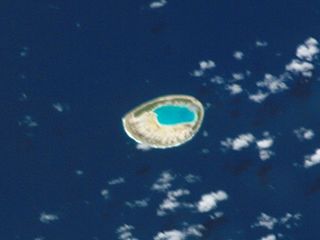
Tepoto Atoll, or Ti Poto, is a small atoll of the Tuamotu Archipelago in French Polynesia. It is located 44 kilometres southwest of Makemo Atoll.

Mataiva, Tepoetiriura or Lazarev atoll is a coral atoll in the Tuamotu Archipelago. It is located in the Palliser group, and is the westernmost of the Tuamotus. The nearest atoll, Tikehau, is located 35 km to the east. Rangiroa is located 79 km to the east, and Tahiti is 311 km to the south.
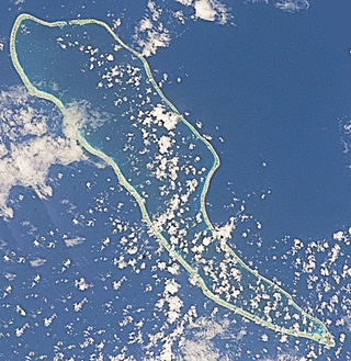
Hao, or Haorangi, is a large coral atoll in the central part of the Tuamotu Archipelago. It has c. 1000 people living on 35 km2 (14 sq mi). It was used to house the military support base for the nuclear tests on Mururoa. Because of its shape, French explorer Louis Antoine de Bougainville named it "Île de la Harpe".

Amanu, Timanu, or Karere, is an atoll in the Tuamotu archipelago. Amanu lies at right angles to neighbouring Hao Atoll; this orientation is quite rare for the Tuamotu atolls.
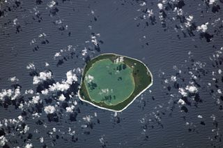
Niau is a small atoll in French Polynesia, in the commune of Fakarava. This atoll has a broad fringing reef, a diameter of 8 km and an area of 53 km2.

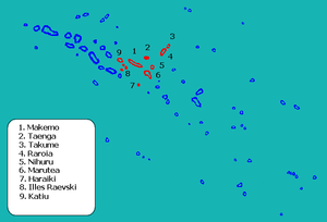
Makemo, Rangi-kemo or Te Paritua, is an inhabited atoll in the Tuamotu archipelago in French Polynesia.

Raroia, or Raro-nuku, is an atoll of the Tuamotus chain in French Polynesia, located 740 km northeast of Tahiti and 6 km southwest of Takume. Administratively it is a part of the commune of Makemo.
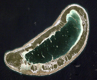
Fangatau, or Nakai-erua, is a small atoll in the Tuamotu group in French Polynesia. The nearest land is Fakahina Atoll, located 72 km to the ESE. This small atoll has an elongated shape. Its length is 8 kilometres, maximum width 3.5 kilometres. It has a total area of 22.2 square kilometres, land area 5.9 km2. Its reef encloses its lagoon completely. Anchorage is difficult. Fangatau Atoll has 150 inhabitants. Teana is the main village.

Takume or Pukamaru is an atoll of the Tuamotus chain in French Polynesia, located 790 km northeast of Tahiti and 6 km northeast of Raroia and 128 kilometres to the west of Fangatau.

Marutea, or Taunga tauranga-e-havana, is one of the Tuamotu atolls in French Polynesia. It is located 24 km to the southeast of Makemo Atoll and 30 km southwest of Nihiru Atoll.
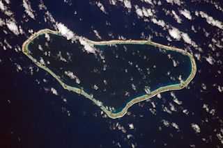
Taenga, or Taunga-hara, is one of the Tuamotu atolls in French Polynesia. It is located 32 km to the northeast of Makemo Atoll and 27 km to the northwest of Nihiru Atoll.

Maria Atoll is an uninhabited small atoll of the Tuamotu group in French Polynesia. It is located in the far southeast of the archipelago, about 72 km (45 mi) southwest from Marutea Sud. Maria's closest neighbour is the small atoll of Matureivavao of the Acteon Group, 56 km (35 mi) to the northwest.

Marutea Atoll, also known as Lord Hood Island, Marutea-i-runga, and Nuku-nui, is an atoll in the far southeast of the Tuamotu group of French Polynesia. It lies in the east-northeast part of the Gambier (commune), about 72 km northeast from Maria Atoll.

Haraiki is a small atoll of the Tuamotu Archipelago in French Polynesia. It is located 42 km southwest of Marutea Nord.

Hiti, or Hiti-rau-mea, is a small atoll of the Tuamotu Archipelago in French Polynesia. It is located 19 km southwest of Makemo Atoll.

Tuanake or Mata-rua-puna is a small atoll located in the Tuamotu Archipelago in French Polynesia. It made up the Raevski Islands subgroup with Tepoto Sud and Hiti. It is administratively attached to the municipality of Makemo.

Katiu, or Taungataki, is an atoll of the central Tuamotu Archipelago in French Polynesia. It is located 23.5 kilometres west of Makemo Atoll's westernmost point. It measures 27 kilometres in length with a maximum width of 12.5 kilometres. Its total area, including the lagoon is 232.5 square kilometres and a land area of approximately 10 square kilometres. There are many narrow islands on the north-eastern side of its long reef with a total land area of about 3 square kilometres. Its lagoon is connected to the ocean.

Tahanea Atoll is an uninhabited atoll of the Tuamotu Archipelago in French Polynesia. It is located 12 kilometres to the east of Faaite Atoll.

Gambier is a commune of French Polynesia in the administrative subdivision of the Tuamotu-Gambier Islands. The commune includes the Gambier Islands as well as several atolls in the Tuamotu Archipelago. All the Tuamotu atolls belonging to the commune are uninhabited except for Marutea Sud, and are sometimes mistakenly included among the Gambier Islands themselves. The commune population was 1,570 at the 2022 census. Its total land area is 45.97 km2.


