
The Tuamotu Archipelago or the Tuamotu Islands are a French Polynesian chain of just under 80 islands and atolls in the southern Pacific Ocean. They constitute the largest chain of atolls in the world, extending over an area roughly the size of Western Europe. Their combined land area is 850 square kilometres. This archipelago's major islands are Anaa, Fakarava, Hao and Makemo.
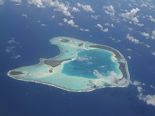
Tetiʻaroa is an atoll in the Windward group of the Society Islands of French Polynesia, an overseas territorial collectivity of France in the Pacific Ocean. Once the vacation spot for Tahitian royalty, the islets are under a 99-year lease contracted by Marlon Brando, and are home to The Brando Resort.

The Tuamotu sandpiper is an endangered member of the large wader family Scolopacidae, that is endemic to the Tuamotu Islands in French Polynesia. It is sometimes placed in the monotypic genus Aechmorhynchus. A native name, apparently in the Tuamotuan language, is kivi-kivi.
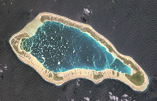
Napuka, or Pukaroa, is a small coral atoll in the Disappointment Islands, in the northeastern part of the Tuamotu Archipelago in French Polynesia. It is located only 15 km to the southeast of Tepoto Nord, its nearest neighbor, forming a small group. These two atolls are quite isolated, the nearest land being Fangatau Atoll 170 km to the south.
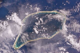
Ahe, Ahemaru or Omaru, is a coral atoll in the northern Tuamotu Archipelago, 14 km to the west of Manihi, in French Polynesia. Its ring shape is broken by only a single small passage into the lagoon. It has a land area of approximately 12 km2 and a lagoon area of 138 km2. As of 2012, Ahe Atoll had 553 inhabitants. The only village in Ahe is Tenukupara with approximately 100 inhabitants. It is located on an island in the south side of the Atoll.
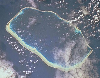
Toau, Pakuria, or Taha-a-titi is a coral atoll in French Polynesia, one of the Palliser Islands. Toau has a wide lagoon; length 35 kilometres, width 18 kilometres. The nearest land is Fakarava Atoll, located 14 kilometres to the southeast.

Tenararo is the smallest atoll in the Acteon Group in the southeastern part of the Tuamotu Islands in French Polynesia. It is administratively a part of the Gambier Islands. It is uninhabited.

Anaa, Nganaa-nui is an atoll in the Tuamotu archipelago, in French Polynesia. It is located in the north-west of the archipelago, 350 km to the east of Tahiti. It is oval in shape, 29.5 km in length and 6.5 km wide, with a total land area of 38 km2 and a population of 504. The atoll is made up by eleven small barren islands with deeper and more fertile soil than other atolls in the Tuamotus. The lagoon is shallow, without entrance, and formed by three main basins. Although it does not have any navigable access, the water of the lagoon renews by several small channels that can be crossed walking.

Amanu, Timanu, or Karere, is an atoll in the Tuamotu archipelago. Amanu lies at right angles to neighbouring Hao Atoll; this orientation is quite rare for the Tuamotu atolls.
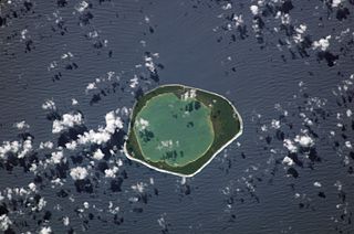
Niau is a small atoll in French Polynesia, in the commune of Fakarava. This atoll has a broad fringing reef, a diameter of 8 km and an area of 53 km2.
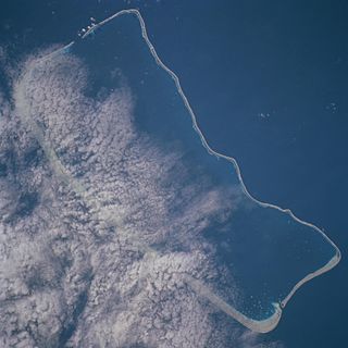
Fakarava, Havaiki-te-araro, Havai'i or Farea is an atoll in the west of the Tuamotu group in French Polynesia. It is the second largest of the Tuamotu atolls. The nearest land is Toau, a coral atoll which lies 14 kilometres to the northwest.

Reao or Natūpe is an atoll in the eastern expanses of the Tuamotu group in French Polynesia. The closest land is Pukarua Atoll, located 48 km to the WNW.

Tikehau or Porutu-kai is a coral atoll in the Palliser Islands group, part of the Tuamotu Archipelago in French Polynesia. It is included in the commune of Rangiroa.
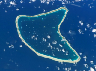
Aratika is an atoll in the Tuamotu group in French Polynesia. The nearest land is Kauehi Atoll, located 35 km to the south east.
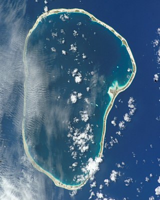
Kauehi, or Putake, is an atoll in the Tuamotu group in French Polynesia. The nearest land is Raraka Atoll, located 17 km to the Southeast. Kauehi has a wide lagoon measuring 24 km by 18 km. The atoll has a lagoon area of 320 km2 (124 sq mi), and a land area of 16 km2 (6 sq mi). Kauehi's lagoon has one navigable pass.

Tuanake or Mata-rua-puna is a small atoll located in the Tuamotu Archipelago in French Polynesia. It made up the Raevski Islands subgroup with Tepoto Sud and Hiti. It is administratively attached to the municipality of Makemo.

Manuhangi is an atoll of the Tuamotu Archipelago in French Polynesia. It is located 68 km southeast of Nengonengo, 52 km west of Paraoa and 845 km east of Tahiti.

Raraka, or Te Marie, is an atoll in the west of the Tuamotu group in French Polynesia. It lies 17 km to the southeast of Kauehi Atoll.

The flora of French Polynesia refers to the native vegetation of the Marquesas Islands, the Tuamotu Archipelago, the Society Islands and the Tubuai Islands, located in Oceania. Due to its type of vegetation, French Polynesia falls within the palaeotropic floral kingdom.

The Tuamotu tropical moist forests is a tropical and subtropical moist broadleaf forests ecoregion in the Tuamotu Archipelago of French Polynesia and the Pitcairn Islands.


