Nijmegen Quarter

Last updated
Nijmegen Quarter by Frederik de Wit, ca 1650 Kwartier van Nijmegen Frederik de Wit ca1650.jpg
Nijmegen Quarter by Frederik de Wit, ca 1650

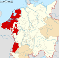
The Nijmegen Quarter (Dutch: Kwartier van Nijmegen) was the first of the four quarters in which the county, later Duchy of Guelders was divided, as they were separated by rivers. In addition Guelders consisted of Zutphen Quarter, the Upper Quarter and Veluwe Quarter. [1] Each quarter had its own capital.

Geography

Nijmegen Quarter, Zutphen Quarter and Veluwe Quarter are the three downstream Lower Quarters that seceded in 1581 to the Dutch Republic, and constitute the present day Dutch province of Gelderland. Nijmegen Quarter with its capital at the city of Nijmegen, included the area between the Meuse and Rhine with the exception of the Cleves enclave Huissen and the independent counties of Buren and Culemborg, that were much later seceded to the Netherlands. [2] The quarter was divided in Nijmegen, Rijk van Nijmegen, Land of Maas and Waal, the Bommelerwaard and Betuwe. The main cities were then Nijmegen, Tiel and Zaltbommel. The quarter had a private university in Nijmegen. [3]

Notes and references

  1. Prak, M.; Webb, D. (2005). The Dutch Republic in the Seventeenth Century: The Golden Age. Cambridge University Press. ISBN   9780521843522.
  2. Nijsten, G. (2004). In the Shadow of Burgundy: The Court of Guelders in the Late Middle Ages. Cambridge University Press. ISBN   9780521820752.
  3. Van Berkel, K.; Van Helden, A.; Palm, L.C. (1999). The History of Science in the Netherlands: Survey, Themes and Reference. Brill. ISBN   9789004100060.

Related Research Articles

<span class="mw-page-title-main">Dutch Republic</span> Predecessor state of the Netherlands (1581–1795)

The United Provinces of the Netherlands, officially the Republic of the Seven United Netherlands, and commonly referred to in historiography as the Dutch Republic, was a confederation that existed from 1579 until the Batavian Revolution in 1795. It was a predecessor state of the present-day Netherlands, and the first independent Dutch state. The republic was established after seven Dutch provinces in the Spanish Netherlands revolted against Spanish rule, forming a mutual alliance against Spain in 1579 and declaring their independence in 1581. It comprised Groningen, Frisia, Overijssel, Guelders, Utrecht, Holland, and Zeeland.

The Union of Utrecht was a treaty signed on 23 January 1579 in Utrecht, Netherlands, unifying the northern provinces of the Netherlands, until then under the control of Habsburg Spain.

<span class="mw-page-title-main">Arnhem</span> City and municipality in Gelderland, Netherlands

Arnhem is a city and municipality situated in the eastern part of the Netherlands, near the German border. It is the capital of the province of Gelderland, located on both banks of the rivers Nederrijn and Sint-Jansbeek, which was the source of the city's development.

<span class="mw-page-title-main">Gelderland</span> Province of the Netherlands

Gelderland, also known as Guelders in English, is a province of the Netherlands, occupying the centre-east of the country. With a total area of 5,136 km2 (1,983 sq mi) of which 176 km2 (68 sq mi) is water, it is the largest province of the Netherlands by land area, and second by total area. Gelderland shares borders with six other provinces and the German state of North Rhine-Westphalia.

<span class="mw-page-title-main">Zutphen</span> City and municipality in Gelderland, Netherlands

Zutphen is a city and municipality located in the province of Gelderland, Netherlands. It lies some 30 km northeast of Arnhem, on the eastern bank of the river IJssel at the point where it is joined by the Berkel. First mentioned in the 11th century, the place-name appears to mean "south fen". In 2005, the municipality of Zutphen was merged with the municipality of Warnsveld, retaining its name. In 2021, the municipality had a population of 48,111.

<span class="mw-page-title-main">Duchy of Guelders</span> Historical county in the Low Countries

The Duchy of Guelders is a historical duchy, previously county, of the Holy Roman Empire, located in the Low Countries.

<span class="mw-page-title-main">Seventeen Provinces</span> Union of states in the Netherlands in the 15th and 16th centuries

The Seventeen Provinces were the Imperial states of the Habsburg Netherlands in the 16th century. They roughly covered the Low Countries, i.e., what is now the Netherlands, Belgium, Luxembourg, and most of the French departments of Nord and Pas-de-Calais (Artois). Also within this area were semi-independent fiefdoms, mainly ecclesiastical ones, such as Liège, Cambrai and Stavelot-Malmedy.

<span class="mw-page-title-main">Roermond</span> City and municipality in Limburg, Netherlands

Roermond is a city, municipality, and diocese in the Limburg province of the Netherlands. Roermond is a historically important town on the lower Roer on the east bank of the river Meuse. It received town rights in 1231. Roermond's town centre has become a designated conservation area.

<span class="mw-page-title-main">Grave, Netherlands</span> City and former municipality in North Brabant, Netherlands

Grave is a city and former municipality in the Dutch province of North Brabant. The former municipality had a population of 12,486 in 2021. Grave is a member of the Dutch Association of Fortified Cities.

<span class="mw-page-title-main">Spanish Netherlands</span> Historical region of the Low Countries (1556–1714)

Spanish Netherlands was the Habsburg Netherlands ruled by the Spanish branch of the Habsburgs from 1556 to 1714. They were a collection of States of the Holy Roman Empire in the Low Countries held in personal union by the Spanish Crown. This region comprised most of the modern states of Belgium and Luxembourg, as well as parts of northern France, the southern Netherlands, and western Germany with the capital being Brussels. The Army of Flanders was given the task of defending the territory.

<span class="mw-page-title-main">County of Zutphen</span>

The County of Zutphen, located in modern-day Gelderland, a province of the Netherlands, was formed in the eleventh century as a fief of the Bishop of Utrecht. It was ruled by the Counts of Zutphen between 1046 and 1138, and then formed a personal union with Guelders. Later, it became one of the 4 quarters of Guelders. After the Act of Abjuration, the three Dutch quarters merged their representation in the Staten of Guelders and Zutphen with a joint delegation to the States General of the Netherlands, effectively ending Zutphen individuality. The name Graafschap (county) is still used for the Achterhoek, the region east of Zutphen, and for the football club De Graafschap from this region.

<span class="mw-page-title-main">Burgundian Circle</span> Imperial circle of the Holy Roman Empire

The Burgundian Circle was an Imperial Circle of the Holy Roman Empire created in 1512 and significantly enlarged in 1548. In addition to the Free County of Burgundy, the Burgundian Circle roughly covered the Low Countries, i.e., the areas now known as the Netherlands, Belgium and Luxembourg and adjacent parts in the French administrative region of Nord-Pas-de-Calais. For most of its history, its lands were coterminous with the holdings of the Spanish Habsburgs in the Empire.

<span class="mw-page-title-main">Habsburg Netherlands</span> Entire period of Habsburg rule in the Low Countries (1482-1797)

Habsburg Netherlands was the Renaissance period fiefs in the Low Countries held by the Holy Roman Empire's House of Habsburg. The rule began in 1482, when the last Valois-Burgundy ruler of the Netherlands, Mary, wife of Maximilian I of Austria, died. Their grandson, Emperor Charles V, was born in the Habsburg Netherlands and made Brussels one of his capitals.

<span class="mw-page-title-main">Reginald II, Duke of Guelders</span>

Reginald II of Guelders, called "the Black", was Count of Guelders, and from 1339 onwards Duke of Guelders, and Zutphen, in the Low Countries, from 1326 to 1343. He was the son of Reginald I of Guelders and Marguerite of Flanders.

<span class="mw-page-title-main">William I of Guelders and Jülich</span> Duke of Guelders

William was Duke of Guelders, as William I, from 1377 and Duke of Jülich, as William III, from 1393. William was known for his military activities, participating in the Prussian crusade five times and battling with neighbors in France and Brabant throughout his rule. His allies included Holy Roman Emperors, Charles IV and Wenceslaus, Richard II of England, and Conrad Zöllner von Rothenstein, the Grand Master of the Teutonic Knights. During his reign the duchies of Guelders and Jülich were temporarily unified.

<span class="mw-page-title-main">Upper Guelders</span>

Upper Guelders or Spanish Guelders was one of the four quarters in the Imperial Duchy of Guelders. In the Dutch Revolt, it was the only quarter that did not secede from the Habsburg monarchy to become part of the Seven United Netherlands, but remained under Spanish rule during the Eighty Years' War.

<span class="mw-page-title-main">Siege of IJsseloord</span> 1585 siege

The siege of IJsseloord or the capture of Arnhem was a siege that took place between the 6 and 15 October 1585 at Arnhem during the Eighty Years' War and the Anglo-Spanish War (1585–1604). The Dutch and English were victorious when the sconce of IJsseloord after seven days capitulated and Arnhem fell into their hands.

<span class="mw-page-title-main">Siege of Zutphen (1591)</span>

The siege of Zutphen was an eleven-day siege of the city of Zutphen by Dutch and English troops led by Maurice of Nassau, during the Eighty Years' War and the Anglo–Spanish War. The siege began on 19 May 1591 after a clever ruse by the besiegers. The city was then besieged for eleven days, after which the Spanish garrison surrendered.

<span class="mw-page-title-main">Veluwe Quarter</span>

Veluwe Quarter was one of the four quarters in the Duchy of Guelders, besides Quarter of Zutphen, Upper Quarter and Nijmegen Quarter. Veluwe Quarter had Arnhem as its capital and included the Veluwe area. The main cities were Elburg, Hattem, Harderwijk and Wageningen. Its location was west of the river IJssel and north of the river Rhine.

<span class="mw-page-title-main">Siege of Nijmegen (1591)</span> Siege that was part of the Eighty Years War

The siege of Nijmegen was a military engagement during the Eighty Years' War and the Anglo–Spanish War which took place from 17 to 21 October 1591. The Spanish garrison in Nijmegen was besieged by a Dutch and English force under Maurice of Nassau and Francis Vere respectively and surrendered soon.