Kuznetsk is a town in Penza Oblast, Russia, located in the foothills of the Volga Upland, mainly on the left bank of the Truyov River. Population: 88,839 (2010 Census); 92,050 (2002 Census); 98,588 (1989 Census).

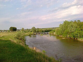
Kamenka is a town and the administrative center of Kamensky District in Penza Oblast, Russia, located on the Atmis River 80 kilometers (50 mi) west of Penza, the administrative center of the oblast. Population: 39,577 (2010 Census); 40,712 (2002 Census); 27,235 (1989 Census); 30,000 (1970).

Nikolsk is a town and the administrative center of Nikolsky District in Penza Oblast, Russia, located on the Vyrgan River 120 kilometers (75 mi) northeast of Penza, the administrative center of the oblast. Population: 22,471 (2010 Census); 24,061 (2002 Census); 26,871 (1989 Census).

Bashmakovsky District is an administrative and municipal district (raion), one of the twenty-seven in Penza Oblast, Russia. It is located in the west of the oblast. The area of the district is 1,618 square kilometers (625 sq mi). Its administrative center is the urban locality of Bashmakovo. Population: 23,304 ; 25,159 (2002 Census); 28,032 (1989 Census). The population of Bashmakovo accounts for 44.7% of the district's total population.
Bekovsky District is an administrative and municipal district (raion), one of the twenty-seven in Penza Oblast, Russia. It is located in the southwest of the oblast. The area of the district is 1,016 square kilometers (392 sq mi). Its administrative center is the urban locality of Bekovo. As of the 2010 Census, the total population of the district was 17,531, with the population of Bekovo accounting for 39.6% of that number.

Gorodishchensky District is an administrative and municipal district (raion), one of the twenty-seven in Penza Oblast, Russia. It is located in the east of the oblast. The area of the district is 2,053 square kilometers (793 sq mi). Its administrative center is the town of Gorodishche. Population: 52,480 ; 53,125 (2002 Census); 58,266 (1989 Census). The population of Gorodishche accounts for 15.4% of the district's total population.

Issinsky District is an administrative and municipal district (raion), one of the twenty-seven in Penza Oblast, Russia. It is located in the north of the oblast. The area of the district is 926.3 square kilometers (357.6 sq mi). Its administrative center is the urban locality of Issa. Population: 11,157 ; 12,611 (2002 Census); 14,746 (1989 Census). The population of Issa accounts for 48.6% of the district's total population.

Kamensky District is an administrative and municipal district (raion), one of the twenty-seven in Penza Oblast, Russia. It is located in the western central part of the oblast. The area of the district is 2,174 square kilometers (839 sq mi). Its administrative center is the town of Kamenka. Population: 62,322 ; 24,275 (2002 Census); 27,235 (1989 Census). The population of Kamenka accounts for 63.5% of the district's total population.

Kameshkirsky District is an administrative and municipal district (raion), one of the twenty-seven in Penza Oblast, Russia. It is located in the southeast of the oblast. The area of the district is 1,270 square kilometers (490 sq mi). Its administrative center is the rural locality of Russky Kameshkir. Population: 12,802 ; 14,404 (2002 Census); 16,733 (1989 Census). The population of Russky Kameshkir accounts for 41.9% of the district's total population.

Kolyshleysky District is an administrative and municipal district (raion), one of the twenty-seven in Penza Oblast, Russia. It is located in the south of the oblast. The area of the district is 1,685 square kilometers (651 sq mi). Its administrative center is the urban locality of Kolyshley. Population: 26,187 ; 27,751 (2002 Census); 29,125 (1989 Census). The population of Kolyshley accounts for 31.7% of the district's total population.

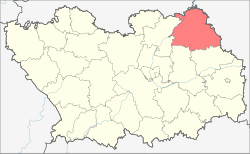
Kuznetsky District is an administrative and municipal district (raion), one of the twenty-seven in Penza Oblast, Russia. It is located in the east of the oblast. The area of the district is 2,071 square kilometers (800 sq mi). Its administrative center is the town of Kuznetsk. Population: 38,056 ; 41,712 (2002 Census); 41,597 (1989 Census).

Mokshansky District is an administrative and municipal district (raion), one of the twenty-seven in Penza Oblast, Russia. It is located in the north of the oblast. The area of the district is 2,200 square kilometers (850 sq mi). Its administrative center is the urban locality of Mokshan. Population: 28,033 ; 30,929 (2002 Census); 33,008 (1989 Census). The population of Mokshan accounts for 41.4% of the district's total population.

Nizhnelomovsky District is an administrative and municipal district (raion), one of the twenty-seven in Penza Oblast, Russia. It is located in the northwest of the oblast. The area of the district is 1,760 square kilometers (680 sq mi). Its administrative center is the town of Nizhny Lomov. Population: 41,974 ; 46,540 (2002 Census); 25,510 (1989 Census). The population of Nizhny Lomov accounts for 54.0% of the district's total population.

Pachelmsky District is an administrative and municipal district (raion), one of the twenty-seven in Penza Oblast, Russia. It is located in the west of the oblast. The area of the district is 1,300 square kilometers (500 sq mi). Its administrative center is the urban locality of Pachelma. As of the 2010 Census, the total population of the district was 16,310, with the population of Pachelma accounting for 49.4% of that number.

Penzensky District is an administrative and municipal district (raion), one of the twenty-seven in Penza Oblast, Russia. It is located in the center of the oblast. The area of the district is 2,823.8 square kilometers (1,090.3 sq mi). Its administrative center is the rural locality of Kondol. Population: 51,308 ; 41,318 (2002 Census); 41,323 (1989 Census). The population of Kondol accounts for 6.5% of the district's total population.

Serdobsky District is an administrative and municipal district (raion), one of the twenty-seven in Penza Oblast, Russia. It is located in the southwest of the oblast. The area of the district is 1,695 square kilometers (654 sq mi). Its administrative center is the town of Serdobsk. Population: 54,520 ; 21,917 (2002 Census); 21,289 (1989 Census). The population of Serdobsk accounts for 64.9% of the district's total population.

Shemysheysky District is an administrative and municipal district (raion), one of the twenty-seven in Penza Oblast, Russia. It is located in the southeastern central part of the oblast. The area of the district is 1,688 square kilometers (652 sq mi). Its administrative center is the urban locality of Shemysheyka. Population: 17,661 ; 19,063 (2002 Census); 22,714 (1989 Census). The population of Shemysheyka accounts for 36.9% of the district's total population.

Spassky District is an administrative and municipal district (raion), one of the twenty-seven in Penza Oblast, Russia. It is located in the northwest of the oblast. The area of the district is 693.3 square kilometers (267.7 sq mi). Its administrative center is the town of Spassk. Population: 13,008 ; 13,827 (2002 Census); 15,475 (1989 Census). The population of Spassk accounts for 57.2% of the district's total population.

Tamalinsky District is an administrative and municipal district (raion), one of the twenty-seven in Penza Oblast, Russia. It is located in the southwest of the oblast. The area of the district is 1,236 square kilometers (477 sq mi). Its administrative center is the urban locality of Tamala. Population: 16,503 ; 19,083 (2002 Census); 21,289 (1989 Census). The population of Tamala accounts for 45.3% of the district's total population.

Zemetchinsky District is an administrative and municipal district (raion), one of the twenty-seven in Penza Oblast, Russia. It is located in the northwest of the oblast. The area of the district is 2,103.2 square kilometers (812.1 sq mi). Its administrative center is the urban locality of Zemetchino. Population: 24,674 ; 31,072 (2002 Census); 38,566 (1989 Census). The population of Zemetchino accounts for 43.7% of the district's total population.