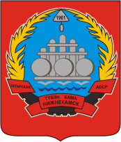
Nizhnekamsk

Last updated • 1 min readFrom Wikipedia, The Free Encyclopedia

Nizhnekamsk
Нижнекамск
Other transcription(s)
  TatarТүбəн Кама
Nizhnekamsk.jpg
Skyline
Flag of Nizhnekamsk rayon (Tatarstan).svg
Coat of Arms of Nizhnekamsk (Tatarstan) (2006).png
Location of Nizhnekamsk
Nizhnekamsk
Russia administrative location map.svg
Red pog.svg
Nizhnekamsk
Location of Nizhnekamsk
Outline Map of Tatarstan.svg
Red pog.svg
Nizhnekamsk
Nizhnekamsk (Tatarstan)
Coordinates: 55°38′N51°49′E / 55.633°N 51.817°E / 55.633; 51.817
Country Russia
Federal subject Tatarstan [1]
Founded1961
Government
  MayorRamil Mullin(Рамиль Муллин)
Elevation
120 m (390 ft)
Population
  Total234,044
  Rank 82nd in 2010
  Subordinated to city of republic significance of Nizhnekamsk [1]
   Capital ofcity of republic significance of Nizhnekamsk, [1] Nizhnekamsky District [1]
   Municipal district Nizhnekamsky Municipal District [3]
  Urban settlementNizhnekamsk Urban Settlement [3]
   Capital ofNizhnekamsky Municipal District, [3] Nizhnekamsk Urban Settlement [3]
Time zone UTC+3 (MSK   OOjs UI icon edit-ltr-progressive.svg [4] )
Postal code(s) [5]
423570
Dialing code(s) +7 8555
OKTMO ID92644101001
1975 coat of arms of Nizhnekamsk Coat of Arms of Nizhnekamsk (Tatarstan) (1975).png
1975 coat of arms of Nizhnekamsk

Nizhnekamsk (Russian : Нижнекамск, IPA: [nʲɪʐnʲɪˈkamsk] ; Tatar : Түбән Кама) is a city in Tatarstan, Russia, located to the south of the Kama River between the cities of Naberezhnye Chelny and Chistopol. Population: 241,479(2021 Census); [6] 234,044(2010 Census); [2] 225,399(2002 Census); [7] 190,793(1989 Soviet census). [8]

Contents

Historical population
YearPop.±%
197048,988    
1979134,199+173.9%
1989190,793+42.2%
2002225,399+18.1%
2010234,044+3.8%
2021241,479+3.2%
Source: Census data

History

As its population increased, spurred by the construction of Nizhnekamskneftekhim petrochemical industrial complex, Nizhnekamsk was granted city status in 1966.

Administrative and municipal status

Within the framework of administrative divisions, Nizhnekamsk serves as the administrative center of Nizhnekamsky District, even though it is not a part of it. [1] As an administrative division, it is, together with three rural localities, incorporated separately as the city of republic significance of Nizhnekamsk—an administrative unit with the status equal to that of the districts. [1] As a municipal division, the city of republic significance of Nizhnekamsk is incorporated within Nizhnekamsky Municipal District as Nizhnekamsk Urban Settlement. [3]

Economy

The city is an important center of the petrochemical industry (Nizhnekamskneftekhim plant). It is served by the Begishevo Airport.

Demographics

Ethnic composition (as of 1989):[ citation needed ]

Sports

HC Neftekhimik Nizhnekamsk is an ice hockey team based in Nizhnekamsk, playing in the Kontinental Hockey League.

Related Research Articles

<span class="mw-page-title-main">Leninogorsk, Russia</span> Town in the Republic of Tatarstan, Russia

Leninogorsk is a town in the Republic of Tatarstan, Russia, located 322 kilometers (200 mi) southeast of Kazan. Population: 64,127 (2010 Census); 65,592 (2002 Census); 62,093 (1989 Soviet census).

<span class="mw-page-title-main">Mendeleyevsk</span> Town in the Republic of Tatarstan, Russia

Mendeleyevsk is a town and the administrative center of Mendeleyevsky District in the Republic of Tatarstan, Russia, located on the right bank of Nizhnekamskoye Reservoir, 238 kilometers (148 mi) from the republic's capital of Kazan. As of the 2010 Census, its population was 22,075.

<span class="mw-page-title-main">Aznakayevo</span> Town in the Republic of Tatarstan, Russia

Aznakayevo is a town in the Republic of Tatarstan, Russia, located on the Styarlya River, 376 kilometers (234 mi) southeast from Kazan. Population: 34,853 (2010 Census); 35,412 (2002 Census); 32,171 (1989 Soviet census).

<span class="mw-page-title-main">Nurlat</span> Town in the Republic of Tatarstan, Russia

Nurlat is a town in the Republic of Tatarstan, Russia, located on the Kondurcha River, 268 kilometers (167 mi) southeast of Kazan. Population: 32,601 (2010 Census); 32,527 (2002 Census); 23,507 (1989 Soviet census).

<span class="mw-page-title-main">Mamadysh</span> Town in the Republic of Tatarstan, Russia

Mamadysh is a town and the administrative center of Mamadyshsky District in the Republic of Tatarstan, Russia, located on the Vyatka River, 167 kilometers (104 mi) from the republic's capital of Kazan. As of the 2010 Census, its population was 14,435.

<span class="mw-page-title-main">Bavly</span> Town in the Republic of Tatarstan, Russia

Bavly is a town in the Tatarstan, Russia, located on the Bavly River, 369 kilometers (229 mi) southeast of Kazan. Population: 22,109 (2010 Census); 22,939 (2002 Census); 20,025 (1989 Soviet census).

Aksubayevo is an urban locality and the administrative center of Aksubayevsky District in the Republic of Tatarstan, Russia, located on the banks of the Malaya Sulcha River, 150 kilometers (93 mi) southeast of the republic's capital of Kazan. As of the 2010 Census, its population was 10,008.

Alexeyevskoye is an urban locality and the administrative center of Alexeyevsky District in the Republic of Tatarstan, Russia, located on the Kama River on the left bank of the Kuybyshev Reservoir. As of the 2010 Census, its population was 11,224.

Kamskoye Ustye is an urban locality and the administrative center of Kamsko-Ustyinsky District in the Republic of Tatarstan, Russia, located on the Kuybyshev Reservoir, near the confluence of the Volga and Kama Rivers, 117 kilometers (73 mi) from the republic's capital of Kazan. As of the 2010 Census, its population was 4,482.
<span class="mw-page-title-main">Nizhnyaya Maktama</span> Urban-type settlement in Tatarstan, Russia

Nizhnyaya Maktama is an urban locality in Almetyevsky District of the Republic of Tatarstan, Russia. As of the 2010 Census, its population was 9,924.

Aktyubinsky is an urban locality in Aznakayevsky District of the Republic of Tatarstan, Russia, located on the Leninogorsk–Aznakayevo auto route, 21 kilometers (13 mi) west of Aznakayevo. As of the 2010 Census, its population was 9,237.
<span class="mw-page-title-main">Kamskiye Polyany</span> Urban-type settlement in Tatarstan, Russia

Kamskiye Polyany is an urban locality in Nizhnekamsky District of the Republic of Tatarstan, Russia, located on the left bank of the Kama River, 37 kilometers (23 mi) southwest of Nizhnekamsk, the administrative center of the district. As of the 2010 Census, its population was 15,795.

Bogatye Saby is an urban locality and the administrative center of Sabinsky District in the Republic of Tatarstan, Russia, located on the Saby River, 98 kilometers (61 mi) from the republic's capital of Kazan. As of the 2010 Census, its population was 7,671.

<span class="mw-page-title-main">Dzhalil (urban-type settlement)</span> Urban-type settlement in Tatarstan, Russia

Dzhalil is an urban locality in Sarmanovsky District of the Republic of Tatarstan, Russia, located near the source of the Menzelya River, 35 kilometers (22 mi) south of Sarmanovo, the administrative center of the district. As of the 2010 Census, its population was 13,937.

Bolshaya Atnya is a rural locality and the administrative center of Atninsky District of the Republic of Tatarstan, Russia. Population: 3,536 (2010 Census); 3,651 (2002 Census);

Novosheshminsk is a rural locality and the administrative center of Novosheshminsky District of the Republic of Tatarstan, Russia. Population: 4,561 (2010 Census); 4,576 (2002 Census); 3,478 (1989 Soviet census).

Pestretsy is a rural locality and the administrative center of Pestrechinsky District of the Republic of Tatarstan, Russia. Population: 8,102 (2010 Census); 7,297 (2002 Census); 6,210 (1989 Soviet census).

Sarmanovo is a rural locality and the administrative center of Sarmanovsky District of the Republic of Tatarstan, Russia. Population: 7,153 (2010 Census); 6,327 (2002 Census); 5,374 (1989 Soviet census).

Tyulyachi is a rural locality and the administrative center of Tyulyachinsky District of the Republic of Tatarstan, Russia. Population: 3,265 (2010 Census); 2,943 (2002 Census);

Zheleznodorozhnoy stantsii Vysokaya Gora is a rural locality and the administrative center of Vysokogorsky District of the Republic of Tatarstan, Russia. Population: 2,968 (2010 Census); 2,936 (2002 Census); 2,759 (1989 Soviet census).

References

Notes

  1. 1 2 3 4 5 6 7 Order #01-02/9
  2. 1 2 Russian Federal State Statistics Service (2011). Всероссийская перепись населения 2010 года. Том 1 [2010 All-Russian Population Census, vol. 1]. Всероссийская перепись населения 2010 года [2010 All-Russia Population Census] (in Russian). Federal State Statistics Service.
  3. 1 2 3 4 5 Law #31-ZRT
  4. "Об исчислении времени". Официальный интернет-портал правовой информации (in Russian). June 3, 2011. Retrieved January 19, 2019.
  5. Почта России. Информационно-вычислительный центр ОАСУ РПО. (Russian Post). Поиск объектов почтовой связи (Postal Objects Search) (in Russian)
  6. Russian Federal State Statistics Service. Всероссийская перепись населения 2020 года. Том 1 [2020 All-Russian Population Census, vol. 1](XLS) (in Russian). Federal State Statistics Service.
  7. Federal State Statistics Service (May 21, 2004). Численность населения России, субъектов Российской Федерации в составе федеральных округов, районов, городских поселений, сельских населённых пунктов – районных центров и сельских населённых пунктов с населением 3 тысячи и более человек [Population of Russia, Its Federal Districts, Federal Subjects, Districts, Urban Localities, Rural Localities—Administrative Centers, and Rural Localities with Population of Over 3,000](XLS). Всероссийская перепись населения 2002 года [All-Russia Population Census of 2002] (in Russian).
  8. Всесоюзная перепись населения 1989 г. Численность наличного населения союзных и автономных республик, автономных областей и округов, краёв, областей, районов, городских поселений и сёл-райцентров [All Union Population Census of 1989: Present Population of Union and Autonomous Republics, Autonomous Oblasts and Okrugs, Krais, Oblasts, Districts, Urban Settlements, and Villages Serving as District Administrative Centers]. Всесоюзная перепись населения 1989 года [All-Union Population Census of 1989] (in Russian). Институт демографии Национального исследовательского университета: Высшая школа экономики [Institute of Demography at the National Research University: Higher School of Economics]. 1989 via Demoscope Weekly.

Sources