North Monroeville, Ohio | |
---|---|
Coordinates: 41°17′15″N82°43′33″W / 41.28750°N 82.72583°W [1] | |
Country | United States |
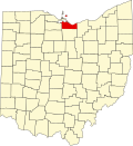
State | Ohio |
County | Erie |
Elevation | 722 ft (220 m) |
Time zone | Eastern (UTC) |
ZIP code | 44847 |
Area code | 419 |
GNIS feature ID | 1065850 [1] |
North Monroeville is an unincorporated community in Erie County, Ohio, United States. Its name derives from Monroeville, an incorporated village south of the community and in Huron County. There is a cemetery in North Monroeville called the North Monroeville Cemetery that has existed since the early 19th century. [2]
Monroe or Monroes may refer to:
Huron County is a county located in the U.S. state of Ohio. As of the 2020 census, the population was 58,565. Its county seat is Norwalk. The county was created in 1809 and later organized in 1815.
Monroeville is the county seat of Monroe County, Alabama, United States. At the 2020 census its population was 5,951.
Monroeville is a village in Huron County, Ohio, United States. The population was 1,300 at the 2020 census.
Monroeville is a home rule municipality in Allegheny County, Pennsylvania, United States. It is a suburb with mixed residential and commercial developments located about 10 miles (16 km) east of Pittsburgh. As of the 2020 census, Monroeville was home to 28,640 people.
Monroeville may refer to:
Interstate 76 (I-76) is an east–west Interstate Highway in the Eastern United States. The highway runs approximately 435.66 miles (701.13 km) from an interchange with I-71 west of Akron, Ohio, east to I-295 in Bellmawr, New Jersey. This route is not contiguous with I-76 in Colorado and Nebraska.
Oxford Township is one of the nine townships of Erie County, Ohio, United States. It is part of the Sandusky, Ohio micropolitan statistical area and the Cleveland-Akron-Canton Combined Statistical Area. The 2020 census recorded 1,140 residents.
State Route 99 (SR 99) is a north–south state highway in the north-central portion of the U.S. state of Ohio. The highway's southern terminus is in the southern end of Willard at a T-intersection with U.S. Route 224 (US 224). Its northern terminus is at a roundabout junction with SR 4 about 6 miles (9.7 km) southwest of the city limits of Sandusky.
Erie MetroParks was formed as the "Erie County Metropolitan Park District" in 1968 and adopted its current name in 1991. It consists of 14 individual park areas located throughout Erie County in the US state of Ohio covering approximately 3,200 acres (1,300 ha).
Pittsburgh–Monroeville Airport is a private airport located one nautical mile (1.8 km) north of the central business district of Monroeville, in Allegheny County, Pennsylvania, United States. The airport is privately owned by the estate of Helen M. Brown and is also known as the Harold W. Brown Memorial Field.
Monroe Township is one of twenty townships in Allen County, Indiana, United States. At the 2010 census, the population was 1,927.
Joel Monroe (1793–1877) was an American farmer and real estate developer during the nineteenth century. He was the eponym for the community of Monroeville, Pennsylvania.
Monroeville is an unincorporated community located within portions of Elk Township in Gloucester County and Upper Pittsgrove Township in Salem County, in the U.S. state of New Jersey. The area is served as United States Postal Service ZIP Code 08343. Monroeville is mostly filled with wooded areas and farms.
The John Hosford House is a historic octagon house located along U.S. Route 20 in Monroeville, Ohio, United States. Built at an unknown point in the mid-nineteenth century, it has been named a historic site.
Monroeville, named for its founder U. P. Monroe, was a town located near the Sacramento River in Glenn County, California. It was located 15 miles (24 km) north of Butte City, near the mouth of Stony Creek, at an elevation of 128 feet.
The Firelands Conference is an Ohio High School Athletic Association (OHSAA) athletic league located in north-central Ohio. The league was formed in the 1960–61 school year and is named for the Firelands area of the old Western Reserve, where most of the member schools reside. High schools in this conference are located in Ashland, Huron, and Richland counties. Some of the schools' district boundaries extend into the neighboring counties of Crawford, Erie, and Lorain. Most of the founding schools came from the defunct Huron-Erie League.
State Route 547 is an east–west state highway in north central Ohio, a U.S. state. The highway's western terminus is at SR 269 approximately four and a half miles (7.2 km) south of Bellevue. The eastern terminus of SR 547 is at the concurrency of U.S. Route 20 (US 20) and SR 18 in downtown Monroeville.
Monroeville is an unincorporated community in Jefferson County, in the U.S. state of Ohio.