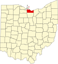
North Monroeville, Ohio | |
|---|---|
| Coordinates: 41°17′15″N82°43′33″W / 41.28750°N 82.72583°W [1] | |
| Country | United States |
| State | Ohio |
| County | Erie |
| Elevation | 722 ft (220 m) |
| Time zone | Eastern (UTC) |
| ZIP code | 44847 |
| Area code | 419 |
| GNIS feature ID | 1065850 [1] |
North Monroeville is an unincorporated community in Erie County, Ohio, United States. Its name derives from Monroeville, an incorporated village south of the community and in Huron County. There is a cemetery in North Monroeville called the North Monroeville Cemetery that has existed since the early 19th century. [2]


