North Red River, Minnesota

Last updated
North Red River, Minnesota
USA Minnesota location map.svg
Red pog.svg
North Red River
Location in Minnesota and the United States
Usa edcp location map.svg
Red pog.svg
North Red River
North Red River (the United States)
Coordinates: 48°46′4″N97°7′1″W / 48.76778°N 97.11694°W / 48.76778; -97.11694
Country United States
State Minnesota
Area
  Total23.7 sq mi (61.4 km2)
  Land23.4 sq mi (60.6 km2)
  Water0.3 sq mi (0.8 km2)
Population
 (2010)
  Total0
  Density0.0/sq mi (0.0/km2)
Time zone UTC-6 (Central (CST))
  Summer (DST) UTC-5 (CDT)
FIPS code 27-47176 [1]

North Red River is an unorganized territory [2] located in Kittson County, Minnesota, United States. The area was organized as a civil township, North Red River Township, until Kittson County dissolved the township in 2000 following a vote in the Minnesota legislature that allowed the county to do so without an election. [3] In 2000, the township had a population of three, and as of the 2010 census, the territory had a total population of zero. As of the 2020 census, the unorganized territory still remained uninhabited. [4]

Contents

Geography

According to the United States Census Bureau, the territory has a total area of 23.7 square miles (61.4 km2), of which 23.4 square miles (60.6 km2) is land and 0.3 square mile (0.8 km2; 1.31%) is water.

Demographics

As of the census [1] of 2000, there were 3 people, 2 households, and 1 family residing in the township. The population density was 0.1 inhabitants per square mile (0.039/km2). There were 4 housing units at an average density of 0.2 per square mile (0.077/km2). The racial makeup of the township was 100.00% White.

There were 2 households, out of which none had children under the age of 18 living with them, none were married couples living together, none had a female householder with no husband present, and 50.0% were non-families. 50.0% of all households were made up of individuals, and none had someone living alone who was 65 years of age or older. The average household size was 1.50 and the average family size was 2.00.

In the township the population was spread out, with 1 person from 18 to 24, 1 person from 45 to 64, and 1 person who was 65 years of age or older. The median age was 54 years. There was 1 female and 2 males in the township, all over the age of 18.

The median income for a household in the township was $13,750, and the median income for a family was $18,750. The per capita income for the township was $8,983. 1 of the 3 people was below the poverty line.

Related Research Articles

Ault Township is a township in Saint Louis County, Minnesota, United States. The population was 109 at the 2010 census.

Ellsburg Township is a township in Saint Louis County, Minnesota, United States. The population was 219 at the 2010 census.

Halden Township is a township in Saint Louis County, Minnesota, United States. The population was 129 at the 2010 census.

Prairie Lake Township is a township in Saint Louis County, Minnesota, United States. The population was 50 at the 2010 census.

Northeast Aitkin is an unorganized territory in Aitkin County, Minnesota, United States. The population was 11 at the 2010 census.

East Cass is an unorganized territory in Cass County, Minnesota, United States. The population was 43 at the 2000 census. It is part of the Brainerd Micropolitan Statistical Area.

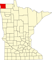
East Kittson is an unorganized territory in Kittson County, Minnesota, United States, named after fur trader and railroad entrepreneur Norman Kittson. The population was 13 at the 2000 census.

Crab Lake is an unorganized territory in Saint Louis County, Minnesota, United States, located north of Eagles Nest Township, and west of Morse Township. The population was 11 at the 2000 census.

Dark River is an unorganized territory in Saint Louis County, Minnesota, United States, located north of Chisholm and Balkan Township. The population was 68 at the 2000 census.

Gheen is an unorganized territory in Saint Louis County, Minnesota, United States. The population was 25 at the 2000 census.

Kabetogama Township is a township in Saint Louis County, Minnesota, United States. The population was 135 at the 2010 census. A portion of the township is located within the Kabetogama State Forest.

Leander Lake is an unorganized territory in Saint Louis County, Minnesota, United States, located near Britt and Great Scott Township. The population was 119 at the 2000 census.

Linwood Lake is an unorganized territory in Saint Louis County, Minnesota, United States. The population was 54 at the 2000 census.

McCormack is an unorganized territory in Saint Louis County, Minnesota, United States, located near Hibbing and Balkan Township. The population was 237 at the 2000 census.

Northeast St. Louis is an unorganized territory in Saint Louis County, Minnesota, United States. The population was 177 at the 2000 census.

Northwest St. Louis is an unorganized territory in Saint Louis County, Minnesota, United States. The population was 306 at the 2000 census.

Slim Lake is an unorganized territory in Saint Louis County, Minnesota, United States, located north of Ely and Morse Township. The population was 75 at the 2000 census.

Tikander Lake is an unorganized territory in Saint Louis County, Minnesota, United States. The population was 783 at the 2000 census.

Whiteface Reservoir is an unorganized territory in Saint Louis County, Minnesota, United States. The population was 292 at the 2000 census.

McKinley is an unorganized territory in Kittson County, Minnesota, United States. The population was 42 at the 2000 census.

References

  1. 1 2 "U.S. Census website". United States Census Bureau . Retrieved 2008-01-31.
  2. "Kittson County" (PDF). Minnesota Department of Transportation. Archived (PDF) from the original on 2015-09-18.
  3. "Archived copy" (PDF). Archived from the original (PDF) on 2005-05-25. Retrieved 2005-07-17.{{cite web}}: CS1 maint: archived copy as title (link)
  4. "Census Bureau profile: North Red River UT, Kittson County, Minnesota". United States Census Bureau. May 2023. Retrieved August 22, 2024.