Deerwood Township, Kittson County, Minnesota

Last updated

Deerwood Township, Minnesota
USA Minnesota location map.svg
Red pog.svg
Deerwood Township
Location in Minnesota and the United States
Usa edcp location map.svg
Red pog.svg
Deerwood Township
Deerwood Township (the United States)
Coordinates: 48°35′39″N96°35′43″W / 48.59417°N 96.59528°W / 48.59417; -96.59528
Country United States
State Minnesota
County Kittson
Area
  Total35.6 sq mi (92.2 km2)
  Land35.6 sq mi (92.2 km2)
  Water0.0 sq mi (0.0 km2)
Elevation
1,007 ft (307 m)
Population
 (2000)
  Total186
  Density5.2/sq mi (2.0/km2)
Time zone UTC-6 (Central (CST))
  Summer (DST) UTC-5 (CDT)
FIPS code 27-15382 [1]
GNIS feature ID0663952 [2]

Deerwood Township is a township in Kittson County, Minnesota, United States. The population was 186 at the 2000 census.

Contents

Deerwood Township was organized in 1888, and named for the deer and woodland within its borders. [3]

Geography

According to the United States Census Bureau, the township has a total area of 35.6 square miles (92 km2), all land.

Demographics

As of the census [1] of 2000, there were 186 people, 71 households, and 56 families residing in the township. The population density was 5.2 inhabitants per square mile (2.0/km2). There were 89 housing units at an average density of 2.5 per square mile (0.97/km2). The racial makeup of the township was 98.39% White, 1.08% Asian, and 0.54% from two or more races. Hispanic or Latino of any race were 1.08% of the population.

There were 71 households, out of which 38.0% had children under the age of 18 living with them, 62.0% were married couples living together, 8.5% had a female householder with no husband present, and 21.1% were non-families. 19.7% of all households were made up of individuals, and 9.9% had someone living alone who was 65 years of age or older. The average household size was 2.62 and the average family size was 3.00.

In the township the population was spread out, with 28.0% under the age of 18, 4.8% from 18 to 24, 22.0% from 25 to 44, 27.4% from 45 to 64, and 17.7% who were 65 years of age or older. The median age was 40 years. For every 100 females, there were 118.8 males. For every 100 females age 18 and over, there were 112.7 males.

The median income for a household in the township was $29,167, and the median income for a family was $30,000. Males had a median income of $27,500 versus $20,625 for females. The per capita income for the township was $13,680. About 23.2% of families and 23.6% of the population were below the poverty line, including 31.9% of those under the age of eighteen and 34.3% of those 65 or over.

Related Research Articles

<span class="mw-page-title-main">Aitkin Township, Aitkin County, Minnesota</span> Township in Minnesota, United States

Aitkin Township is a township in Aitkin County, Minnesota, United States. The population was 918 as of the 2020 census. The 2021 population estimate is 934.

Hazelton Township is a township in Aitkin County, Minnesota, United States. The population was 844 as of the 2010 census.

Morrison Township is a township in Aitkin County, Minnesota, United States. The population was 200 as of the 2010 census.

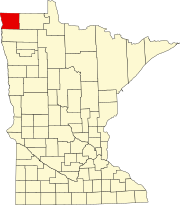
Langor Township is a township in Beltrami County, Minnesota, United States. The population was 186 as of the 2000 census.

<span class="mw-page-title-main">Deerwood, Minnesota</span> City in Minnesota, United States

Deerwood is a city in Crow Wing County, Minnesota, United States. The population was 526 at the 2020 census. It is part of the Brainerd Micropolitan Statistical Area.

Deerwood Township is a township in Crow Wing County, Minnesota, United States. The population was 1,244 at the 2000 census.

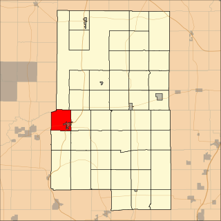
Jo Daviess Township is a township in Faribault County, Minnesota, United States. The population was 281 at the 2000 census. The township was named for Major Joseph Hamilton Daveiss (1774–1811), who was killed at the Battle of Tippecanoe.

Bath Township is a township in Freeborn County, Minnesota, United States. The population was 479 at the 2000 census.

Erdahl Township is a township in Grant County, Minnesota, United States. The population was 343 at the 2000 census.

Mound Prairie Township is a township in Houston County, Minnesota, United States. The population was 661 at the 2000 census.

Bearville Township is a township in Itasca County, Minnesota, United States. The population was 205 at the 2010 census.

Wabana Township is a township in Itasca County, Minnesota, United States. The population was 537 at the 2010 census.

Burbank Township is a township in Kandiyohi County, Minnesota, United States. The population was 510 at the 2000 census.

Walter Township is a township in Lac qui Parle County, Minnesota, United States. The population was 186 at the 2000 census.

Nicollet Township is a township in Nicollet County, Minnesota, United States. The population was 511 at the 2000 census.

McDonaldsville Township is a township in Norman County, Minnesota, United States. The population was 186 at the 2000 census.

Smiley Township is a township in Pennington County, Minnesota, United States. The population was 528 at the 2000 census.

Brook Park Township is a township in Pine County, Minnesota, United States. The population was 495 at the 2000 census.

Toivola Township is a township in Saint Louis County, Minnesota, United States. At the 2010 census, the population was 170. Toivola is a name Finnish in origin.

Moran Township is a township in Todd County, Minnesota, United States. The population was 515 at the 2000 census. By the 2020 census the population had declined to 489.

References

  1. 1 2 "U.S. Census website". United States Census Bureau . Retrieved January 31, 2008.
  2. "US Board on Geographic Names". United States Geological Survey. October 25, 2007. Retrieved January 31, 2008.
  3. Upham, Warren (1920). Minnesota Geographic Names: Their Origin and Historic Significance. Minnesota Historical Society. p.  277.