Mata Ortiz is a small village in the state of Chihuahua, Mexico, less than 100 miles (160 km) from the US-Mexico border. The community is one of the designated localidades (localities) in the municipio libre (municipality) of Casas Grandes, one of several such pueblos in a wide, fertile valley long inhabited by indigenous people. Mata Ortiz is located at the base of a mountain known as El Indio and on the west bank of the Rio Palanganas, a tributary of the Rio Casas Grandes. The ancient ruins of Casas Grandes are located nearby. As of 2010, Mata Ortiz had a population of 1,182.

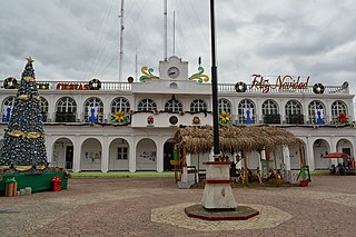
Temixco is the fourth-largest city in the Mexican state of Morelos. It stands at 18°51′N99°14′W in the west-northwest part of the state.

Nuevo Casas Grandes is a city and the seat of the Nuevo Casas Grandes Municipality in northern Mexico. It is located in the northwestern part of the state of Chihuahua, on the Casas Grandes or San Miguel river, situated in a wide, fertile valley on the 4,000-foot Mesa del Norte of the Plateau of Mexico. Nearby is the Sierra Madre Occidental.

Ocosingo is a city and its surrounding municipality of the same name in the Mexican state of Chiapas.

Cuauhtémoc is a municipality in the Mexican state of Chihuahua. It was named after the Aztec Indian ruler Cuauhtémoc, which means "águila que cae". The municipality's seat is Cuauhtémoc, Chihuahua. The municipality is located to the west of the Chihuahua's capital city, Chihuahua. There is a close relation between three cultures in this region: Mennonite culture, Tarahumara culture and mestizo culture. Since 1994 there is a multi-cultural, multi-disciplinary arts festival known as "Festival de las Tres Culturas".

Colonia Dublán began as a Mormon colony, located in the state of Chihuahua, Mexico. It is now a part of Nuevo Casas Grandes Municipality. It is one of two surviving Mormon colonies in Mexico.

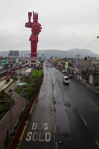
Chimalhuacán is a city and municipality located in the eastern part of State of Mexico, Mexico. It lies just outside the northeast border of Mexico City and is part of the Greater Mexico City urban area.
Tarímbaro is a municipality in the Mexican state of Michoacán. The municipality has an area of 258.57 square kilometres and is bordered to the north by Copándaro, Meson Nuevo and Cuitzeo, to the east by Álvaro Obregón, to the south by Morelia and Charo, and to the west by Chucándiro. The municipality had a population of 51,479 inhabitants according to the 2005 census. Its municipal seat is the city of the same name.

A cavalcade is a procession or parade on horseback, or a mass distance ride by a company of riders.

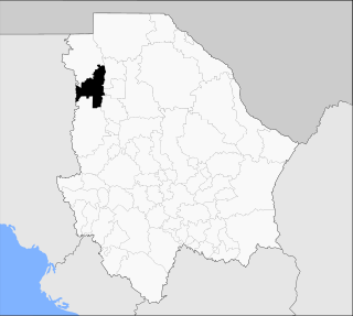
Casas Grandes Municipality is located in the northern Mexican state of Chihuahua. The municipal seat is the town of Casas Grandes, Chihuahua.

The seventh federal electoral district of Chihuahua is one of the 300 electoral districts into which Mexico is divided for elections to the federal Chamber of Deputies and one of nine such districts currently operating in the state of Chihuahua.

The ninth federal electoral district of Chihuahua is one of the 300 electoral districts into which Mexico is divided for elections to the federal Chamber of Deputies and one of nine such districts currently operating in the state of Chihuahua.
La Perla is a municipality in the Mexican state of Veracruz. It is located in central zone of the State of Veracruz, about 75 km from Xalapa, the state capital. It has a surface of 199.880 km2. It is located at 18°56′N97°08′W.
The following is a timeline of the history of the city of Chihuahua, Mexico.
This article lists events occurring in Mexico during 2020. 2020 is the "Year of Leona Vicario, Benemérita (Praiseworthy) Mother of the Fatherland". The article also lists the most important political leaders during the year at both federal and state levels and will include a brief year-end summary of major social and economic issues.

The COVID-19 pandemic in Mexico is part of the ongoing worldwide pandemic of coronavirus disease 2019 caused by severe acute respiratory syndrome coronavirus 2.

Hugo López-Gatell Ramírez is a Mexican epidemiologist, author, and public health official who has served as head of the Undersecretariat of Prevention and Health Promotion at the Mexican Secretariat of Health since 2018. Since January 2020, he has also been the spokesman and one of the lead members of the federal governments response to the COVID-19 pandemic in Mexico.
This article lists events occurring in Mexico during the year 2021. The article lists the most important political leaders during the year at both federal and state levels and will include a brief year-end summary of major social and economic issues. Cultural events, including major sporting events, are also listed. For a more expansive list of political events, see 2021 in Mexican politics and government.

The 2021 Mexican local elections, held on June 6, 2021, saw voters electing fifteen governors for six-year terms, deputies for thirty state congresses, and officials for 1,910 municipalities. These elections took place concurrently with the country's federal legislative election. The elections, alongside the federal legislative election, were one of the most violent in the country's history, with 91 candidates assassinated prior to election day.


