
Delaware County is a county located in the U.S. state of Oklahoma. As of the 2020 census, the population was 40,397. Its county seat is Jay. The county was named for the Delaware Indians, who had established a village in the area prior to the Cherokees being assigned to relocate to Indian Territory in the 1830s. Delaware County was created in 1907. Prior to becoming Delaware County, a large portion of the area was known as the Delaware District of the Cherokee Nation. Today, Delaware County continues to be recognized by the Cherokee Nation as the Delaware District.
Shawnee Hills is a census-designated place (CDP) in Greene County, Ohio, United States. Shawnee Hills consists of a planned community centered on the 250-acre (1.0 km2) Shawnee Lake. The population was 2,230 at the 2020 census. It is part of the Dayton Metropolitan Statistical Area, and should not be confused with the incorporated village of Shawnee Hills in Delaware County.
Brush Creek is an unincorporated community and census-designated place (CDP) in Delaware County, Oklahoma, United States. The population was 35 at the 2010 census.
Cloud Creek is an unincorporated community and census-designated place (CDP) in Delaware County, Oklahoma, United States. The population was 121 at the 2010 census, a 40.7 percent increase over the figure of 86 recorded in 2000 census.
Dripping Springs is an unincorporated community and census-designated place (CDP) in Delaware County, Oklahoma, United States. The population was 50 at the 2010 census, up from the figure of 41 recorded in 2000.
Flint Creek is an unincorporated area and census-designated place (CDP) in Delaware County, Oklahoma, United States. The population was 732 at the 2010 census, up from 580 in 2000.

Twin Oaks is an unincorporated community and census-designated place (CDP) in Delaware County, Oklahoma, United States. The population was 198 at the 2010 census. A tornado hit the town on March 12, 2006, destroying 42 homes and injuring 8 people in Delaware County.
Seven Oaks is a census-designated place (CDP) in Lexington County, South Carolina, United States, 8 miles (13 km) northwest of downtown Columbia, the state capital. The population of the CDP was 15,144 at the 2010 census. It is part of the Columbia Metropolitan Statistical Area.
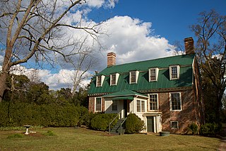
Mechanicsville is an unincorporated community and census-designated place (CDP) in Hanover County, Virginia, United States. The population was 39,482 during the 2020 census, up from 36,348 in the 2010 census.
Cetronia is a census-designated place (CDP) in South Whitehall Township in Lehigh County, Pennsylvania, located near Allentown. As of the 2020 census, its population was 2,421.

Piney is a census-designated place (CDP) in Adair County, Oklahoma, United States. The population was 115 at the 2010 census. Piney was the "head town" of the first wave of relocated Cherokee people who relocated there from their ancestral homelands in the southeastern United States.
White Water is a census-designated place (CDP) in Delaware County, Oklahoma, United States. The population was 80 at the 2010 census.
Cave Spring is a census-designated place (CDP) in Adair County, Oklahoma, United States. Part of the Cherokee Nation, it was first listed as a CDP prior to the 2020 census.
Lakeside Village is a census-designated place (CDP) in Comanche County, Oklahoma, United States. It was first listed as a CDP prior to the 2020 census.
Little Rock is an unincorporated community and census-designated place (CDP) in Mayes County, Oklahoma, United States. It was first listed as a CDP prior to the 2020 census.
Nelagoney is an unincorporated community and census-designated place (CDP) in Osage County, Oklahoma, United States. It was first listed as a CDP prior to the 2020 census.
Franklin Forge is a census-designated place (CDP) in Blair County, Pennsylvania, United States. It was first listed as a CDP prior to the 2020 census.
Royer is an unincorporated community and census-designated place (CDP) in Blair County, Pennsylvania, United States. It was first listed as a CDP prior to the 2020 census.
Dovesville is an unincorporated community and census-designated place (CDP) in Darlington County, South Carolina, United States. It was first listed as a CDP prior to the 2020 census. Per the 2020 census, the population was 827.


