Kenwood, Oklahoma

Last updated

Kenwood, Oklahoma
USA Oklahoma location map.svg
Red pog.svg
Kenwood
Usa edcp location map.svg
Red pog.svg
Kenwood
Coordinates: 36°18′04″N94°59′52″W / 36.30111°N 94.99778°W / 36.30111; -94.99778 [1]
Country United States
State Oklahoma
Counties Delaware, Mayes
Area
[2]
  Total
45.06 sq mi (116.70 km2)
  Land45.06 sq mi (116.70 km2)
  Water0.00 sq mi (0.00 km2)
Elevation
[1]
814 ft (248 m)
Population
 (2020) [3]
  Total
904
  Density20.06/sq mi (7.75/km2)
Time zone UTC-6 (Central (CST))
  Summer (DST) UTC-5 (CDT)
ZIP Codes
Area codes 539/918
GNIS feature ID2584383 [1]
FIPS code 40-39450

Kenwood is an unincorporated community and census-designated place (CDP) in Delaware and Mayes counties, Oklahoma, United States. As of the 2020 census, it had a population of 904, [3] down from 1,224 in 2010. [4]

Contents

History

Kenwood once had a post office, which opened on May 25, 1922. The community's name came from a combination of William Kennedy and the National Hardwood Company. [5]

Geography

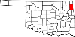
The eastern half of Kenwood is in Delaware County, while the western half is in Mayes County. Kenwood is 20 miles (32 km) by road southwest of Jay, the Delaware County seat. It is 11 miles (18 km) east of Salina. According to the U.S. Census Bureau, the Kenwood CDP has an area of 45.1 square miles (116.8 km2), all of it recorded as land. [2] The community is drained by Saline Creek, which flows west through the center of the CDP and joins the Neosho River in Lake Hudson 3 miles (5 km) to the west of the CDP's border.

Demographics

Historical population
CensusPop.Note
2010 1,224
2020 904−26.1%
U.S. Decennial Census [6]

Education

It is divided between the Wickliffe Public School elementary school district and the Salina Public Schools school district. [7]

References

  1. 1 2 3 U.S. Geological Survey Geographic Names Information System: Kenwood, Oklahoma
  2. 1 2 "2024 U.S. Gazetteer Files: Oklahoma". United States Census Bureau. Retrieved May 22, 2025.
  3. 1 2 "P1. Race – Kenwood CDP, Oklahoma: 2020 DEC Redistricting Data (PL 94-171)". U.S. Census Bureau. Retrieved May 22, 2025.
  4. "Geographic Identifiers: 2010 Demographic Profile Data (G001): Kenwood CDP, Oklahoma". U.S. Census Bureau, American Factfinder. Archived from the original on February 13, 2020. Retrieved December 10, 2015.
  5. Shirk, George (1987). Oklahoma Place Names. University of Oklahoma Press. p. 27. ISBN   9780806120287.
  6. "Census of Population and Housing". Census.gov. Retrieved June 4, 2016.
  7. "2020 CENSUS - SCHOOL DISTRICT REFERENCE MAP: Mayes County, OK" (PDF). U.S. Census Bureau . Retrieved October 13, 2024. - Text list